| Photographs of Perth, Western Australia | |||
Mollerin - Photographs of Western Australia Mollerin is a district within the northern wheatbelt area. There is no townsite here now although back in 1928 there was a hall and store. Both have since been removed. The district is located on the Bonnie Rock - Burakin Road and railway, centred at the head of the Koorda Road, which is some 40 kms north of Koorda. Nearby are the dry Lakes Mollerin and Samphire. The area is named after Mollerin Rocks which are a few kilometres south of the district centre |
|||
| South to Koorda | |||
| East to Beacon | |||
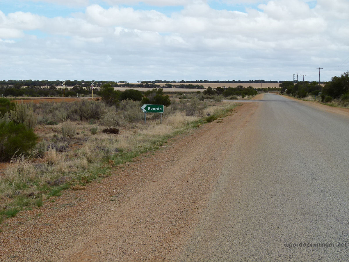 |
Mollerin - Koorda Junction The road from Beacon heading west towards Kalannie sweeps past Mollerin. Here is the turn-off to Koorda. The railway crossing is also in the picture. March 2015. Photos Ref: MOLL001 |
||
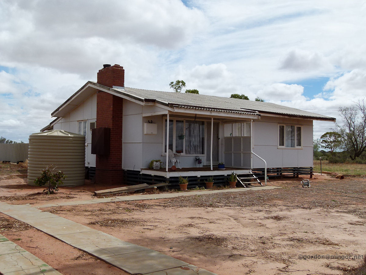 |
Mollerin - School House On Mollerin-North road the former teacher's house is still here and occupied but not by a teacher anymore. It's the only house around for miles and it stands out quite starkly. March 2015. Photos Ref: MOLL002 |
||
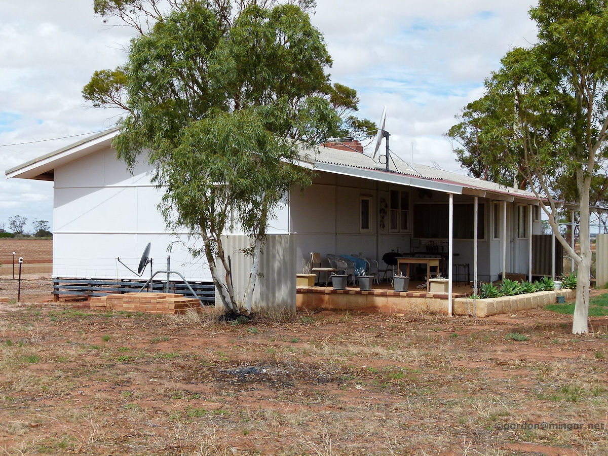 |
Mollerin - School House The rear of the teacher's house. The house relied on its own generator for power which also supplied the school. Water for both the school and house was collected by winter rainfall runoff and stored in several tanks. If the water ran out then it had to be carted in by road. March 2015. Photos Ref: MOLL003 |
||
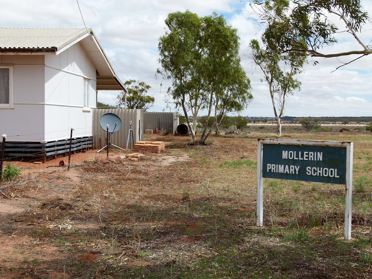 |
Mollerin - School Sign A section of the school house and next to that the school sign. March 2015. Photos Ref: MOLL004 |
||
 |
Mollerin - School Sign Mollerin school 1940 - 1985. Either the school population got too low or running costs became too high, or probably both. The government not only closed the school in 1985, but took it with them. The school consisted of a demountable building divided into two classrooms plus a small staff room which doubled as a store room. March 2015. Photos Ref: MOLL005 |
||
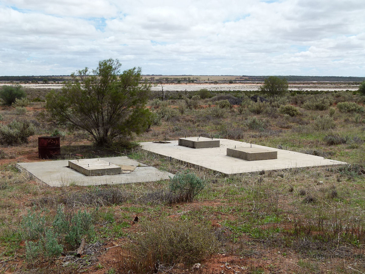 |
Mollerin - School Foundations Concrete foundations remain at the rear of the school. This supported a shed housing the Dunlite generator which supplied power to both the school and the house. A part of the northern section of Lake Samphire (or a sub-lake) can be seen in the background. Mollerin Lake is located south of the Bonnie Rock - Burakin Road. March 2015. Photos Ref: MOLL006 |
||
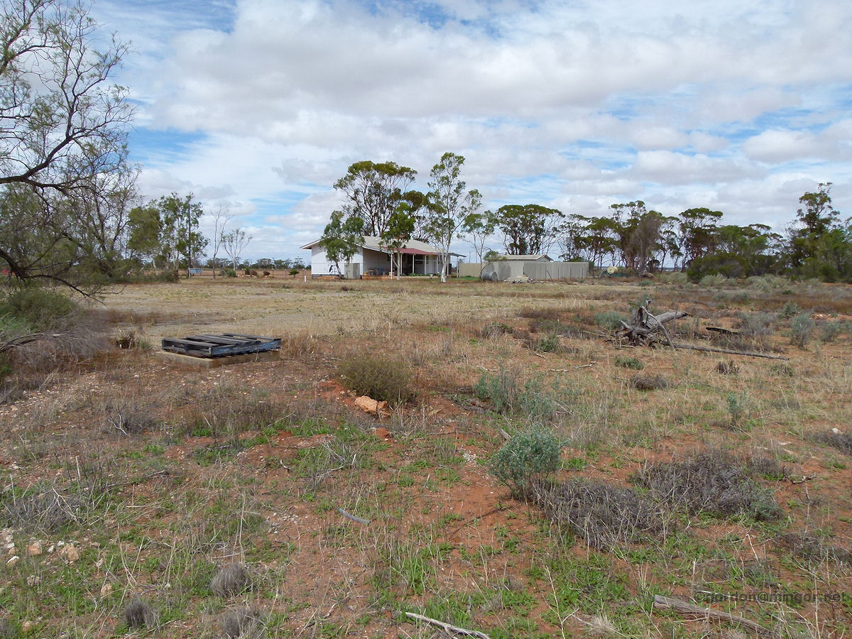 |
Mollerin - School Playground This is a view looking over where the school once sat. The school house is in the distance. Just beyond that pallet the bitumen of the school quadrangle has still not fully broken up. March 2015. Photos Ref: MOLL007 |
||
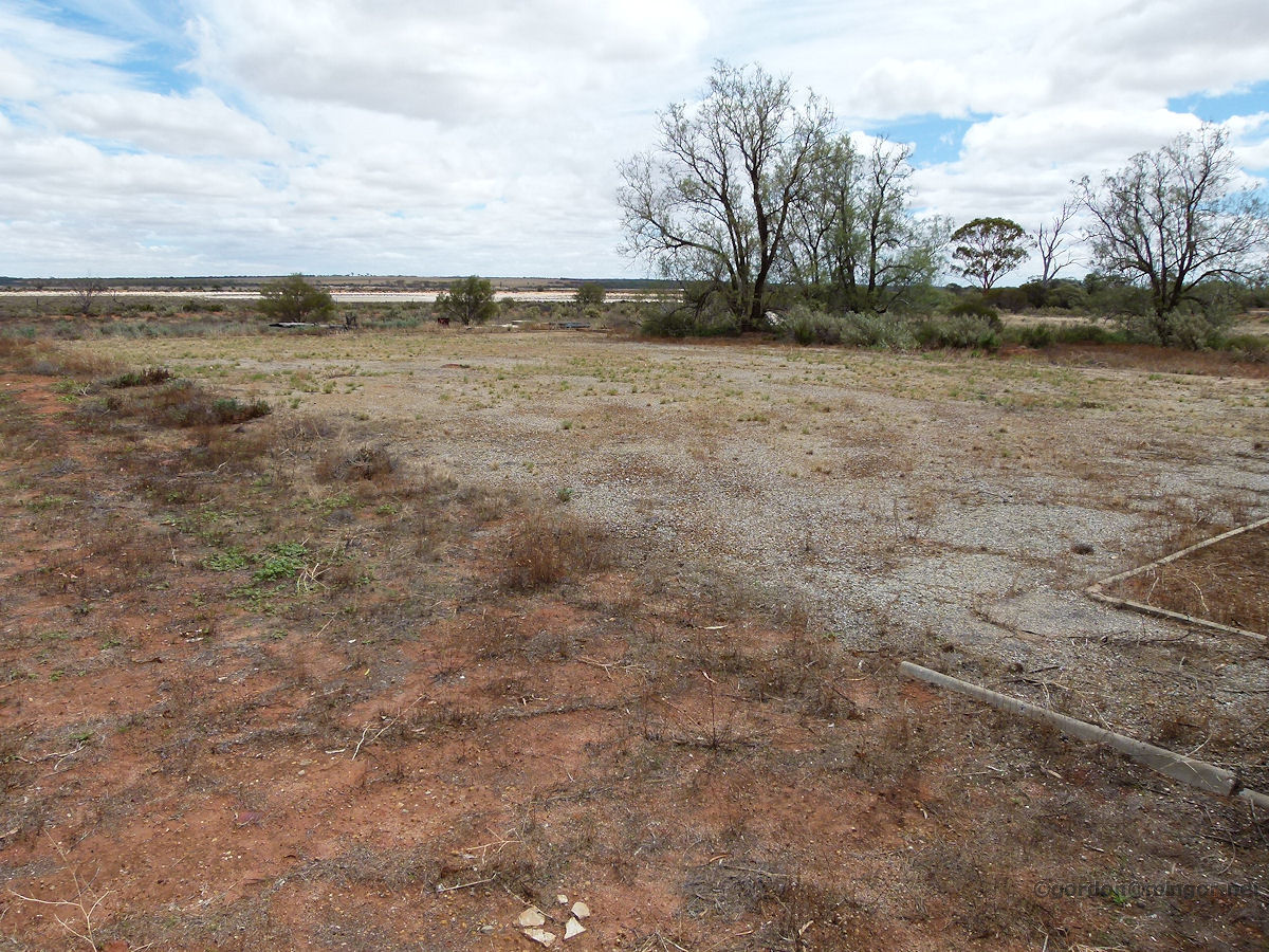 |
Mollerin - School Site A clearer view of the quadrangle and evidence of a pathway with some concrete bordering still intact. South of here, closer to the Bonnie Rock - Burakin Road was the school oval. This was regularly slashed by local farmers just prior to school sports carnivals. March 2015. Photos Ref: MOLL008 |
||
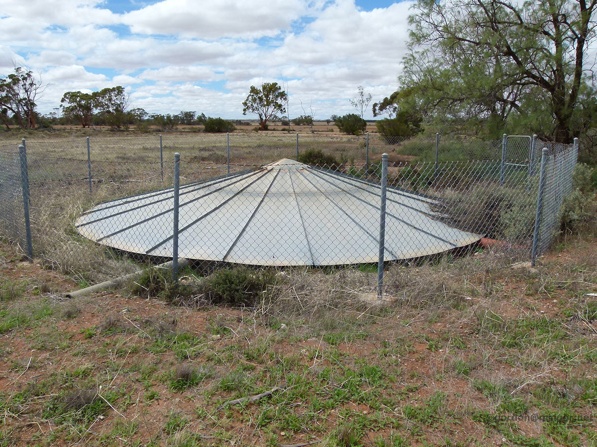 |
Mollerin - Bore This bore would have serviced both the school and house. The bore was sunk post mid-1970's. March 2015. Photos Ref: MOLL009 |
||
All images published on this website are copyright © of the webmaster. See About section for clarification and special schools permission |
|||