| Photographs of Perth, Western Australia | |||
Rivers seen in Western Australia The south of Western Australia is not renowned for large, perennial, free-flowing rivers. Indeed, even the state's most well-known river, the Swan River, is kept alive by seawater coming in from the ocean. The Avon River is a major tributary of the Swan but the flow depends upon rainfall levels in its catchment area. A few of the rivers featured here have been dammed upstream resulting in little or no water flow beyond the dams at anytime during the year |
|||
 |
Avon River at Beverley The source of the Avon River is near Yealering. The river's path winds north to Brookton, then passes through Beverley, York and Toodyay before heading west to finally become the Swan River somewhere around Upper Swan. Photo - September 2010 |
||
 |
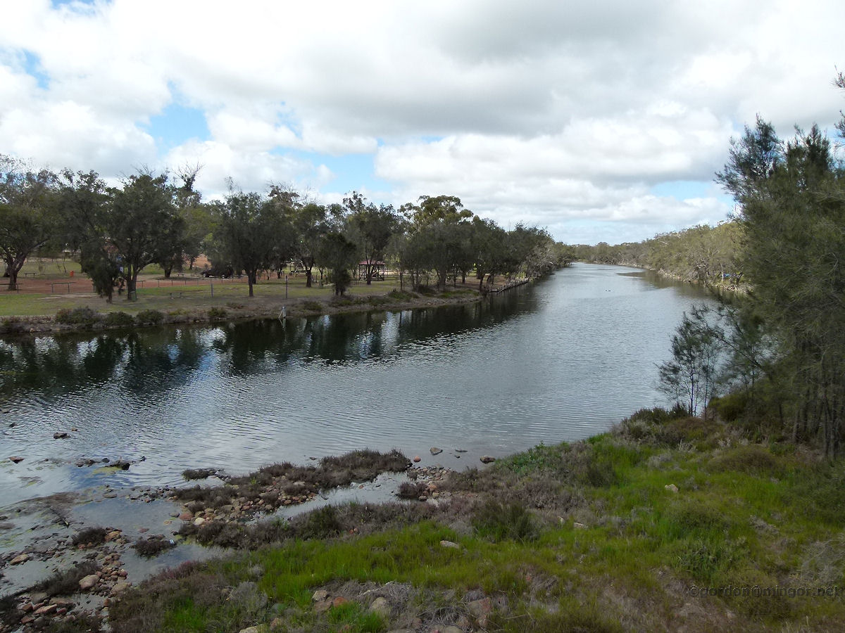
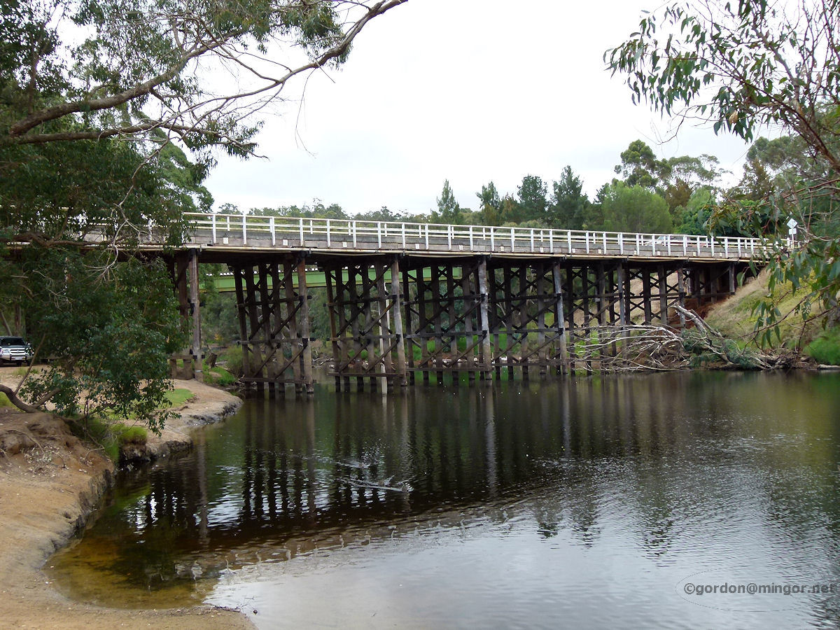
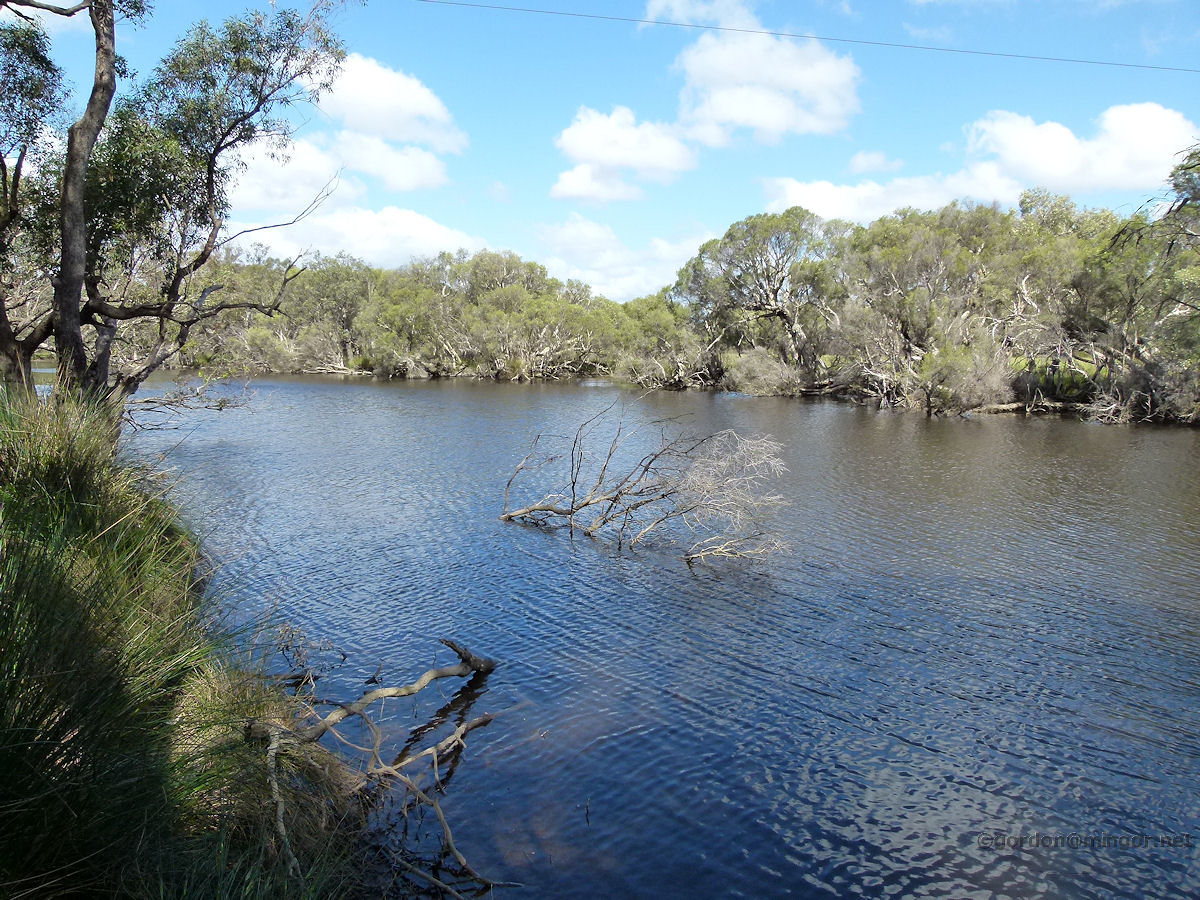
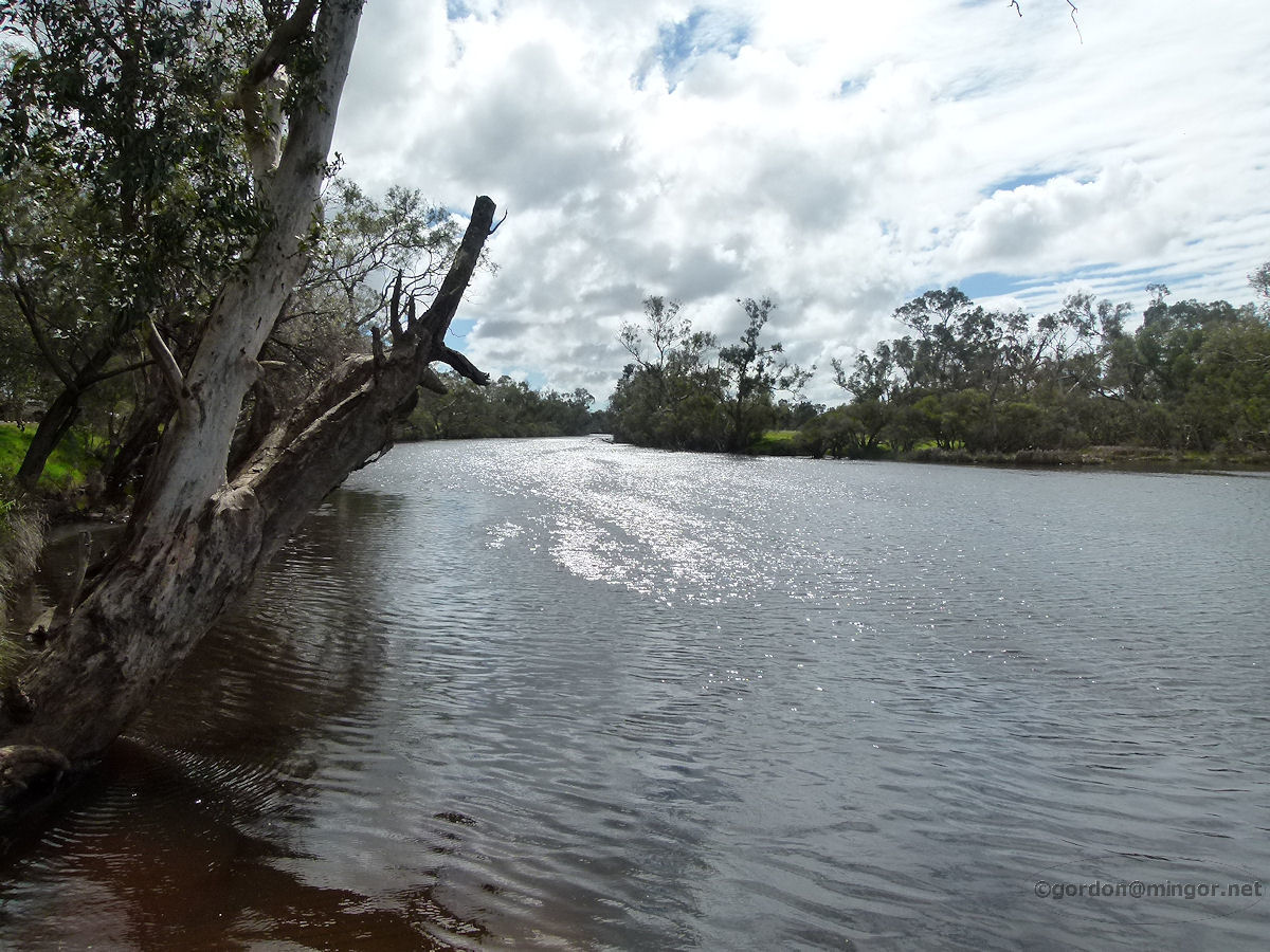
Avon River at York Towns along the Avon River route were built there simply because of the proximity of the river. The river provided much-needed water for these communities in the old days. In this picture the Avon River is looking quite high through good rains. This view is taken from the York swing-bridge looking up towards the road bridge. Photo - September 2010 |
||
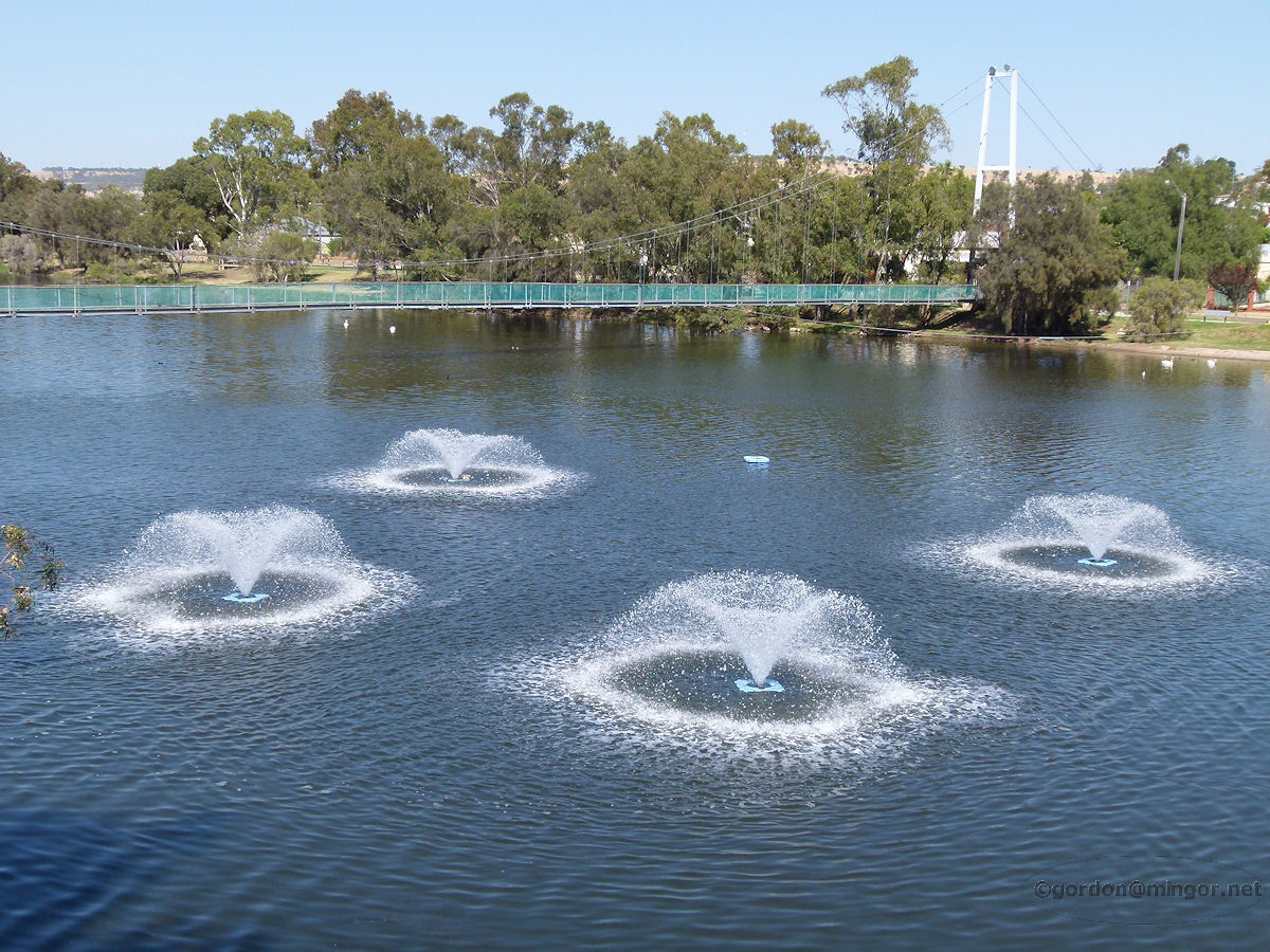 |
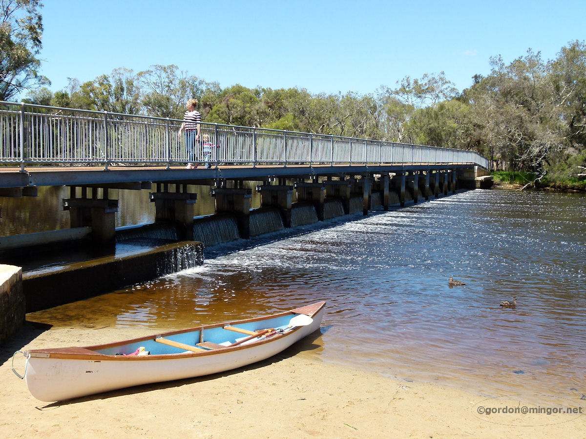
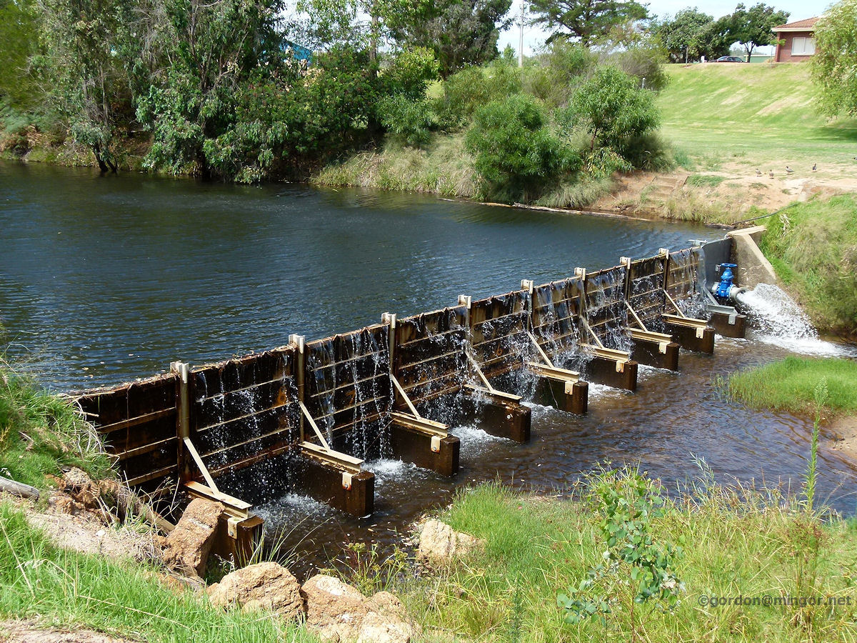
Avon River at Northam At Northam, the Avon River has a small artificial weir which serves to retain some water in the town section hence this spectacle. This is a view from the Avon River Descent starting tower looking upstream across a quartet of attractive fountains and towards the river suspension bridge. Photo - October 2012 |
||
 |
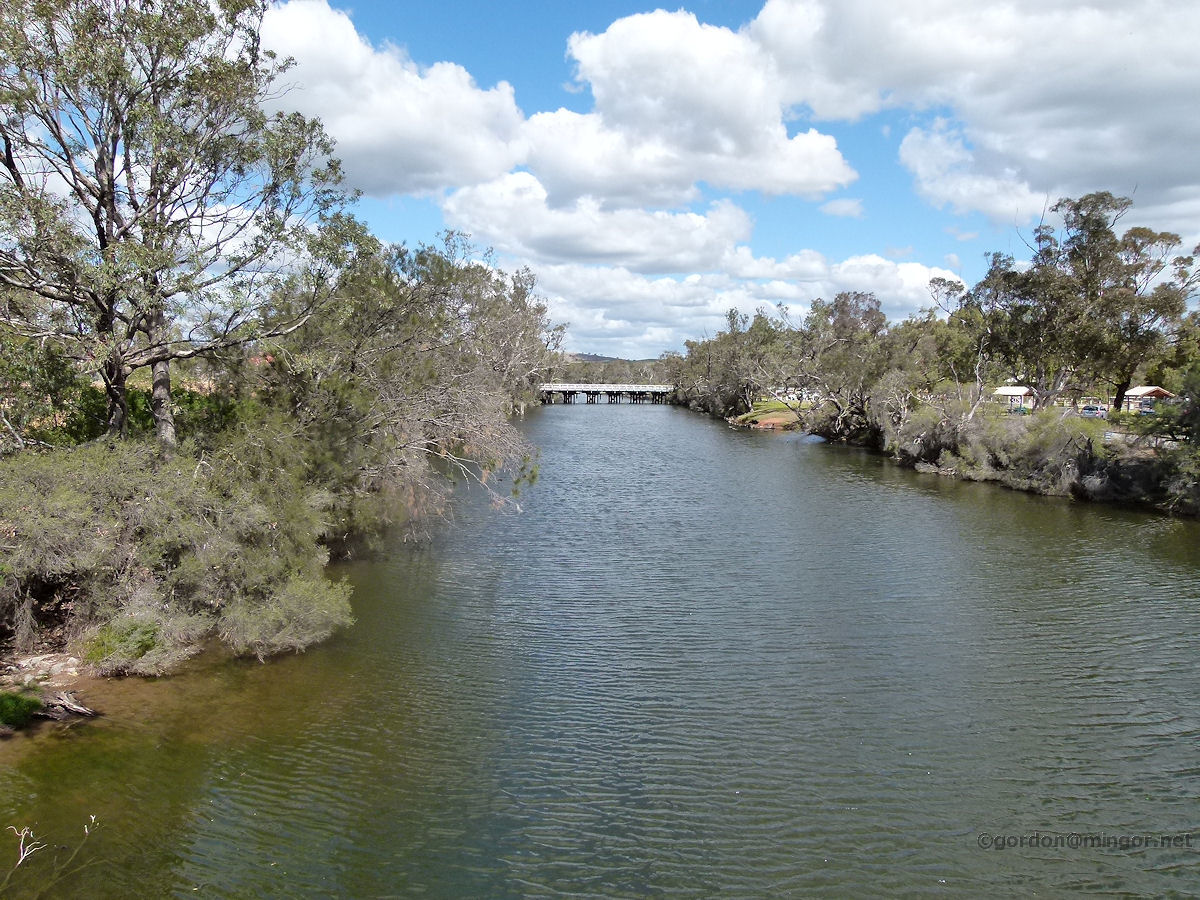
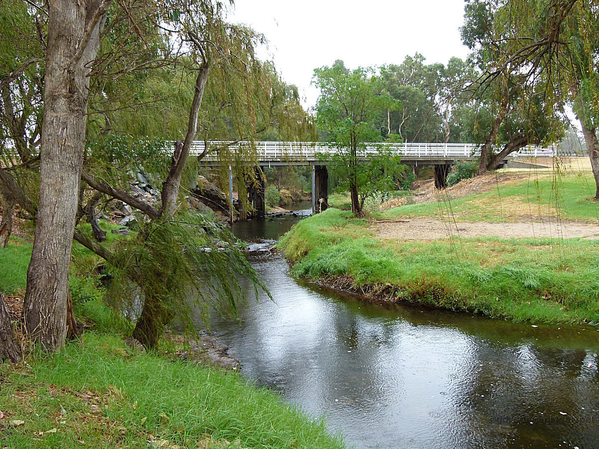
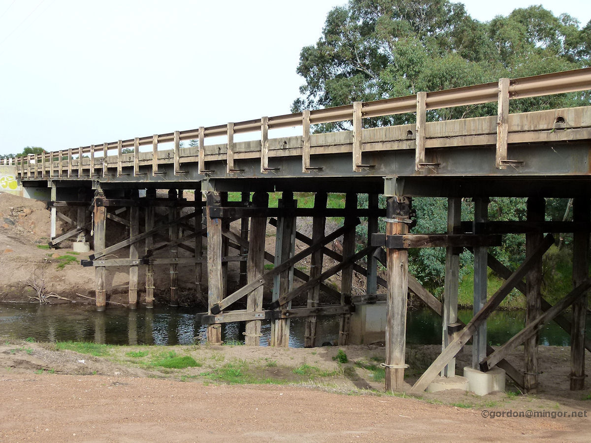
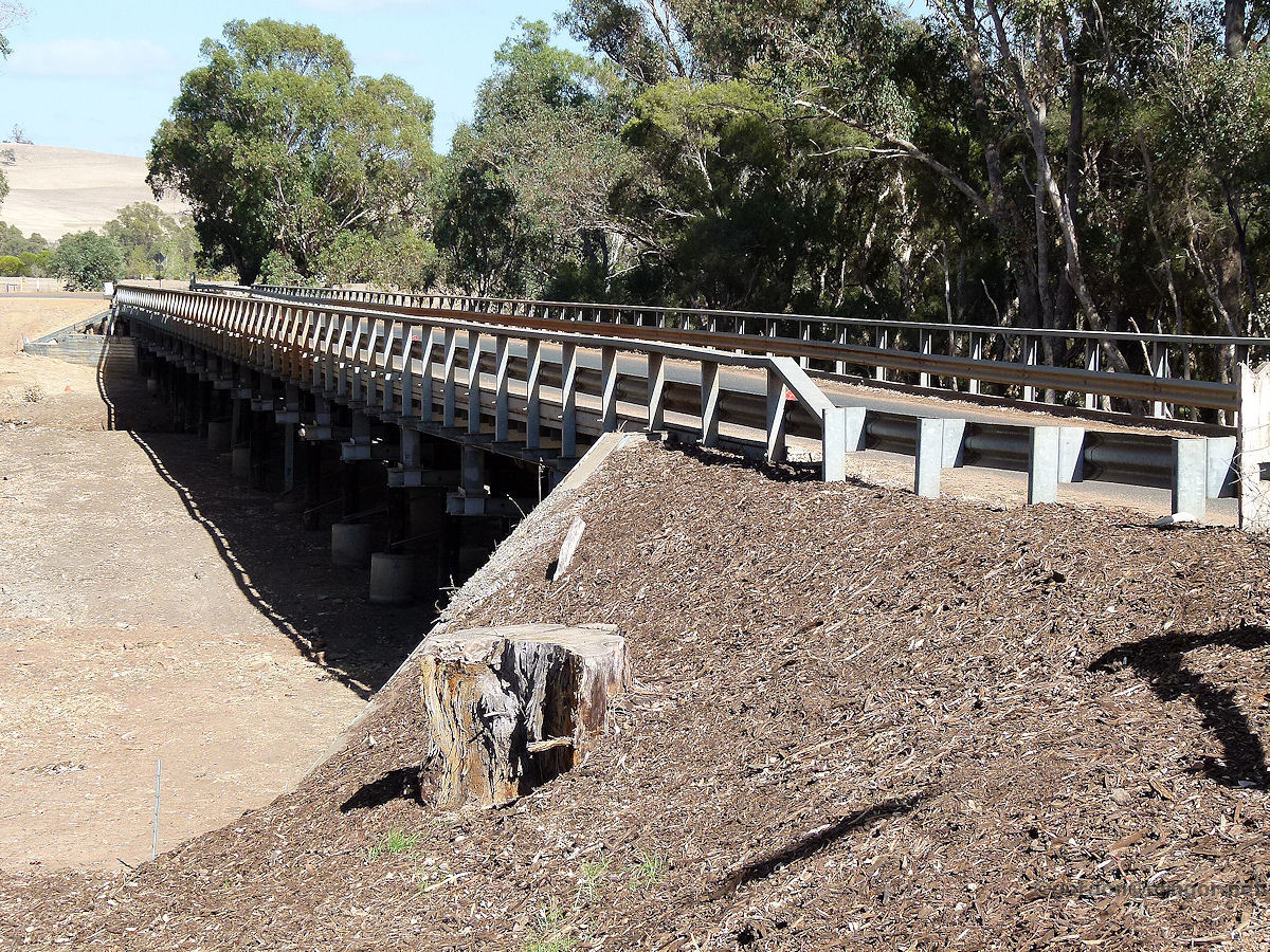
Avon River at Toodyay The Telegraph Road Bridge spans the Avon River adjacent to Duidgee Park in Toodyay. By the time the Avon River reaches Toodyay is has usually been fed by streams and creeks along the way. A major tributary is the Mortlock River which joins the Avon near Northam. Photo - October 2013 |
||
 |
Blackwood River at Bridgetown The Blackwood River is a part of a major river system in the south-west. The river source is near Quelarup which is very close to the Moodiarrup locality featured on this website. From the source, the river travels through the towns of Boyup Brook, Bridgetown and Nannup before finally reaching its mouth located near Augusta. In the photo the South Western Highway road bridge crosses the Blackwood. Photo - April 2012 |
||
 |
Blackwood River at Nannup The Blackwood River near the road bridge. There is a little water in there. You can see evidence of a former bridge which once crossed the river here. The road to Balingup (about 42 km) winds its way alongside the river for much of the way. Surprisingly for this time of year, there is quite a bit of water in most sections of the river next to that road. Photo - January 2015 |
||
 |
Blackwood River at Augusta Overlooking the Blackwood River and across the sandbar is Flinders Bay. The river mouth is just around the corner. This picture was taken from the rear of the Augusta Hotel. Photo - December 2013 |
||
 |
Brunswick River at Brunswick A view of the Brunswick River as it heads west, under the South Western Highway Bridge. Photo - March 2014 |
||
 |
Canning River at Cannington Running behind Marriamup and Woodloes Streets in Cannington is the Canning River which is in fine flow today replenishing spring rains. The Canning River rises beyond the Darling Scarp but is dammed near Roleystone to provide a major source of Perth's drinking water supply. That is the Canning Dam. Photo - October 2013 |
||
 |
Canning River at Wilson The Canning River at the Kent Street Weir in Wilson. You can see the weir in the picture. Many ducks around, kids playing, and the sound of the water cascading over the weir is relaxing. The weir was built in 1928 to stop salt water moving from here upstream. Photo - October 2012 |
||
 |
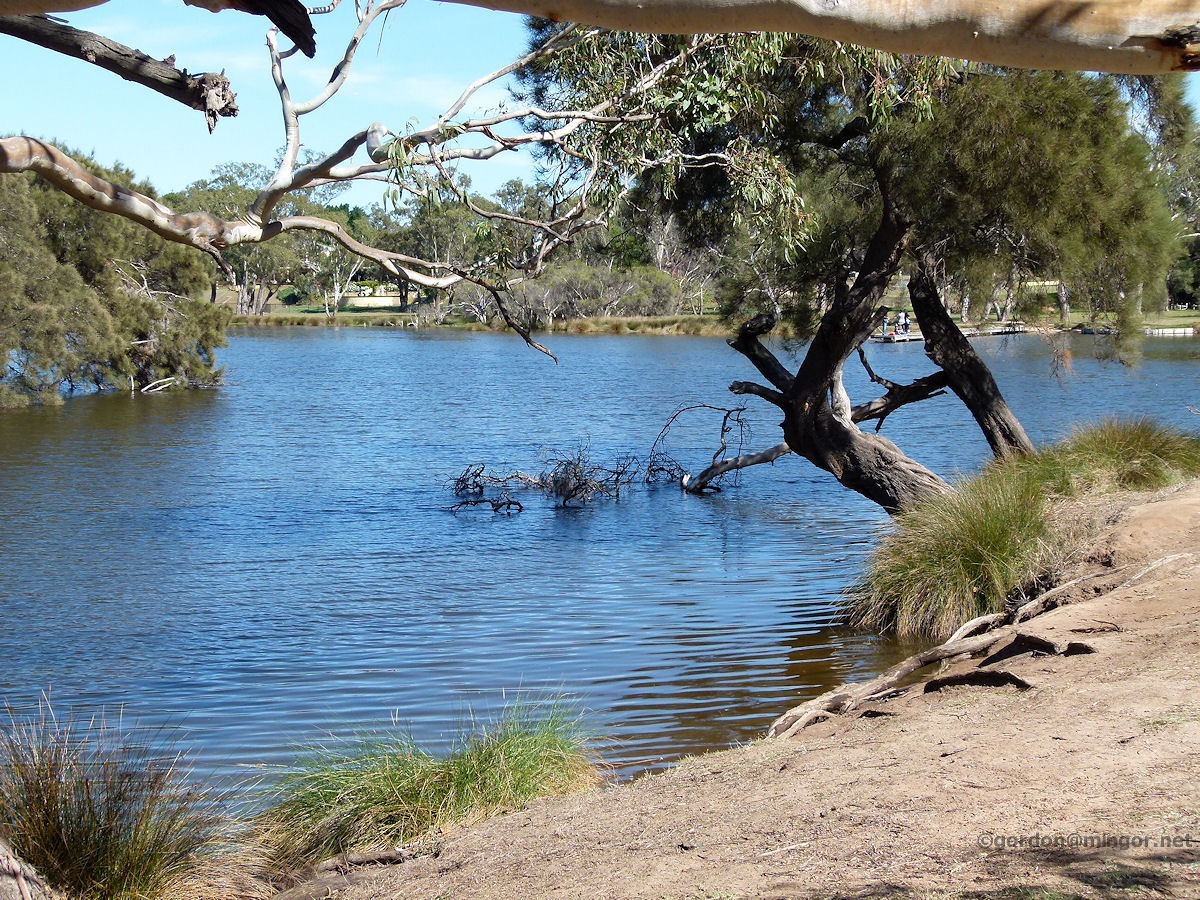
Canning River at Mount Pleasant The Canning River joins the Swan River here. Since the Canning is dammed upstream, from 4-5 kilometres east of here and way up to the dam, the river can be very low for much of the year. At this point the river is fed by the Swan which in turn is fed by the sea. Still water and contaminating runoffs are causing algae blooms which are becoming more and more common upstream from here. Photo - July 2010 |
||
 |
Capel River at Capel This is a view of the Capel River, looking down from the middle of the Bussell Highway road bridge. The source of the Capel River is in hilly country east near Kirup. The river enters the sea only a few kilometres north-west of Capel at Peppermint Grove Beach. Photo - February 2011 |
||
 |
Collie River at Burekup Here the South Western Highway crosses the Collie River just adjacent to the Burekup townsite. The river rises near Darkan and flows through Collie. The Wellington Dam is on the Collie River. Water is the dam is slightly saline and therefore not suitable for drinking. Recently the dam overflowed enabling the river downstream to be flushed out. The river empties into the Leschenault Estuary at Eaton near Bunbury. Photo - April 2013 |
||
 |
Denmark River at Denmark A peaceful scene looking along the Denmark River to the road bridge. The park was full of seagulls. The road bridge was built in 1968. The old one, the former rail bridge converted to a road bridge, burnt down in 1967. Photo - October 2014 |
||
 |
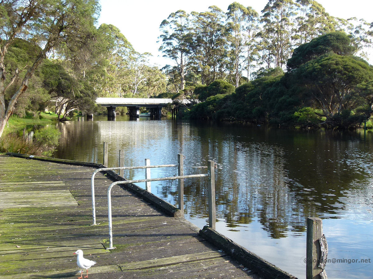
Frankland River at Nornalup The Frankland River flows lazily on its way to the coast. The mouth is on the Nornalup Inlet, south of Walpole. Photo - October 2014 |
||
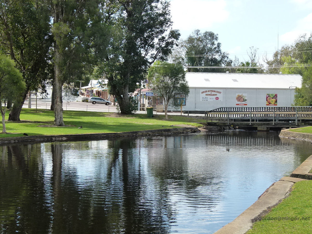 |
Gingin Brook at Gingin The Gingin Brook flowing through the town of Gingin. A small dam in Granville Park creates this picturesque lake and also water to drive an old nearby waterwheel. The Gingin Brook joins the Moore River about 30 kilometres east of Guilderton. Photo - September 2013 |
||
 |
Greenough River at Greenough The Greenough River estuary. A sand bar currently blocks any flow into the ocean. Just a handful of kilometres upstream, the river is totally dry. Photo - September 2014 |
||
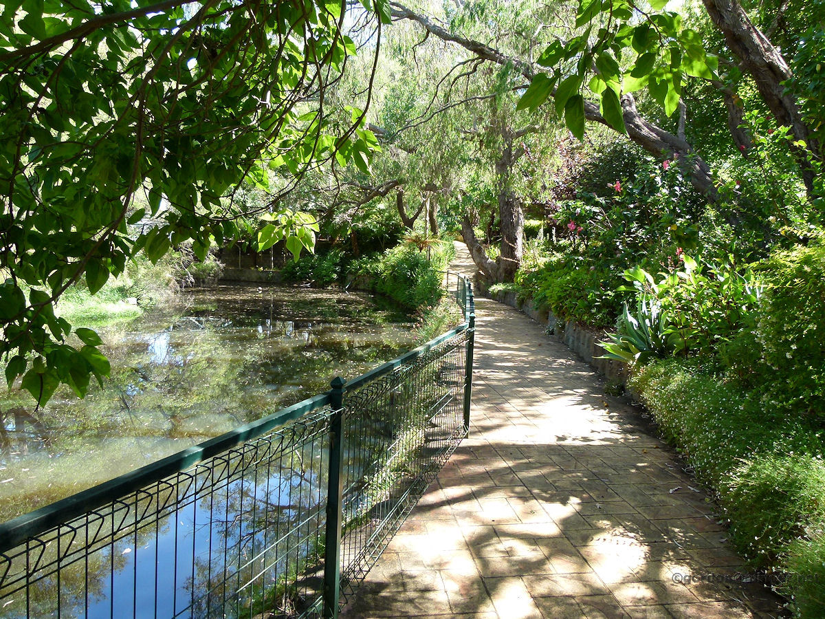 |
Harvey River at Harvey A walk through the Heritage Gardens behind Stirling Cottage can take you along this pathway which follows the Harvey River almost right up to the South Western Highway road bridge. Photo - January 2014 |
||
 |
Helena River at Guildford At Kings Meadow Oval in Guildford is where the Helena River meets the Swan River. This water is mostly sustained by the Swan River. A significant water level in the Helena River only continues a couple of hundred metres left of this picture. By the time you get to the river bridge on Great Eastern Highway, water is virtually non-existent. The Helena is dammed upstream creating the Mundaring Weir. Photo - April 2013 |
||
 |
Henley Brook at Henley Brook Henley Brook flowing strongly through this lovely green paddock on a July winter's day. The brook originates in what were wetlands adjacent to where the suburb of Ellenbrook is now situated. The brook flows into the Swan River. Photo - July 2011 |
||
 |
Hotham River at Boddington The Hotham River flowing through Boddington. The river rises some 30 kilometres east of Pingelly where it is fed by a number of local seasonal creeks and streams. South of Boddington, the Williams River joins and from that point the system is known as the Murray River. Photo - October 2011 |
||
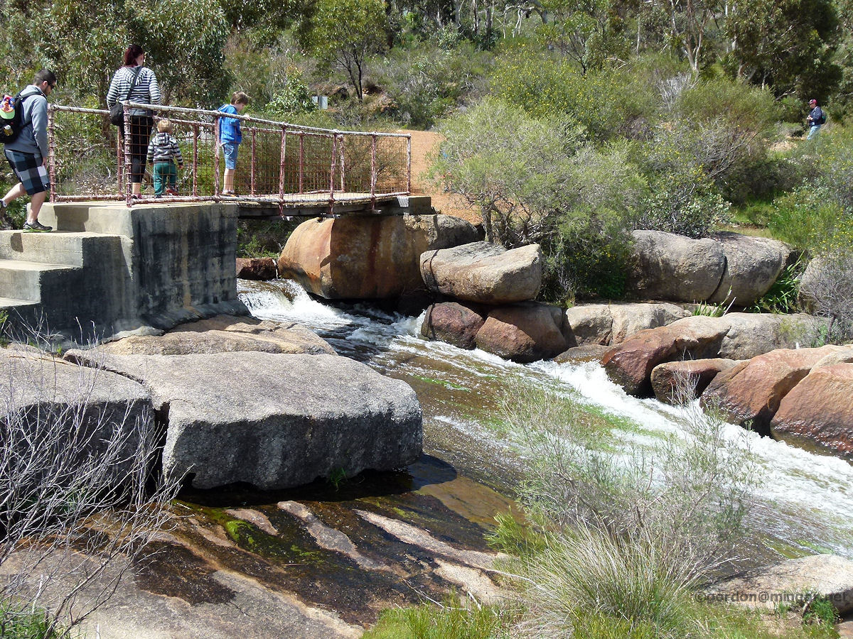 |
Jane Brook at John Forrest National Park The Jane Brook in full flow. These are the Hovea Falls located about 900 metres east of the central park area. Here's a handy way of traversing Jane Brook. This bridge is also a popular viewing platform. Photo - September 2013 |
||
 |
Jane Brook at John Forrest National Park Looking downstream from the the Hovea Falls from near the bridge crossing. Photo - September 2013 |
||
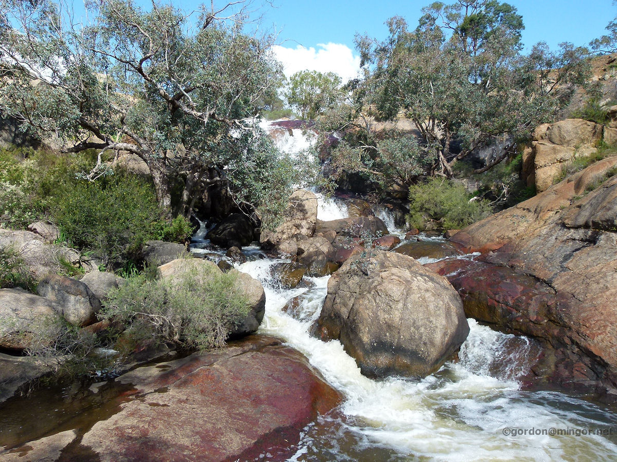 |
Jane Brook at John Forrest National Park The National Park Falls within the park. Still on Jane Brook, these falls are located some one kilometre west of the central park area. This is looking up at the falls from the lower level. Photo - September 2013 |
||
 |
Jane Brook at John Forrest National Park The National Park Falls this time viewed from the top which is a popular viewing area. Photo - September 2013 |
||
 |
Lefroy Brook at Pemberton Mist lingers over the Pemberton Pool and sunlight shafts through more mist above the water. This is part of the Lefroy Brook. Photo - October 2014 |
||
 |
Mahogany Creek at John Forrest National Park Mahogany Creek is one of a number of water courses which run through John Forrest National Park. Another of note is the Jane Brook. Pictured is a section of the Mahogany Creek in the Park. Further downstream the Glenbrook Dam collects as much water as the creek can give it. The creek therefore peters out just to the south of the dam. Photo - October 2010 |
||
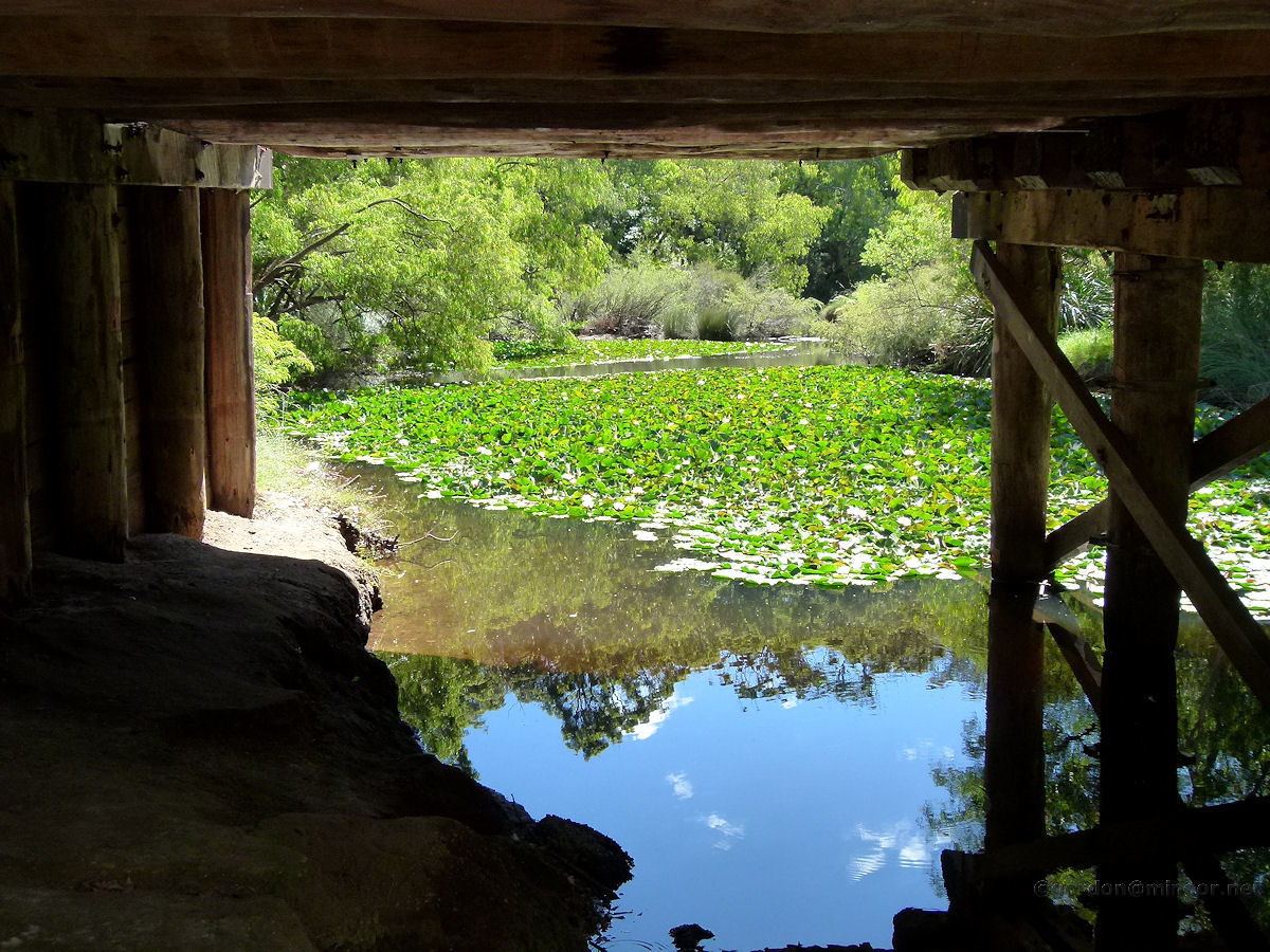 |
Margaret River at Margaret River A look at a section of the Margaret River from underneath the Bussell Highway road bridge. Photo - December 2013 |
||
 |
Margaret River at the River Mouth For most of the year the Margaret River mouth is blocked from the ocean by a sand bar. Here you can see a section of sea in the foreground and the Margaret River beyond the bar. Photo - December 2013 |
||
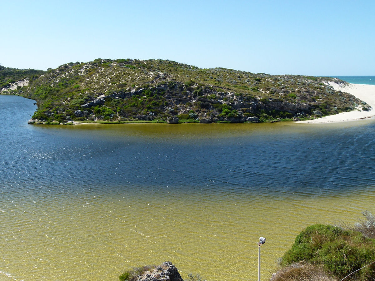 |
Moore River at Guilderton This is the spectacular Moore River estuary at Guilderton. A sand-bar exists across the mouth of the river for most of the year, preventing water outflow into the ocean, hence the healthy estuary water level as you can see here. The Moore River originates in the Piawaning area. Upstream water flow is seasonal and sporadic. Photo - January 2011 |
||
 |
Murray River at Pinjarra The Murray River commences at the confluence of the Hotham and Williams Rivers adjacent to the Harvey - Quindanning Road, about 20 kilometres south-west of Boddington. The river continues its course largely though bushland and hills before reaching Pinjarra. Here is a section of the Murray River at Pinjarra. Photo - August 2011 |
||
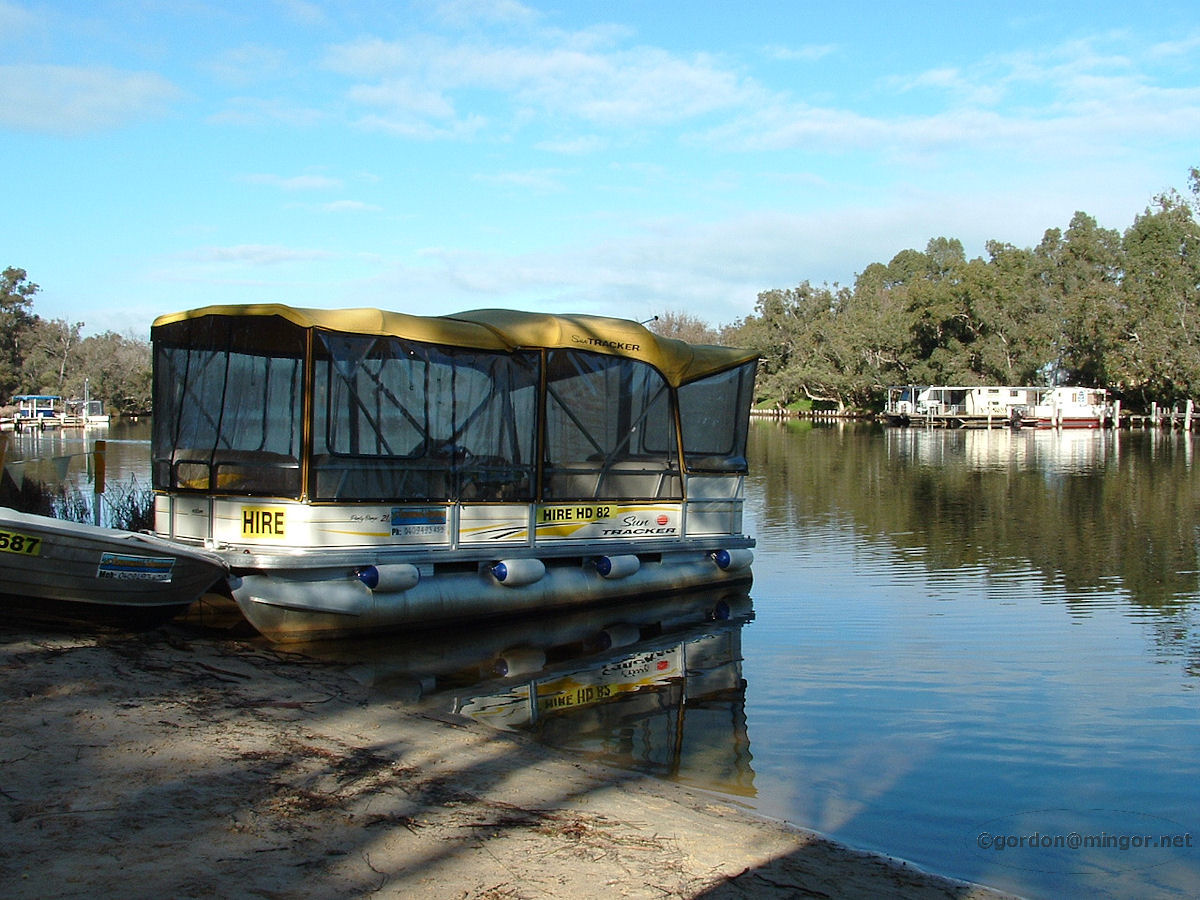 |
Murray River at Ravenswood Boats for hire at Ravenswood, on the Murray River. After the river leaves Pinjarra, it meanders quite a lot through rich farmland before it passes through nearby Ravenswood, and then finally empties into the Peel Inlet at South Yunderup. Photo - July 2010 |
||
 |
Preston River at Donnybrook The Preston River flowing through Gnangangarich Park in Donnybrook. This weir helps retain a good water level in the park. The river rises near Mumballup and eventually meets the sea in the Leschenault Estuary near Bunbury. The river's overall length is 84 kilometres. Photo - February 2011. |
||
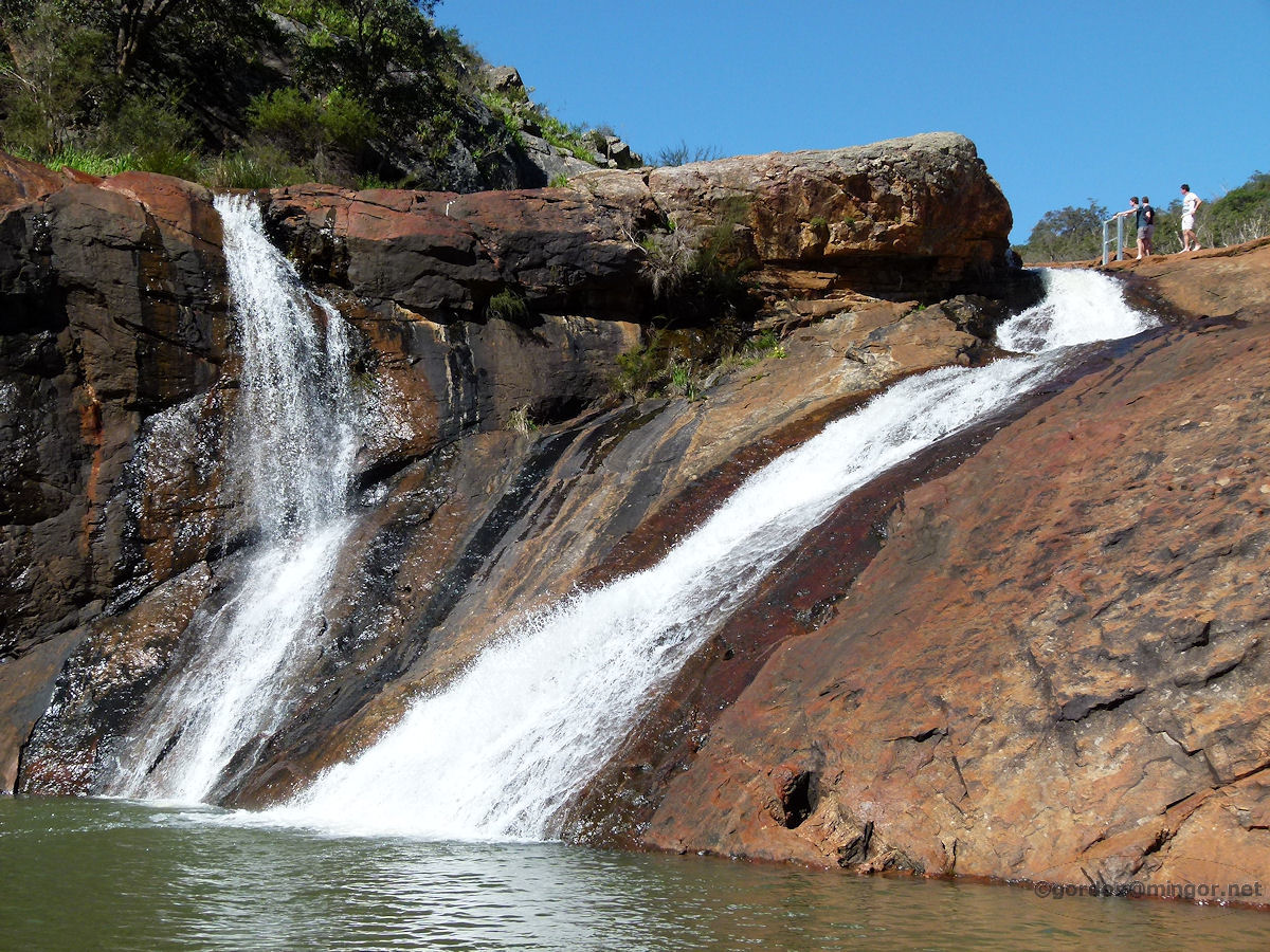 |
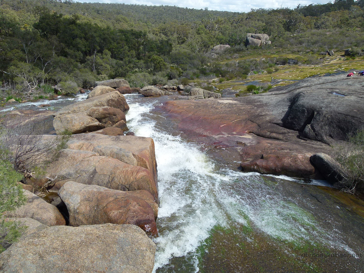
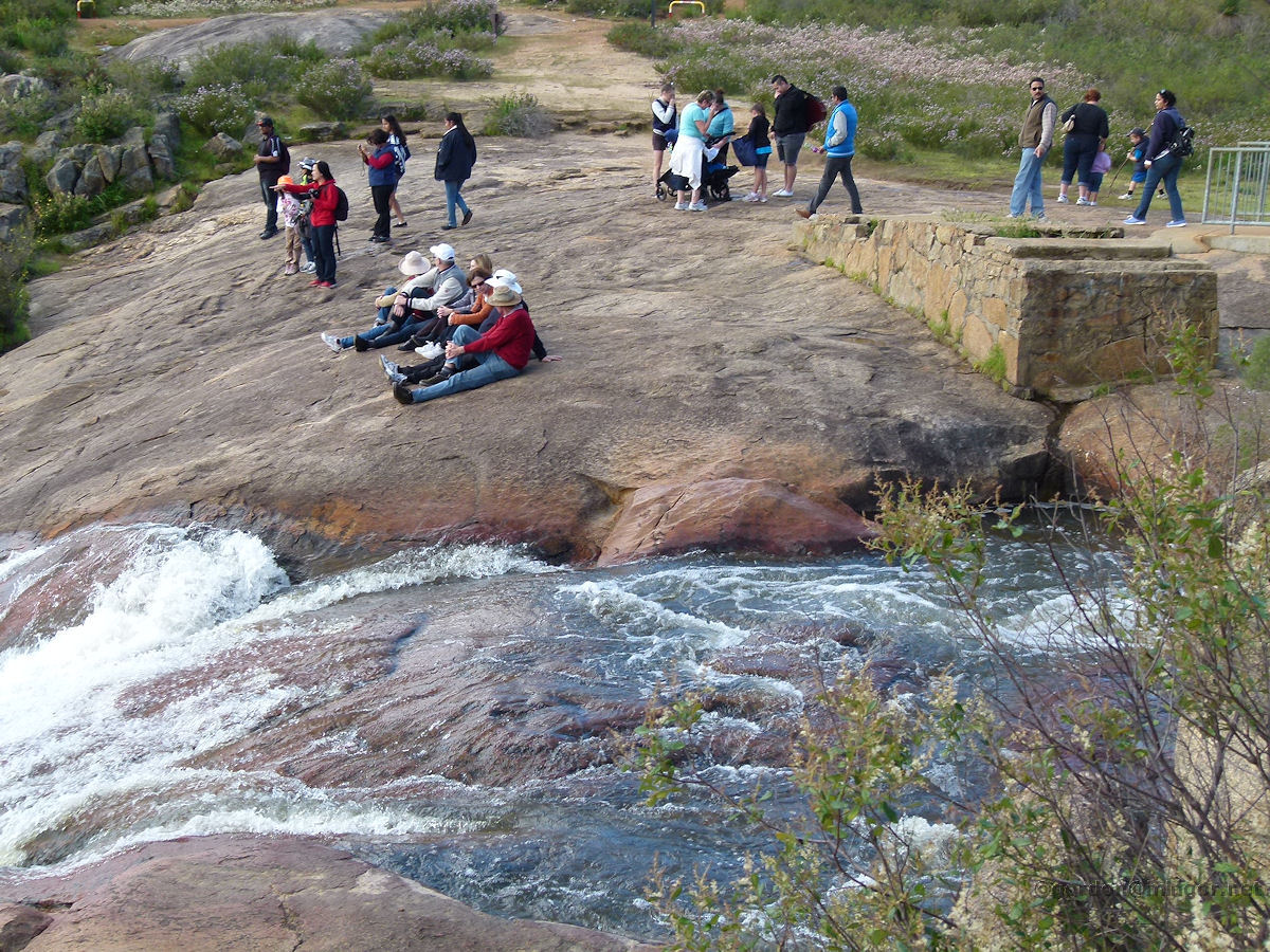
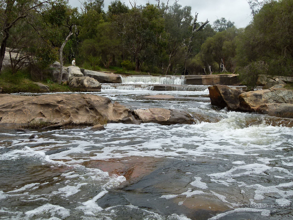
Serpentine River at Serpentine Falls Here are the Serpentine Falls. The noise is loud, lots of water after reasonable rains, kids swimming in the pool at the bottom and around the overflow spillway, all-in-all, pretty good. You can get an idea of the size by those kids who did a dangerous walk across steep rock-faces to get where they are. Photo - September 2012 |
||
 |
South Dandalup River at Fairbridge The South Dandalup River flows through the Fairbridge Village north of Pinjarra. The river is dammed just south of Dwellingup forming the South Dandalup Dam. Water flow in this stretch of the river is seasonal. It can be dry in summer and then flow quite strongly after effective winter rains in the nearby hills. Photo - July 2010 |
||
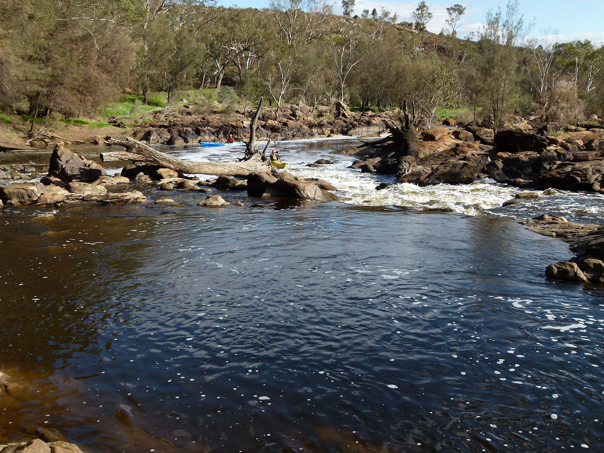 |
Swan River at Brigadoon The upper reaches of the Swan River at Bells Rapids in Brigadoon. Good June rains see the river flowing quite well and a couple of hardy fellows seem to be kayak practicing for the Avon Decent which is held in early August. Photo - July 2011 |
||
 |
Swan River at Middle Swan Despite its prestige, the Swan River is a relatively short river, emanating from the Avon River a few kilometres upstream from Middle Swan. The Swan and Avon Rivers are two of the few remaining waterways in the Perth region which has not been dammed. Early explorer James Stirling was able to navigate up the river as far as Henley Brook. Photo - October 2013 |
||
 |
Swan River at Woodbridge Below the river side of the Woodbridge Restaurant is this private jetty belonging to the Woodbridge House Estate. Over on the far bank grape vines are enjoying their Caversham spring sunlight. This is perhaps an upstream Swan River view at its finest. It is easy to see here why the river is so important and attractive in Perth. Photo - October 2012 |
||
 |
Swan River at Guildford The "Guildford Harbour Bridge" crosses the Swan River at Guildford. That's Success Hill on the other bank. This is fairly close to where the Helena River joins. An area of the river stretching from here to Bayswater has been susceptible to toxic algae blooms during the summer months caused by a mixture of a minimal water movement, a higher water temperature and the presence of nutrients leeched into the river from agricultural fertilizers. Photo - July 2010 |
||
 |
Swan River at Bayswater An idyllic view of the Swan River at Bayswater Riverside Gardens. This is looking south-west towards Perth City, taking in a small riverside beach and the Garrett Road bridges. In the left of picture is a section of a small river island. Photo - July 2013 |
||
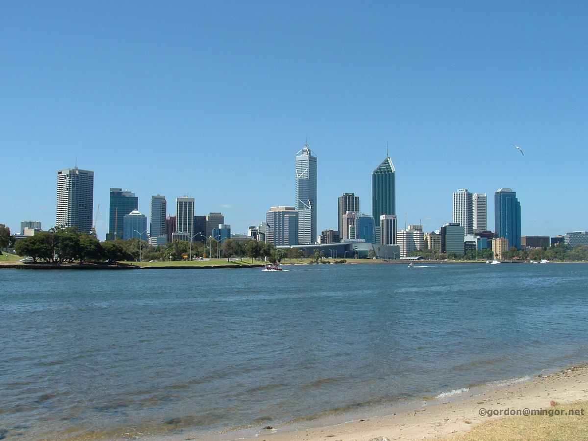 |
Swan River at South Perth Perth City looking across the Swan River from South Perth. This stretch is known as Perth Water. The water is still pretty clean. Many jellyfish can be seen along the banks. Fishing and boating is popular. The river water is salty and somewhat tidal, being fed upstream from the river mouth in Fremantle. Photo - January 2009 |
||
 |
Swan River at Como On the shoreline of the Swan River between Comer and Preston Streets in Como. There are a number of small breakwaters, bagged like this, or made of stone. During stormy weather during the winter and when the tide is high, the river water has been known to wash onto adjacent roads. Particularly vulnerable are Riverside Drive, Mounts Bay Road and occasionally the Kwinana Freeway here in Como. Photo - October 2012. |
||
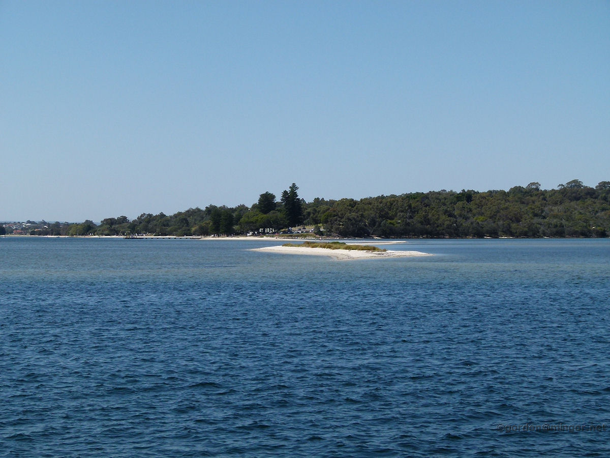 |
Swan River at Bicton A really good attraction at Point Walter in Bicton is this great sand spit which reaches right out into the middle of the Swan River. Many people walk to the end, even when the tide is high. This is a view from the very end of the spit. It was taken from a Captain Cook cruise boat en route from Perth to Fremantle which has to navigate close to the far bank to avoid this river hazard. Photo - October 2010 |
||
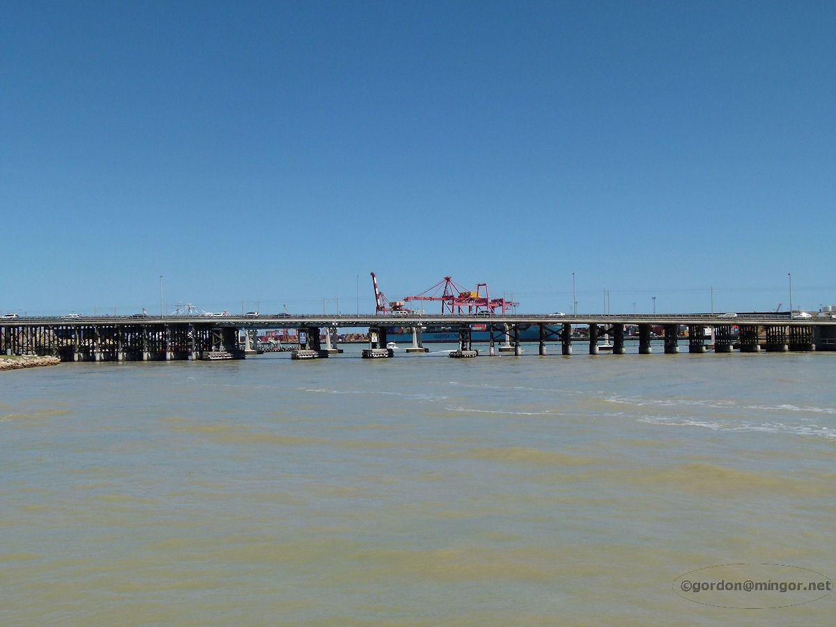 |
Swan River at East Fremantle On the Swan River in East Fremantle approaching the old Fremantle Traffic Bridge on the Captain Cook boat. Beyond this bridge is the Port of Fremantle. The water here is rather murky due to dredging being undertaken in the port area. Photo - October 2010 |
||
 |
Swan River at Fremantle The mouth of the Swan River. The river passes through the Port of Fremantle and then in between Rous and Arthur Heads before meeting the Indian Ocean. Photo - October 2012 |
||
 |
Vasse River at Busselton Slightly north of town, the Vasse River flows languidly if at all, a somewhat series of billabongs right now, which probably accounts for the algae greenness. The bridge over there is the southern end of Causeway Road which is the main entrance into the town of Busselton from the north. Photo - January 2013 |
||
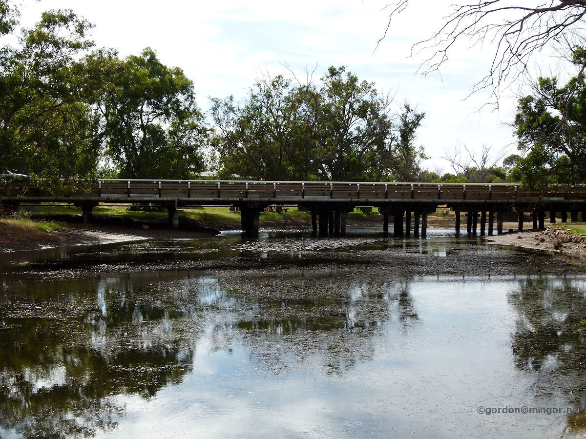 |
Williams River at Williams The Williams River seen here flowing under the Albany Highway road bridge on the south side of the Williams townsite. The head of this river is located approximately half way between Williams and Narrogin. The river joins the Hotham River south of Boddington. Photo - November 2011 |
||
 |
Williams River at Quindanning The road bridge across the Williams River as viewed from next to the hotel. Beyond the bridge is the Williams-Harvey road junction and the community centre. At present the river is completely dry. Photo - April 2014 |
||
 |
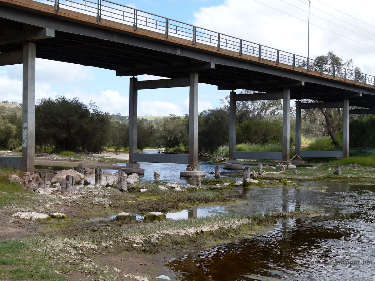
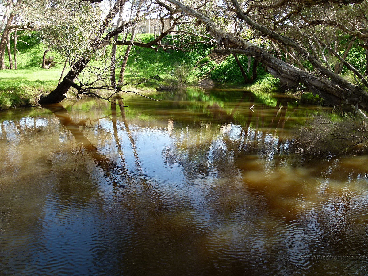
Wooroloo Brook at Noble Falls The Wooroloo Brook is a tributary of the Avon River. The brook runs east and north of Gidgegannup. On the brook is the Noble Falls. Here is a view of the brook looking east back towards the falls. In summer the creek bed is generally dry but some pools continue to exist just east of the falls. Photo - October 2013 |
||
All images published on this website are copyright © of the webmaster. See About section for clarification and special schools permission |
|||