| Photographs of Perth, Western Australia | |||
Bridgetown - Photographs of Western Australia A large community on the Blackwood River, 268 kms south of Perth. Settled in 1861 and originally named Geegelup, the present name was adopted in 1868 named after the wool carrying vessel the "Bridgetown". This ship was the first to carry wool and other local produce from this area out through the port of Bunbury. The town is located between Greenbushes and Manjimup on the South Western Highway. The town was gazetted as Bridgetown in 1868 |
|||
| North to Greenbushes | South to Manjimup | ||
| West to Nannup | East to Boyup Brook | ||
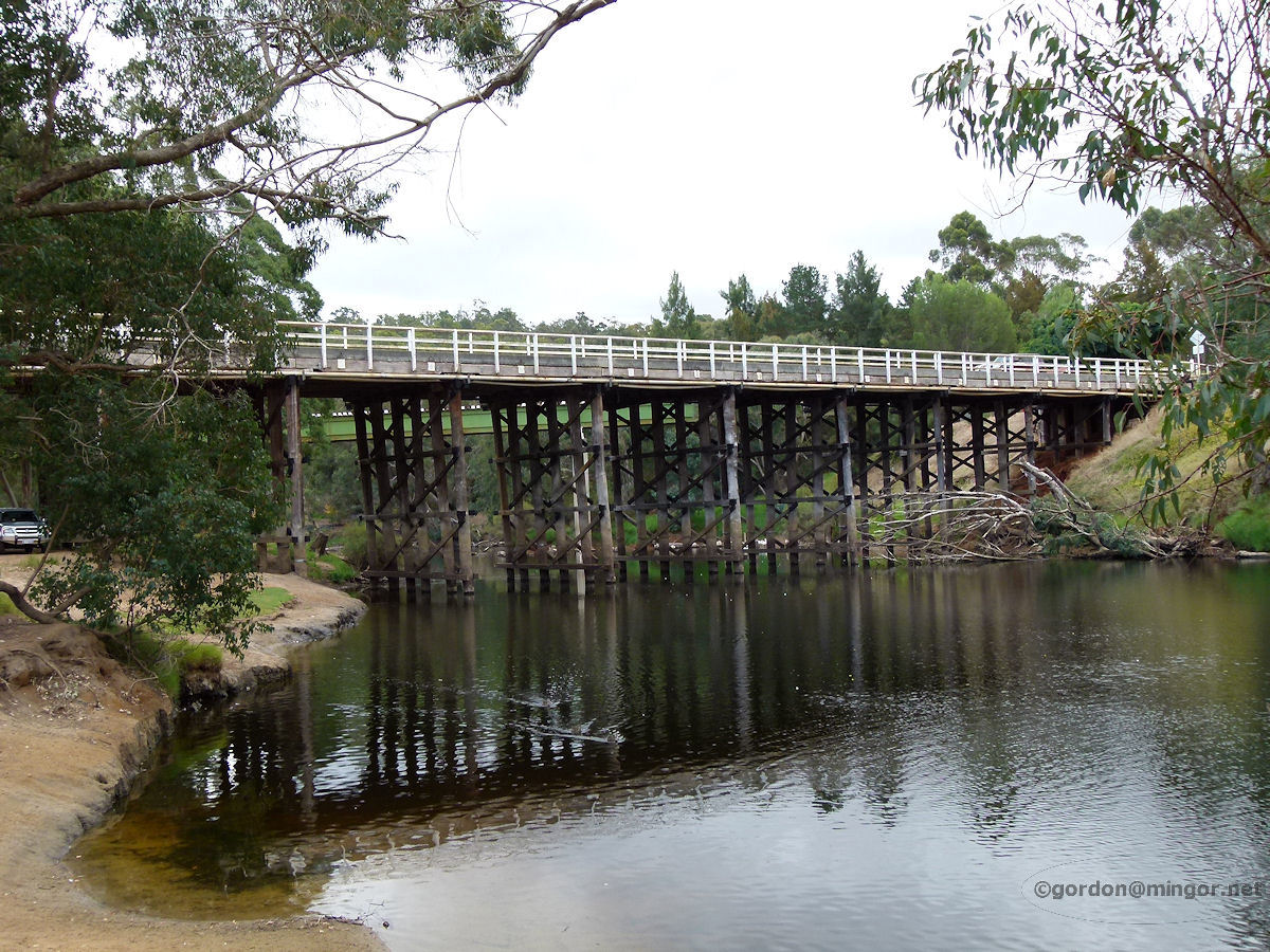 |
Bridgetown - Road Bridge over Blackwood This large wooden road bridge spans the Blackwood River to the south of the town, carrying the South Western Highway. April 2012. Photos Ref: BRID001 |
||
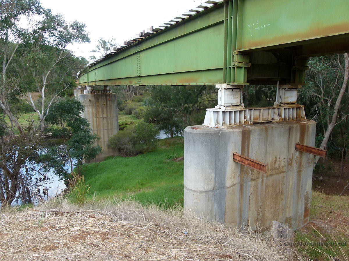 |
Bridgetown - Rail Bridge over Blackwood River Running parallel to the wooden road bridge is this concrete and metal rail bridge also crossing the Blackwood River. April 2012. Photos Ref: BRID002 |
||
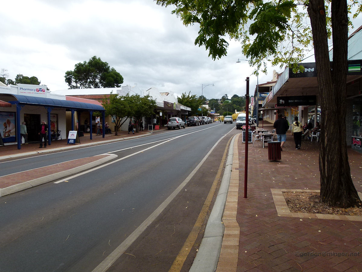 |
Bridgetown - South Western Highway A view looking north along the South Western Highway in the centre on town. You can just see the "Hotel" sign on the left which is the Freemasons Hotel. April 2012. Photos Ref: BRID003 |
||
 |
Bridgetown - Steere Street A view looking west down Steere Street. The old rail line crosses the road. Down there past the newsagency is the Freemasons Hotel. April 2012. Photos Ref: BRID004 |
||
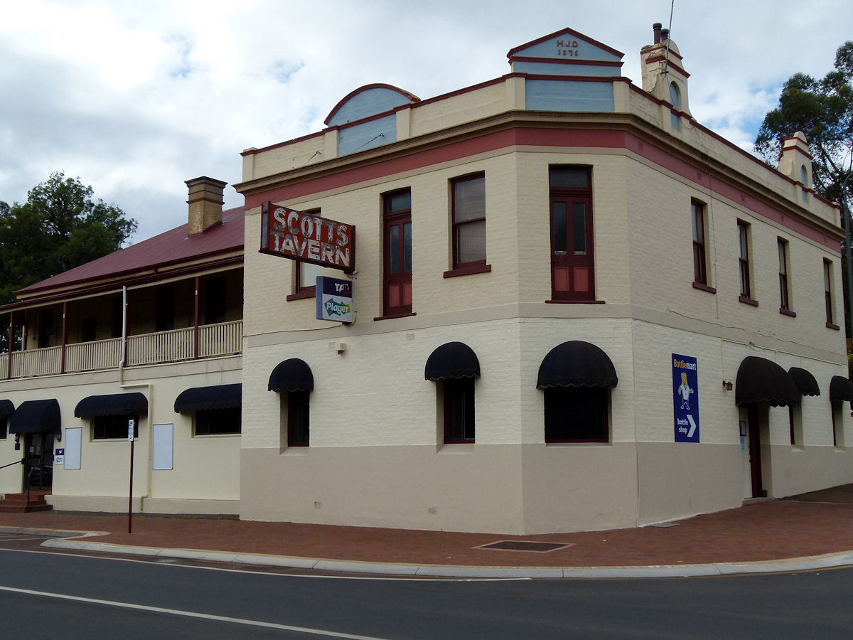 |
Bridgetown - Scott's Tavern One of three hotels in Bridgetown, this is Scott's Tavern towards the south end of town. It was built in 1876 and was originally called The Farmers' Home Hotel. After World War 1, the hotel lessee, Mr J. Scott bought the hotel from the owner, Mr Henry Doust, and renamed it Scott's Hotel. April 2012. Photos Ref: BRID005 |
||
 |
Bridgetown - Solicitor's Office and Hill A view of Hampton Street (South West Highway) taking in the old Solicitor's Office, local traffic and steep hill beyond. April 2012. Photos Ref: BRID006 |
||
 |
Bridgetown - Solicitor's Office A closer look at the solicitor's office. It may be coincidental that this was originally built for such a purpose circa 1890 and today it is occupied by Howard Evans, Barrister and Solicitor. April 2012. Photos Ref: BRID007 |
||
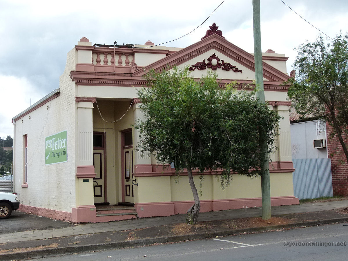 |
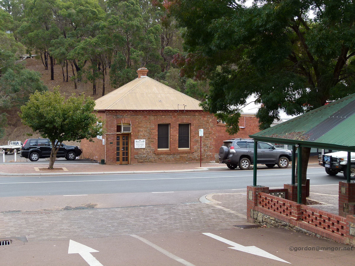
Bridgetown - Road Board Building The well preserved old Road Board building partially obscured by a tree. This was constructed in 1887 and is currently occupied by Fetter Chiropractic. April 2012. Photos Ref: BRID008 |
||
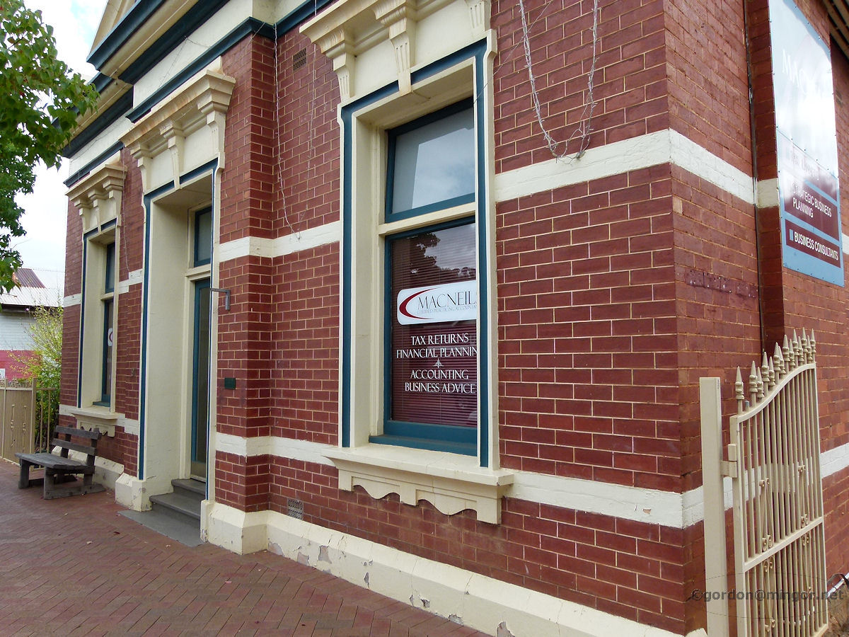 |
Bridgetown - National Bank Building A glimpse of the front of the old National Bank Building constructed circa 1910. It is currently occupied by MacNeils, Certified Practicing Accountants. April 2012. Photos Ref: BRID009 |
||
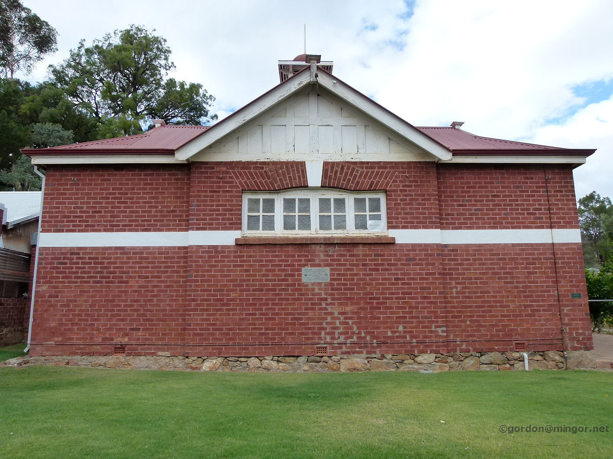 |
Bridgetown - Masonic Lodge The sturdy Masonic Lodge on the main street. The Foundation Stone was laid by Bro. H. Doust, Treas., on 13th April 1910. United Lodge No. 60 WAC. I would assume that Bro. Doust is Henry Doust, the original owner of Scott's Tavern. April 2012. Photos Ref: BRID010 |
||
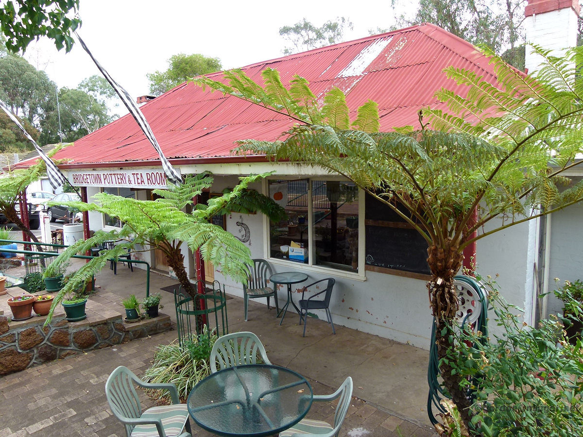 |
Bridgetown - Maslin House The historic Maslin House was built in 1870. Today, Bridgetown Pottery and Tearooms occupy it. It has an interesting history. Originally it was home for the Maslin family and used as a 'Lying-in House' for women in childbirth. From 1937 to 1950's it was used as a boarding house and general store and then known as Macedonia House. April 2012. Photos Ref: BRID011 |
||
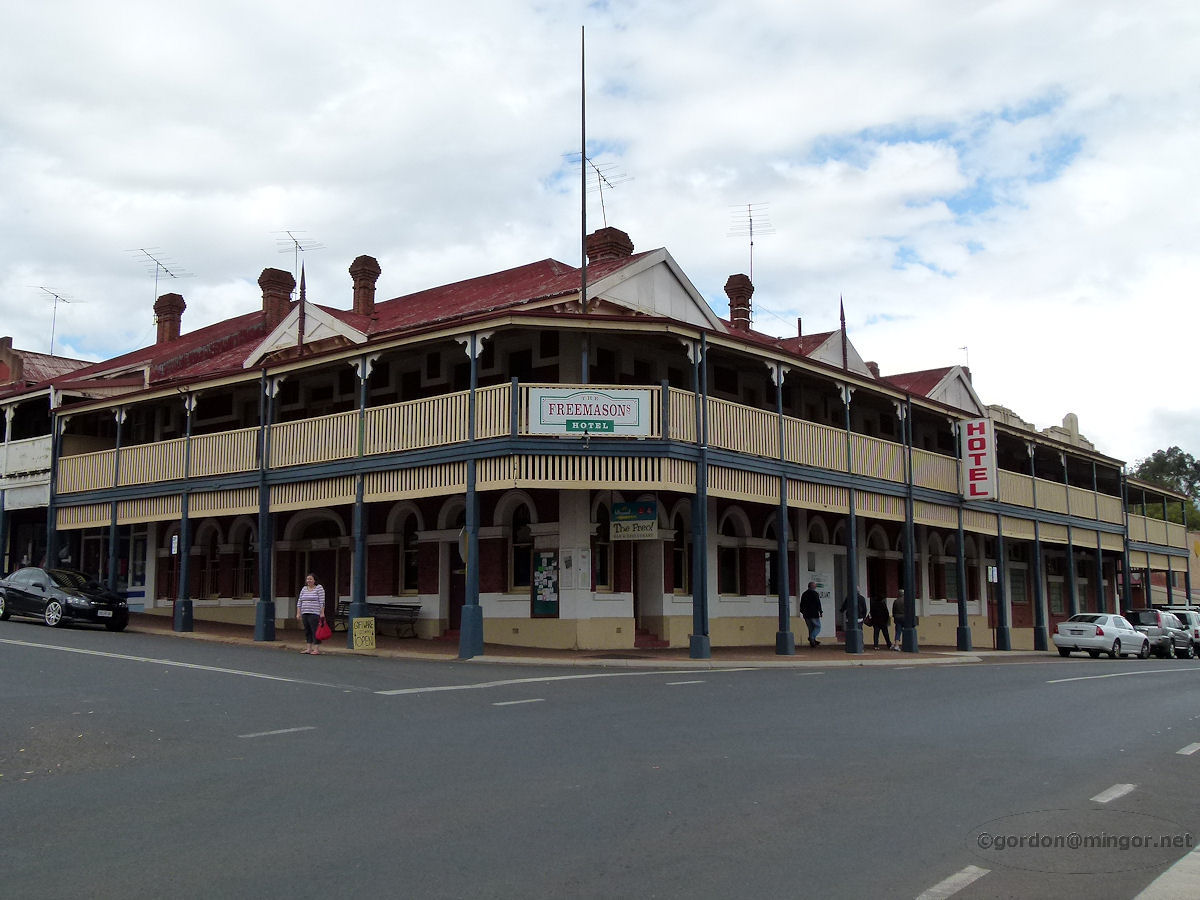 |
Bridgetown - Freemason's Hotel On the corner of Steere Street and Hampton Street (or South Western Highway) is the impressive Freemasons Hotel. The hotel was constructed in 1904. April 2012. Photos Ref: BRID012 |
||
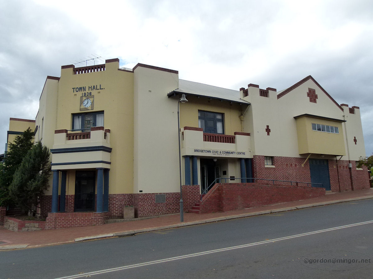 |
Bridgetown - Town Hall Constructed in 1936, here is the Bridgetown Town Hall, Civic and Community Centre. April 2012. Photos Ref: BRID013 |
||
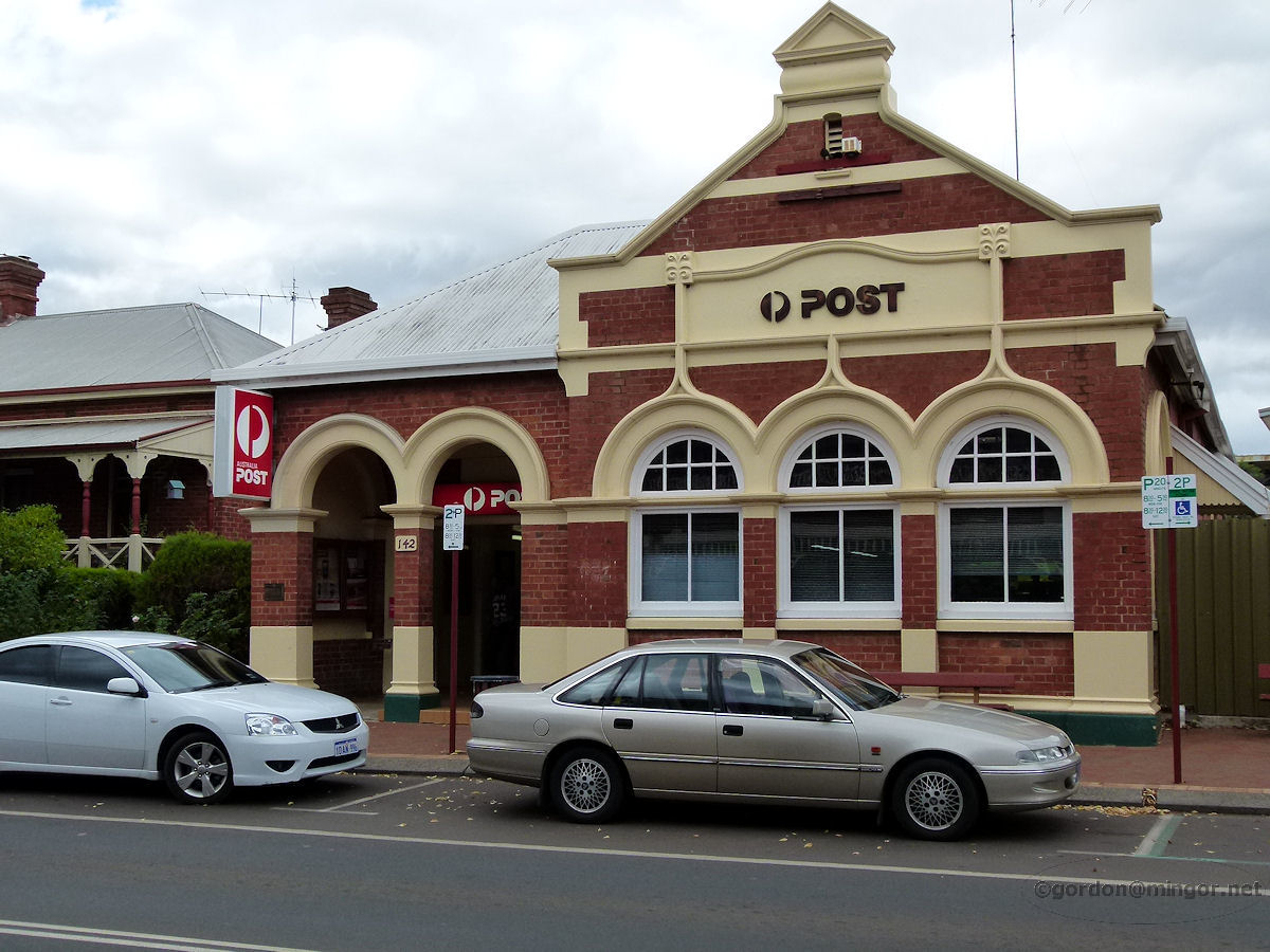 |
Bridgetown - Post Office The Bridgetown post office, just across the road from the Bridgetown Hotel. This building was constructed prior to 1895 although records are unclear. However, it is known that the first Postmaster in the district was Mr J. Blechynden from 14th April 1864. Mrs Esther Moulton replaced him in 1866. These historic facts are displayed on Geegelup Heritage Trail signs. April 2012. Photos Ref: BRID014 |
||
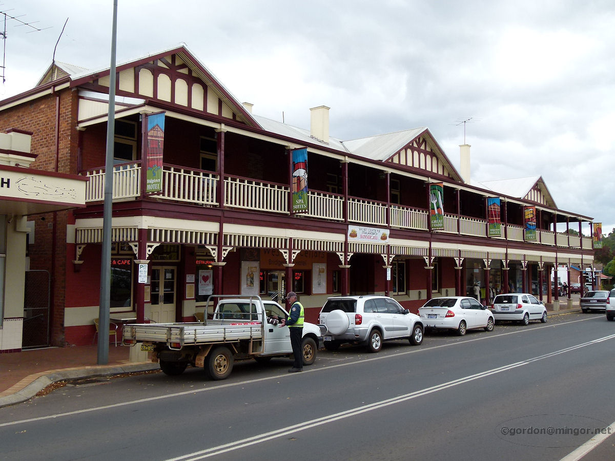 |
Bridgetown - Bridgetown Hotel Just north of the Steere Street and South Western Highway intersection is the Bridgetown Hotel. A Town Ranger (you can see him in picture) told me that this pub was almost at demolition point 10 or so years ago but new owners took over and has been renovated at considerable cost to them. April 2012. Photos Ref: BRID015 |
||
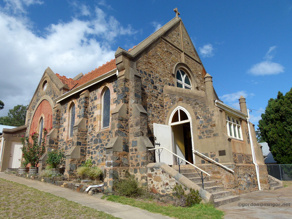 |
Bridgetown - St Paul's Anglican Church St Paul's Anglican Church, Bridgetown. The Foundation Stone was laid by Frances Dean, President, on behalf of St Paul's Ladies Guild on 26th January 1911. April 2012. Photos Ref: BRID016 |
||
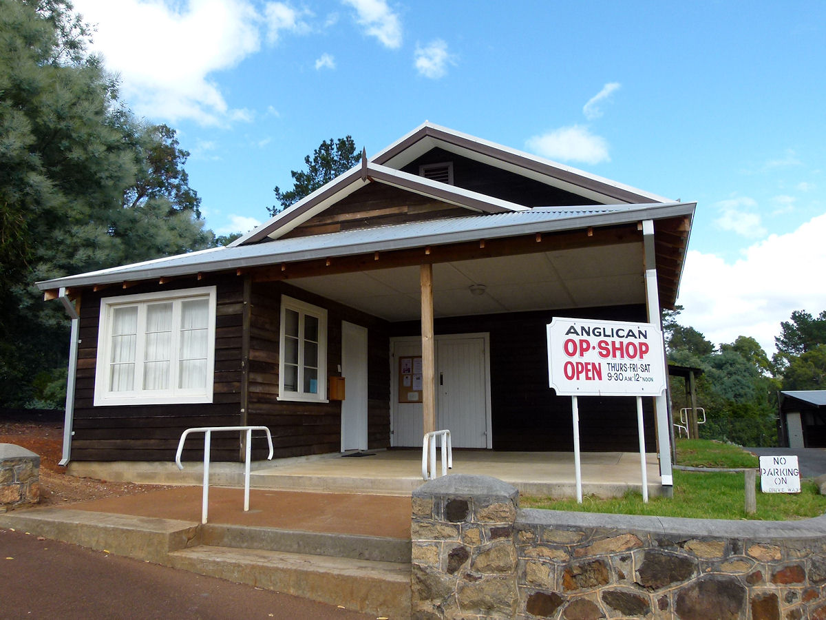 |
Bridgetown - Anglican Church Opportunity Shop Next door to St Paul's Anglican Church, built of dark wood and painted with white trim, is the Anglican Church Opportunity Shop. Undoubtedly local timber. April 2012. Photos Ref: BRID017 |
||
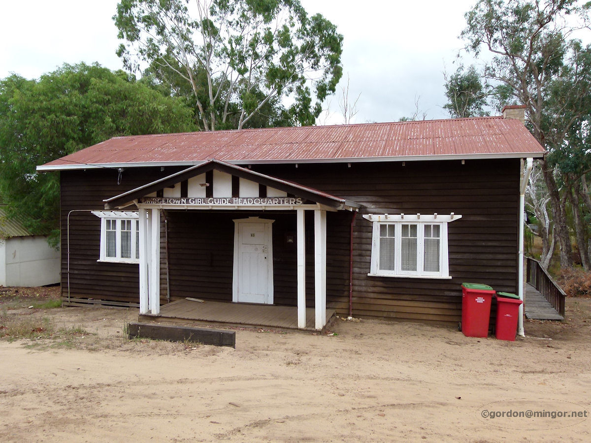 |
Bridgetown - Girl Guide Hall The attractive looking local Girl Guide Association Hall constructed in a style and with materials reminiscent of the Anglican Church Opportunity Shop. April 2012. Photos Ref: BRID018 |
||
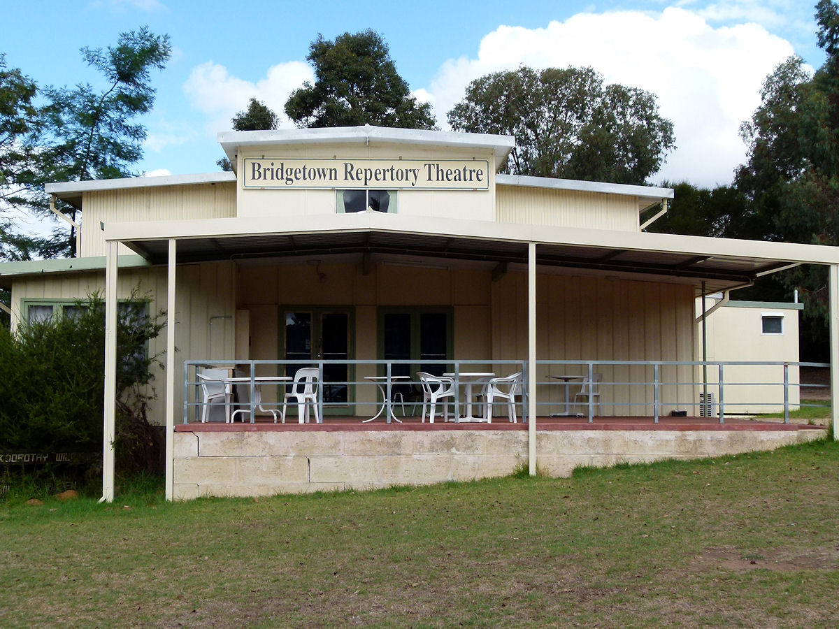 |
Bridgetown - Repertory Theatre On the northern outskirts of town is the Bridgetown Repertory Theatre. April 2012. Photos Ref: BRID019 |
||
 |
Bridgetown - Uniting Church The Uniting Church in Australia, Bridgetown Congregation. Originally known as the Wesley Church, the Foundation Stone was laid by Mrs W. A. G. Walter on 26th December 1898. April 2012. Photos Ref: BRID020 |
||
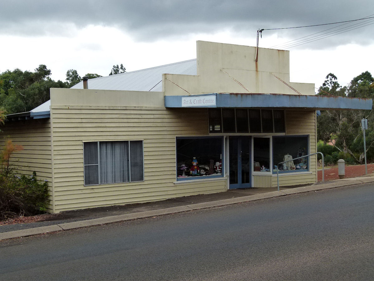 |
Bridgetown - Art and Craft Centre The Art and Craft Centre occupies an old shop up on Steere Street. April 2012. Photos Ref: BRID021 |
||
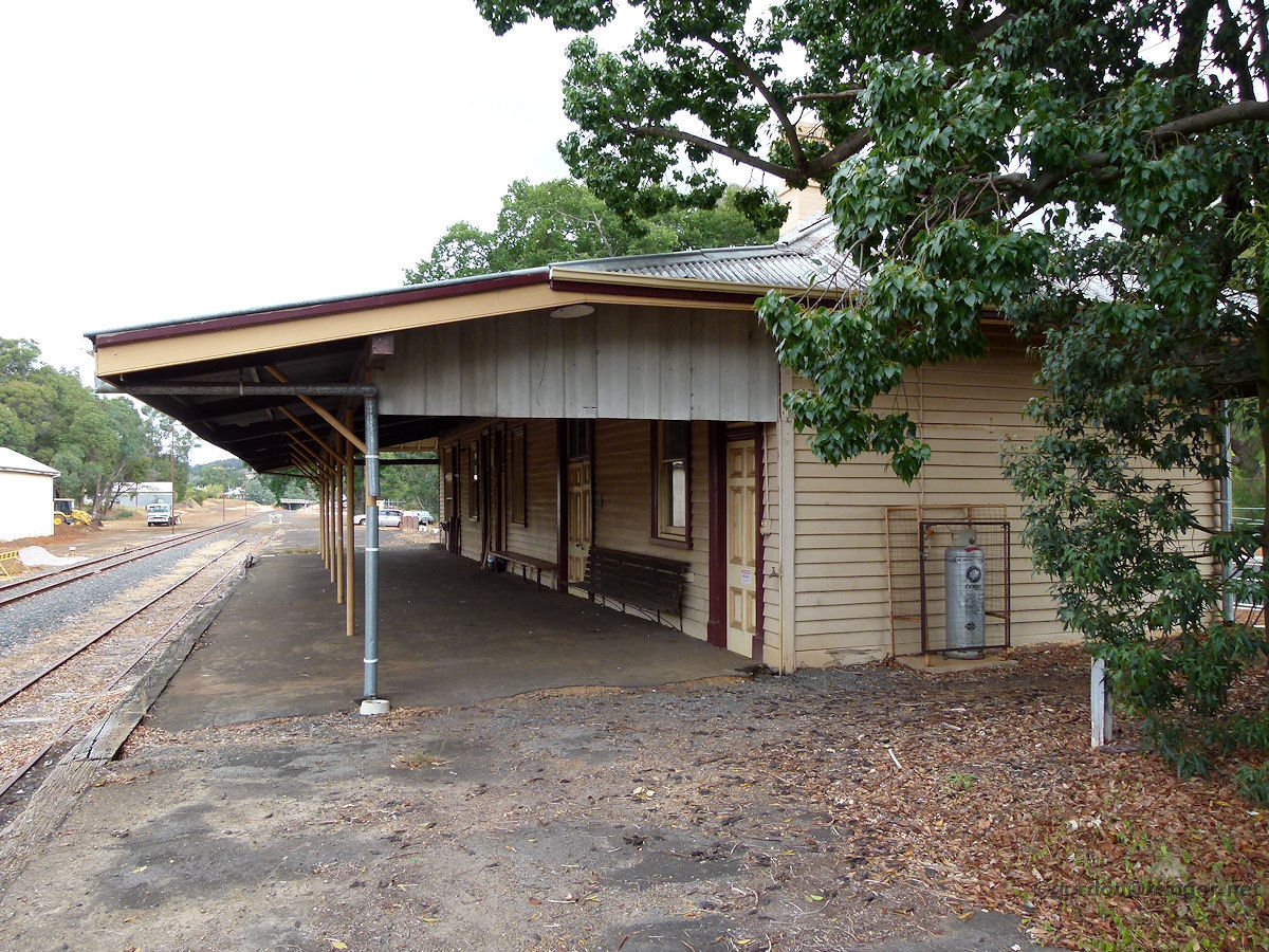 |
Bridgetown - Railway Station The Bridgetown railway station. The tracks are still here and like many of rural Western Australian train stations, the buildings remain and look fine - all that's missing are the trains. The station is now used as the Environment and Land Care Centre. April 2012. Photos Ref: BRID022 |
||
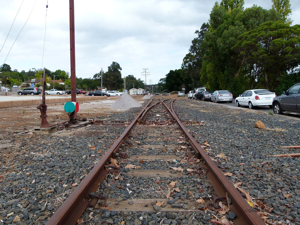 |
Bridgetown - Rail Yard Looking back up the track towards the train station. You can see the station building up there on the loop line. Behind, the line continues on south to Manjimup and ahead to Donnybrook and beyond. April 2012. Photos Ref: BRID023 |
||
All images published on this website are copyright © of the webmaster. See About section for clarification and special schools permission |
|||