| Photographs of Perth, Western Australia | |||
Gillingarra - Photographs of Western Australia A tiny townsite on the Bindoon - Moora Road, adjacent to the Moore River, situated around 12 kilometres north of Mogumber, and within the Shire of Victoria Plains. The townsite hardly rates in my detailed map book and is not included on Landgate's "History of W.A. Place Names" webpage. Featuring its own school, church and public amenities, not to mention the passing railway, years ago this was quite a thriving locality. Today it looks very smart |
|||
| North to Moora | South to Mogumber | ||
 |
Gillingarra - Primary School Here is the entrance to the Gillingarra Primary School situated on the main road, the Bindoon - Moora Road. July 2012. Photos Ref: GLGR001 |
||
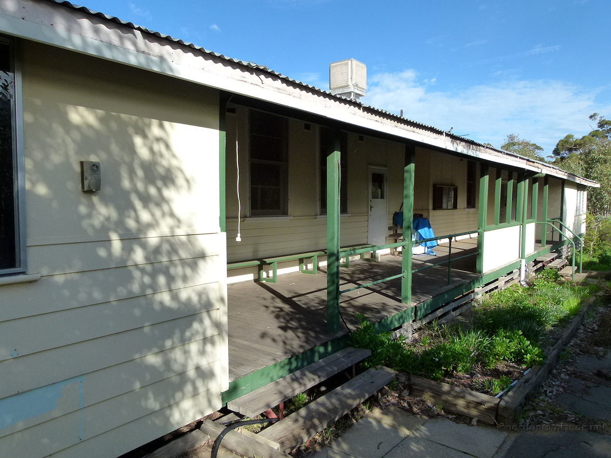 |
Gillingarra - Primary School Looking down the verandah at the class rooms of the school. All's quiet now as all the children would be enjoying their holidays on their farms. July 2012. Photos Ref: GLGR002 |
||
 |
Gillingarra - Main Street A view looking south down the main street. The house pictured is one of very few in town. The house is located next door to the school. July 2012. Photos Ref: GLGR003 |
||
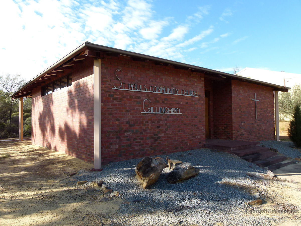 |
Gillingarra - St Paul's Community Catholic Church St Paul's Community Catholic Church is on the main road, located between the primary school and the hall. This brick building was erected in 1972. Gillingarra had an earlier Catholic church, built in 1907 and renovated in the late 1960's but unfortunately it burnt down in 1973. Cooperating with the Benedictine Community, the Anglican and Lutheran Churches also contributed to the construction of the new church. July 2012. Photos Ref: GLGR004 |
||
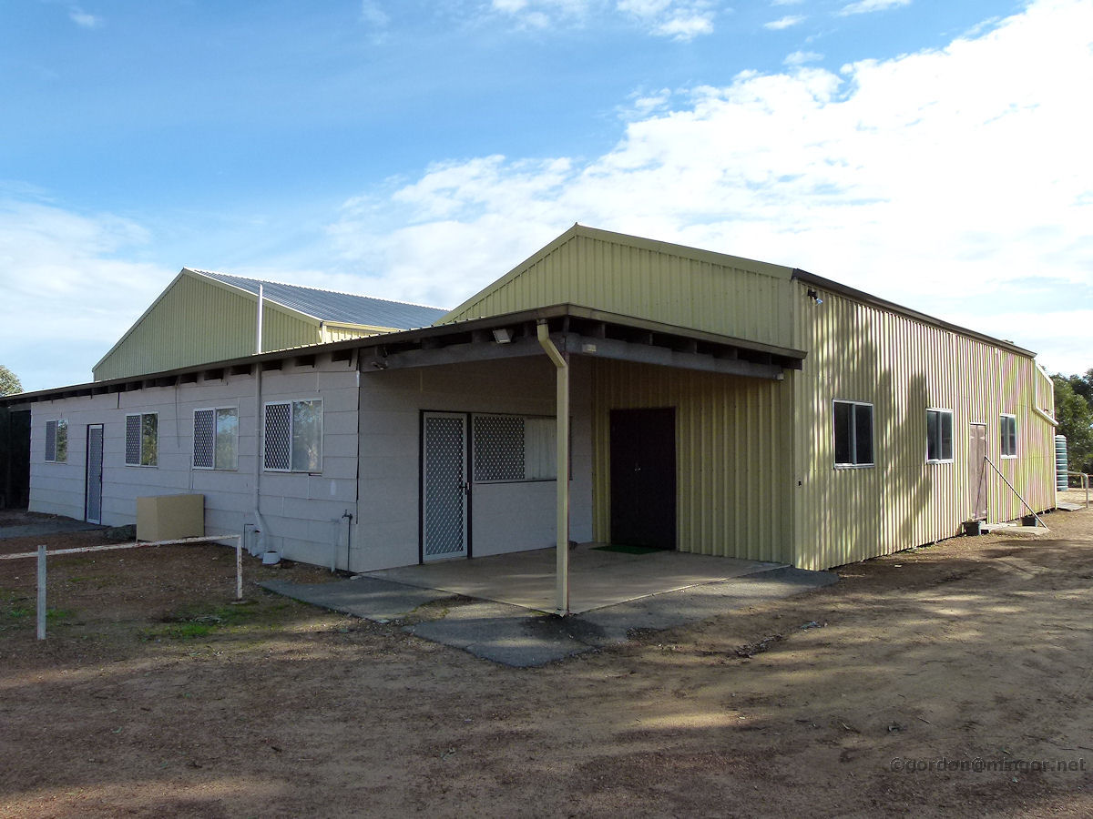 |
Gillingarra - Hall The local hall which also contains a kiosk probably to support sporting events on the sports ground at the rear, as would the building in general. The original hall was built in 1936. A new hall was built around the shell of the old one in 1986. July 2012. Photos Ref: GLGR005 |
||
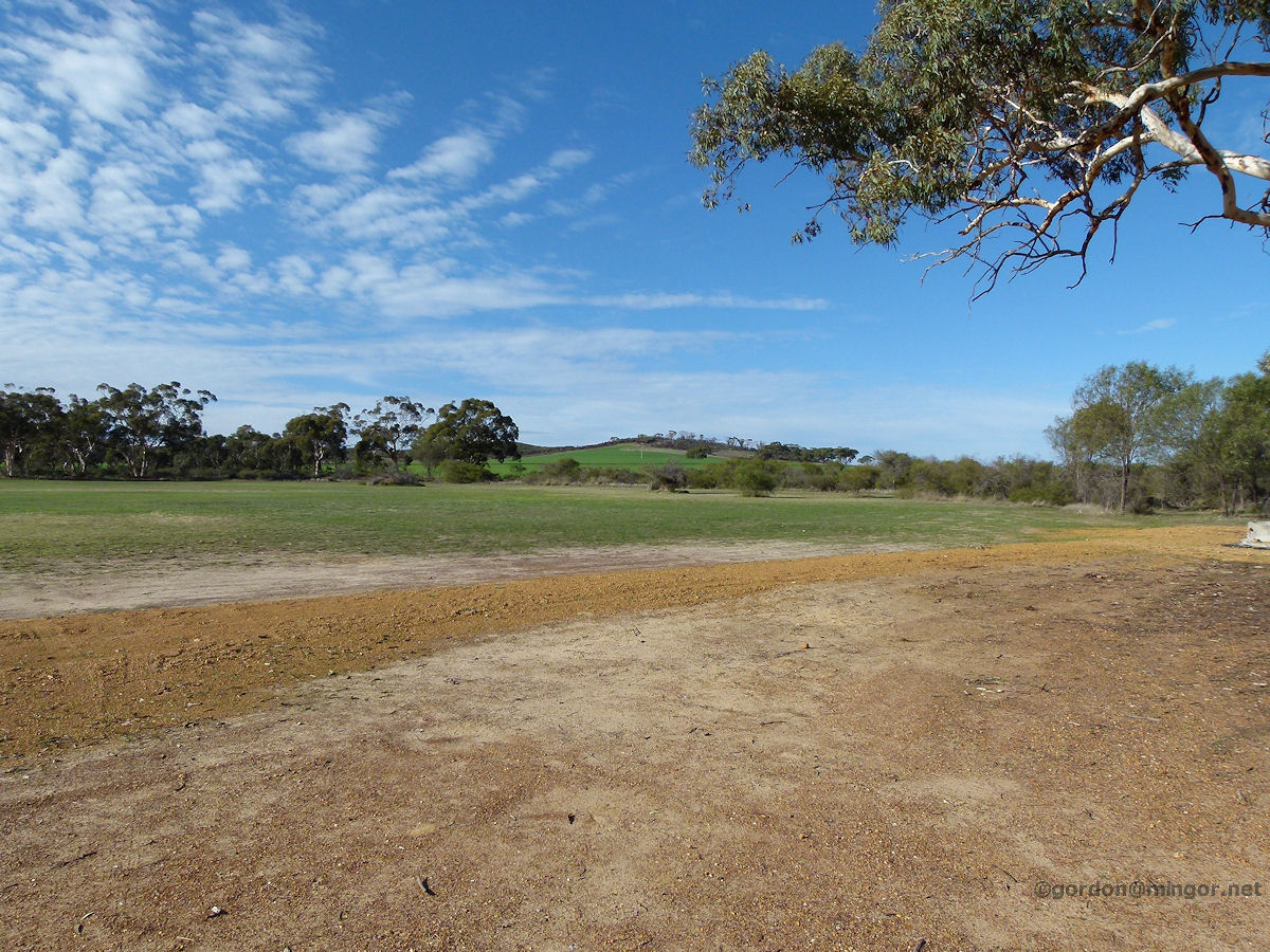 |
Gillingarra - Sports Ground At the rear of the hall is this sports ground and attractive views off into the distant paddocks and hills. July 2012. Photos Ref: GLGR006 |
||
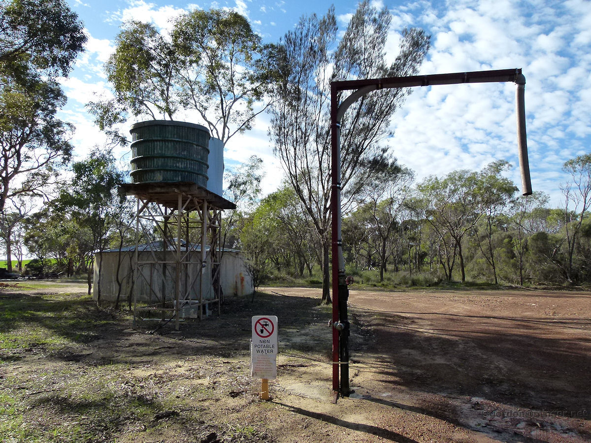 |
Gillingarra - Water Supply A part of the town water supply, storage tanks and pumping equipment. This is non-potable water so may be a fire engine watering point. Drinking water is stored elsewhere. July 2012. Photos Ref: GLGR007 |
||
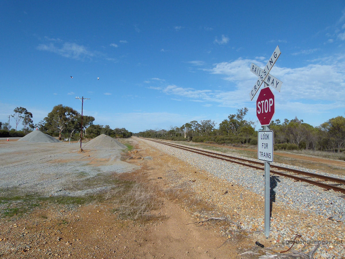 |
Gillingarra - Railway Just to add a bit of perspective, the rail line runs through here but there is no stopping point. July 2012. Photos Ref: GLGR008 |
||
All images published on this website are copyright © of the webmaster. See About section for clarification and special schools permission |
|||