| Photographs of Perth, Western Australia | |||
Mukinbudin - Photographs of Western Australia Mukinbudin is an agricultural centre some 300 road kms north-east of Perth. It is located about half way along what is now known as the Bencubbin to Bullfinch Road. Settlers were in the area in the late 1800's but it was not until the railway came through in the early 1920's, that land for the townsite was acquired and the townsite was gazetted. The locality was originally called Muckenbooding (an Aboriginal name) but this was shortened to Mukinbudin in 1922 |
|||
| West to Bencubbin | South to Kununoppin | ||
| East to Bullfinch | |||
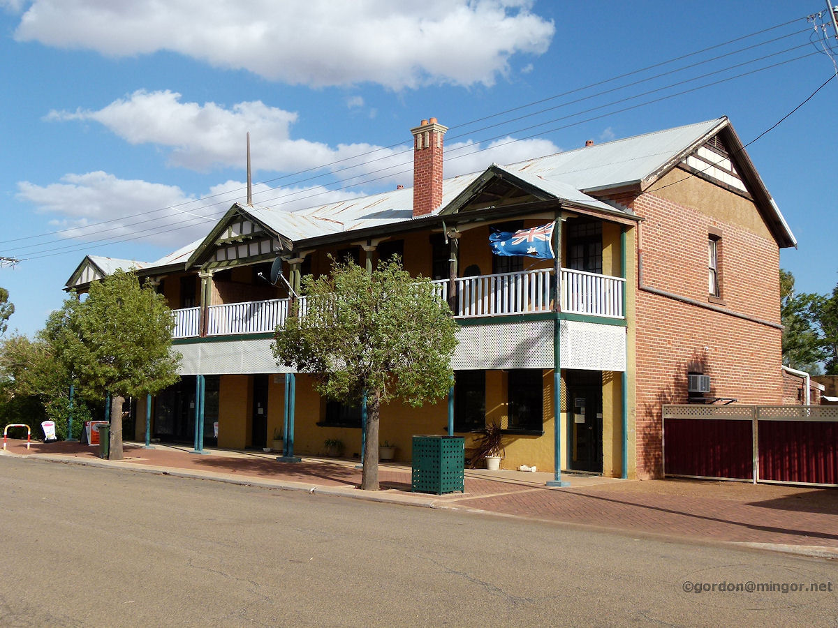 |
Mukinbudin - Hotel The Mukinbudin Hotel on the main street, Shadbolt Street (the Koorda - Bullfinch Road). The hotel was constructed in 1925. March 2015. Photos Ref: MUKB001 |
||
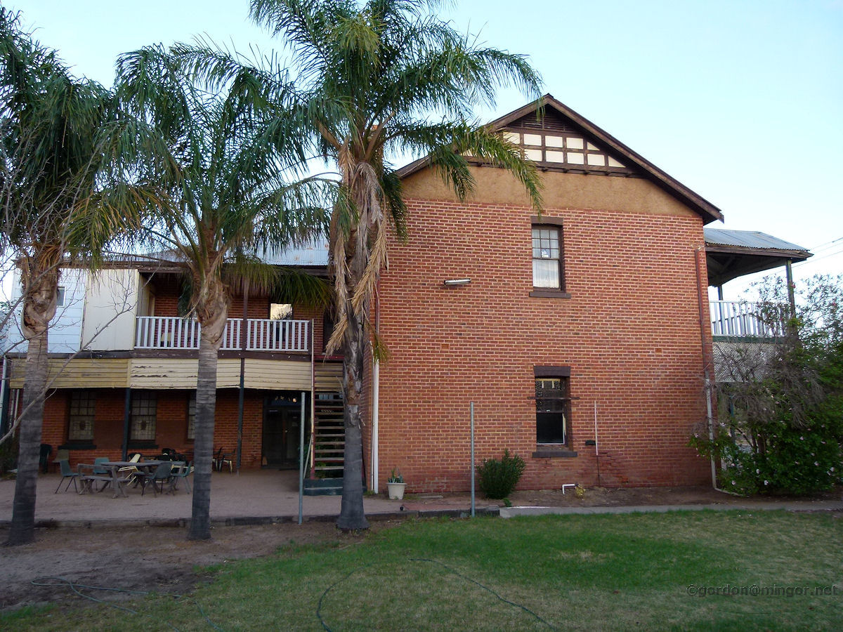 |
Mukinbudin - Hotel The eastern face of the hotel catches light soon after sun-up. The upper storey of the hotel is used as accommodation for the owners and their live-in staff. A small block of self-contained motel units sits beside the hotel. This picture was taken from the door of one of the motel units. March 2015. Photos Ref: MUKB002 |
||
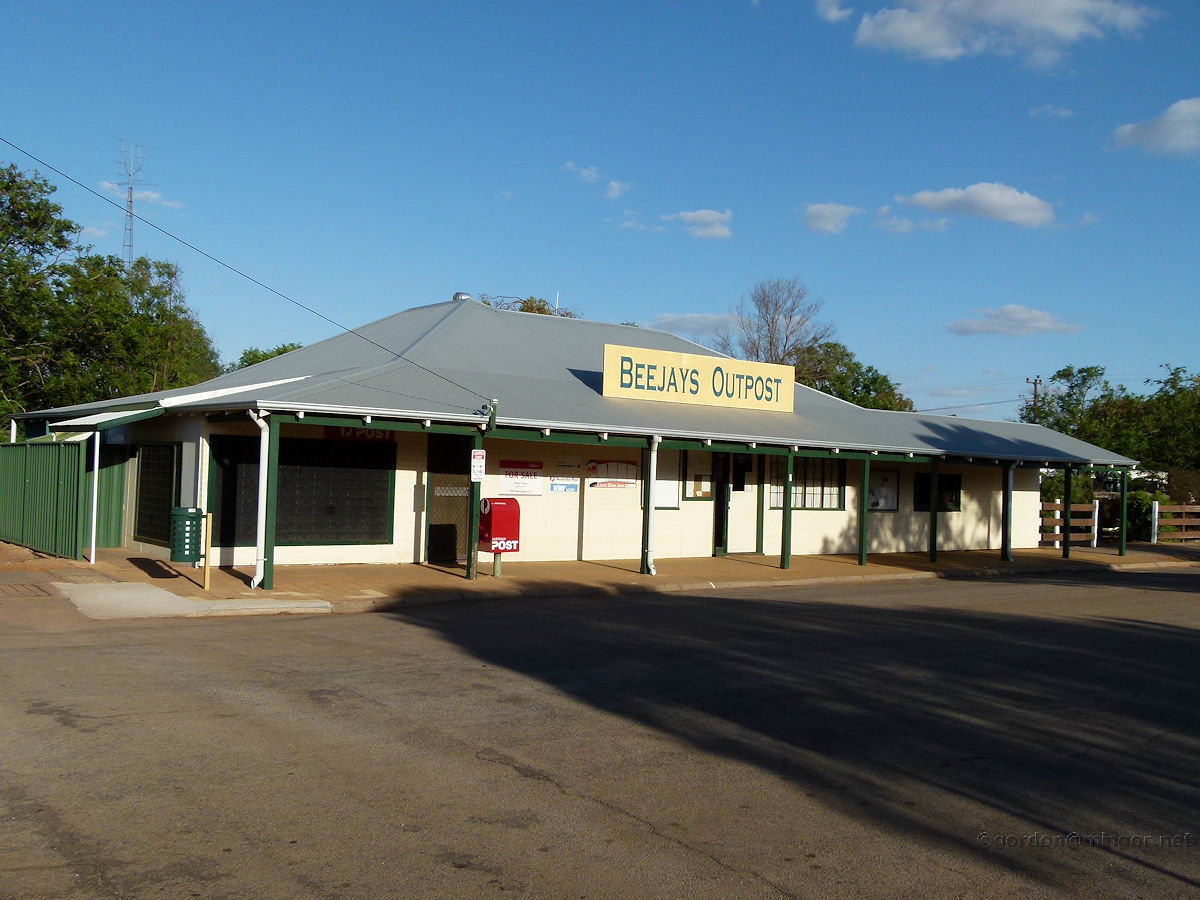 |
Mukinbudin - Beejays Beejays Outpost is the town's post office and it is located on White Street. The first part of this building was erected in 1925 and has been extended and modified over time. By 1928 this building housed the town's telephone exchange and boasted a 20-line switchboard. At various times, the post office building also housed other businesses, such as drapery. March 2015. Photos Ref: MUKB003 |
||
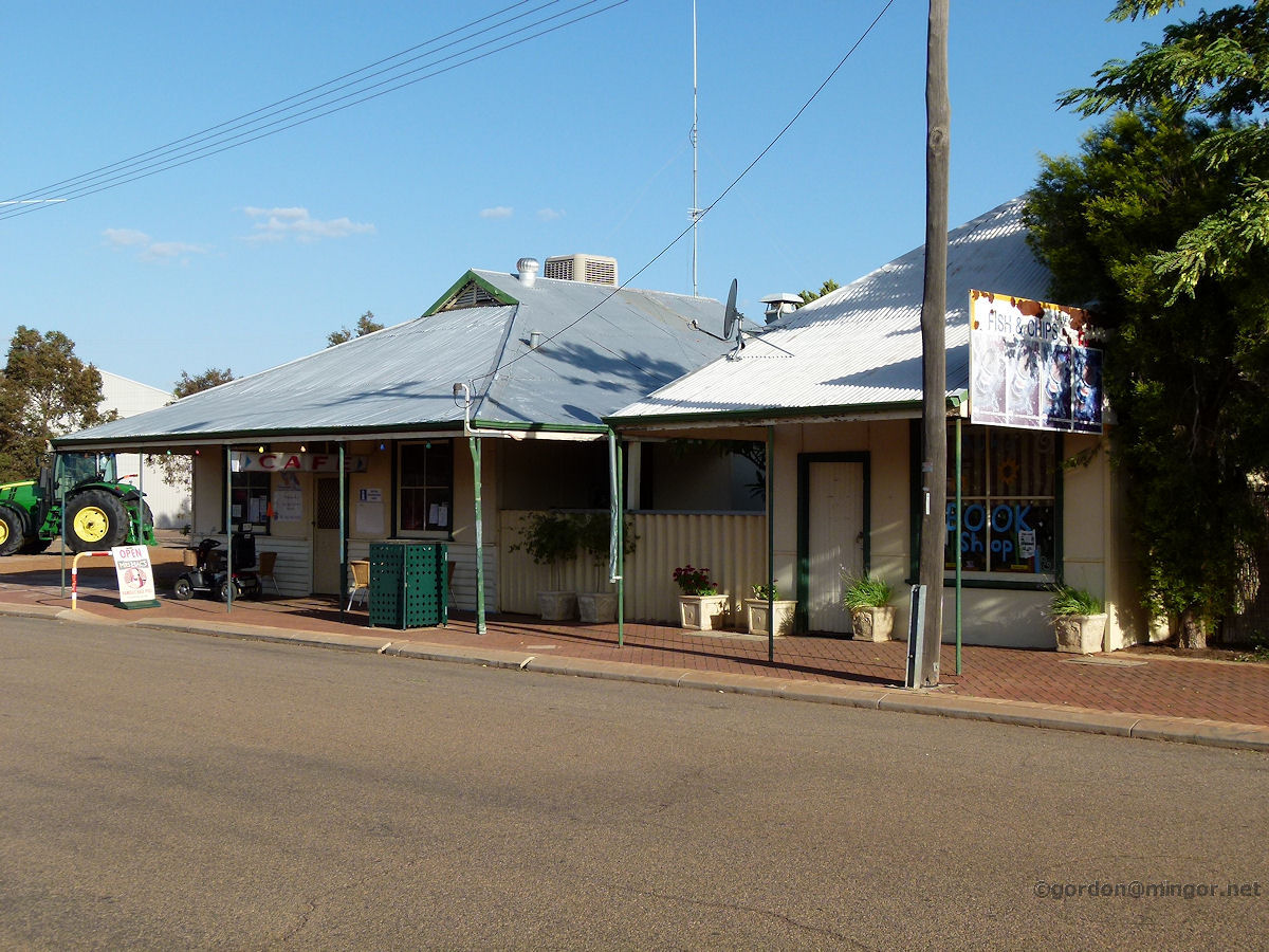 |
Mukinbudin - Cafe and Book Shop A fine brace of old shops. The one on the left is a cafe and the one to right is a bookshop. This is on Shadbolt Street. The cafe was built in 1929, originally as a boarding house. March 2015. Photos Ref: MUKB004 |
||
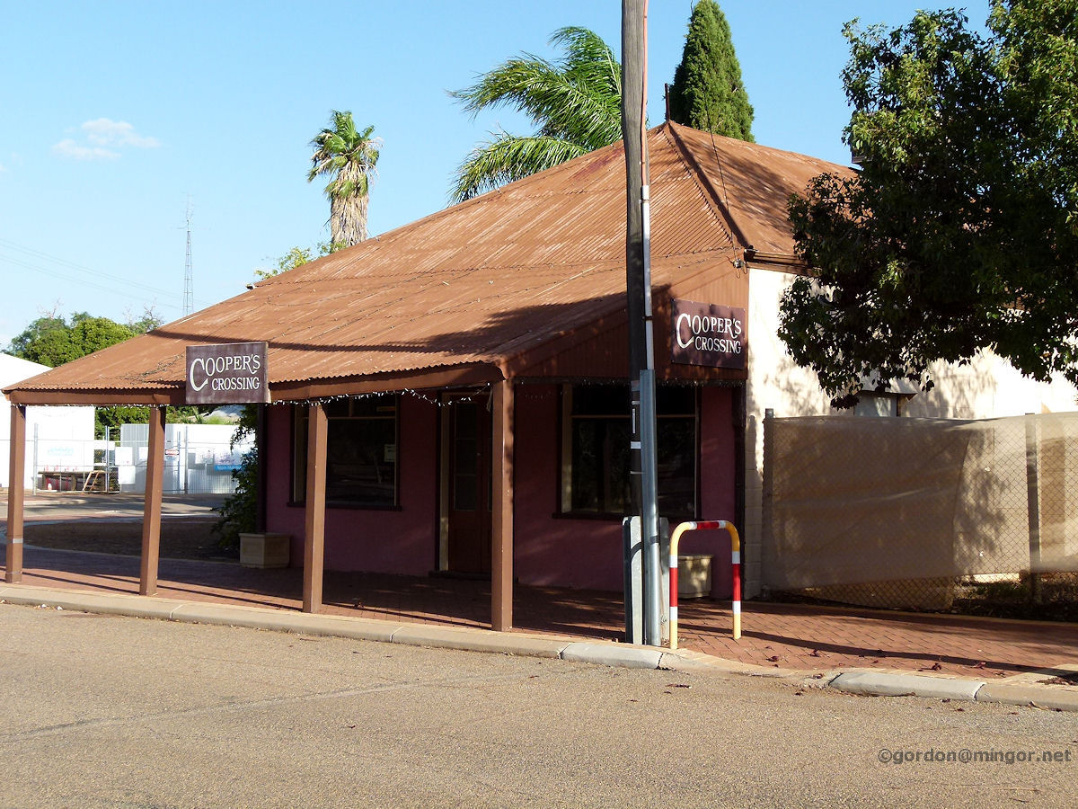 |
Mukinbudin - Cooper's Crossing Cooper's Crossing is a seller of artistic bric-a-brac and is on the main street. The shop was built in 1934 and was then known as Sirr's Store. Mr Sirr built these premises during the depression years to operate as a hairdressers, chemist shop and a billiards saloon, amongst other things. Sirr's later branched out into selling fuels, groceries and apparel. March 2015. Photos Ref: MUKB005 |
||
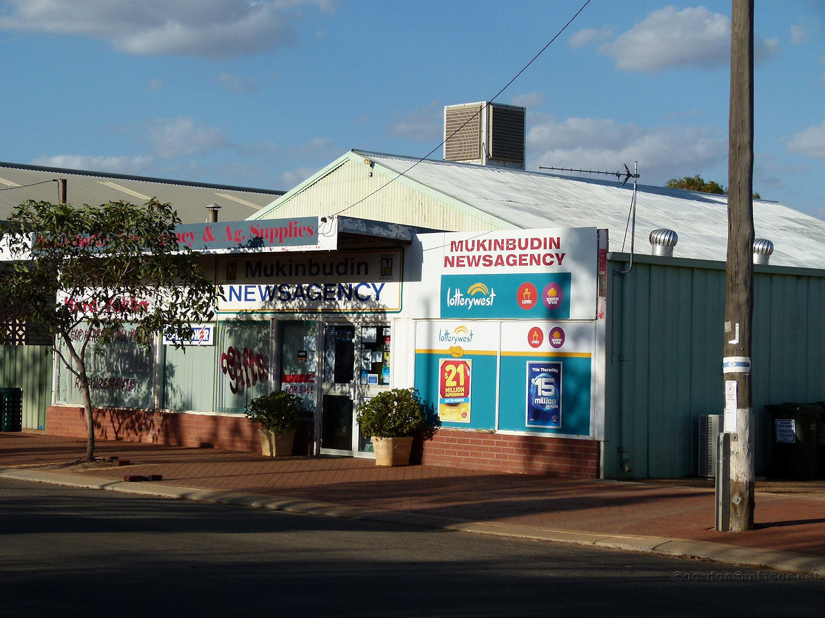 |
Mukinbudin - Newsagency The Mukinbudin Newsagency, gift shop and agricultural supplier. A very mixed business. This is on Bent Street. March 2015. Photos Ref: MUKB006 |
||
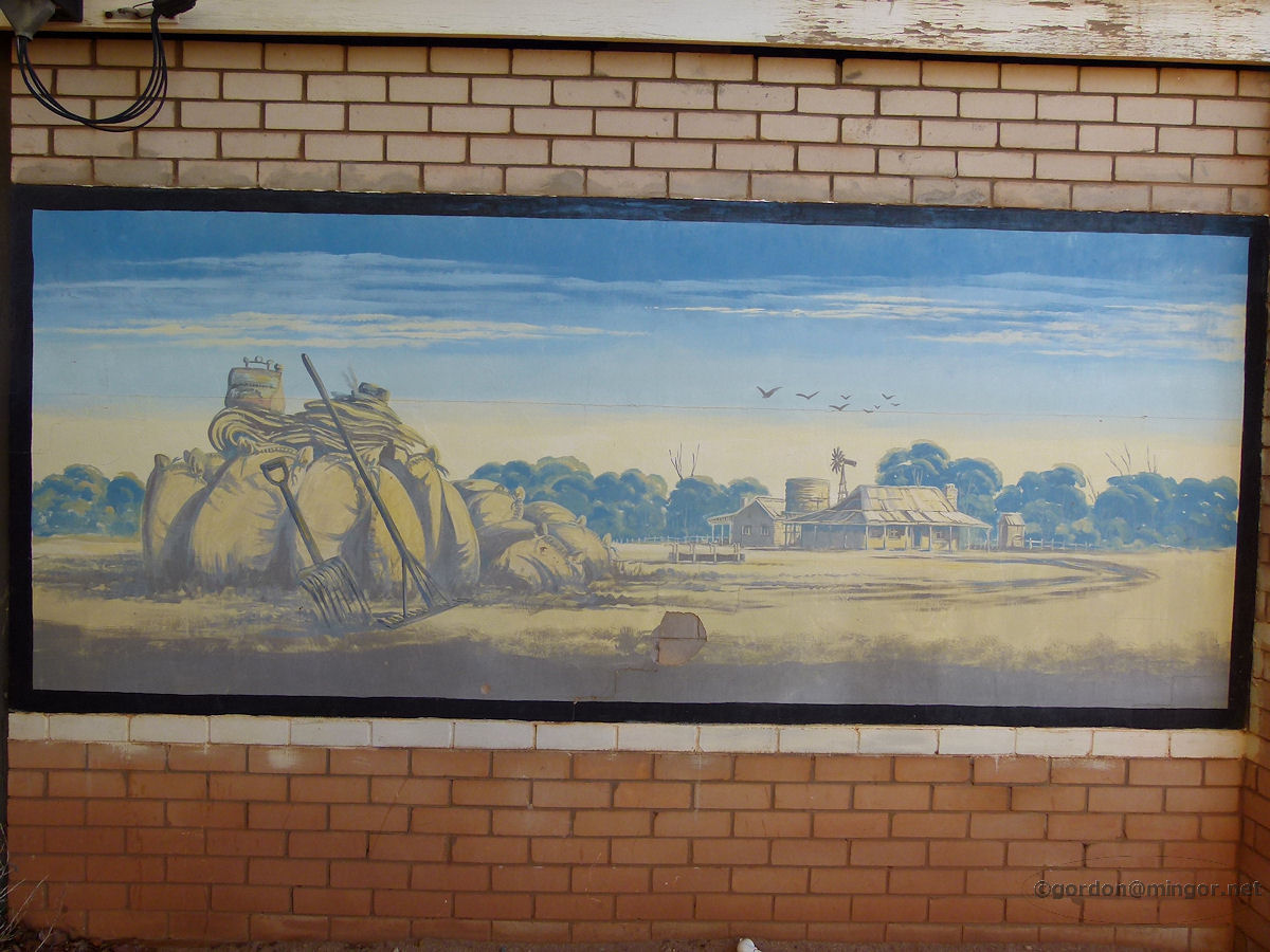 |
Mukinbudin - IGA Wall Artwork Painted on a wall of the I.G.A. supermarket is this picture depicting bringing in the wheat crop in the pioneering days. March 2015. Photos Ref: MUKB007 |
||
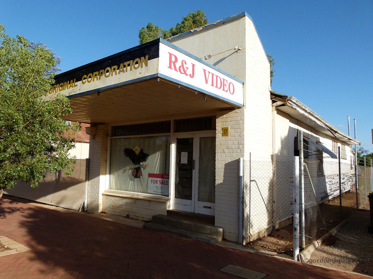 |
Mukinbudin - Former Video Store One of the very few still functioning shops which is currently unoccupied. This was a video store. It was later taken over by another business which apparently did not survive. March 2015. Photos Ref: MUKB008 |
||
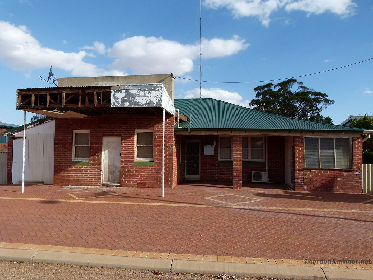 |
Mukinbudin - Old Shop A former shop on the main street which is now a private residence. March 2015. Photos Ref: MUKB009 |
||
 |
Mukinbudin - Memorial Hall The Mukinbudin Town Hall and Community Centre. The Foundation Stone was laid by Edward L. Calder, Chairman (assume Road Board) and George W. Maddock J.P., on October 11th, 1935. The Mukinbudin Sunshine Club (Senior Citizens) now use the premises as a meeting place. March 2015. Photos Ref: MUKB010 |
||
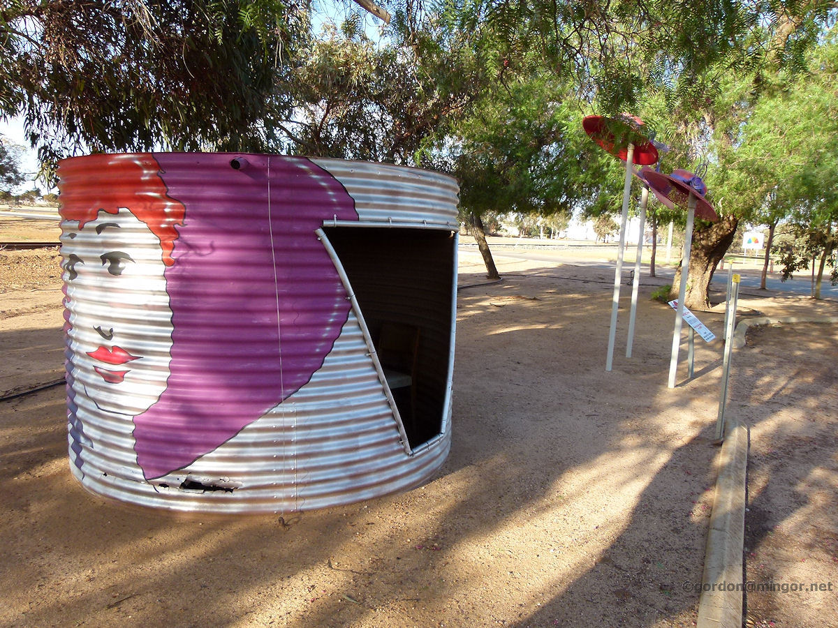 |
Mukinbudin - Red Hat Town This rainwater tank is by the side of the main street. You can climb inside where there are 5-6 seats. This would be a handy bus shelter for children. Beyond are some hats on poles and the explanatory sign reads "Mukinbudin is a Red Hat Town, home of the Dusty Diamonds. When the dust settles, we shine". Followed by a couple of contact numbers for Queen Joan of Tarts and Dame Willowy Whisp. March 2015. Photos Ref: MUKB011 |
||
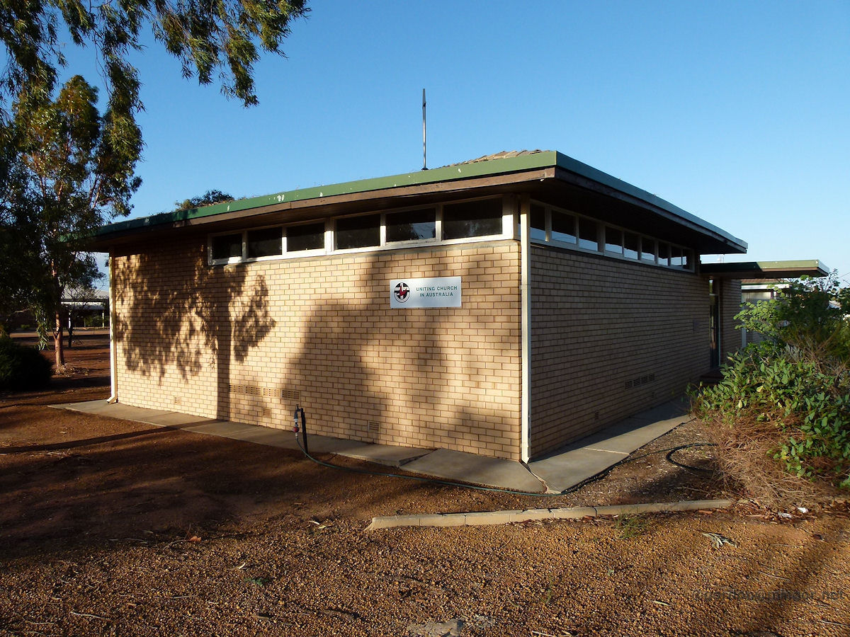 |
Mukinbudin - Uniting Church "To the Glory of God. This Church was erected for the use of Presbyterian, Methodist and Congregational Churches by the residents of Mukinbudin district to commemorate the memory of the Pioneers of the District. Opened and dedicated by the State Moderator of the Presbyterian Church, the Rt Rev. C. J. P. McKaay B.A. B.D. on 21st March 1964". March 2015. Photos Ref: MUKB012 |
||
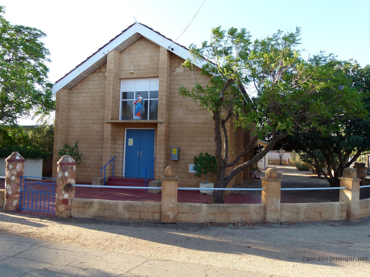 |
Mukinbudin - Catholic Church Our Lady Help of Christians Catholic Church, Mukinbudin. The Foundation Stone proclaims the Church was opened by Right Rev. G. Gomez, Abbot Nullius of New Norcia, on November 13th, 1955. March 2015. Photos Ref: MUKB013 |
||
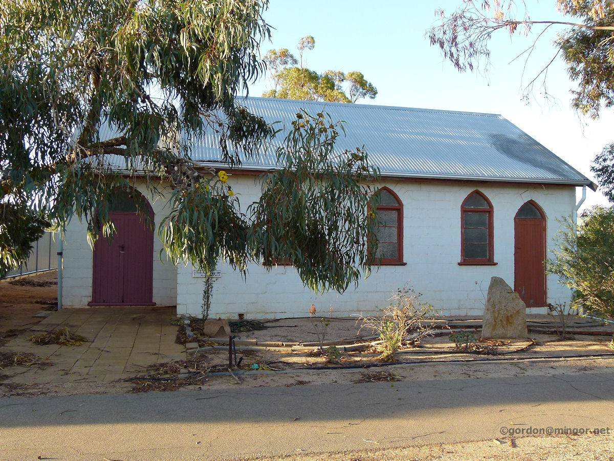 |
Mukinbudin - Anglican Church The former St Lukes Anglican Church of Mukinbudin. The church ceased to operate as such a few years ago. The building is showing signs of disrepair. The Foundation Stone was laid by Most Rev. R. W. H. Moline, Archbishop of Perth, on May 12th, 1953. March 2015. Photos Ref: MUKB014 |
||
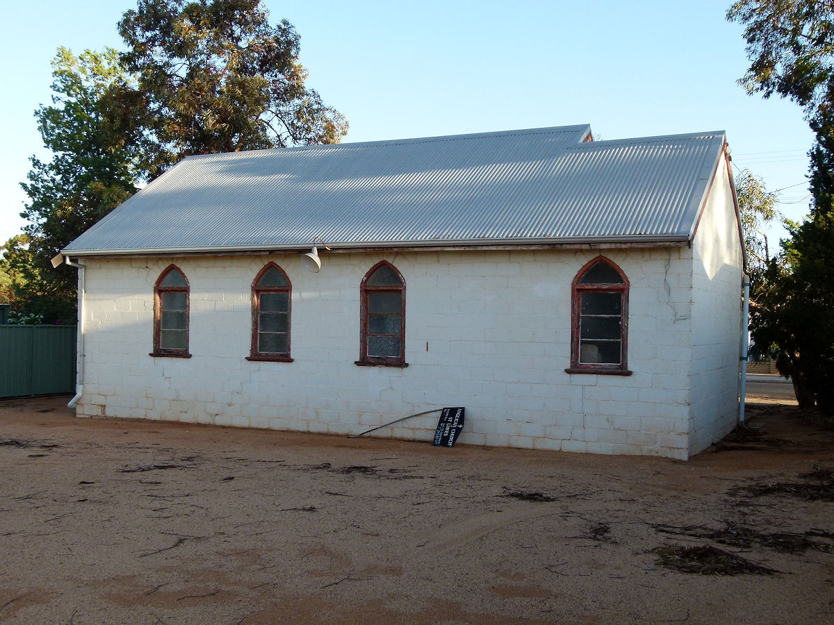 |
Mukinbudin - Anglican Church A view of the rear of the former St Lukes Anglican Church. I thought that the Church sign seemingly discarded against the wall there looks a bit lonely. March 2015. Photos Ref: MUKB015 |
||
 |
Mukinbudin - Railway Station Still here after all these years and pleasantly preserved. This is the Mukinbudin Railway Station building. The railway here was established in 1923. March 2015. Photos Ref: MUKB016 |
||
 |
Mukinbudin - Railway Yard The rail yard looking east towards the wheat bins. This is where the rail line ex-Wyalkatchem terminates. Prior to 1957, the line went further east to Bullfinch. The line is now classified as tier 2 and therefore is still very much maintained and in use during the grain harvest season. A local ex-farmer told me that this is "cheap wheat" country. A successful crop here means bumper crops in more favourable growing areas thus the state-wide yield is bigger but the receipts to the individual farmers is inversely lower. March 2015. Photos Ref: MUKB017 |
||
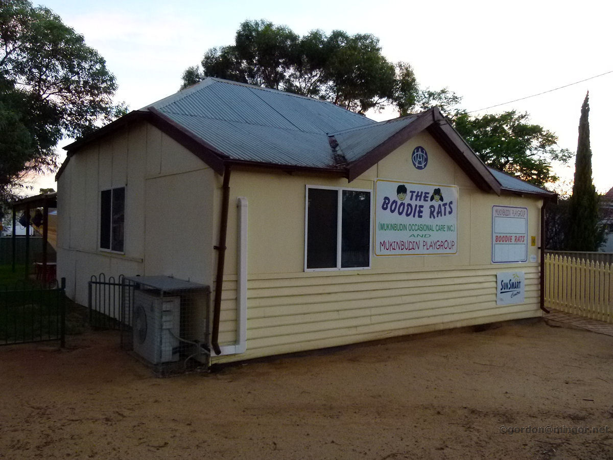 |
Mukinbudin - CWA Building The Country Women's Association building which is now used by The Boodie Rats, occasional child care and playgroup. The CWA building was erected in 1938. March 2015. Photos Ref: MUKB018 |
||
 |
Mukinbudin - Courthouse The courthouse and police station complex. This is on Maddock Street and was built in 1967. March 2015. Photos Ref: MUKB019 |
||
 |
Mukinbudin - House For Sale There are many very smart looking houses around town. This one is for sale. The town appears to be thriving as well as it can do, and doing better than some other wheatbelt towns. I heard a lot of positive talk about the future and the attitude seems good. March 2015. Photos Ref: MUKB020 |
||
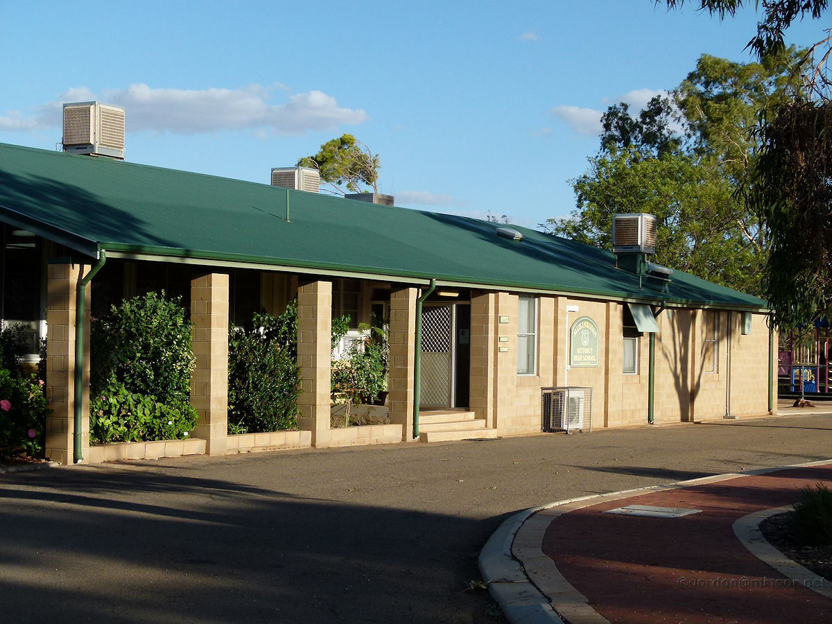 |
Mukinbudin - School The Mukinbudin school. These days this school caters from kindergarten age up to year 12. The approximate 2015 total enrolment is in the vicinity of 60-70 children. Not too many years ago, the total number of pupils was around 200. March 2015. Photos Ref: MUKB021 |
||
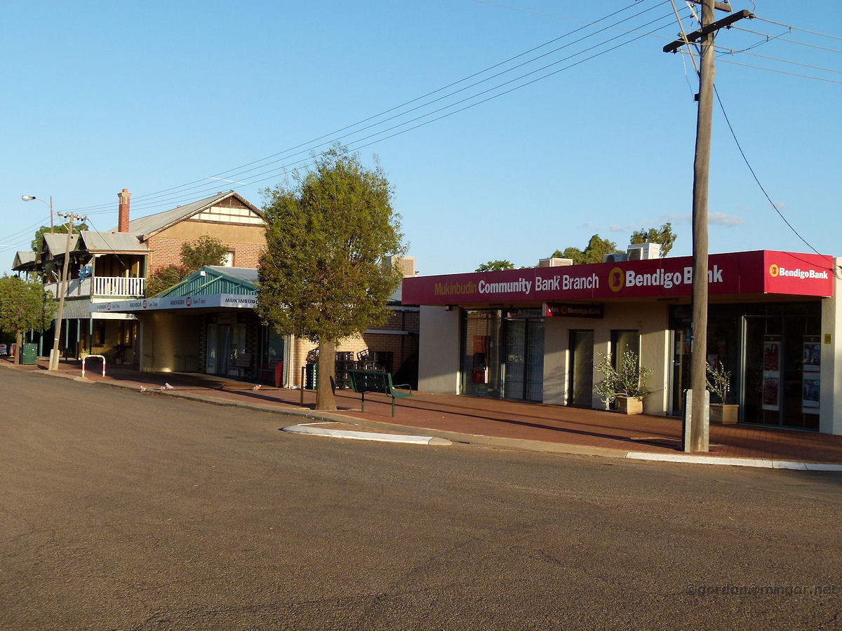 |
Mukinbudin - Shadbolt Street View This is a view looking east down the main street. Foreground is the Bendigo Bank. Beyond is the IGA supermarket and then the hotel. March 2015. Photos Ref: MUKB022 |
||
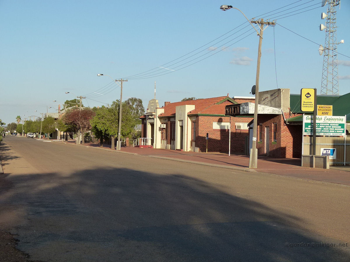 |
Mukinbudin - Shadbolt Street View Another view along the main street, this time from further east. You can see the Memorial Hall and Community Centre. March 2015. Photos Ref: MUKB023 |
||
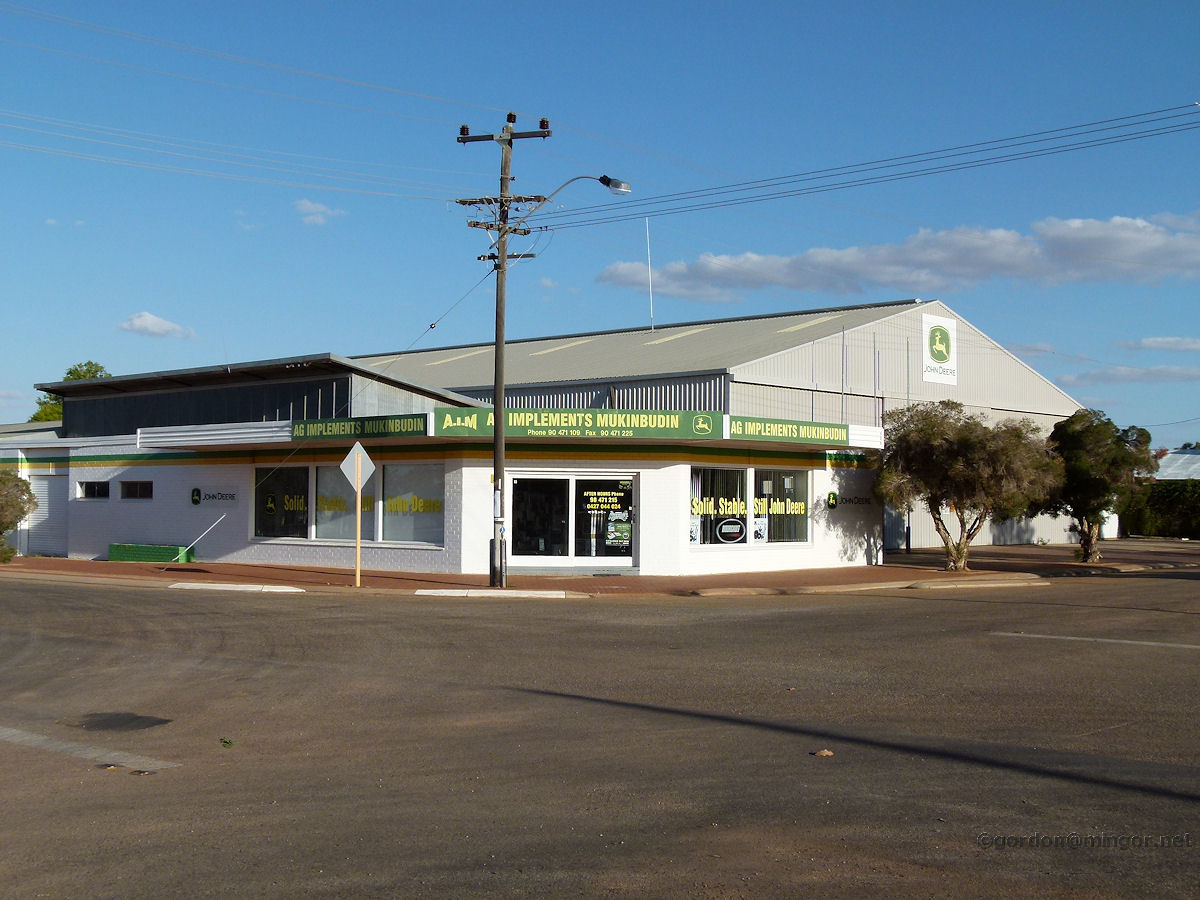 |
Mukinbudin - Farming Implements AG Implements Mukinbudin, sellers of farming equipment. This is on the corner of Bent Street and the Koorda-Bullfinch Road. March 2015. Photos Ref: MUKB024 |
||
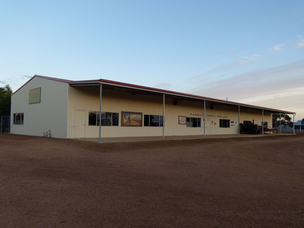 |
Mukinbudin - Community Workshop The Community Workshop on the north side of the railway line. March 2015. Photos Ref: MUKB025 |
||
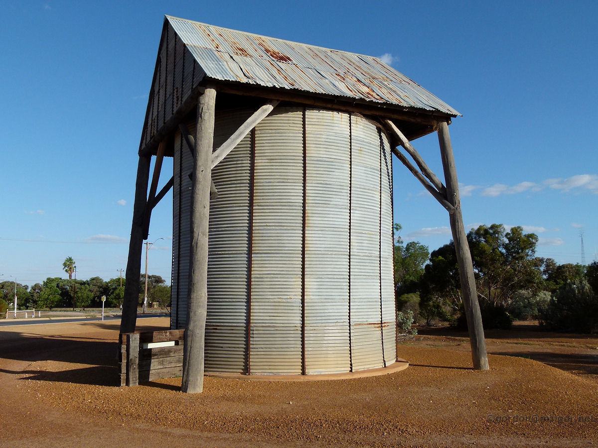 |
Mukinbudin - Heritage Silo An early wheat silo. This was constructed in 1949 by farmer Mr Jack Jones. It is larger than it probably looks. Considering in those days builders did not have the benefit of modern machinery (for example cranes), construction of this silo was an engineering marvel. March 2015. Photos Ref: MUKB026 |
||
 |
Mukinbudin - Drive-In Movies On the north side of town is this drive-in theatre. It looks to be in fairly good repair but does not seem to be in use any longer. This picture was taken very soon after dawn. March 2015. Photos Ref: MUKB027 |
||
 |
Mukinbudin - Wheat Bins The local wheat bins. Beyond, the undulating country seems to go on forever. Today sharp winds where whipping up dust storms. March 2015. Photos Ref: MUKB028 |
||
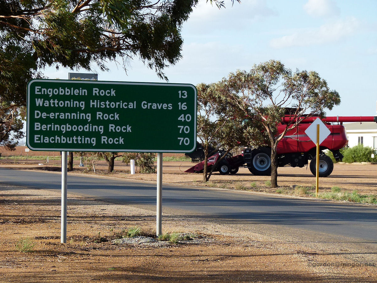 |
Mukinbudin - Road Sign There are no towns of substance directly north of Mukinbudin within hundreds of kilometres. If you are heading north though, these are some of the places you can expect to encounter. You can do the road trip through to Bonnie Rock or Wiaki but these places are not mentioned on the sign. These settlements would offer few amenities for travellers. March 2015. Photos Ref: MUKB029 |
||
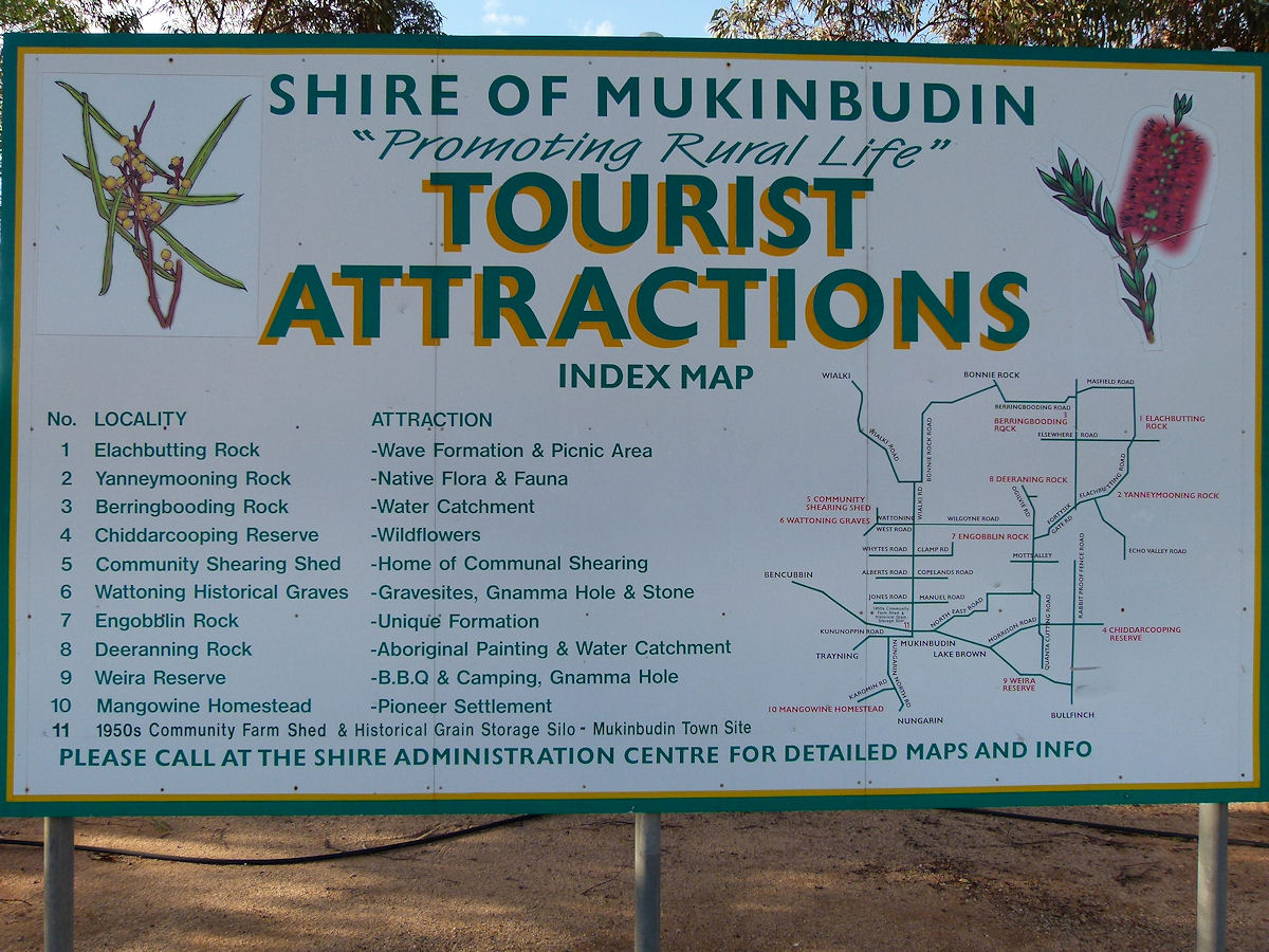 |
Mukinbudin - Tourist Sign Here is a sign promoting area tourist attractions which may be of use to anyone intending on visiting this fine area. March 2015. Photos Ref: MUKB030 |
||
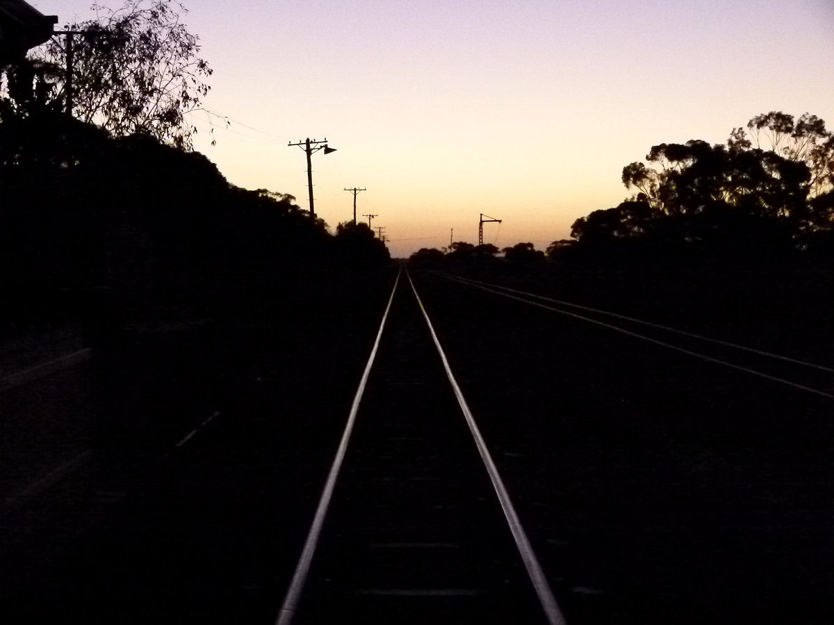 |
Mukinbudin - Sunset As the sun disappears in the evening, the last rays glint off the rail lines heading west to Bencubbin and beyond. I'm staying in town overnight so it's back to the hotel now. What a pleasant stay it turned out to be. Nice town. March 2015. Photos Ref: MUKB031 |
||
All images published on this website are copyright © of the webmaster. See About section for clarification and special schools permission |
|||