| Photographs of Perth, Western Australia | |||
Kununoppin - Photographs of Western Australia Situated between Trayning and Nungarin and south west of Mukinbudin is the small wheatbelt town of Kununoppin. The Wyalkatchem - Merredin rail line passes through the town. The locality is 247 kms north-east of Perth. The town was established when the rail line was constructed in the area in 1911. The name Kununoppin is of Aboriginal origin and has been changed from the origin Coonoonoppin to conform with town government nomenclature rules of the day |
|||
| North to Mukinbudin | South to Nungarin | ||
| West to Trayning | |||
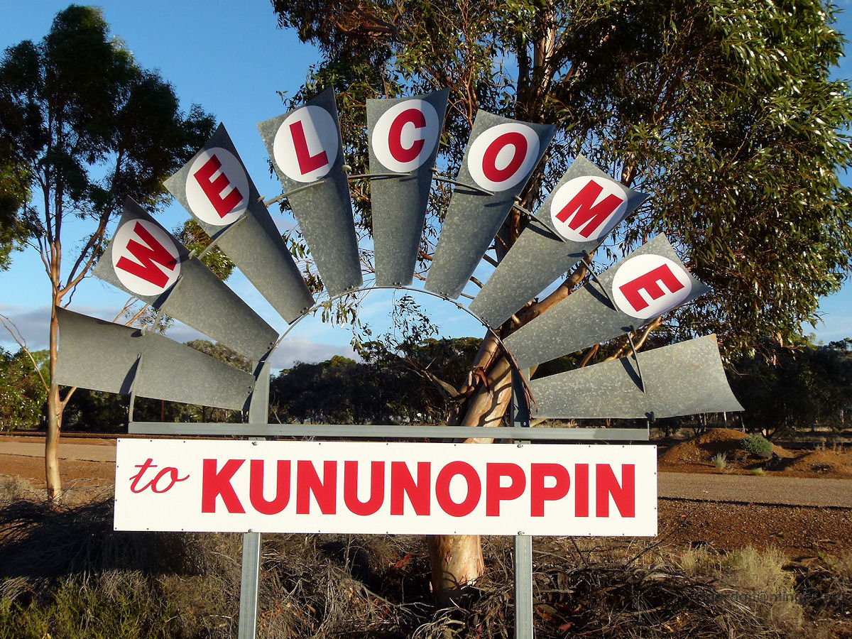 |
Kununoppin - Welcome Sign Welcome to Kununoppin is displayed on these windmill blades. March 2015. Photos Ref: KNPN001 |
||
 |
Kununoppin - Town Map Here is a town map which shows all the places of possible interest, some of which you can find on this page. March 2015. Photos Ref: KNPN002 |
||
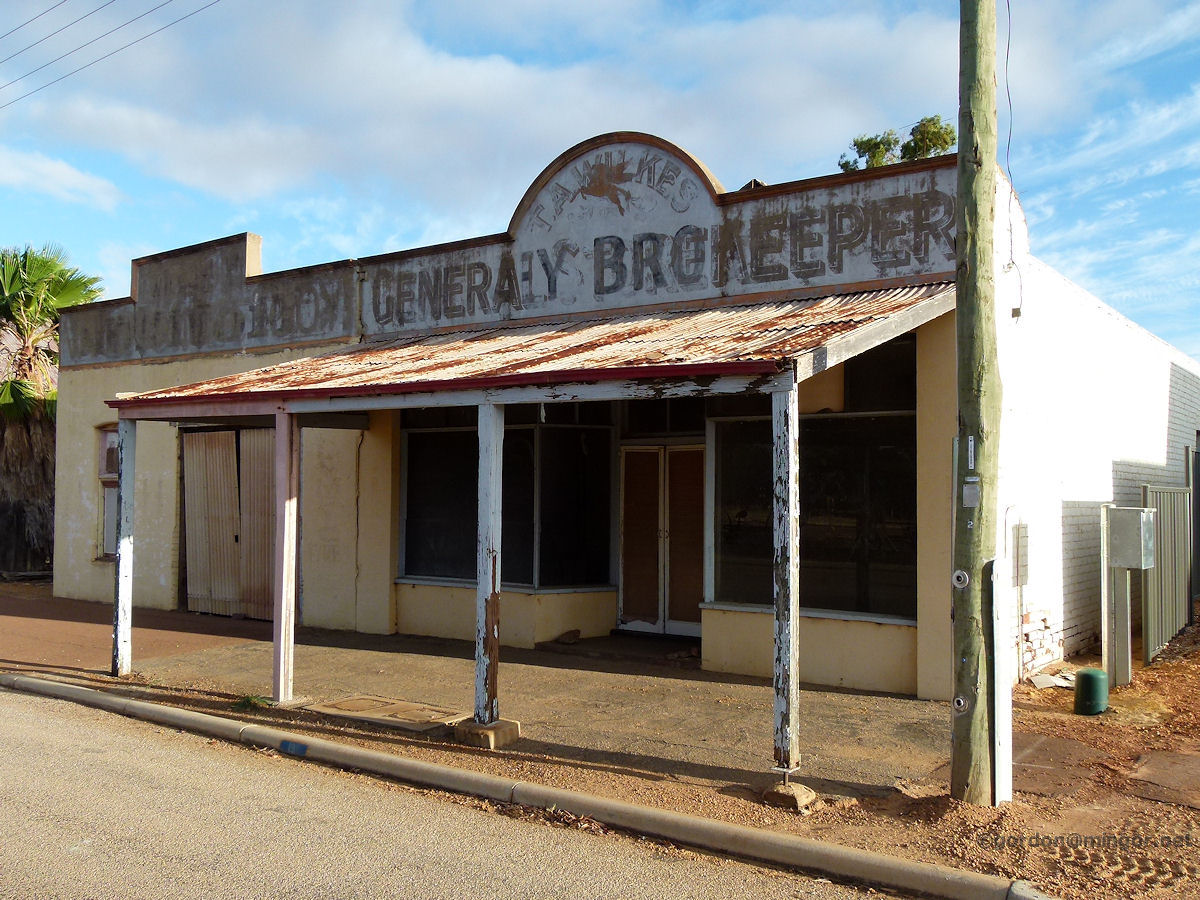 |
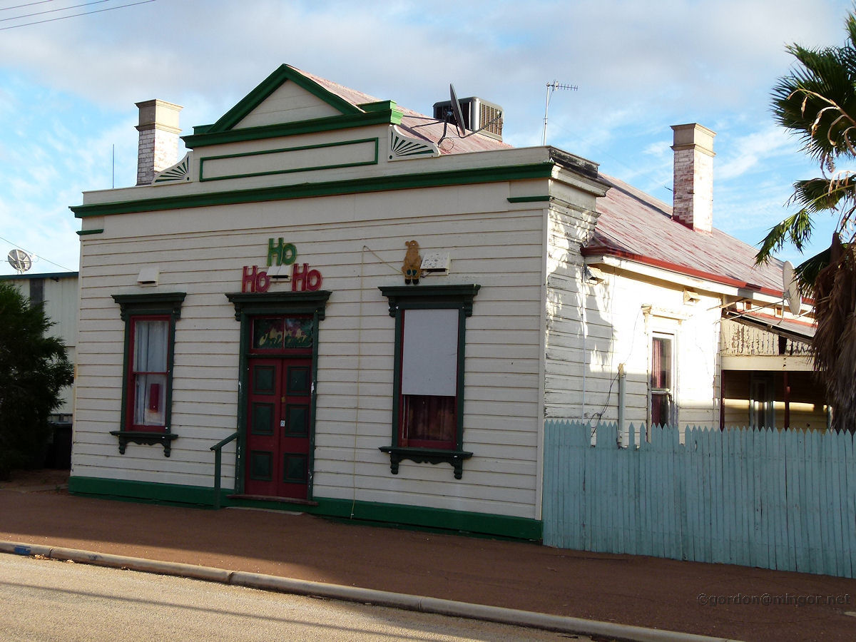
Kununoppin - Bunney Bros Garage & Shop A couple of old shops on the town's main street. The signage is faded and has been painted over a couple of times. You can still make out "T. A. Wilkes ..ey Bro" at the top and on the sides "General ... Keeper" which was later added. This is the former Bunney Bros Garage and Shop constructed in 1912. The garage is the left section of the building, beyond the verandah. The Caltex winged horse is also still visible up top. March 2015. Photos Ref: KNPN003 |
||
 |
Kununoppin - Post Office Post Office, Kununoppin. This was built in 1911 and has been a private mixed business since 1974. March 2015. Photos Ref: KNPN004 |
||
 |
Kununoppin - Burton's Store This is the former Burton's Store on Wilson Street, built in 1920. Over the years it has been used for other commercial purposes. This is now apparently an Arts and Crafts Building. March 2015. Photos Ref: KNPN005 |
||
 |
Kununoppin - Main Street A look along the main street, Wilson Street. The red bricks of the post office can be seen. Beyond the post office are the former Bank of NSW and Agricultural Bank buildings. March 2015. Photos Ref: KNPN006 |
||
 |
Kununoppin - Hall The Kununoppin Hall on Wilson Street which was built in 1930. March 2015. Photos Ref: KNPN007 |
||
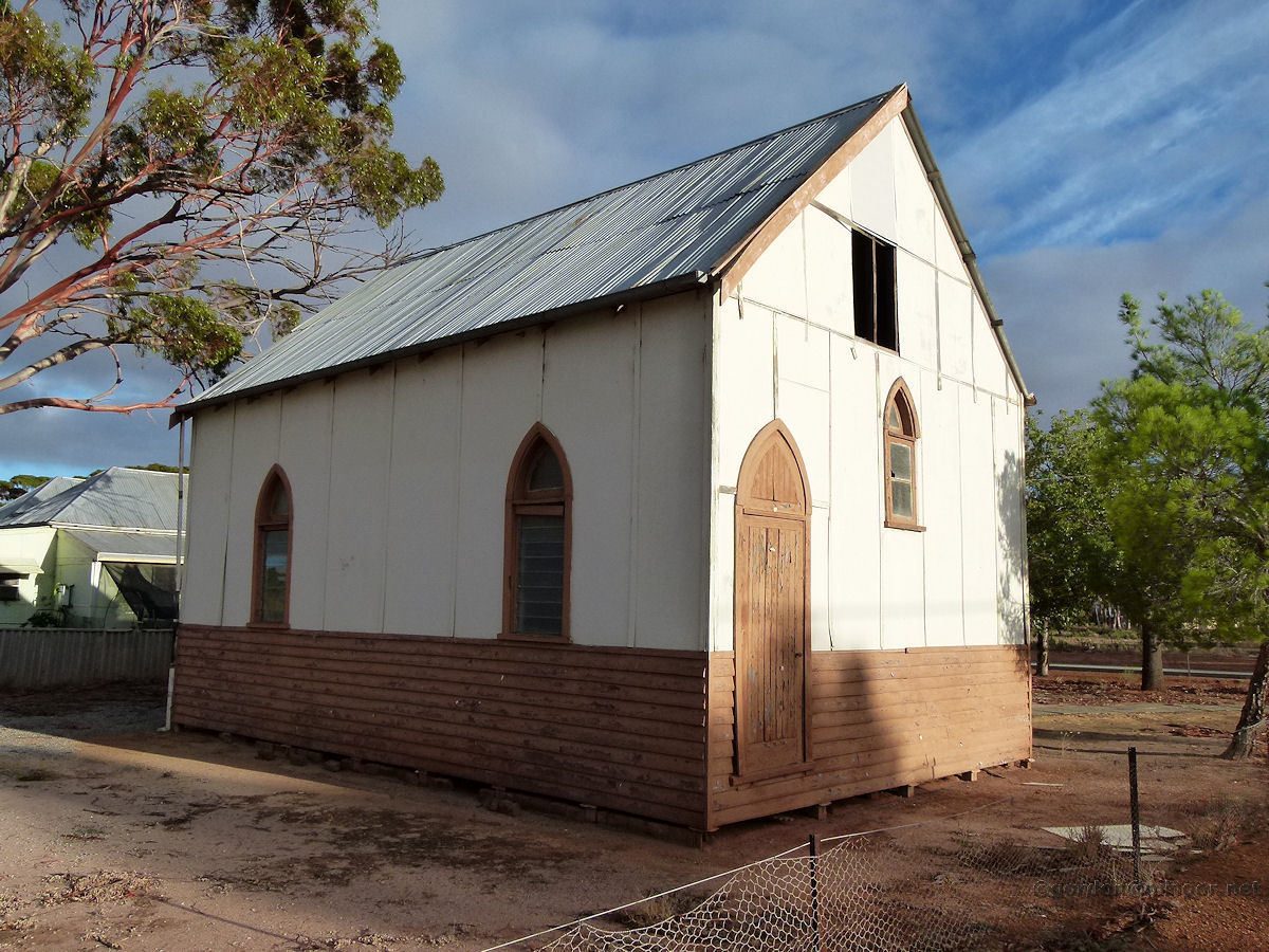 |
Kununoppin - Anglican Church This was the local Church of England from 1928 to 1970. After 1970 it was used as a Scout Hall. It now appears to be unused. March 2015. Photos Ref: KNPN008 |
||
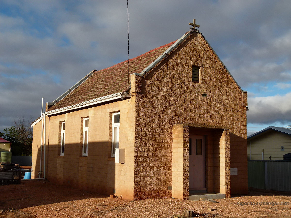 |
Kununoppin - Catholic Church The Catholic Church in Kununoppin has no outwards signage and its name is unknown. The Foundation Stone was laid by Rt Rev. Gregory Gomez, Abbot Nullius of New Norcia, on November 28th, 1954. Perhaps the Church is no longer in use. March 2015. Photos Ref: KNPN009 |
||
 |
Kununoppin - Bank of NSW Here is the former Bank of New South Wales on Wilson Street. This was erected in 1915. This is now a private residence. March 2015. Photos Ref: KNPN010 |
||
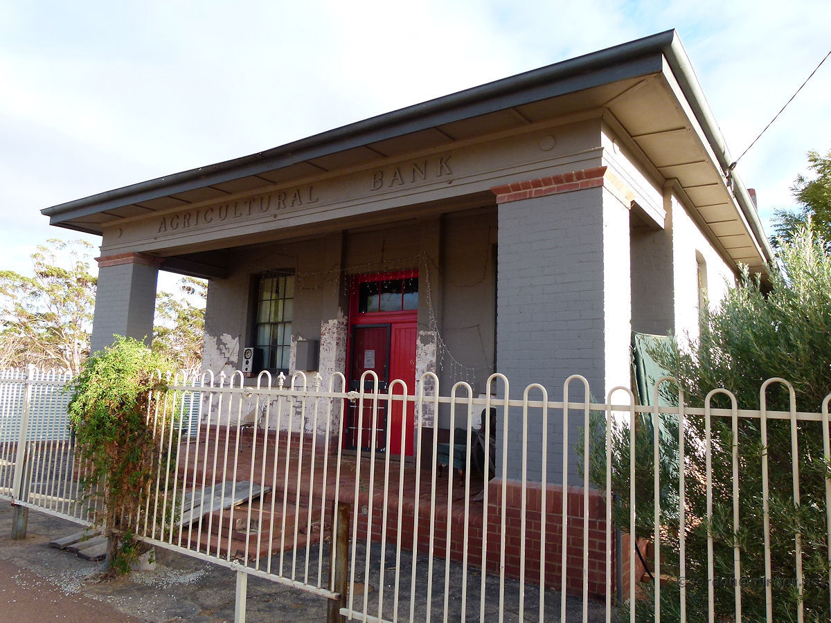 |
Kununoppin - Agricultural Bank On Wilson Street is the former Agricultural Bank which operated here between 1936 and 1942. This was then the R. & I. Bank between 1948 and 1979. The building was erected in 1936. It is now a private residence and the owners have done some fine renovations. March 2015. Photos Ref: KNPN011 |
||
All images published on this website are copyright © of the webmaster. See About section for clarification and special schools permission |
|||