| Photographs of Perth, Western Australia | |||
Rockingham - Photographs of Western Australia The town of Rockingham is 38 kms south from Perth and is situated on Mangles Bay. The town is named after the ship Rockingham which ran aground in 1830, where the beach-front is now. This ship was one of three which were carrying Thomas Peel's first settlers destined for where Mandurah is today. The townsite was surveyed in 1847. Nearby Cape Peron is a popular holiday spot. Garden Island is connected to Rockingham via a causeway over the bay |
|||
| North to Naval Base | South to Shoalwater | ||
| East to Mundijong | |||
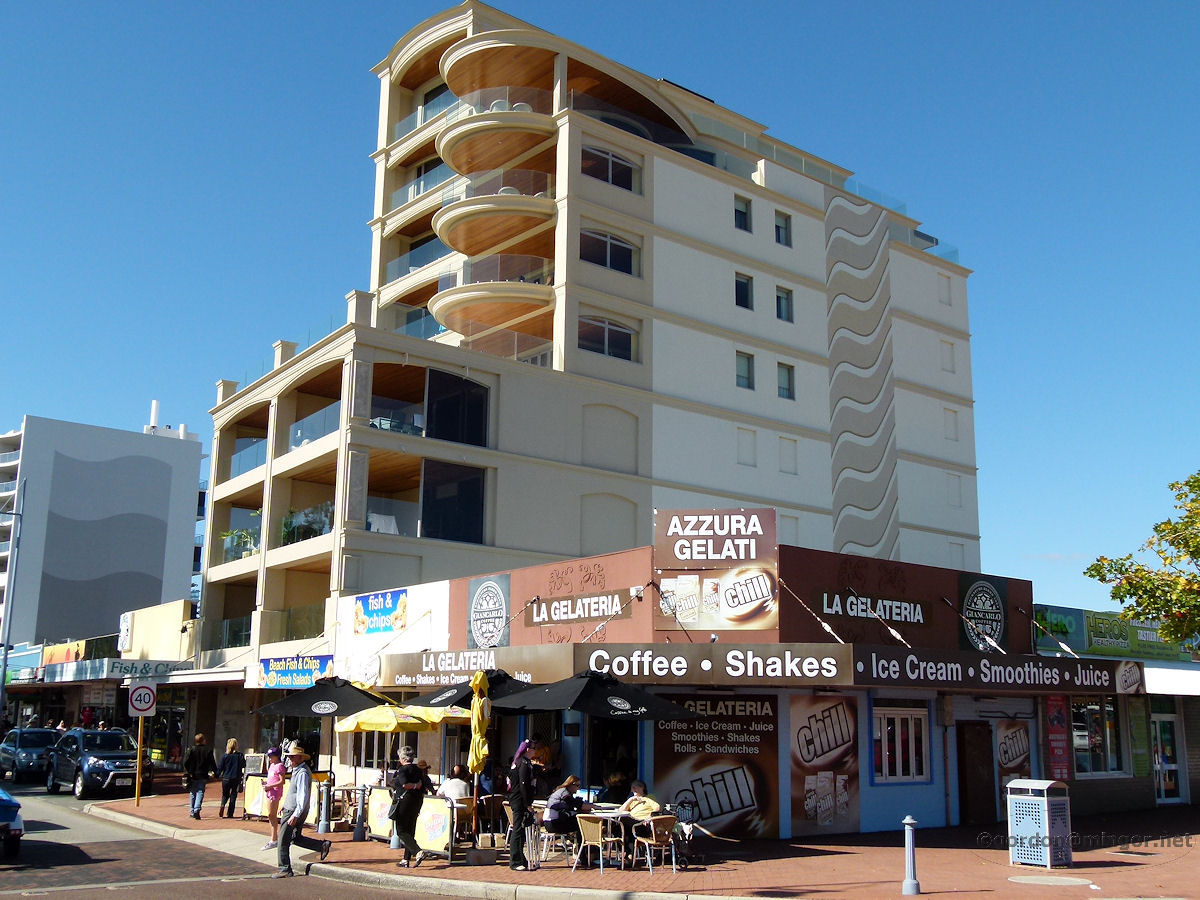 |
Rockingham - Coffee Shop Coffee, Shakes, Ice Cream, Smoothies and Juice. La Gelateria is opposite Churchill Park in the town centre. Beyond is a fairly new apartment block. May 2015. Photos Ref: ROCK001 |
||
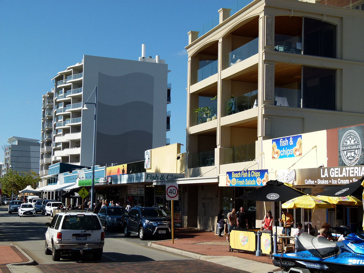 |
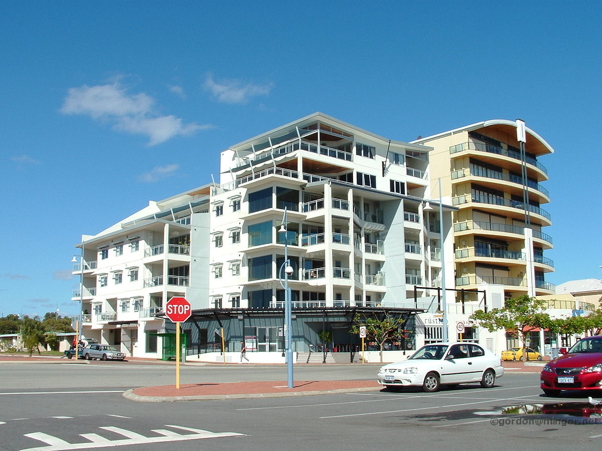
Rockingham - Main Street A view looking north-west along Rockingham Beach Road. Foreground is a slice of the above shop. May 2015. Photos Ref: ROCK002 |
||
 |
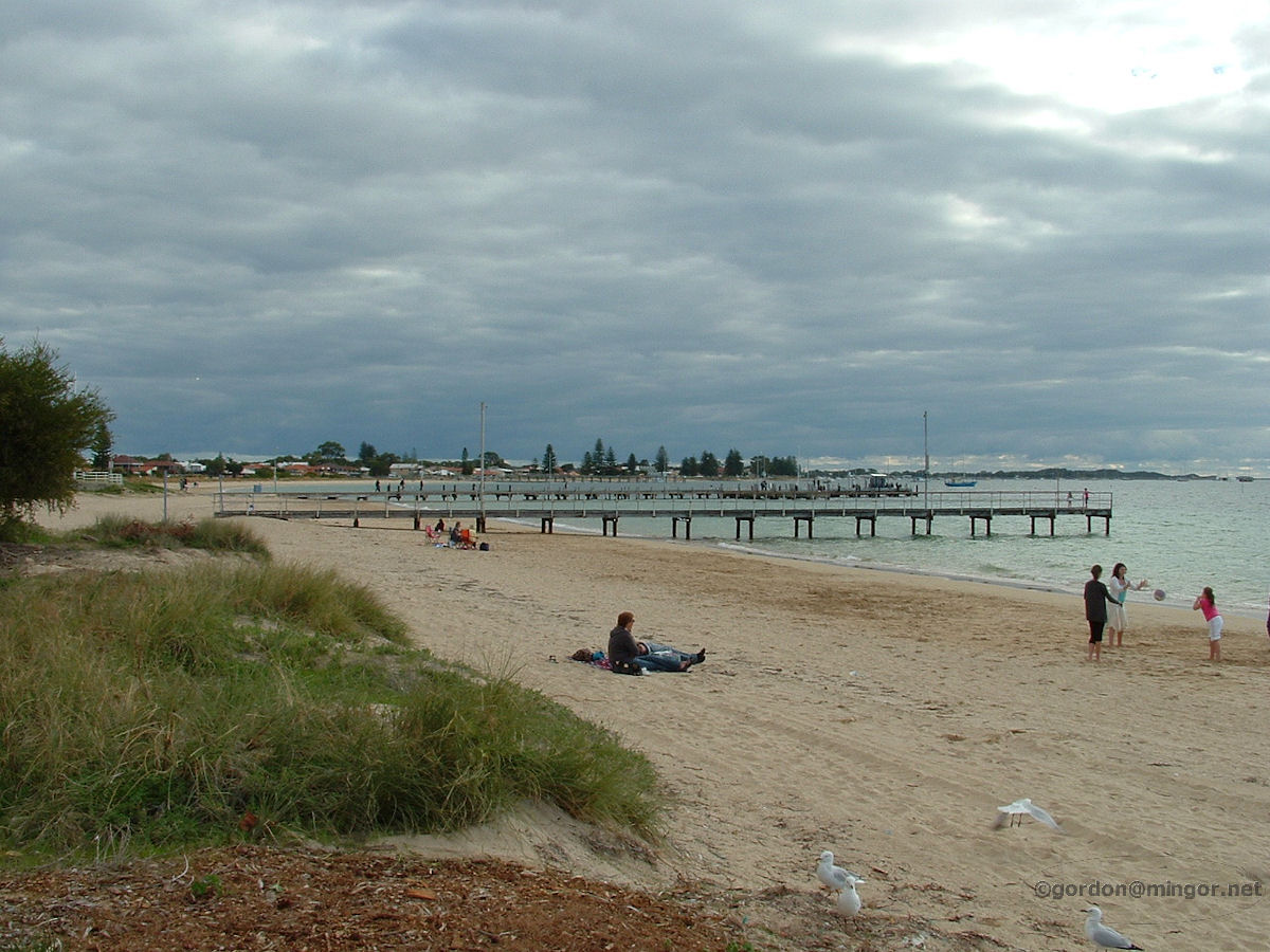
Rockingham - Beach Front This elevated lookout is at the western end of Val, overlooking Mangles Bay. A good place to view the beach and across to Garden Island. May 2015. Photos Ref: ROCK003 |
||
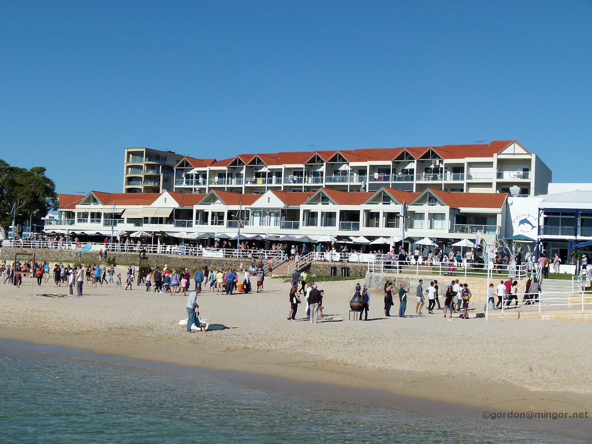 |
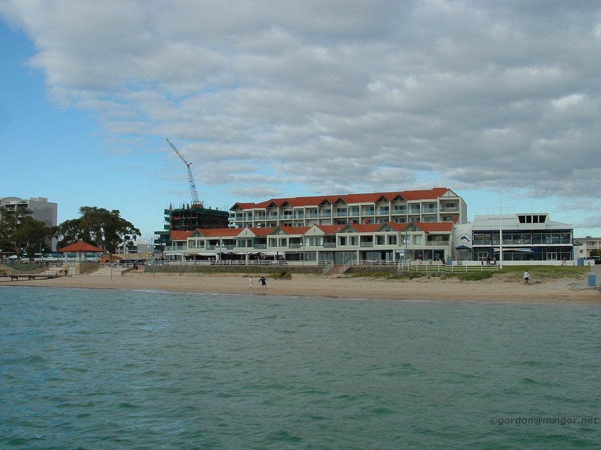
Rockingham - Latitude A view back towards the beach from the Cruising Yacht Club jetty. Centre is a large building containing mainly restaurants at street level and apartments above. One of the restaurants in there is Latitude 32. To the right is the Cruising Yacht Club. May 2015. Photos Ref: ROCK004 |
||
 |
Rockingham - Yacht Club The Cruising Yacht Club of Western Australia Inc., on Val Street, Rockingham, right on the beach front. This building was opened in 1992. May 2015. Photos Ref: ROCK005 |
||
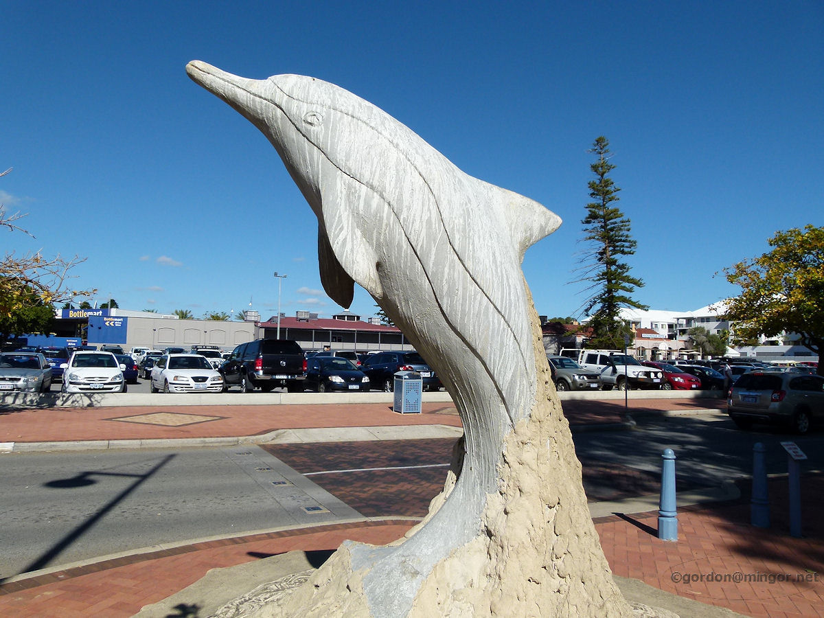 |
Rockingham - Dolphin Sculpture A sculpture of a dolphin sits in the town centre near the foreshore. May 2015. Photos Ref: ROCK006 |
||
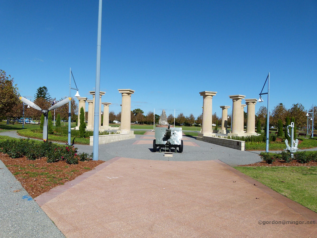 |
Rockingham - War Memorial On Flinders lane is the Rockingham War Memorial. The propeller, the cannon and the anchor serve to represent the three branches of the Australian armed forces - the airforce, army and navy. May 2015. Photos Ref: ROCK007 |
||
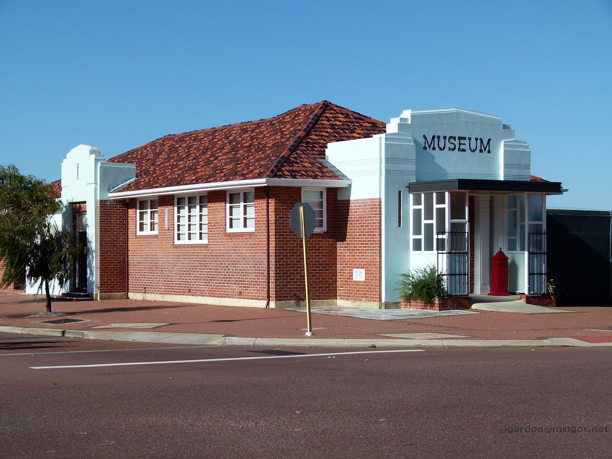 |
Rockingham - Museum The former Road Board building and now the Rockingham Museum. This is on the corner of Kent Street and Flinders Lane. The building foundation stone was laid by Hon. E. H. Gray, Minister for Local Government, on July 3rd, 1946. May 2015. Photos Ref: ROCK008 |
||
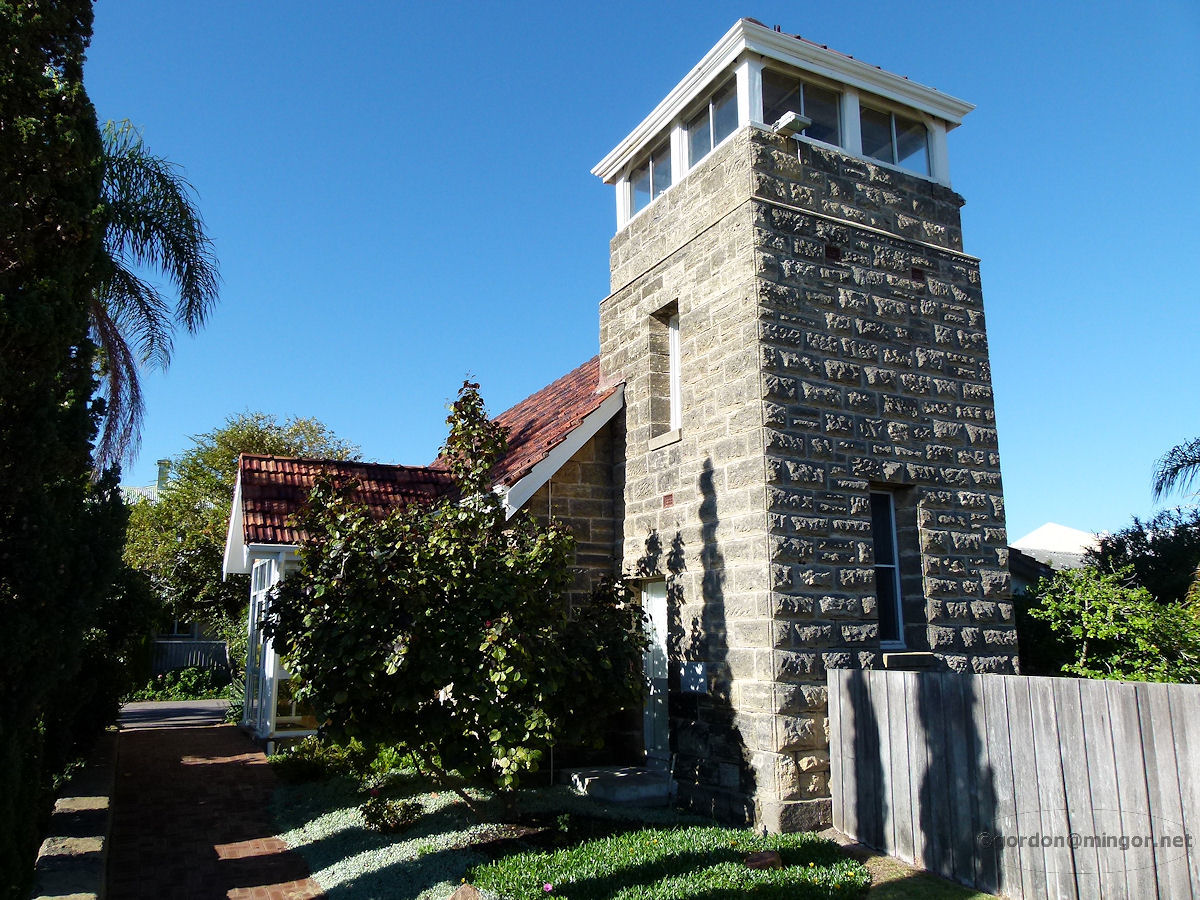 |
Rockingham - All Saints Church Now a dentist surgery, this is the former Anglican St Nicholas All Saints Church on Kent Street. The Foundation Stone was laid by Henry Frewen Le Fanu, Archbishop of Perth, on May 12th, 1945. A second stone is dated August 31st 1980 and was laid by Colonel Roy Lovatt. This building became a dentists in 1990. May 2015. Photos Ref: ROCK009 |
||
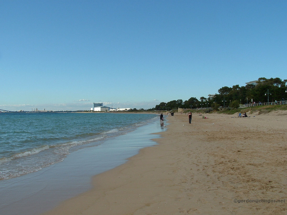 |
Rockingham - Foreshore looking North A winter's view of Rockingham Beach looking north. You can see some of the Kwinana industry in the distance. July 2009. Photos Ref: ROCK010 |
||
 |
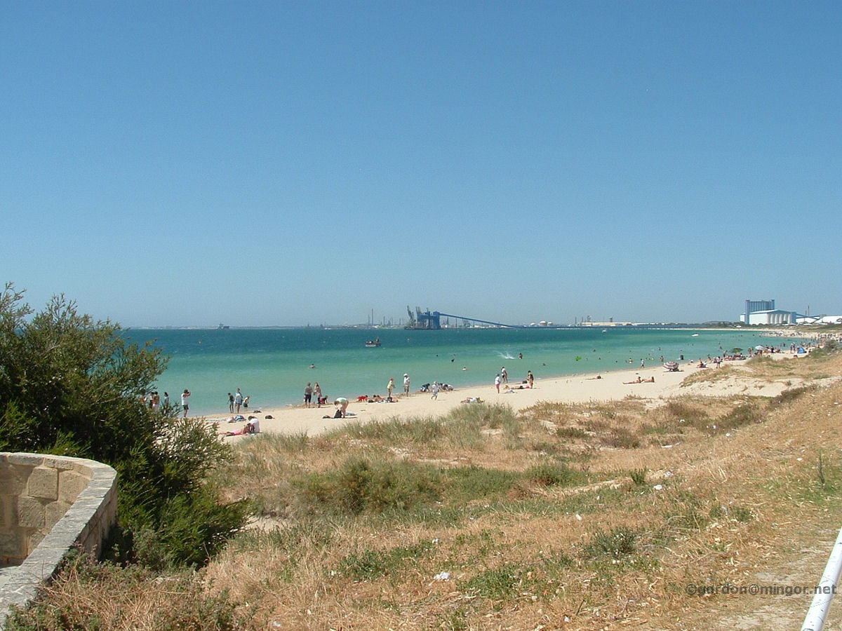
Rockingham - Foreshore View to Garden Island Rockingham Beach looking south and across the water to Garden Island. The Garden Island Causeway is there but perhaps too far away to be seen. January 2008. Photos Ref: ROCK011 |
||
 |
Rockingham - Foreshore Looking South Rockingham Beach looking north. Visible are ship facilities up in the Kwinana area. January 2008. Photos Ref: ROCK012 |
||
 |
Rockingham - Foreshore Grass Area Many people enjoy a warm summer day here on the grass next to Rockingham Beach. Jan 2008. Photos Ref: ROCK013 |
||
 |
Rockingham - Foreshore to Shops on Esplanade These shops are located on The Esplanade. This picture was taken from one of the jetties which, this day, were well populated with people fishing. July 2009. Photos Ref: ROCK014 |
||
 |
Rockingham - Apartments Overlooking Mangles Bay Apartment buildings overlooking Mangles Bay on Rockingham Road, slightly east of the town centre. Mangles Bay is a small section of Cockburn Sound which hugs the Rockingham Beach area. August 2010. Photos Ref: ROCK015 |
||
 |
Rockingham - Foreshore Holiday Homes Holiday homes for rent right on the foreshore slightly to the east of the town centre. August 2010. Photos Ref: ROCK016 |
||
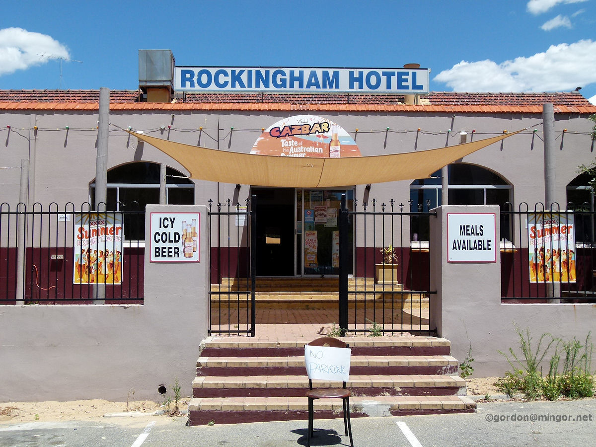 |
Rockingham - Hotel Set a little bit back from Rockingham Beach Road and extending through to Kent Street is the Rockingham Hotel. This is a view from the beach side. The hotel looks very 1960's in design. January 2012. Photos Ref: ROCK017 |
||
 |
Rockingham - Zeldas On the corner of Kent Street and Railway Terrace is Zelda's, occupying a slice of a retail centre which opened in the late 1970's. This is a night club which is only open nights, Wednesday through to the weekend. January 2012. Photos Ref: ROCK018 (2023 update: Seems this place closed down about 10 years ago and now it is VAT116) |
||
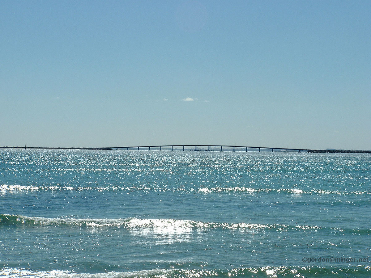 |
Rockingham - Fleetbase West Causeway The sun glistens off Cockburn Sound. In the distance the bridge and causeway provide road access from the mainland over to Fleetbase West otherwise known as HMAS Stirling naval facility on Garden Island. August 2010. Photos Ref: ROCK019 |
||
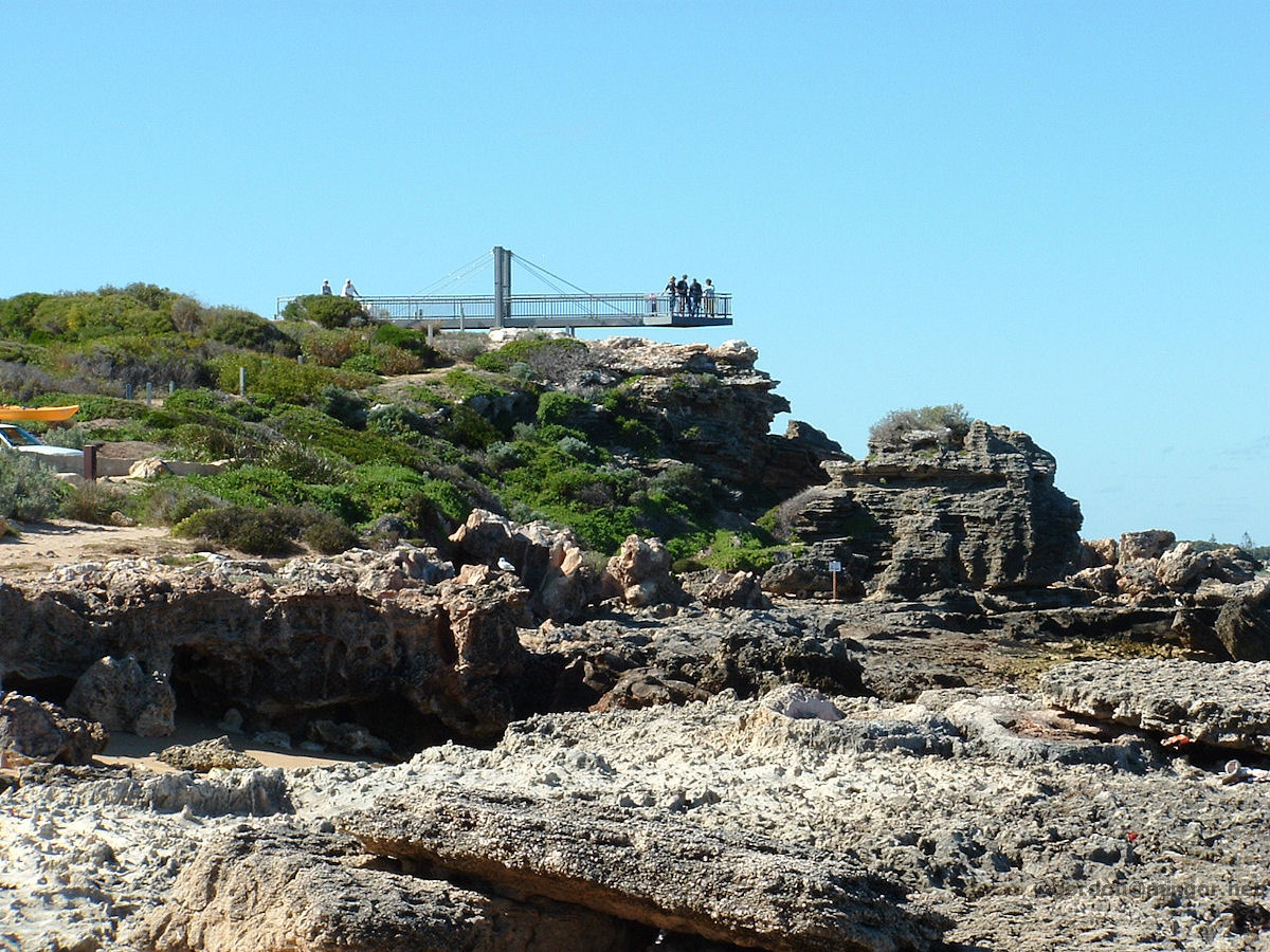 |
Rockingham - Cape Peron Lookout Cape Peron protrudes into the ocean between Shoalwater Bay and Cockburn Sound. It's the site of many holiday cottage sites and camps. Much of the land is a reserve with natural vegetation. This lookout high above the rocks provides an excellent view of Shoalwater Bay and nearby islands. August 2010. Photos Ref: ROCK020 |
||
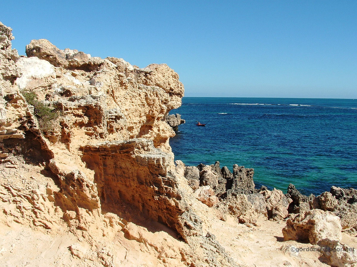 |
Rockingham - Cape Peron Rock Formations Rock formations eaten away by the wind and tides over eons. Beyond the rocks is the open ocean. These rocks are at the end of Point Peron. August 2010. Photos Ref: ROCK021 |
||
 |
Rockingham - Cape Peron Hole in Rock A hole has been eroded through the surrounding harder rock. Here's a look through the hole out to the Indian Ocean. June 2011. Photos Ref: ROCK022 |
||
 |
Rockingham - Cape Peron Mushroom Rock Towards to end of the cape is this island that looks a little thin around the bottom. One day, one wave too many will cause this to tumble into the sea. This is called Mushroom Rock. June 2011. Photos Ref: ROCK023 |
||
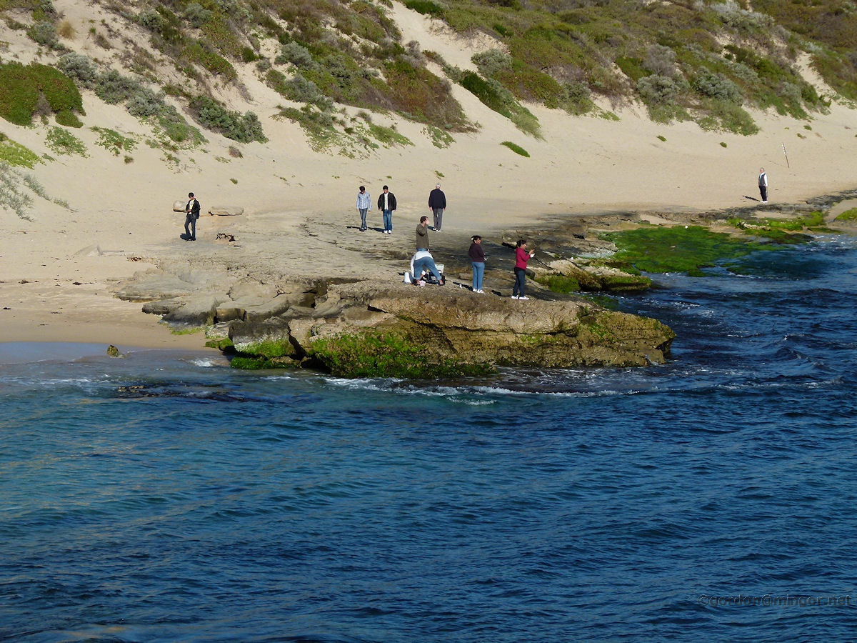 |
Rockingham - Cape Peron Fishing Fishing is a popular pastime from these rocks along this stretch of beach between Point Peron and nearly up to where Mushroom Rock is. June 2011. Photos Ref: ROCK024 |
||
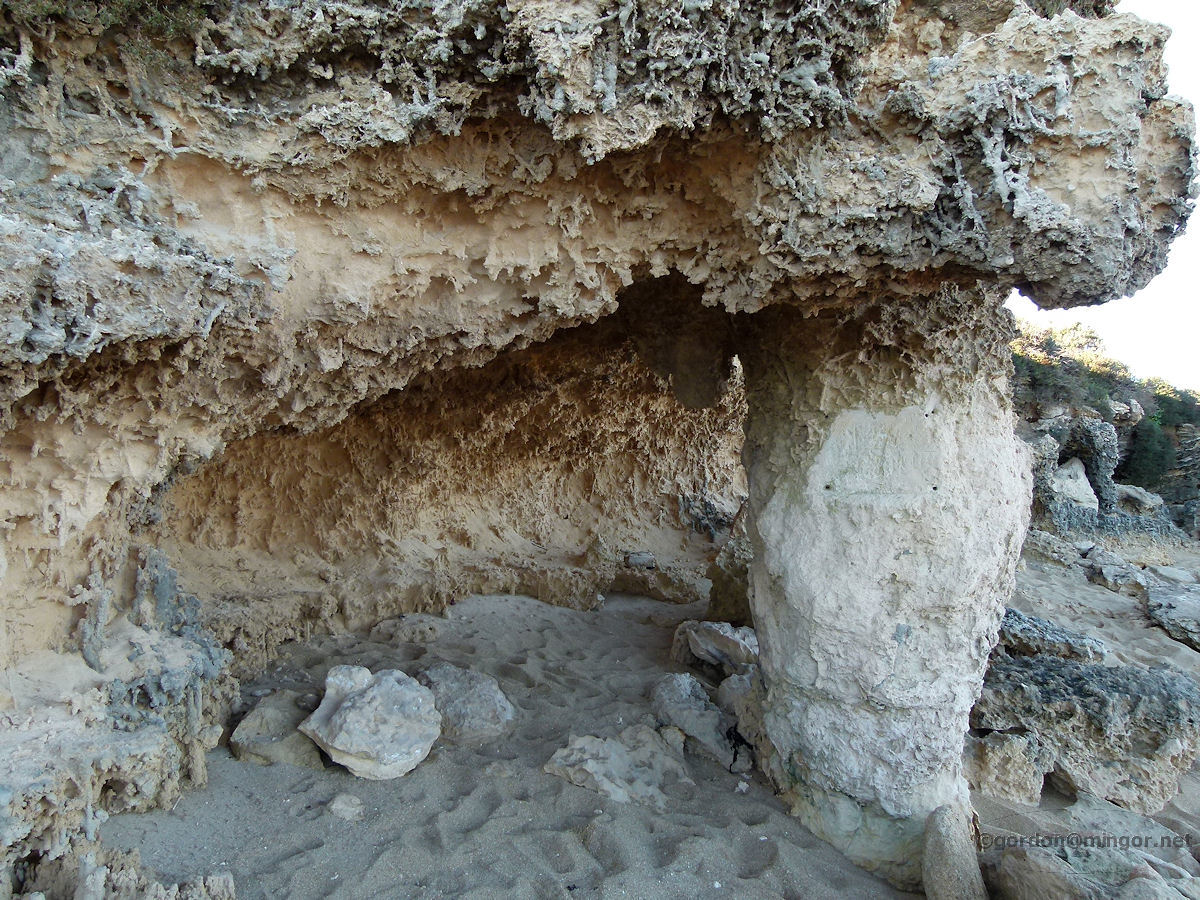 |
Rockingham - Cape Peron Cave Great looking cave very close to Point Peron and an adjacent parking area. June 2011. Photos Ref: ROCK025 |
||
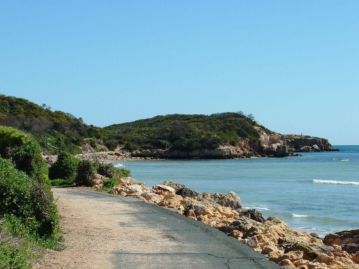 |
Rockingham - Cape Peron John Point This is the north side of the cape. The track presumably winds along the shore right to the tip of John Point which can be seen in the picture. August 2010. Photos Ref: ROCK026 |
||
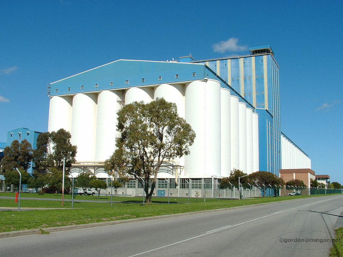 |
Rockingham - Cooperative Bulk Handling Building The Cooperative Bulk Handling building is huge. This is actually in East Rockingham almost in the Kwinana Beach industrial area. The building is used for the storage of Western Australia's wheat harvest prior to export. August 2010. Photos Ref: ROCK027 |
||
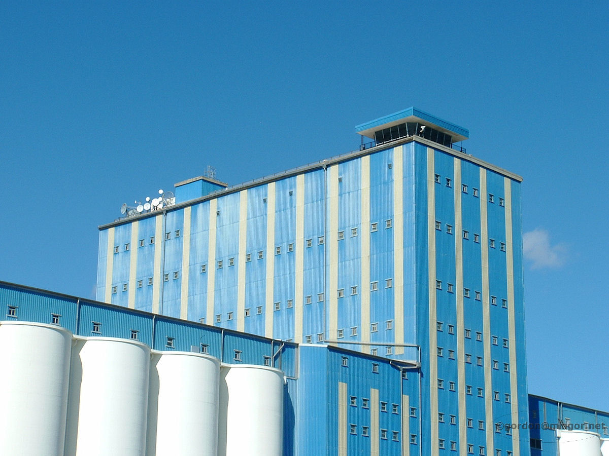 |
Rockingham - Cooperative Bulk Handling Building Looking high up on the grain terminal is what looks like an airport control room. This is used for directing activities at the adjacent shipping facilities. August 2010. Photos Ref: ROCK028 |
||
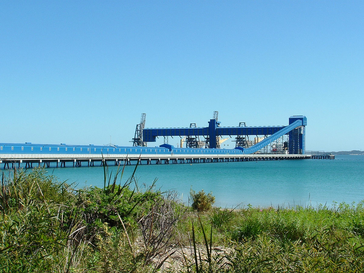 |
Rockingham - Cooperative Bulk Handling Jetty Cooperative Bulk Handling's shipping facility. The jetty protrudes into Cockburn Sound. August 2010. Photos Ref: ROCK029 |
||
All images published on this website are copyright © of the webmaster. See About section for clarification and special schools permission |
|||