| Photographs of Perth, Western Australia | |||
Roleystone - Photographs of Western Australia Nestled in the Darling Scarp east of Kelmscott on the Brookton Highway is Roleystone. A name that often reminds some of a rock band. The derivation is in fact Rolling Stone, or Rowley Stone but of course with a different origin. The name goes way back to 1858 when a Mr Thomas Buckingham had a property in the district thus named. The original large property was sub-divided into small-holdings in 1902, primarily for fruit and vegetable cultivation |
|||
| North to Karragullen | |||
| West to Kelmscott | |||
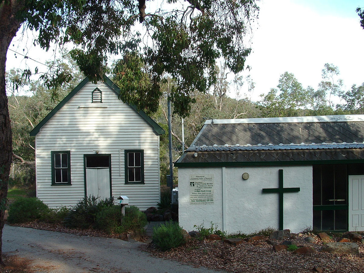 |
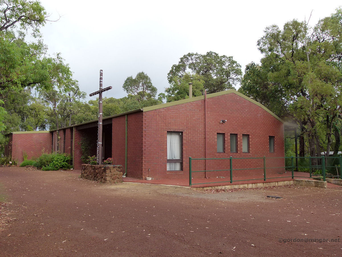
Roleystone - Community Church Roleystone Community Church off Brookton Highway. The original Roleystone Hall, which later became a Congregational Church, is the building on the left. It was constructed in 1912. The current Community Church is the structure on the right. This was built later. May 2010. Photos Ref: ROLE001 |
||
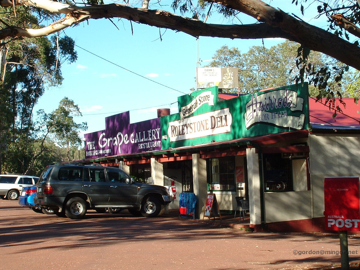 |
Roleystone - General Store The General Store and Grapevine Gallery, on Brookton Highway, near Croyden Road. May 2010. Photos Ref: ROLE002 |
||
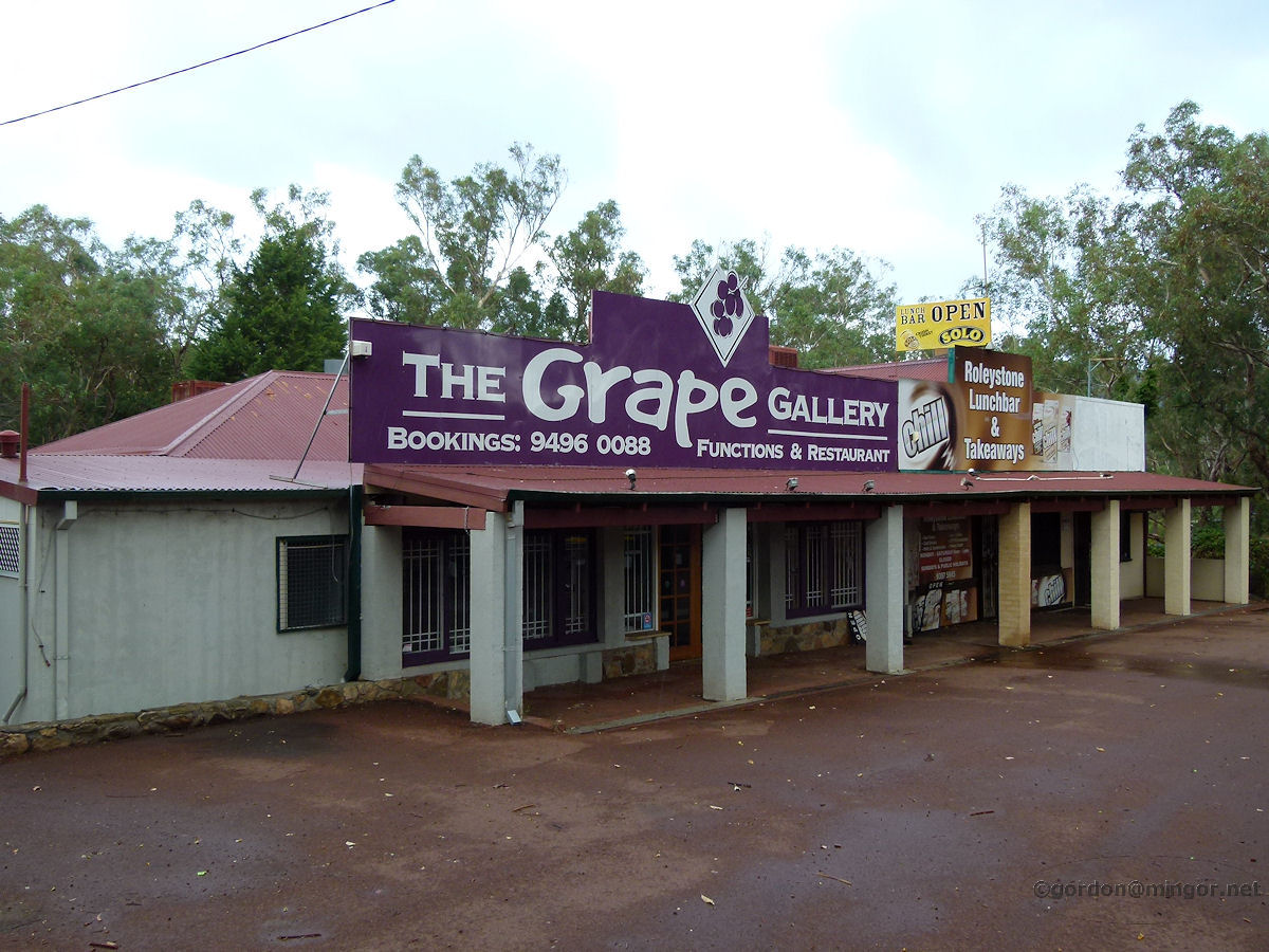 |
Roleystone - General Store You can see a few changes here since the above last picture taken nearly five years ago. This is the General Store and Grapevine Gallery facing Brookton Highway, near Croyden Road. Hairrods have moved out into their own premises next door. The section that they used to occupy here remains vacant. March 2015. Photos Ref: ROLE003 |
||
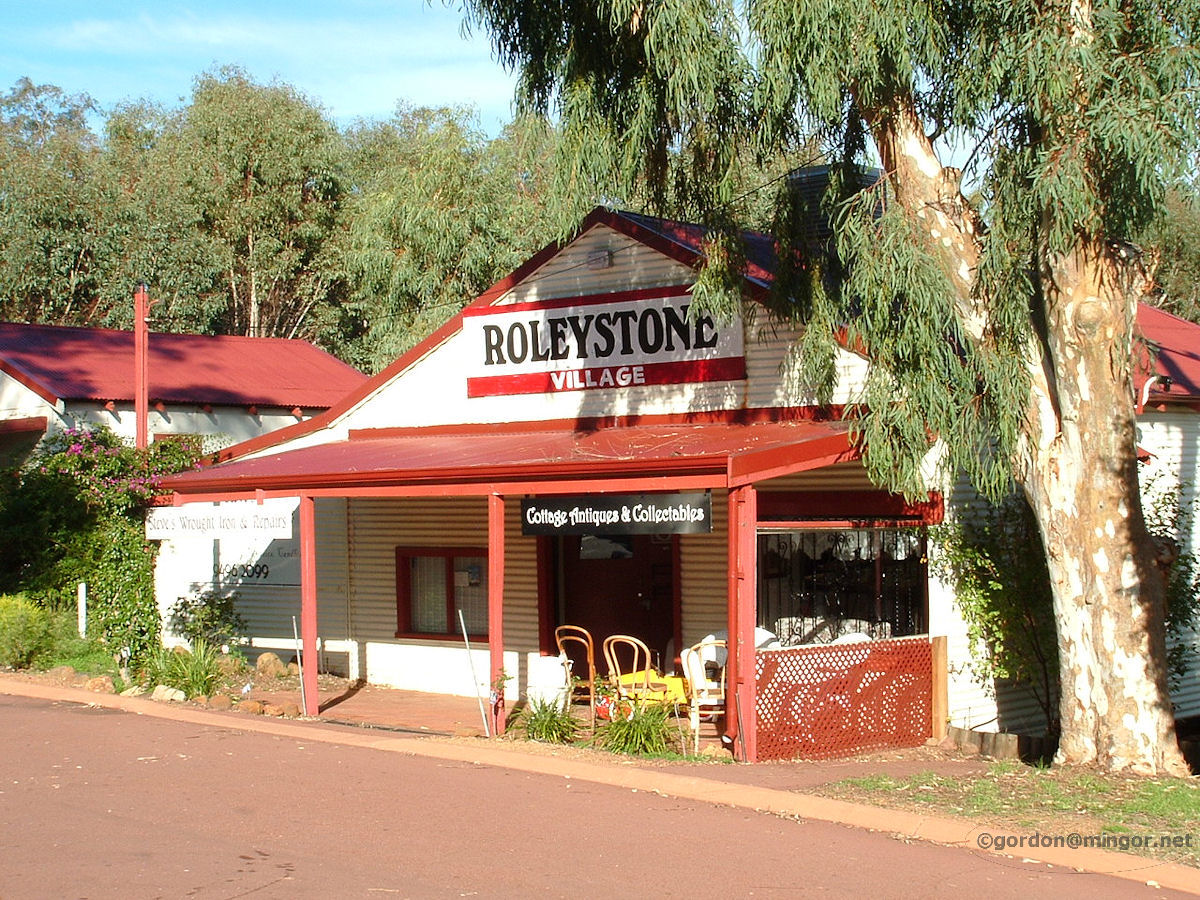 |
Roleystone - Roleystone Village Next door but one to the General Store is this old shop. It is currently occupied by Cottage Antiques and Collectables. July 2010. Photos Ref: ROLE004 |
||
 |
Roleystone - Roleystone Village Five years on, here is an update of Roleystone Village. Former occupants have gone. The premises are currently vacant. March 2015. Photos Ref: ROLE005 |
||
 |
Roleystone - Hairrods Between the Roleystone Village building and the General Store is this cottage occupied by Hairrods hair stylists. This business used to be in a section of the General Store building. Photos Ref: ROLE006 |
||
 |
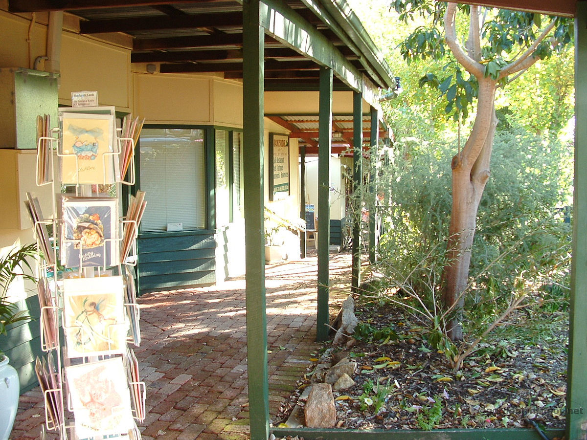
Roleystone - Brackenridge Village The Brackenridge Village is full of craft, art and similar shops, and a restaurant. The Village dates back to 1921 when the first Store and Post Office were opened here. This area used to be known as Flat Rock. July 2010. Photos Ref: ROLE007 |
||
 |
Roleystone - Brackenridge Village Shops, trees, grass and items for sale in Brackenridge Village. July 2010. Photos Ref: ROLE008 |
||
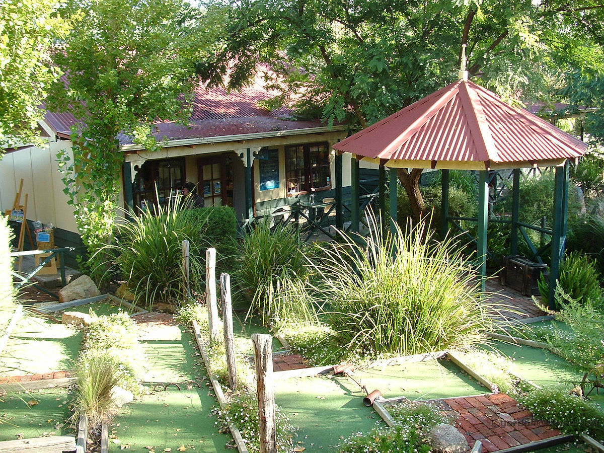 |
Roleystone - Brackenridge Village The centre of Brackenridge Village. There is a mini golf course and rest areas in here. July 2010. Photos Ref: ROLE009 |
||
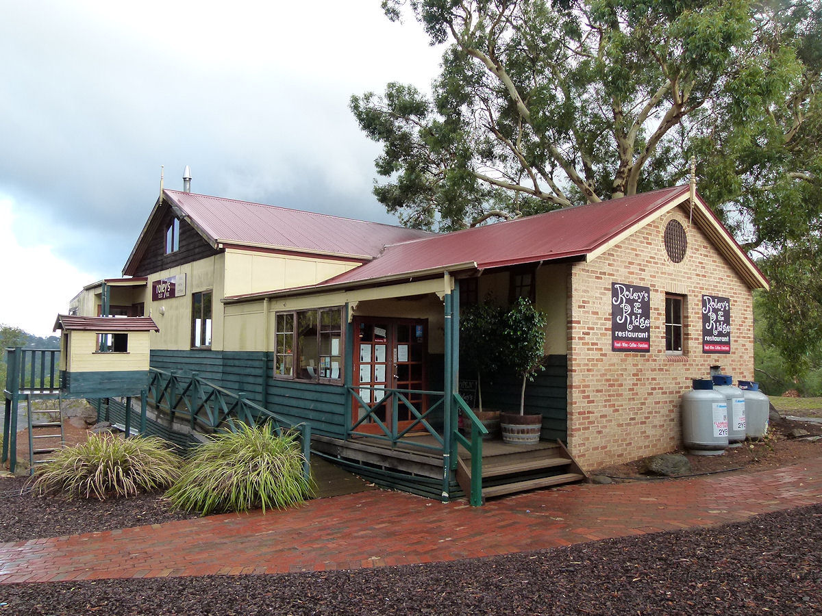 |
Roleystone - Roley's Restaurant Roley's on the Ridge restaurant in Brackenridge Village. At the rear of the restaurant are magnificent valley views. This is set next to Flat Rock. March 2015. Photos Ref: ROLE010 |
||
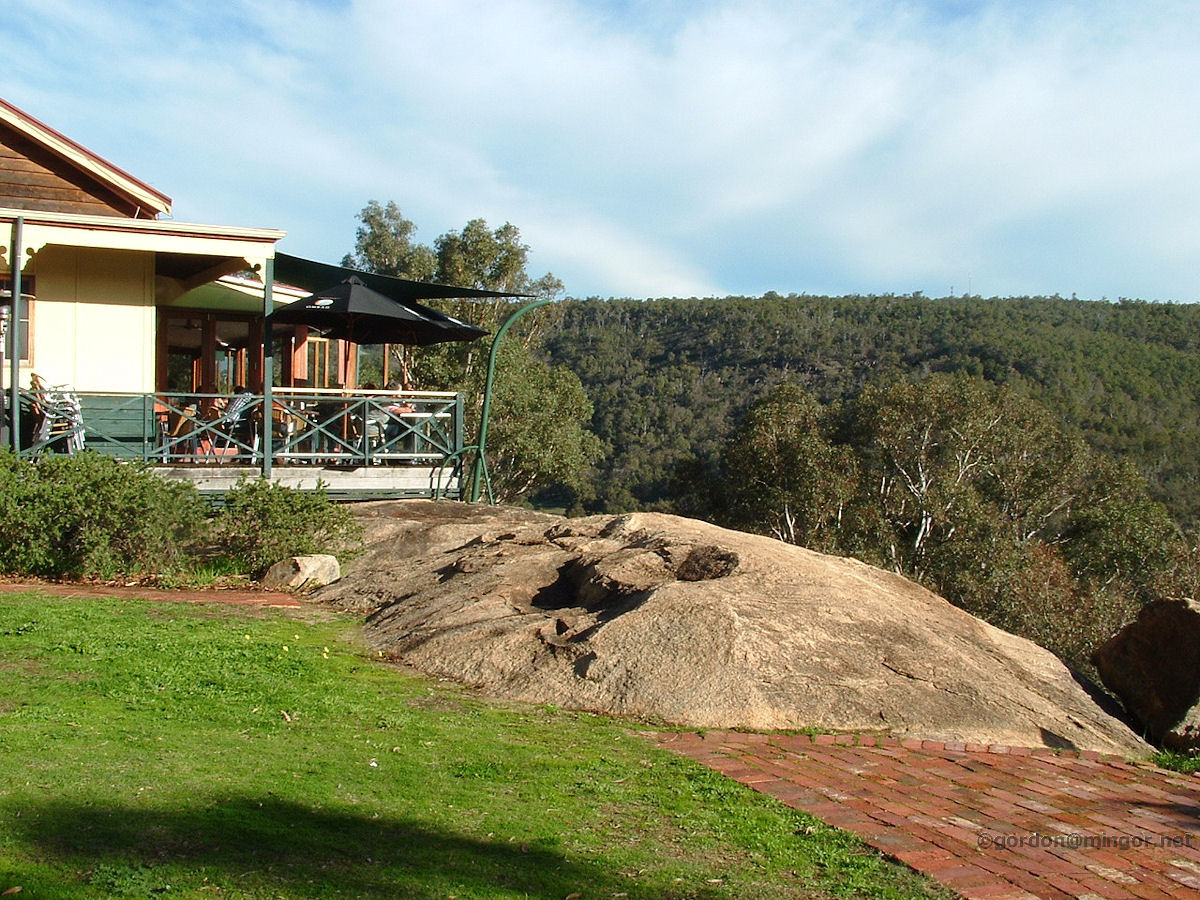 |
Roleystone - Brackenridge Village The restaurant is in the left picture. Centre is a typical large granite rock of the Darling Scarp. Is is undoubtedly the rock which inspired the site's early name of Flat Rock. July 2010. Photos Ref: ROLE011 |
||
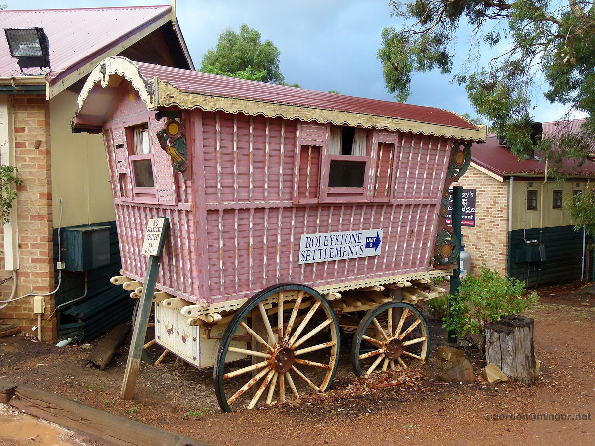 |
Roleystone - Caravan in Brackenridge Village This old Romany-style caravan welcomes people to Brackenridge Village. The name Ginder is painted on the caravan door. March 2015. Photos Ref: ROLE012 |
||
 |
Roleystone - Theatre The Roleystone Theatre on Brookton Highway near the intersection of Croyden Road. The hall was built in 1922 as a Community Hall. The theatre group was formed in 1933 and was then known as the Roleystone Choral and Dramatic Society. January 2012. Photos Ref: ROLE013 |
||
 |
Roleystone - Anglican Church St Christopher's Anglican Church on Hall Road. This church dates back to 1938 though the current building appears to be far more recent. March 2015. Photos Ref: ROLE014 |
||
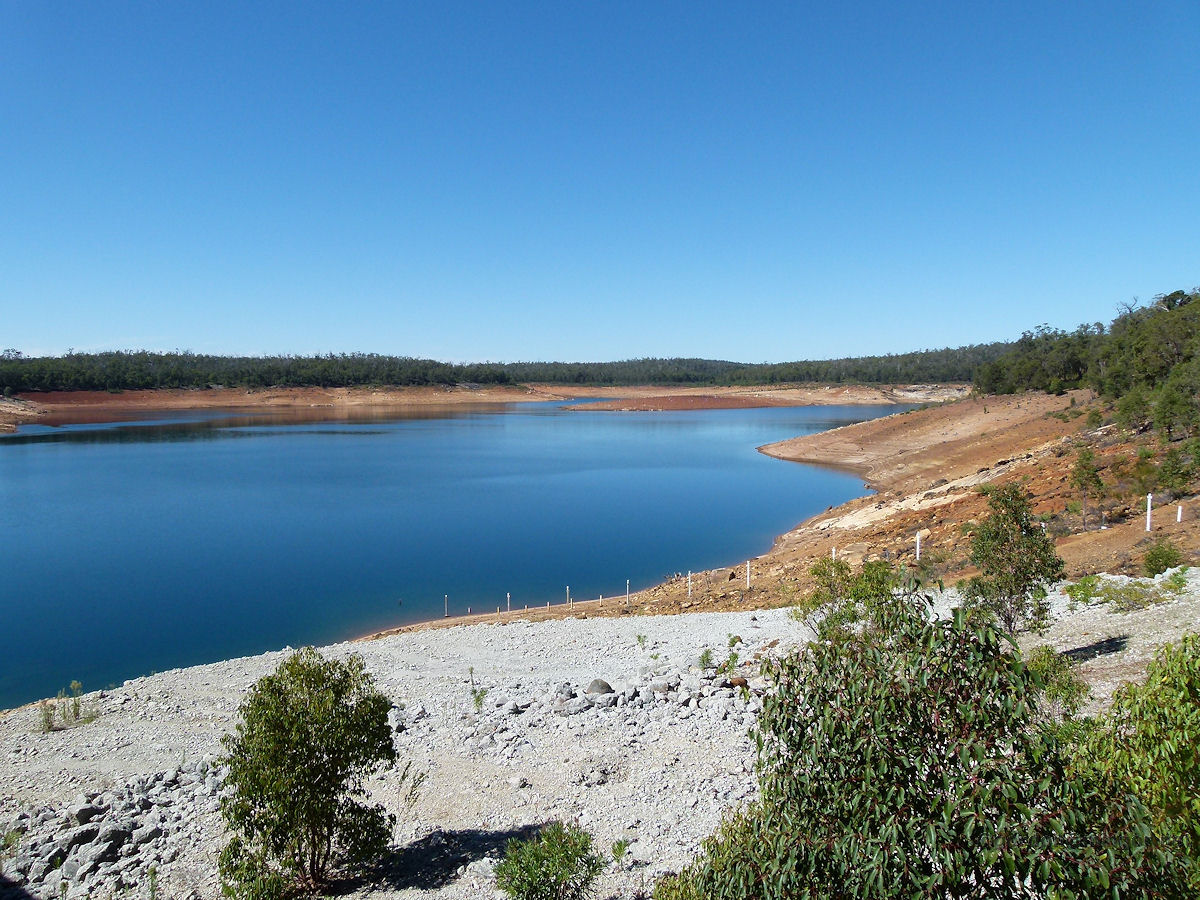 |
Roleystone - Canning Dam About 7 kilometres south of Roleystone but still in the district. The water level at Canning Dam, which supplies the bulk of Perth domestic water, is depressingly low. However it is at the end of summer. March 2013. Photos Ref: ROLE015 |
||
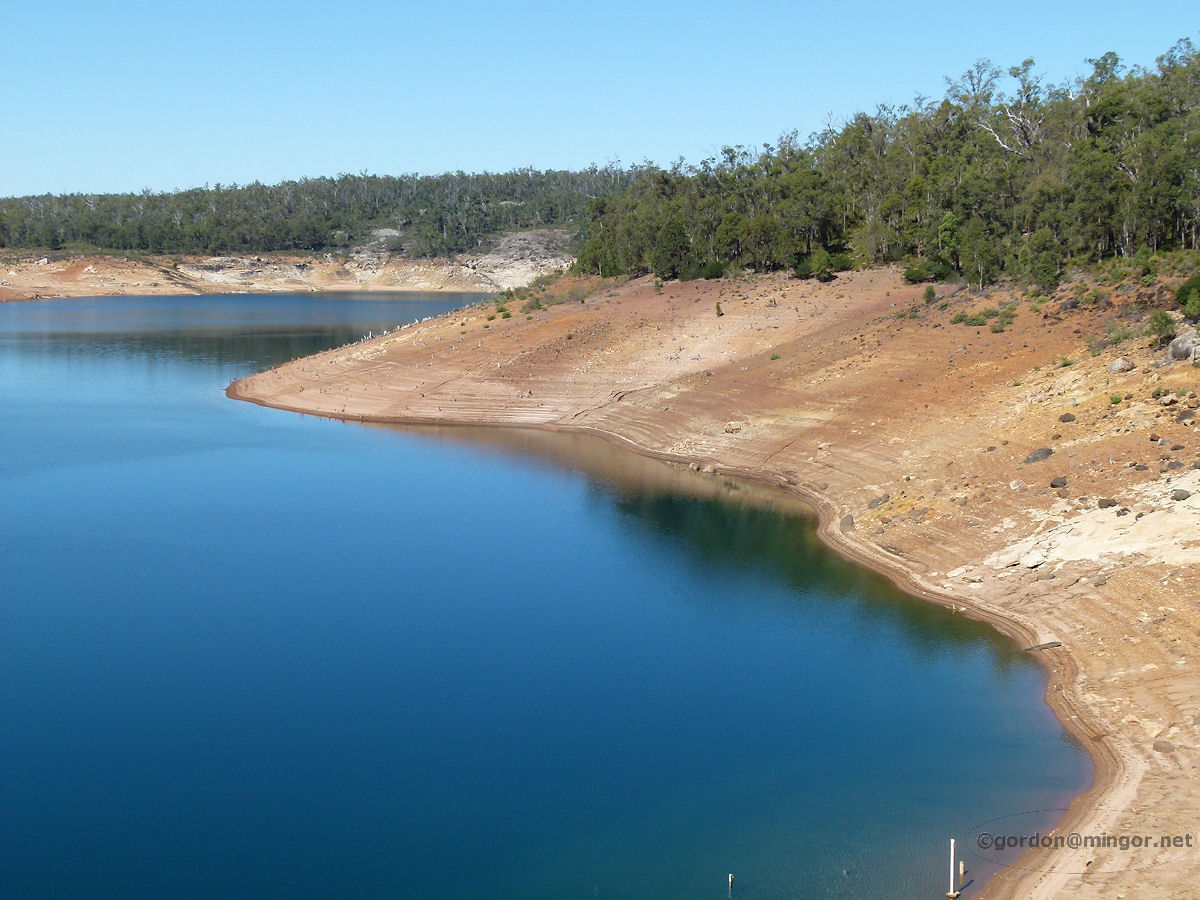 |
Roleystone - Canning Dam Another look at the dam water level. A Water Supply chap who was on site told me that water levels would be a lot lower except for the fact that desalinated water is pumped into this reservoir. Then some of the water is transferred to Mundaring Dam to service the Goldfields. March 2013. Photos Ref: ROLE016 |
||
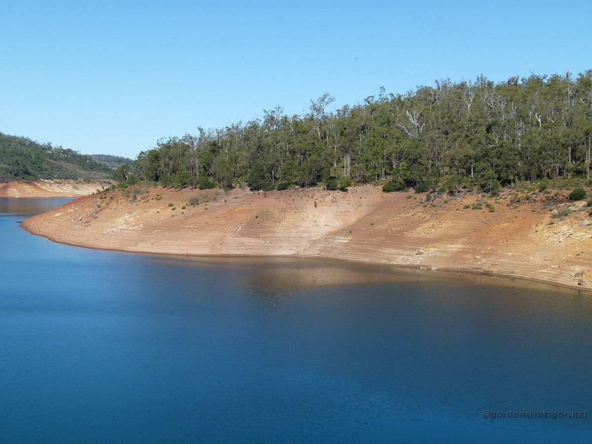 |
Roleystone - Canning Dam Tiers of sand on the shoreline mark the continual downward volume in the dam. The tree-line is where the water line was years ago and should be now. The dropping level is partially due to reduced rainfall but the main issue is the massive population growth of Perth and the proportional increase of demands on the water supply. March 2013. Photos Ref: ROLE017 |
||
 |
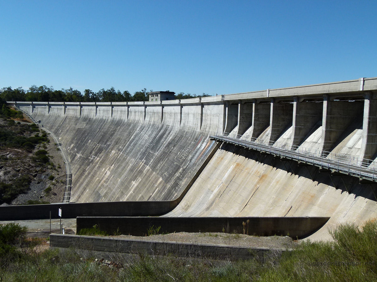
Roleystone - Canning Dam Looking down from the top of the dam wall is the bottom of the spillway and pumping equipment. March 2013. Photos Ref: ROLE018 |
||
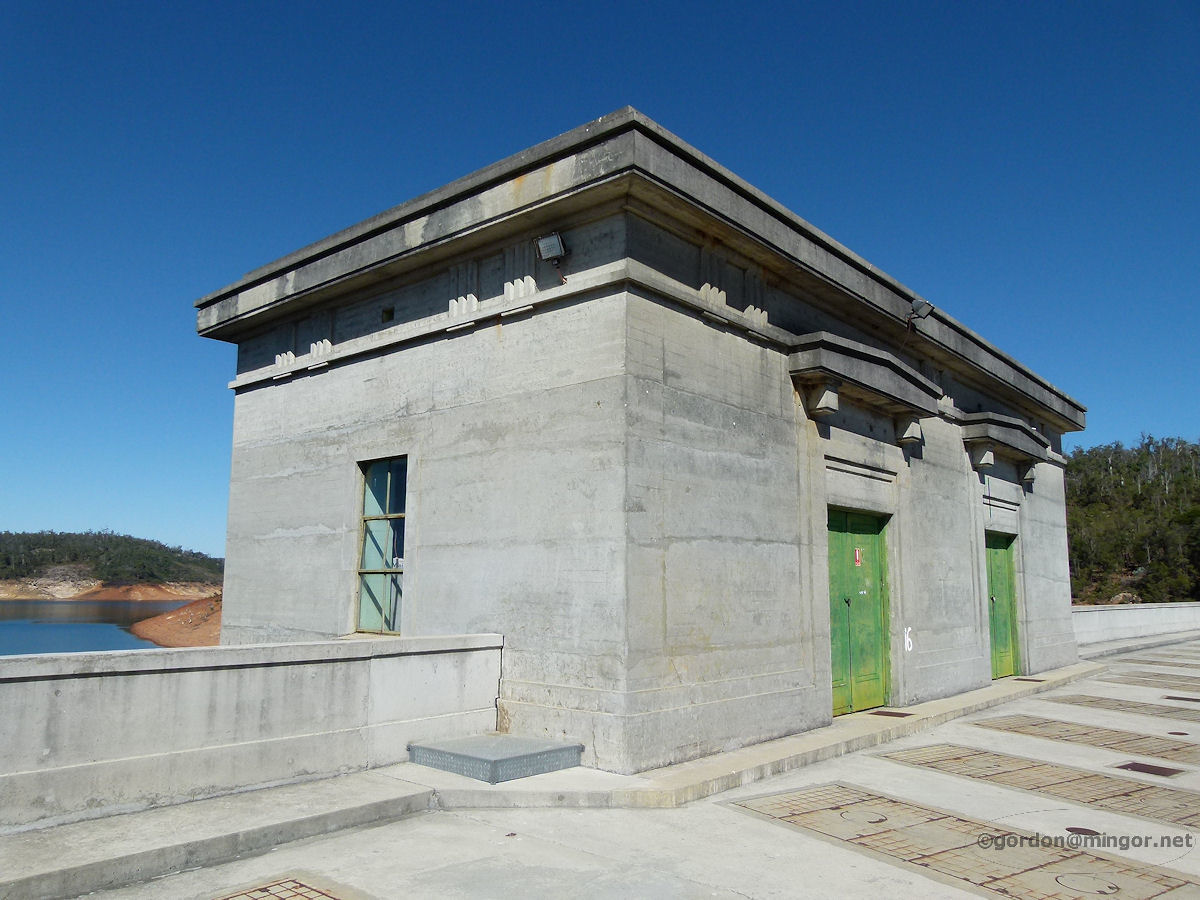 |
Roleystone - Canning Dam On top of the dam wall is this old building which is probably used as a control centre for measuring the water level and operating valves and the like. March 2013. Photos Ref: ROLE019 |
||
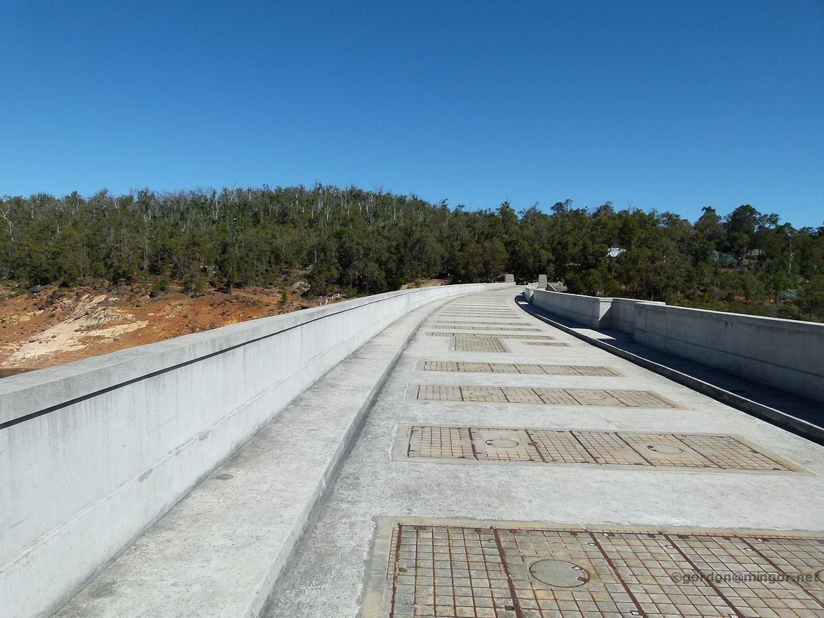 |
Roleystone - Canning Dam Atop the dam wall is this road which is open to traffic although none on here right now. March 2013. Photos Ref: ROLE020 |
||
 |
Roleystone - Canning Dam The dam wall, access pathways for engineers, and the seemingly eternally dry spillways. March 2013. Photos Ref: ROLE021 |
||
 |
Roleystone - Canning Dam Another view of the dam wall taken from the steps which lead from the parking area up to the top of the dam wall. March 2013. Photos Ref: ROLE022 |
||
All images published on this website are copyright © of the webmaster. See About section for clarification and special schools permission |
|||