| Photographs of Perth, Western Australia | |||
Canning Bridge - Photographs of Western Australia Canning Bridge is not a suburb in its own right although the name is used by some residents and businesses to describe their locale. The Canning Bridge spans the mouth of the Canning River close to its confluence with the Swan. There have been four bridges here, the first built in 1849 (only 4 metres wide and later suffered flood damage), the next in 1867 (suffered fire damage), another in 1908, then the first of the two parallel present bridges completed in 1939, built wider and sturdier |
|||
| West to Applecross | East to Como | ||
 |
Canning Bridge - Train Station Here is a view from along the bridge which crosses the Kwinana Freeway and rail lines. This is not the Canning Bridge, that is west yonder a bit. You can see bus ports on the bridge. Down below is the new railway station which is not yet opened. November 2007. Photos Ref: CNBR001 |
||
 |
Canning Bridge - Train Station Canning Bridge train station now that it's opened. That other platform over there will get you to Mandurah. We're back off to Perth on the next train coming up from Mandurah. January 2008. Photos Ref: CNBR002 |
||
 |
Canning Bridge - Boat on River A boat lazily cruises along the Swan River. Viewed through the pylons under Canning Bridge. Following on a bit from the history above, the 1908 bridge was kept in place until after World War II as a hedge against the new bridge suffering war damage. The 1939 bridge was duplicated in 1958 to cater for increased traffic from the brand new Kwinana Freeway. Thence one bridge carried eastbound traffic, and the other westbound, as they do today. January 2008. Photos Ref: CNBR003 |
||
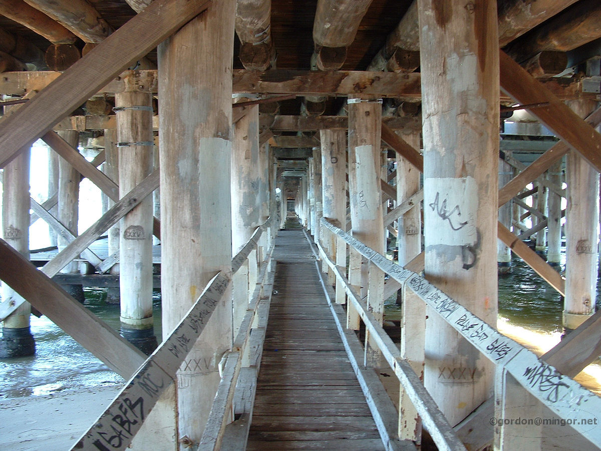 |
Canning Bridge - Under the Bridge Underneath the Canning Bridge. I never knew this existed. Well, I knew the underneath existed but didn't know you could get down here! Amazing the places you can explore with a four-year-old. The wooden pylons are etched with sets of roman numerals, for example XXXIV, which may corollate to the upper beams they support. January 2008. Photos Ref: CNBR004 |
||
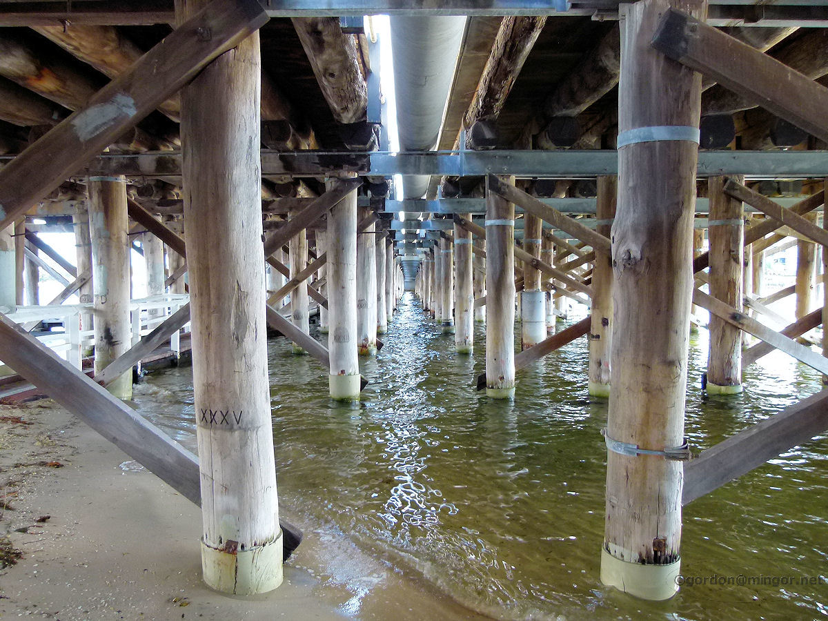 |
Canning Bridge - Under the Bridge Underneath the Canning Bridge again (after a six year absence). This shows both the 1939 and 1958 bridges - you can see the split up above where that pipe runs and light comes through. Which is which? Visually, it is not very evident. However, the southern bridge (left in picture), with the underside fishing platform, is the 1958 addition. May 2014. Photos Ref: CNBR005 |
||
 |
Canning Bridge - From the North Here is the Canning Bridge viewed from the north along an eastern bank of the Canning River. Behind us is the Kwinana Freeway. Over in the distance is Applecross. May 2014. Photos Ref: CNBR006 |
||
 |
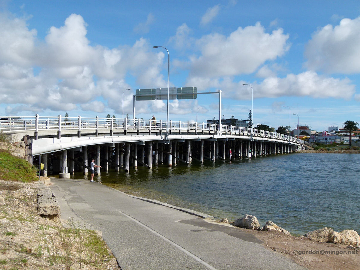
Canning Bridge - From the South The Canning Bridge viewed from the south, from Mount Pleasant. This is looking east across the bridge. The Freeway exits and Canning Highway continuance signs can be seen over the bridge. May 2014. Photos Ref: CNBR007 |
||
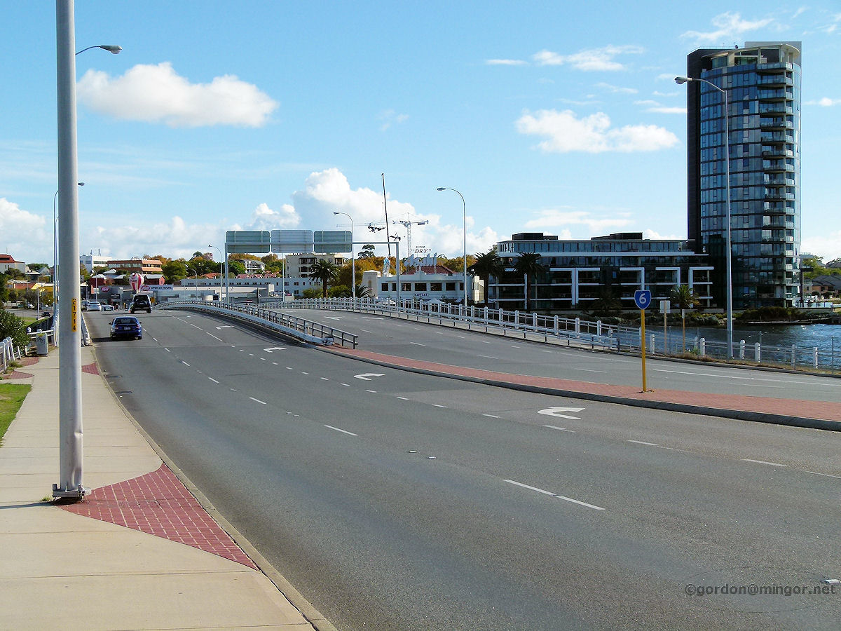 |
Canning Bridge - Looking West Looking west across the bridge towards Applecross. Centre of picture is the Raffles Hotel and the large apartment block to the right has Swan River frontage. May 2014. Photos Ref: CNBR008 |
||
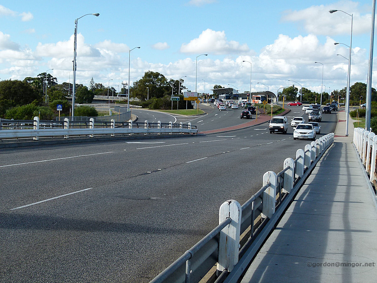 |
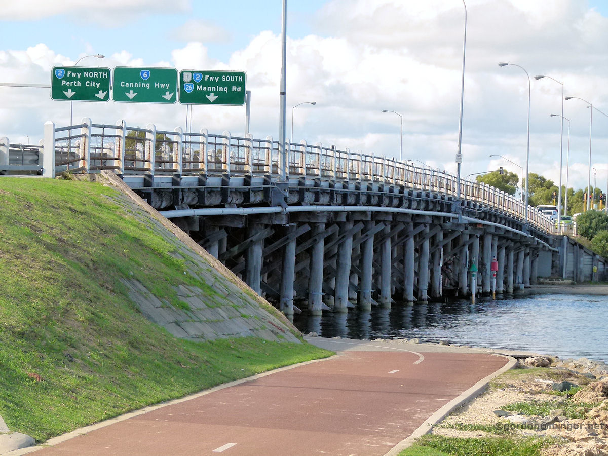
Canning Bridge - Looking East Here is a view looking east taking in the bridge over the Kwinana Freeway and bus ports atop that bridge, over the top of the Canning Bridge Station. May 2014. Photos Ref: CNBR009 |
||
All images published on this website are copyright © of the webmaster. See About section for clarification and special schools permission |
|||