| Photographs of Perth, Western Australia | |||
Claremont - Photographs of Western Australia Claremont is a residential suburb situated on the Stirling Highway halfway between Perth and Fremantle. The area's first European name was Butler's Swamp. Development flourished after the Fremantle - Guildford rail line was constructed in 1881. Mr John Butler also explored an area near Wanneroo, hence the Butler suburb name. The Claremont name was first used in 1883 by Mr James Morrison, who owned land here, named after his wife, Clara |
|||
| North to Showground | South to Dalkeith | ||
| West to Swanbourne | |||
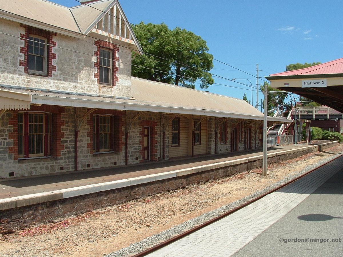 |
Claremont - Railway Station When the rail line opened here in 1881, the station was called Butler's Swamp. The current station was built in 1886. Here is part of the original railway station viewed from the platforms now in use. There is no public access to the old platform. The stonework is typical of the period. February 2008. Photos Ref: CLMT001 |
||
 |
Claremont - Railway Station Part of a mural on a wall at Claremont Station depicting rail passenger transport in days gone by. February 2008. Photos Ref: CLMT002 |
||
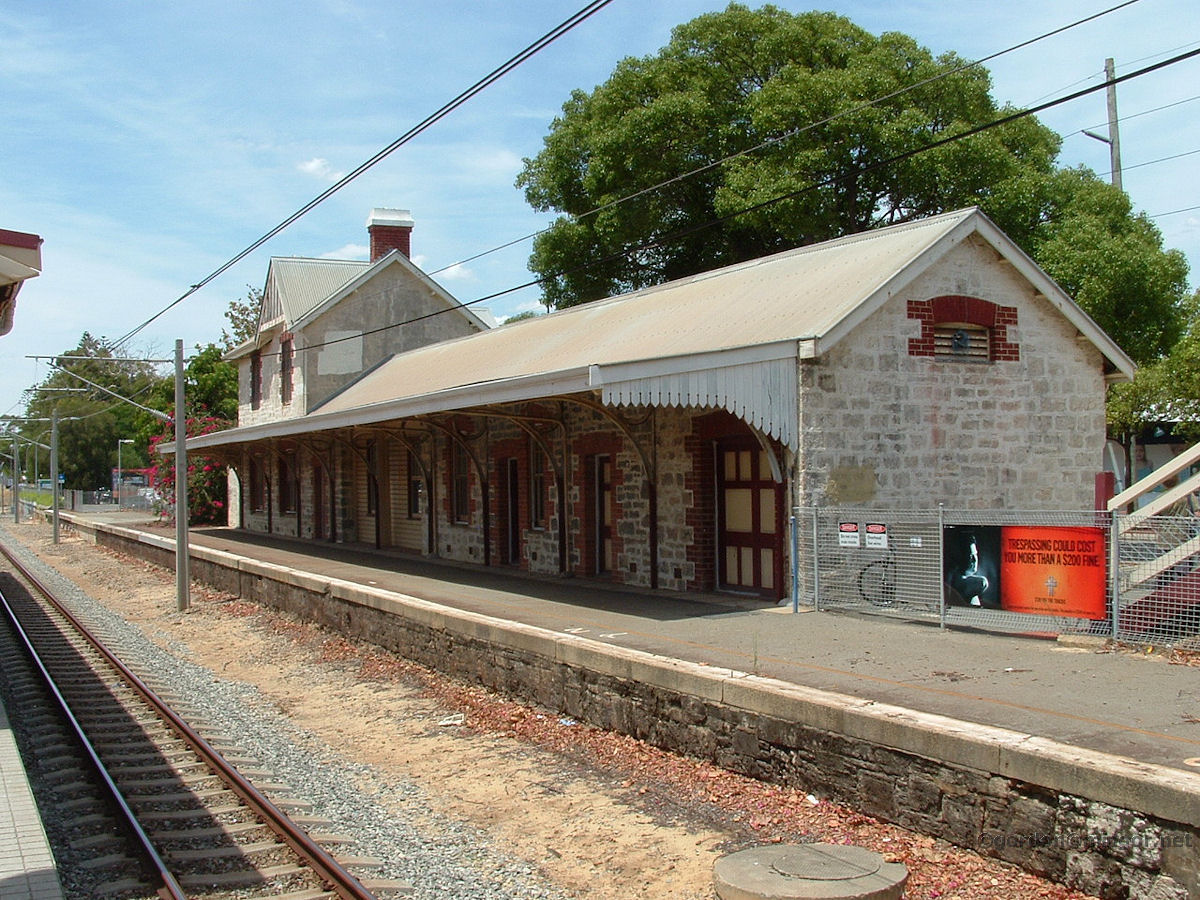 |
Claremont - Railway Station Apart from Perth, Maylands, Daglish, Guildford, Bassendean & Fremantle, I believe this is the only other suburban train station to preserve some of the older or original buildings. However, the old Subiaco and East Perth stations, the East Perth and Cottesloe signal cabins, and the Midland locomotive turntable have been relocated to and preserved in Whiteman Park. February 2008. Photos Ref: CLMT003 |
||
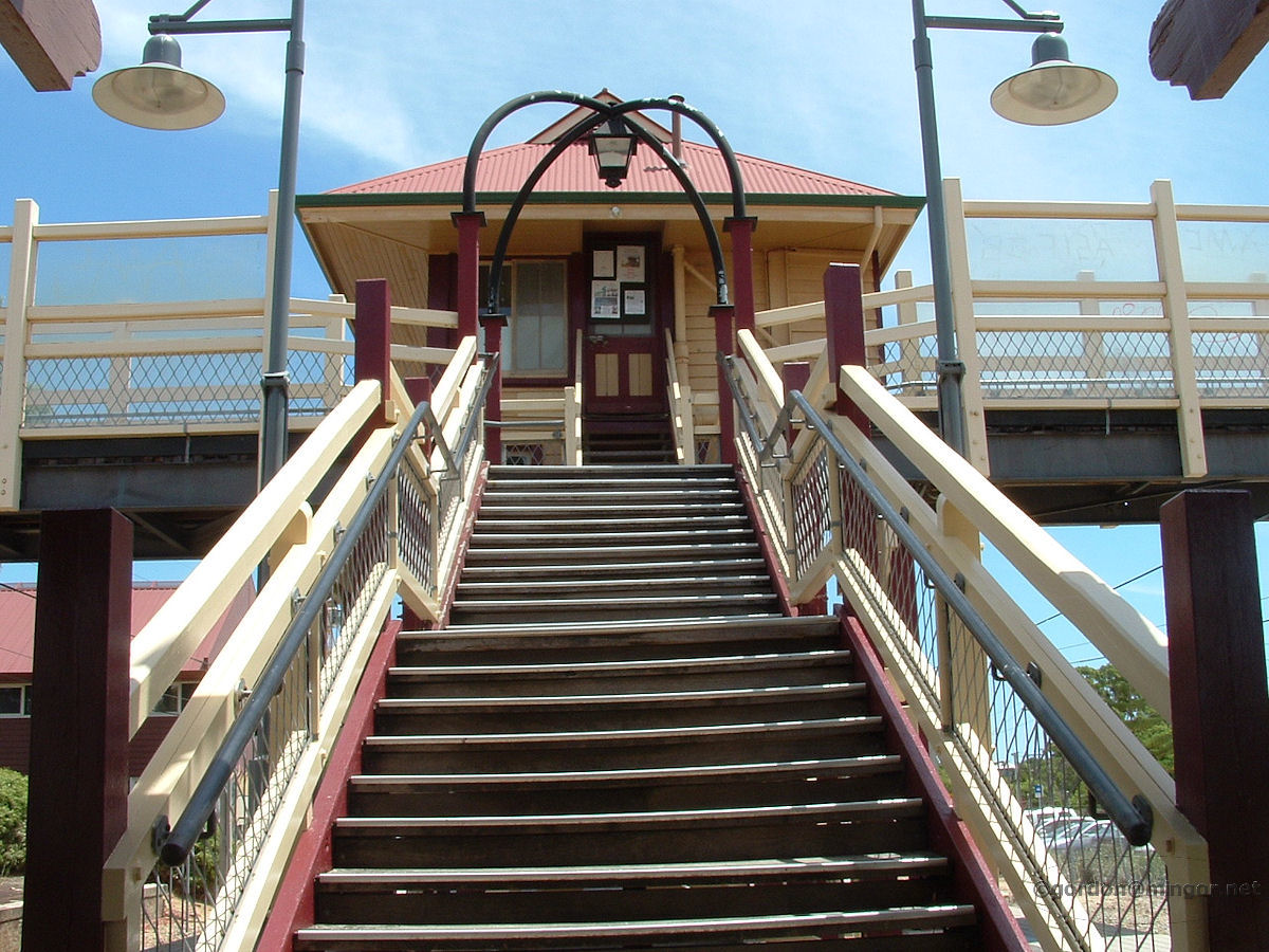 |
Claremont - Railway Station Looking up the wooden steps from the platform at the railway station. Atop is the old wooden passenger bridge which spans the tracks. On the bridge is the now-disused signal cabin which has been preserved. The signal cabin now houses a museum. The steps and bridge are still very much in use. February 2008. Photos Ref: CLMT004 |
||
 |
Claremont - Railway Station Here is a view of the Bay View Terrace side of railway station. This building is currently (2012) being occupied by some of the Town of Claremont staff as a fire severely damaged their own premises on Stirling Highway a year or so ago. January 2012. Photos Ref: CLMT005 |
||
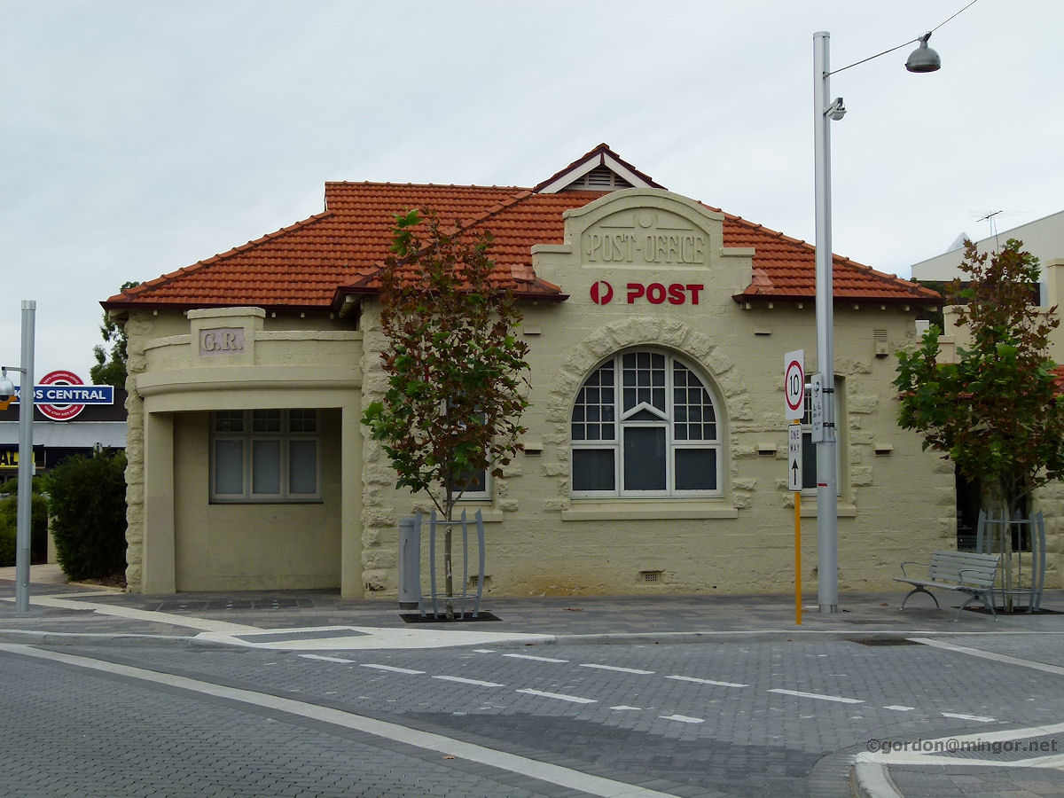 |
Claremont - Post Office The Claremont Post Office on the corner of Bay View Terrace and Gugeri Street. This building was designed in 1896 and built shortly afterwards. The Post Office was structurally altered during the 1920's and again more recently. April 2013. Photos Ref: CLMT006 |
||
 |
Claremont - Claremont Hotel The Claremont Hotel on the corner of Bay View Terrace and Gugeri Street. When built in 1902, it was called the Family and Commercial Hotel. It became the Fink Hotel in 1912, named after the then licensee, Karl Fink. Up until a few years ago the hotel was known as the Continental Hotel. The hotel verandah was demolished in 1953 but rebuilt some years later. April 2013. Photos Ref: CLMT007 |
||
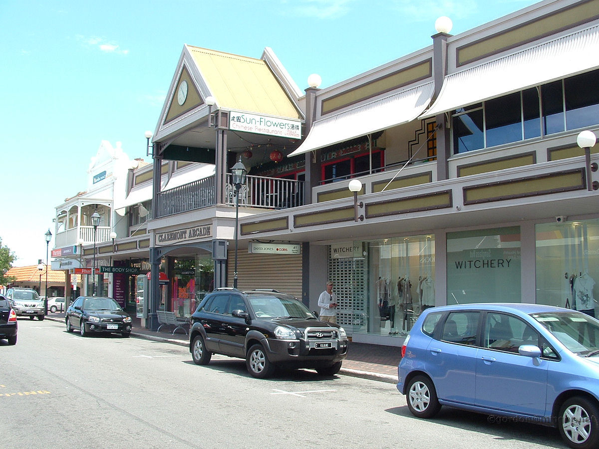 |
Claremont - Bay View Terrace Looking down Bay View Terrace from the west. Centre is Claremont Arcade with the Chinese Restaurant above. Beyond is Jacobson's Pharmacy and the Commonwealth Bank. A one-time arcade in the area contained Frank Smith's Discurio record bar. Whereas Frank catered for all music genres I recall he was something of a jazz buff. Near Discurio was Starving Stan's lunch bar. "Pass Me and We Both Starve", said his sign. February 2008. Photos Ref: CLMT008 |
||
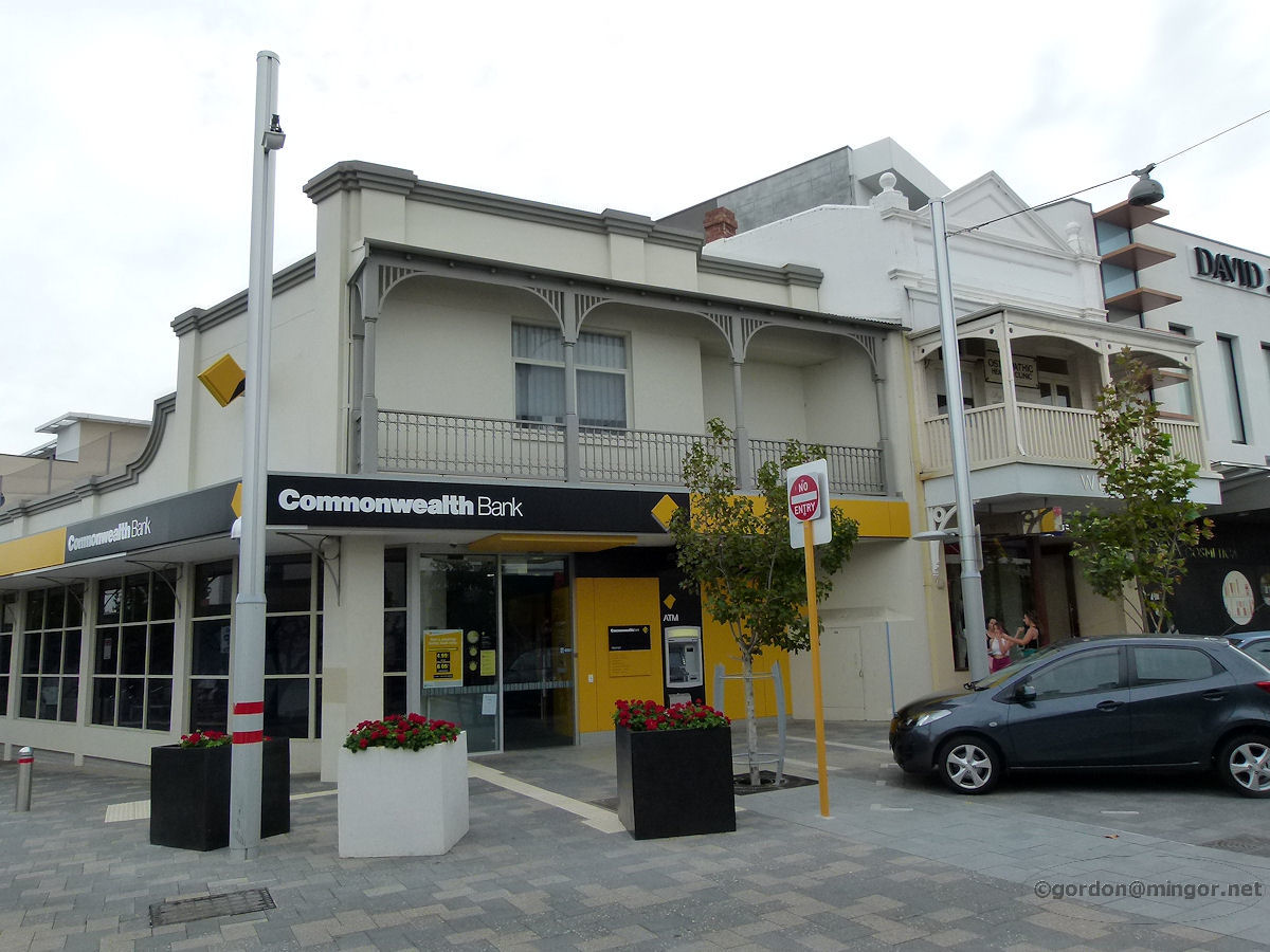 |
Claremont - Commonwealth Bank The Commonwealth Bank premises on Bay View Terrace. To the right is the Jacobson's Pharmacy building which was erected in 1925. April 2013. Photos Ref: CLMT009 |
||
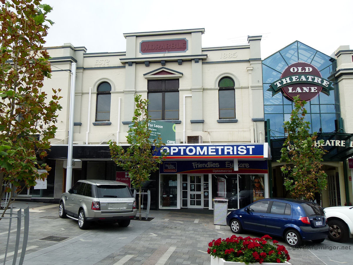 |
Claremont - Drabbles Building This Drabbles Building was constructed in 1924 as Walter Drabble's hardware store. It is on Bay View Terrace next to the Old Theatre Lane. An optometrist is in residence at present. The "1885" on the top of the building is the year Drabbles was established, not the year the building was built. Etching the company establishment year rather than the building construction year was common practice in those days. The Bank of N.S.W. did that frequently on its bank buildings. April 2013. Photos Ref: CLMT010 |
||
 |
Claremont - Old Theatre Building Adjacent to the Old Theatre Lane on Bay View Terrace is the old theatre building itself. This was Princess Theatre and built in 1914. It was used for films and concerts. Old Theatre Lane was created in 1977 and incorporates the old theatre and the Drabbles building. April 2013. Photos Ref: CLMT011 |
||
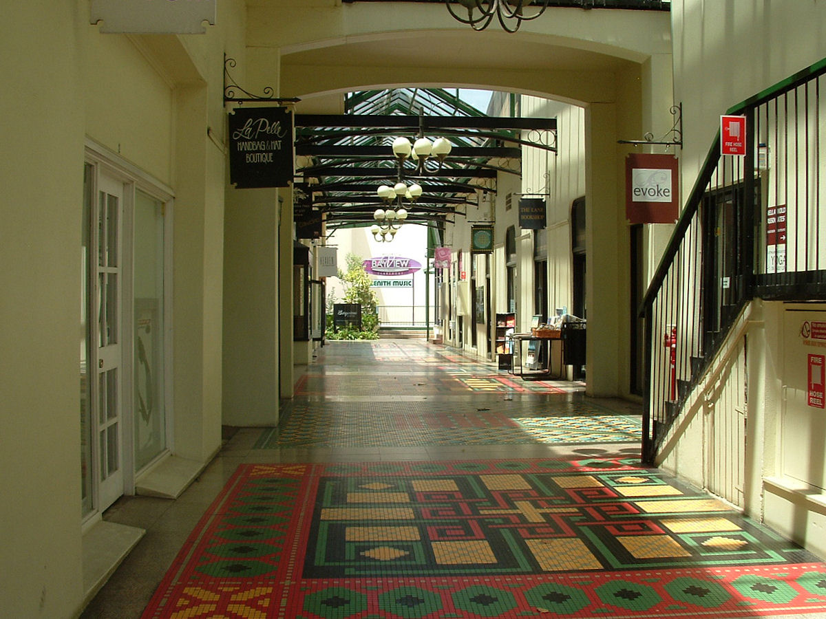 |
Claremont - Old Theatre Lane The Old Theatre Lane - a lovely arcade off Bay View Terrace with colourful floor tile mosaics and an agreeable ambience. February 2008. Photos Ref: CLMT012 |
||
 |
Claremont - Old Theatre Lane The Old Theatre Lane arcade looking back towards Bay View Terrace. February 2008. Photos Ref: CLMT013 |
||
 |
Claremont - National Bank Building Sitting on the corner of Bay View Terrace and Stirling Highway is the former National Bank Building which was erected in 1911. As was often the custom in those days, the bank manager lived on the upper floor. The building was constructed by Mr Walter Drabble. April 2013. Photos Ref: CLMT014 |
||
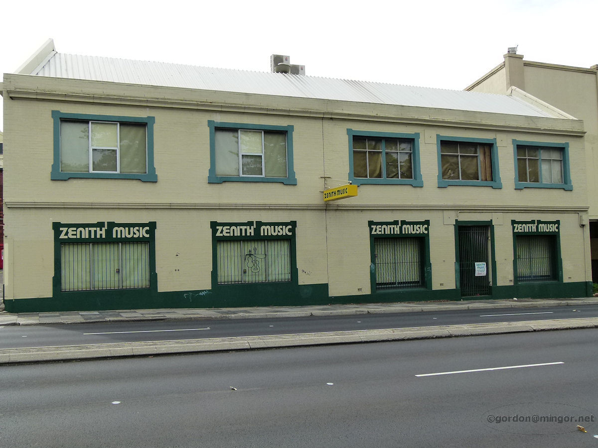 |
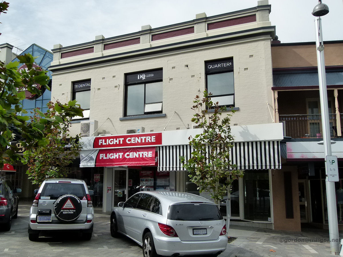
Claremont - Zenith Music The premises of Zenith Music on Stirling Highway has been a landmark since the store was established here in 1969. April 2013. Photos Ref: CLMT015 |
||
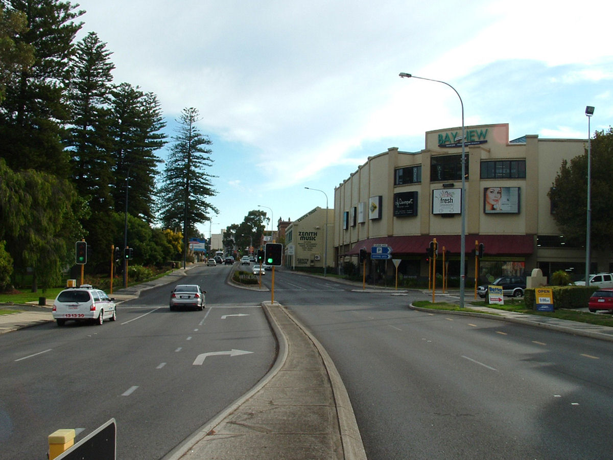 |
Claremont - Stirling Highway Looking south along Stirling Highway towards Zenith Music and Bay View Terrace. April 2010. Photos Ref: CLMT016 |
||
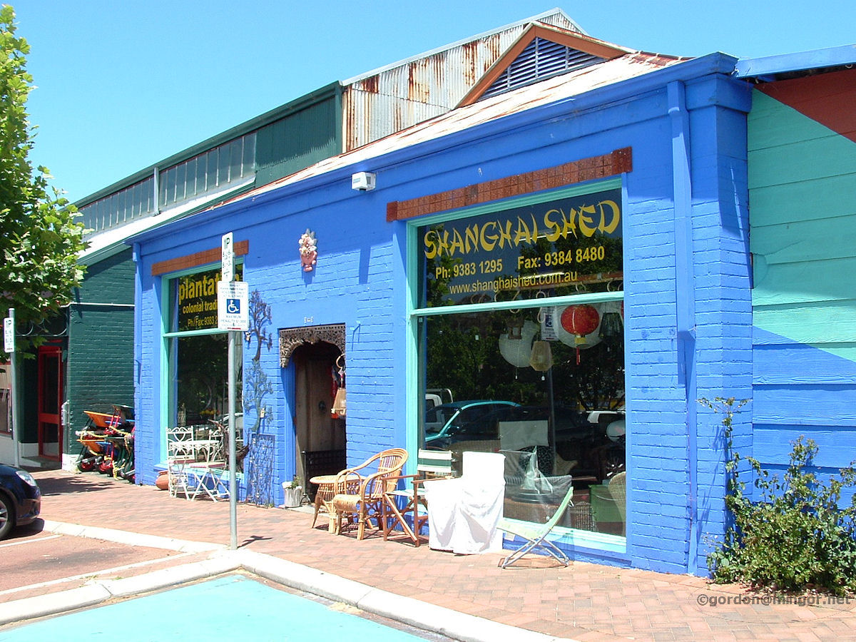 |
Claremont - Shanghai Shed On Leura Avenue this Shanghai-Shed shop looks very colourful. November 2008. Photos Ref: CLMT017 |
||
 |
Claremont - St Thomas Catholic Church St Thomas Catholic Church is located on the corner of Melville Street and College Road, close to Loch Street railway station. Behind the church is St Thomas Primary School. The church Foundation Stone was laid by Archbishop Prendiville on July 22nd, 1936. April 2013. Photos Ref: CLMT018 |
||
 |
Claremont - Council Chambers The Claremont Council Chambers at the end of Bay View Terrace looking across Stirling Highway. This building was badly damaged by fire a year or two after this photo was taken. Construction commenced in 1899 with alterations being made in 1935. February 2008. Photos Ref: CLMT019 (Since partially destoyed by fire) |
||
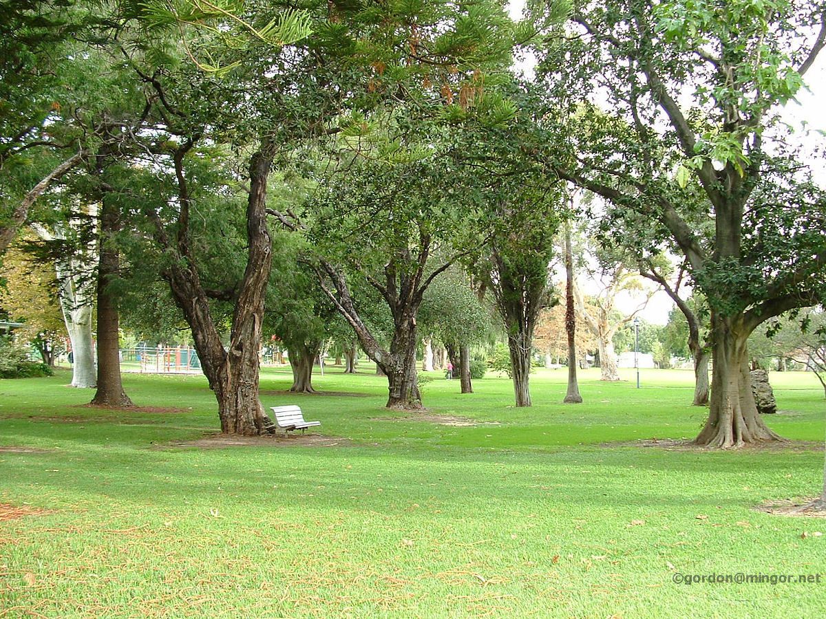 |
Claremont - Claremont Park This park is off to the left and back of the council offices, on the corner of Stirling Highway and Bay View Terrace. April 2010. Photos Ref: CLMT020 |
||
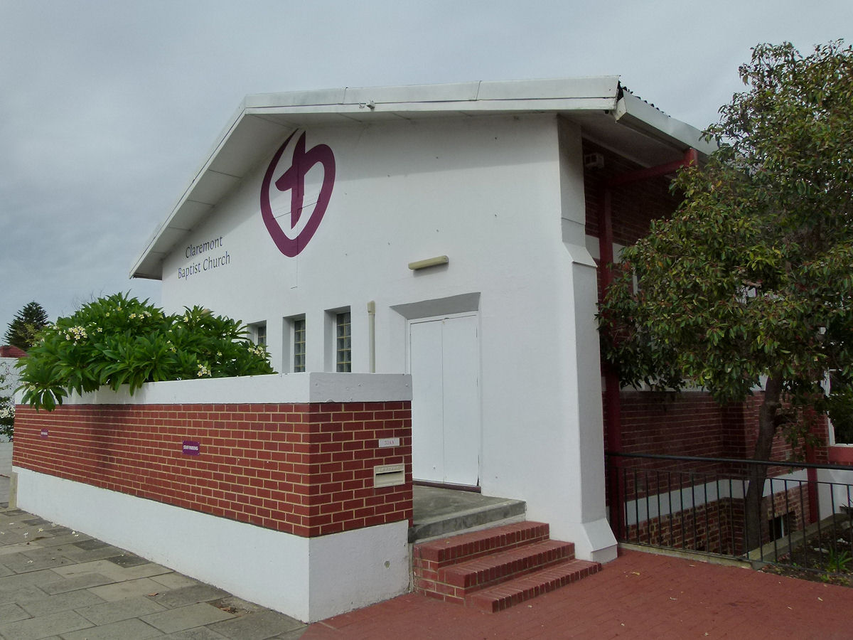 |
Claremont - Baptist Church The Claremont Baptist Church celebrated its centenary in 1998. This building was constructed in 1905. The Foundation Stone was laid by Mrs C. W. Simpson and Mrs J. E. Ackland on 15th March, 1905. This is on the east side of Stirling Highway just south of Bay View Terrace. April 2013. Photos Ref: CLMT021 |
||
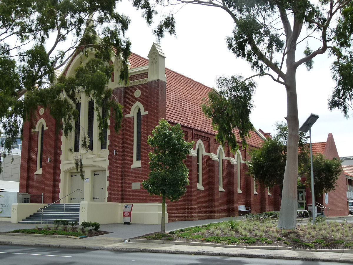 |
Claremont - Town Hall and Library On Stirling Highway across the road from the Baptist Church is the Claremont Town Hall (Community Centre) and Library. This was originally a Methodist Church which was purchased by the Council in 1981. The Church Foundation Stone was laid by Sir Robert Furse McMillan, Lieutenant Governor, on September 10th, 1922. April 2013. Photos Ref: CLMT022 |
||
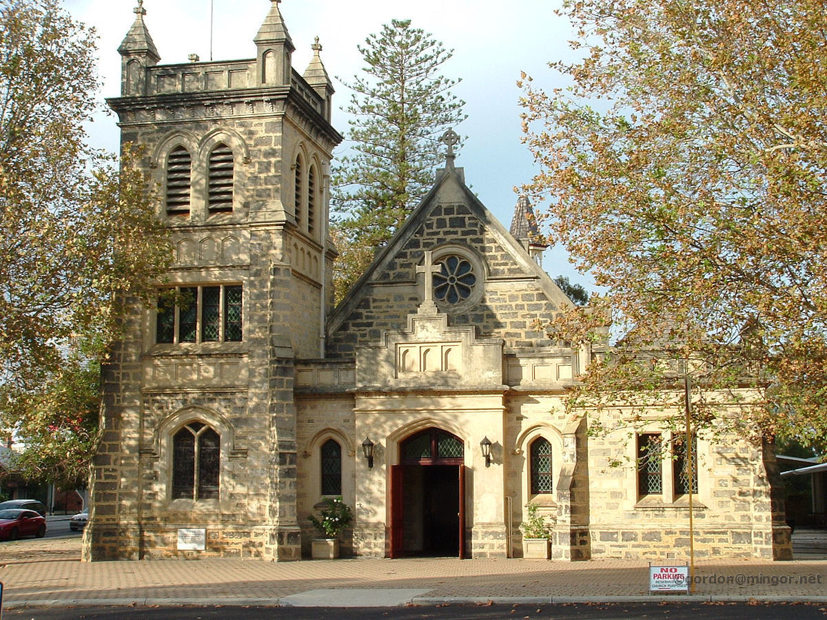 |
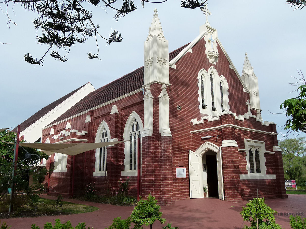
Claremont The Claremont Christ Church on Stirling Highway. Building commenced in 1892. The Church was consecrated by the second Bishop of Perth, Harry Hutton Parry on 11th April 1893. The church was damaged in the Meckering earthquake of 1968. This, together with natural deterioration over the years, necessitated significant renovations which were completed and eventually dedicated by Bishop Michael Challen in March 1981. April 2010. Photos Ref: CLMT023 |
||
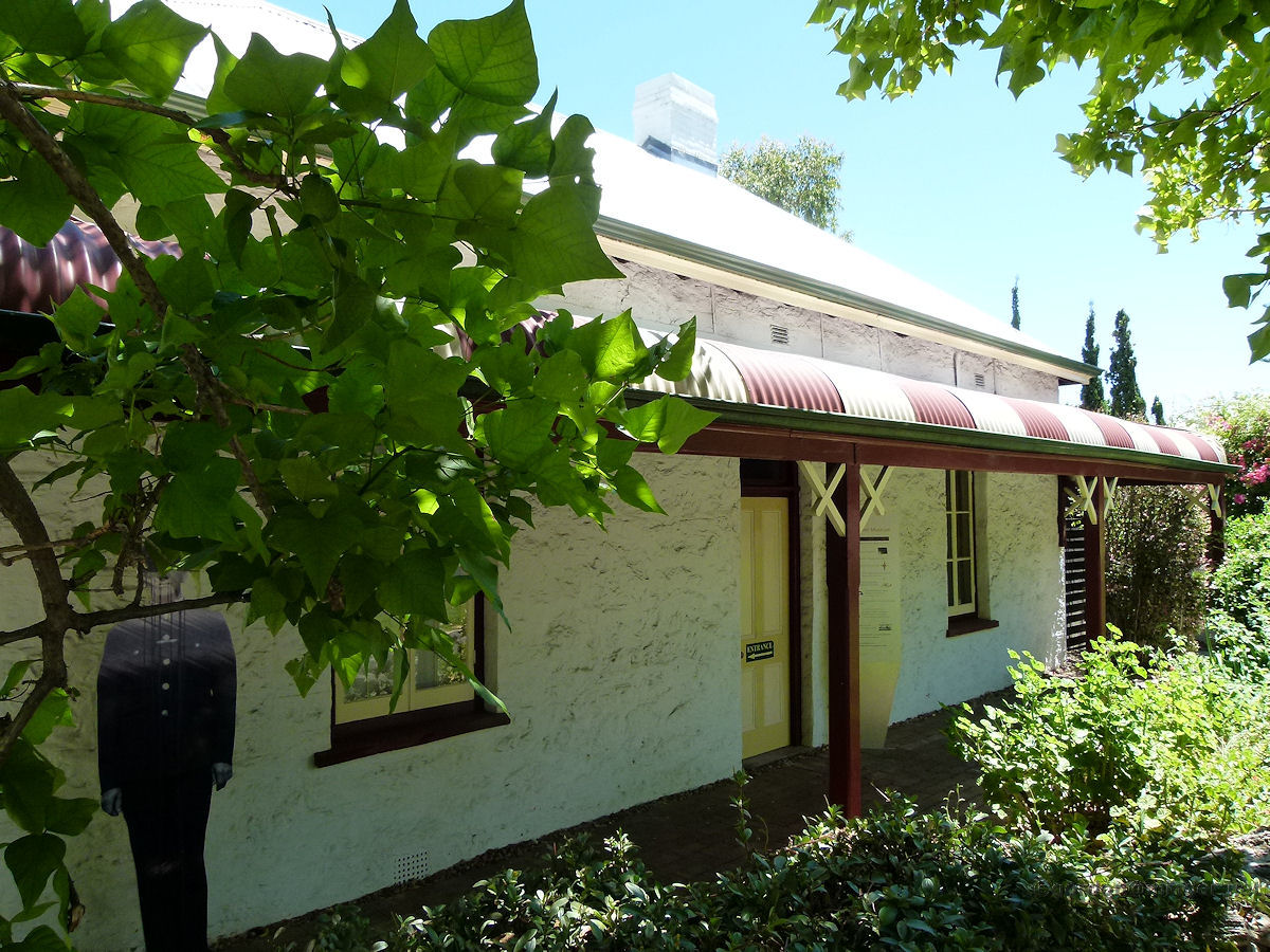 |
Claremont - Museum on Victoria Avenue On Victoria Avenue, virtually opposite the end of Bay Street, is the Claremont Museum. Victoria Avenue is a leafy-green street which leads on down to Dalkeith and eventually turns into Jutland Parade. Central to the museum is a school built in 1862. The museum opened here in 1975. December 2010. Photos Ref: CLMT024 |
||
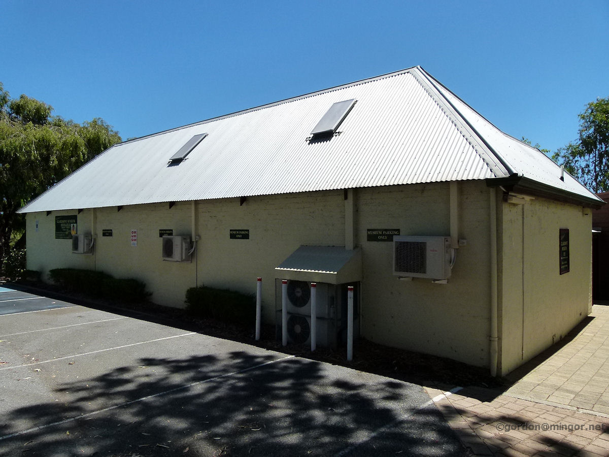 |
Claremont - Museum on Victoria Avenue There are a number of buildings in the Claremont Museum and this is another. The museum recently changed its name to the Freshwater Bay Museum. It is open 1.00pm - 4.00pm Monday to Friday (and in the afternoon of the first Sunday in each month). You are invited to "Pick a few herbs and enjoy the aroma". December 2010. Photos Ref: CLMT025 |
||
 |
Claremont - Congregational Church This old church is now occupied by Flannel. The church was built next to the Congregational Hall in 1906 as a result of increased church attendance. There are two Foundation Stones. One laid by Sir Frederick Bedford, Governor of W. A., on April 4th, 1906; and the other by Sydney Stubbs Esq., Mayor of Perth, on the same date. April 2013. Photos Ref: CLMT026 |
||
 |
Claremont - Congregational Hall Next to the former Congregational Church is the old Congregational Hall, constructed in 1896. The hall pre-dates the church by some 10 years. This building was used for, amongst other things, religious services until the church next door was built. The premises are now occupied by Garland International and Jackie Battley Interior Design. April 2013. Photos Ref: CLMT027 |
||
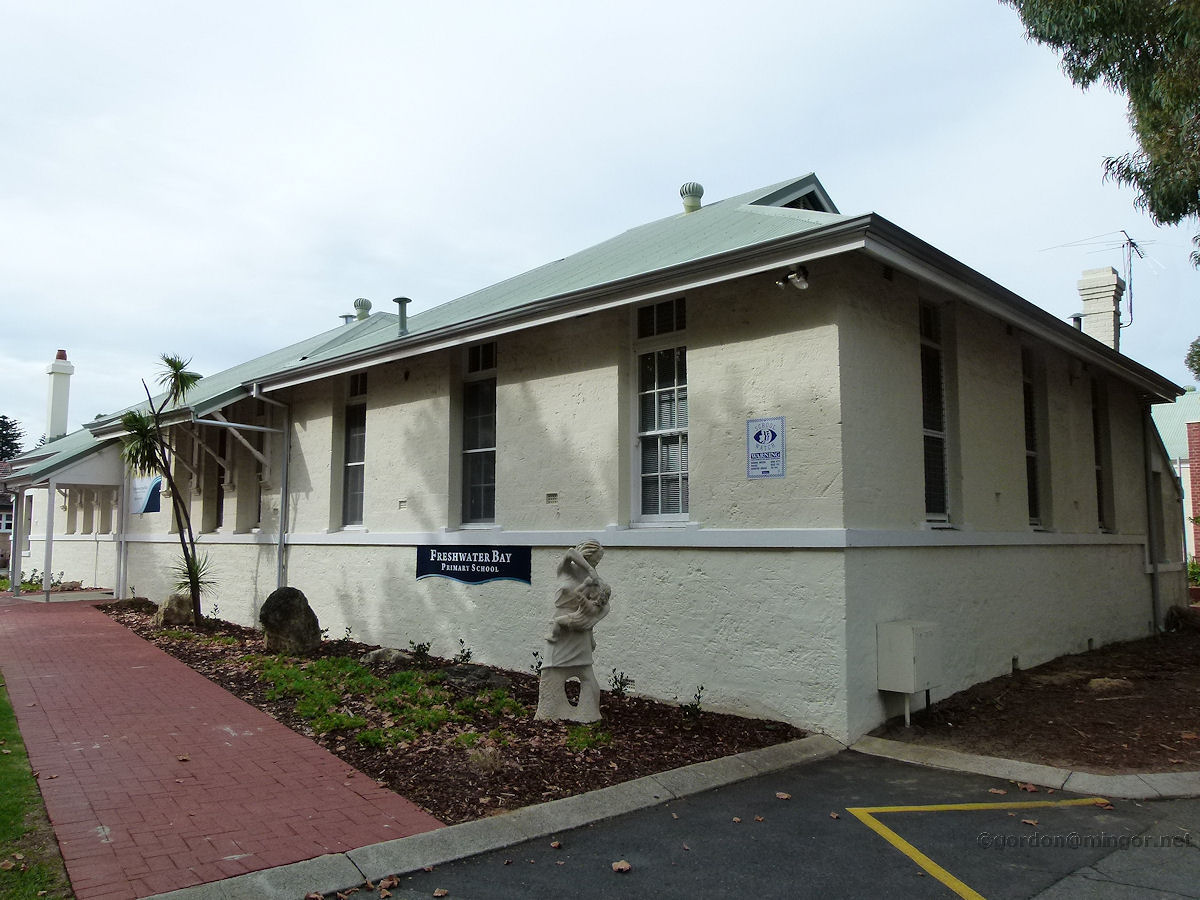 |
Claremont - Freshwater Bay School On the south part of Bay View Terrace, beyond the council buildings and park, is the Freshwater Bay Primary School (formerly the Claremont Primary School). This building looks like one of the oldest in the group and faces Bay View Terrace. April 2013. Photos Ref: CLMT028 |
||
 |
Claremont - St Aidan's Uniting Church On the corner of Princess Road and Chester Road is the St Aidan's Uniting Church. It was opened in 1903 for the local Presbyterian Church congregation but was not given its current name (St Aidan's) until the late 1930's. The Uniting Church was formed in 1977. April 2013. Photos Ref: CLMT029 |
||
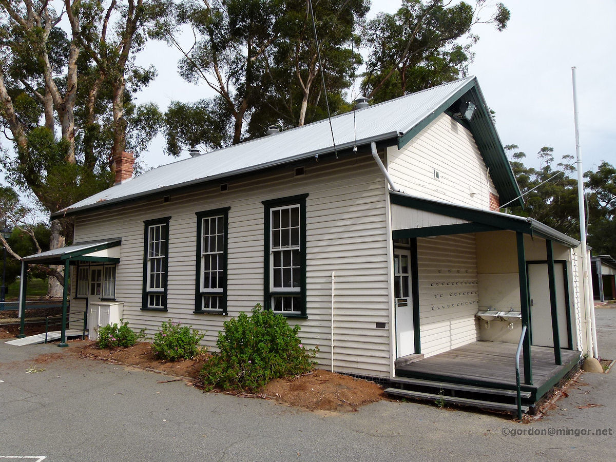 |
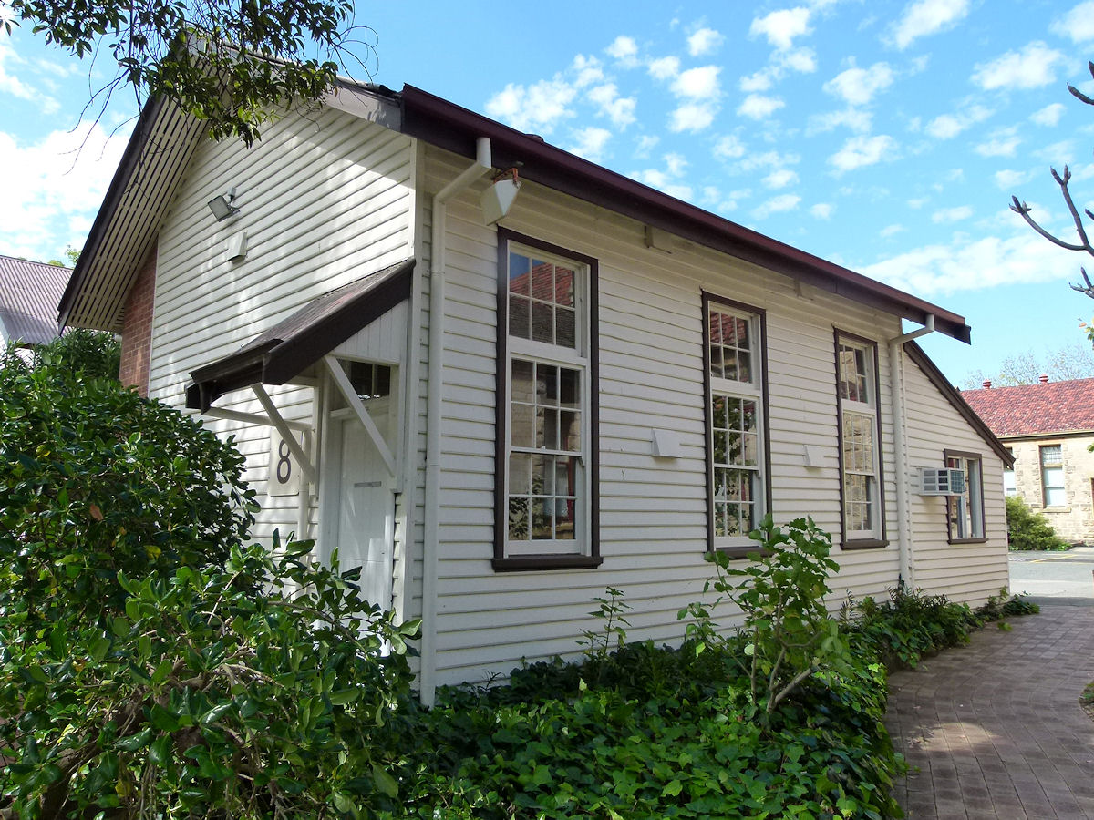
Claremont - East Claremont School On Princess Road is the East Claremont Primary School. This looks like an original class-room. The school is adjacent to the Teacher's College so many a student teacher might have used this as a teaching "Prac" school. April 2013. Photos Ref: CLMT030 This primary school has since been amalgamed with another and this building is now part of the University of W.A. Claremont Campus |
||
 |
Claremont - East Claremont School Once part of the East Claremont School, this building is now the nucleus of the U.W.A. Claremont campus English department. September 2019. Photos Ref: CLMT031 |
||
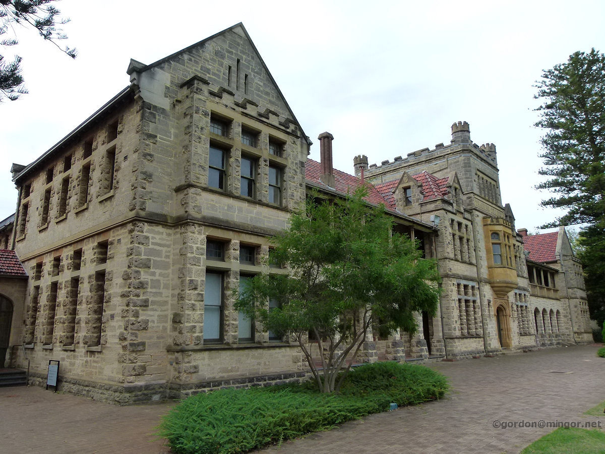 |
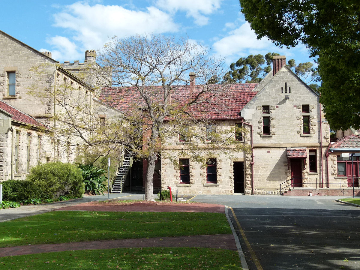
Claremont - UWA - Teachers College In the grounds of the University of Western Australia's Claremont Campus off Princess Road is the flagship building, the former Teacher's Training College constructed in 1901. April 2013. Photos Ref: CLMT0321 |
||
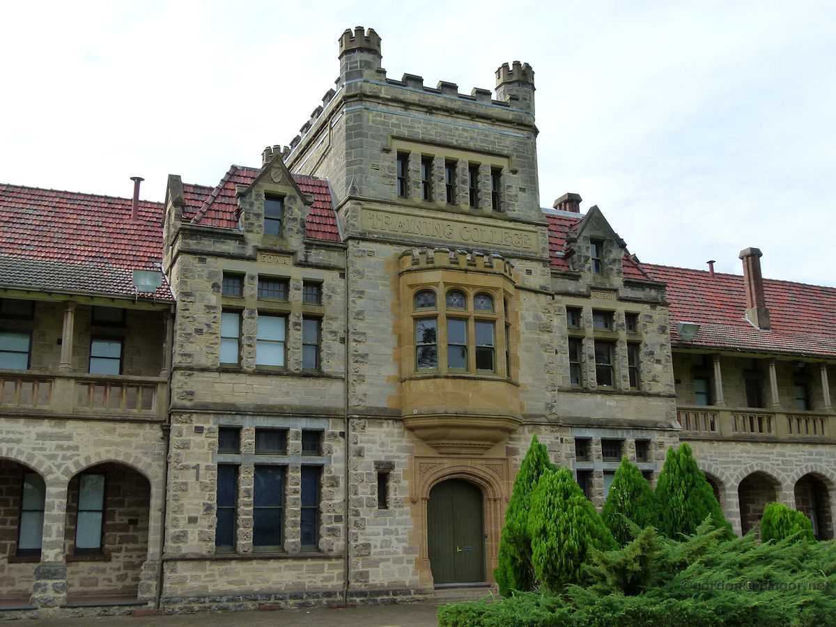 |
Claremont - UWA - Teachers College A close-up view of the Teacher's Training College main entrance. A magnificent building designed in keeping with architectural eminence of the day bestowed on institutions such as this. April 2013. Photos Ref: CLMT033 |
||
 |
Claremont - UWA - Teachers College The rear or view from the west of the old Teacher's College main building. September 2019. Photos Ref: CLMT034 |
||
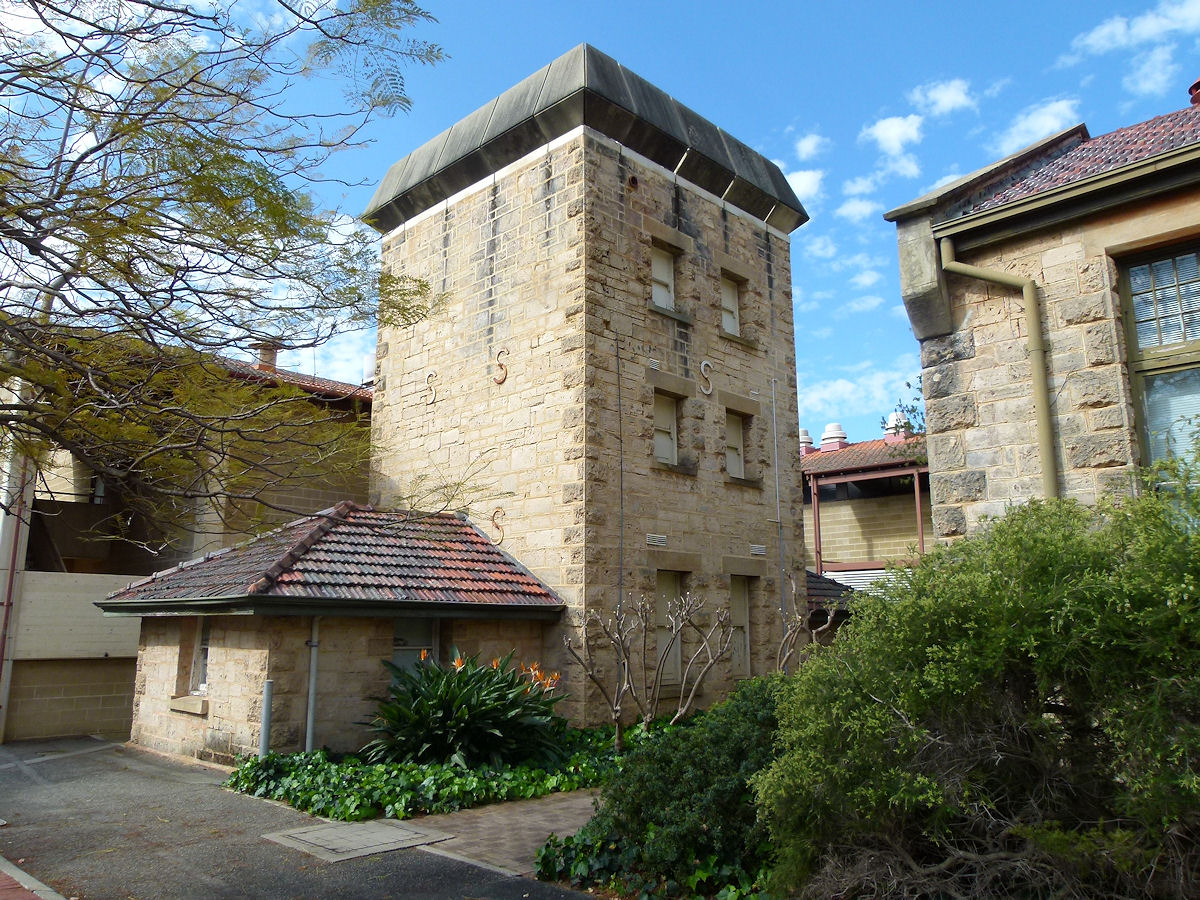 |
Claremont - UWA - Teachers College Within the confines of the old college buildings is this former silo. I wonder what its use was? It seems to be a storage area now. September 2019. Photos Ref: CLMT035 |
||
 |
Claremont - UWA - Teachers College Around the Teacher's College campus are quite a few buildings such as this which are old classrooms. The school rooms have been relocated here and preserved and perhaps served to remind trainee teachers of school conditions to be expected in their bush postings. April 2013. Photos Ref: CLMT036 |
||
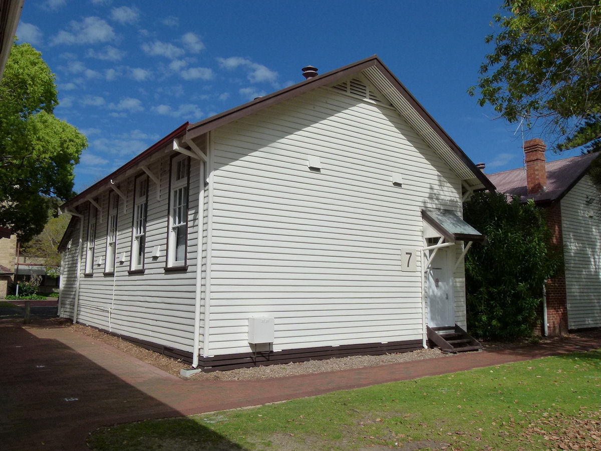 |
Claremont - UWA - Teachers College This is building 7 looking from the south. Another old style classroom. September 2019. Photos Ref: CLMT037 |
||
 |
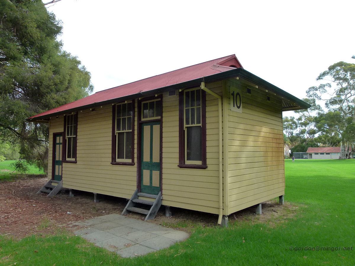
Claremont - UWA - Teachers College And here is building 8. Very smart. If anyone knows whether these are old bush-looking schools were brought in or purposely build to look like them? I'd love to know. September 2019. Photos Ref: CLMT038 |
||
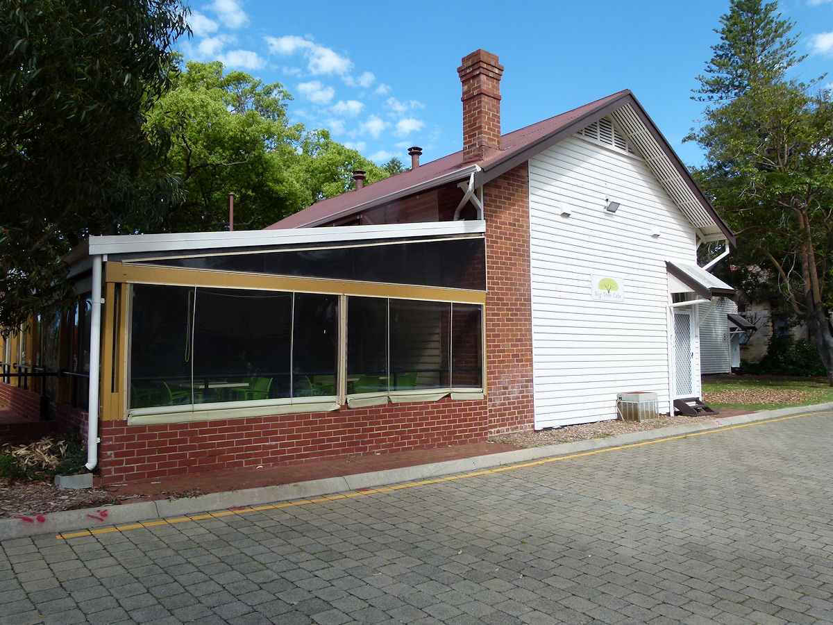 |
Claremont - UWA - Teachers College This is the Big Tree Cafe. There is a huge Chinese student population at this campus. I can tell you that this would be one of the most authenic "China" Chinese restaurants that I have visited in Perth. Student fare provided by very friendly staff. September 2019. Photos Ref: CLMT039 |
||
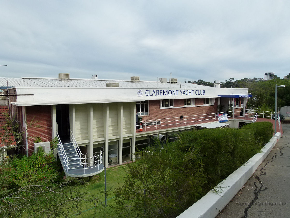 |
Claremont - Yacht Club The Claremont Yacht Club's northern face which looks up to Victoria Avenue. Down below are parking areas and all the boat moorings. April 2013. Photos Ref: CLMT040 |
||
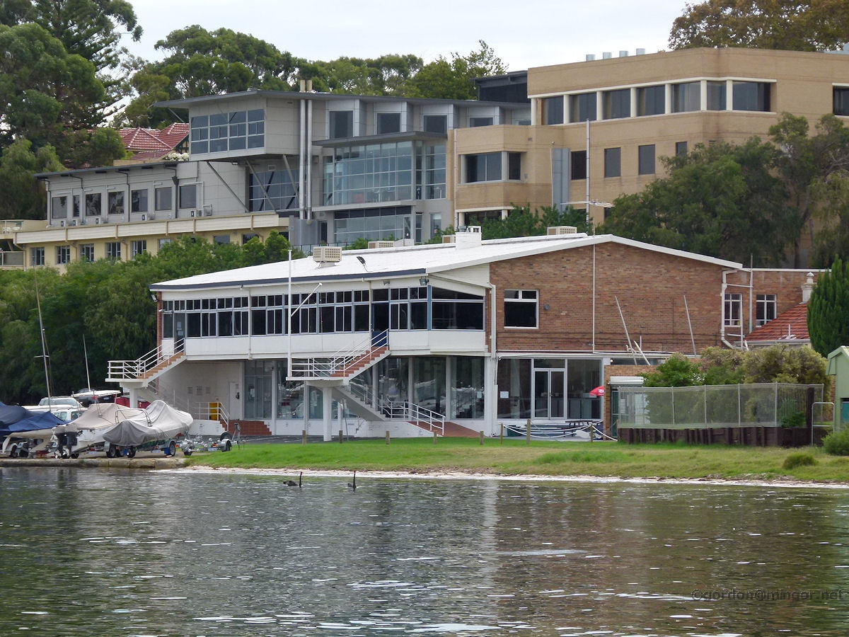 |
Claremont - Yacht Club The Claremont Yacht Club's "river" side viewed from the Claremont jetty. Behind, up the hill slightly, are apartments on Victoria Avenue or Queenslea Drive. April 2013. Photos Ref: CLMT041 |
||
 |
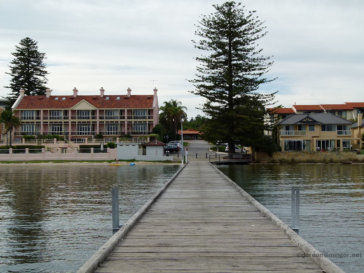
Claremont - Jetty on Swan River At the end of Jetty Road, which runs off Victoria Avenue, is the Claremont Jetty. Over there across the river is Mosman Bay and Mosman Park, actually on the same side of the river. The jetty was constructed in 1898 and served as an important point for goods and passenger transfers. It was renovated in 1991. April 2013. Photos Ref: CLMT042 |
||
 |
Claremont - Jetty on Swan River A look back to Claremont from the jetty towards Jetty Road. The building on the left is a set of five individual apartments. April 2013. Photos Ref: CLMT043 |
||
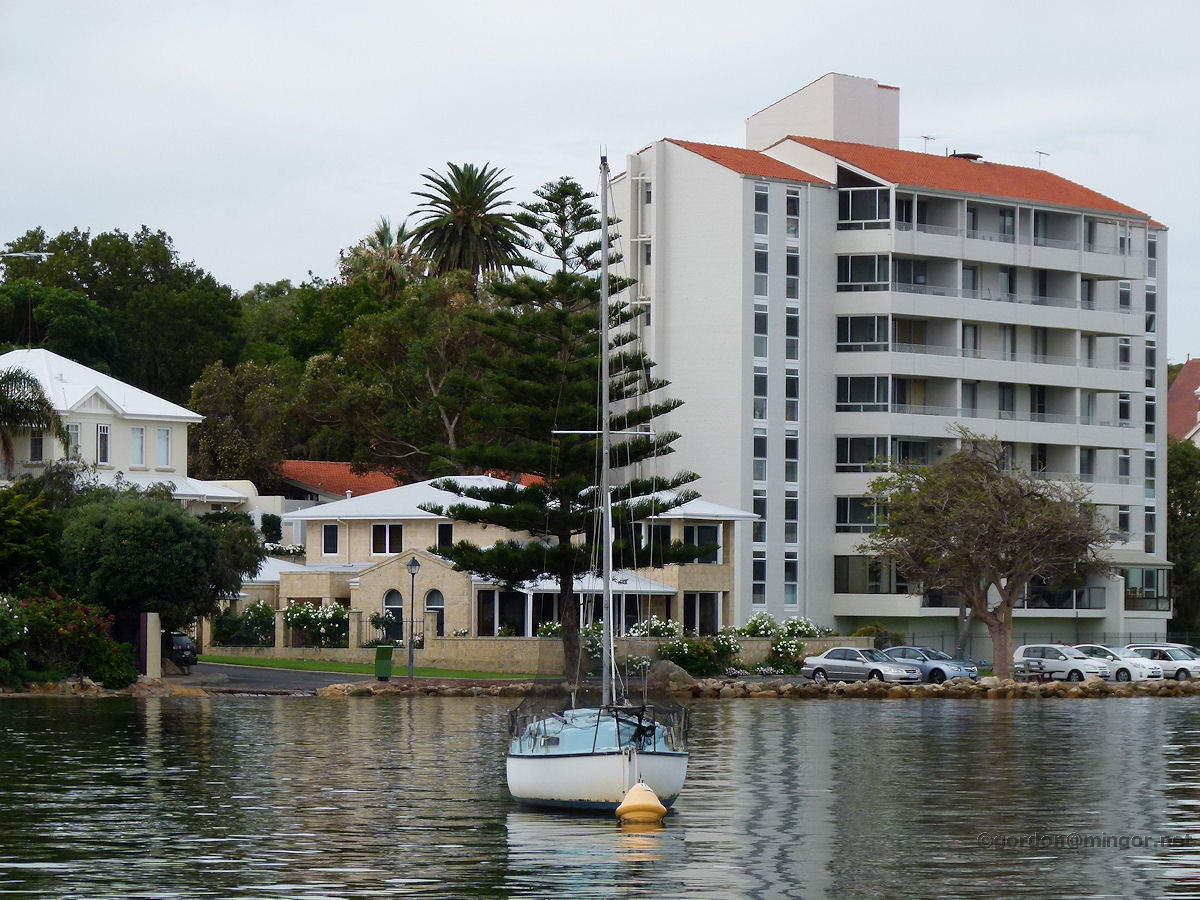 |
Claremont - Riverside Apartments From the Claremont jetty looking slightly north, this view takes in a set of apartments and a few houses which overlook a moored yacht on the placid river. April 2013. Photos Ref: CLMT044 |
||
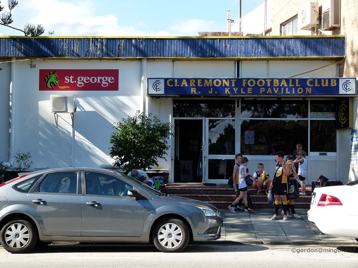 |
Claremont - Football Oval On Davies Road, this is the entrance to Claremont Football Club's R.J. Kyle Pavilion and through here are the club rooms and facilities and access to the main grandstand. The oval was opened in 1905 as the Claremont Recreation Ground. The first W.A.F.L. game was played here in 1927 after the grandstand was built and the ground was brought up to football league standards. July 2011. Photos Ref: CLMT045 |
||
 |
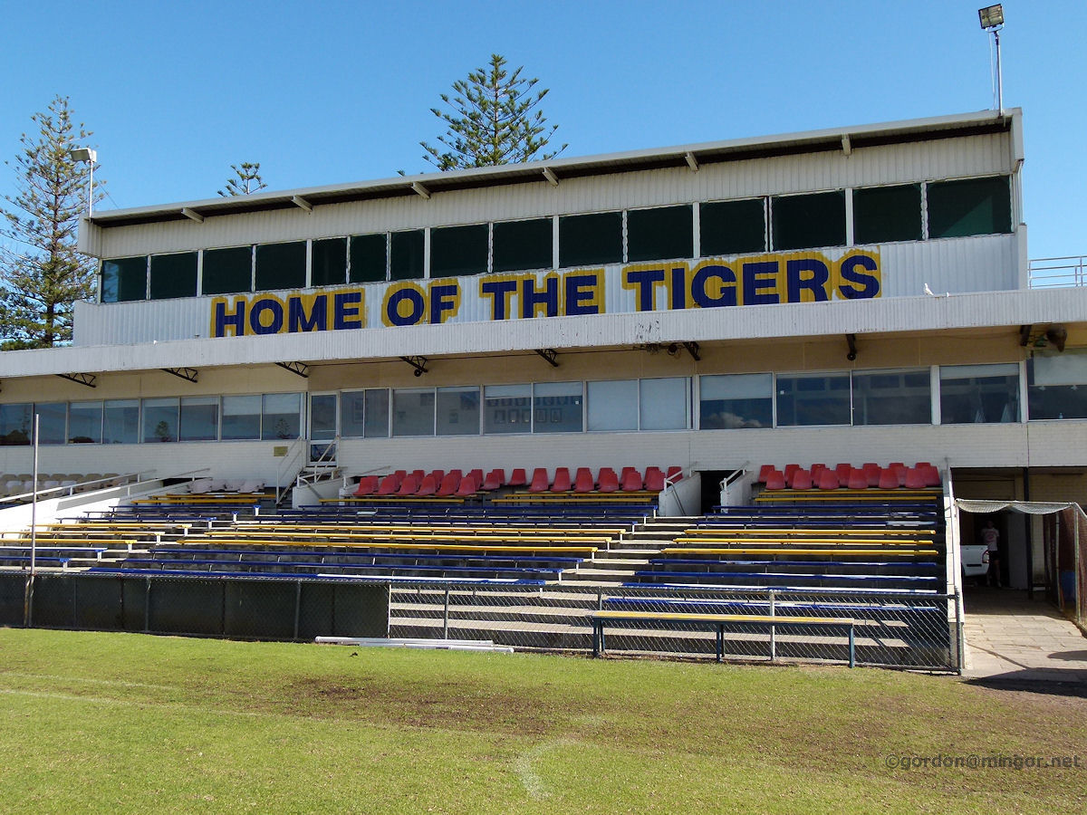
Claremont - Football Oval Inside Claremont Oval, this is a view looking up into the main grandstand, the John O'Connell Stand. July 2011. Photos Ref: CLMT046 |
||
 |
Claremont - Football Oval To the right of the John O'Connell Stand (when looking from the oval) is this stand which looks like it contains the Football Club's room and memorabilia. July 2011. Photos Ref: CLMT047 |
||
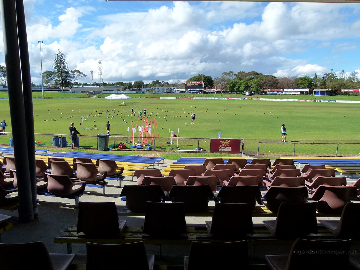 |
Claremont - Football Oval Looking down across the oval from the John O'Connell Stand. Today hundreds of lower primary school children, almost all decked in their Tigers shirts, are taking part in a school-holiday football workshop, and having a great time. July 2011. Photos Ref: CLMT048 |
||
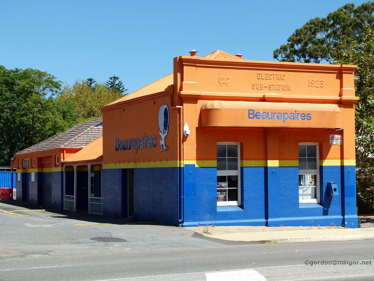 |
Claremont - Electric Substation On Stirling Highway is the former 1923 Electric Sub-Station building which is now Beaurepaires. March 2015. Photos Ref: CLMT049 |
||
All images published on this website are copyright © of the webmaster. See About section for clarification and special schools permission |
|||