| Photographs of Perth, Western Australia | |||
Tammin - Photographs of Western Australia A small agricultural centre located halfway between Cunderdin and Kellerberrin on the Great Eastern Highway in the central agricultural region and some 179 road kms from Perth. When the rail line was built out to Southern Cross in 1894-5, Tammin was one of the original stations on the line. It was named after nearby Tammin Rock (explorer C. C. Hunt, 1864). The name may be a derivative of the Aboriginal word "Tammar". The town was gazetted in 1899 |
|||
| North to Wyalkatchem | East to Kellerberrin | ||
| West to Cunderdin | |||
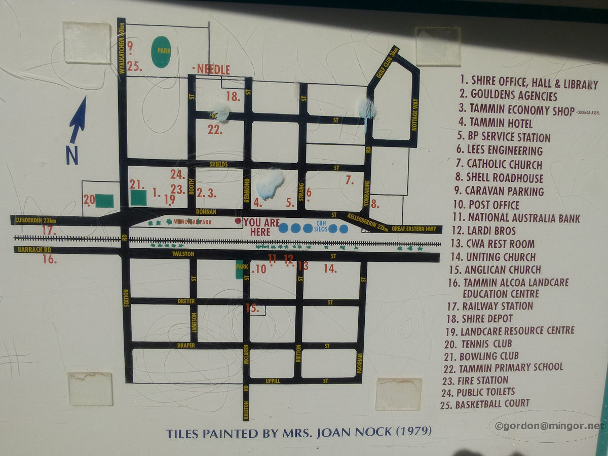 |
Tammin - Map of Town A map of the townsite of Tammin in a road-side information booth. The directory was painted by Mrs Joan Nock in 1979. June 2011. Photos Ref: TAMM001 |
||
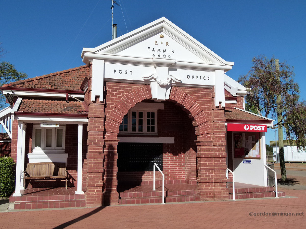 |
Tammin - Post Office On Walston Street is Post Office Tammin. This was constructed in 1940 and also includes staff quarters. It appears that there may have been an earlier Post Office building on this site which was erected in 1900. June 2011. Photos Ref: TAMM002 |
||
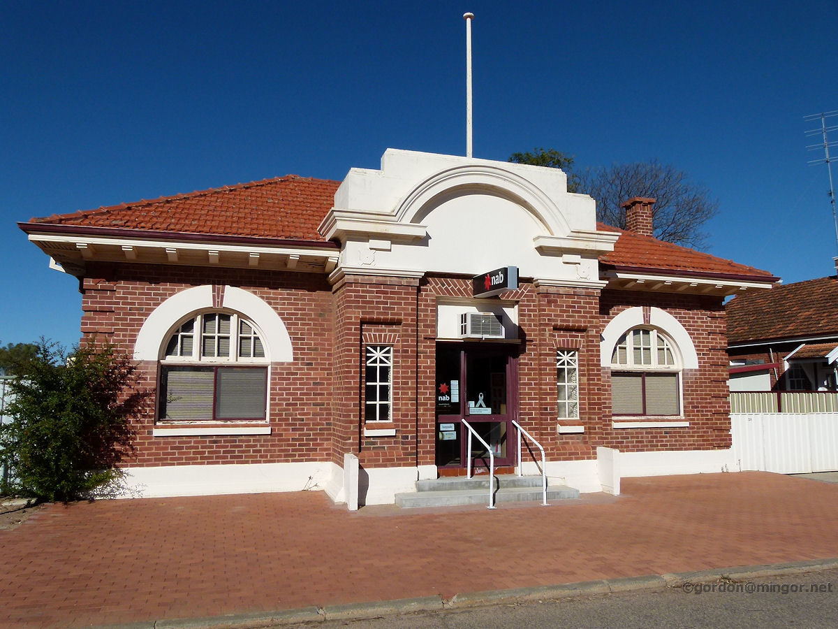 |
Tammin - National Australia Bank The National Bank building, Tammin, which was constructed in 1930. This is located on Walston Street next to the post office. June 2011. Photos Ref: TAMM003 |
||
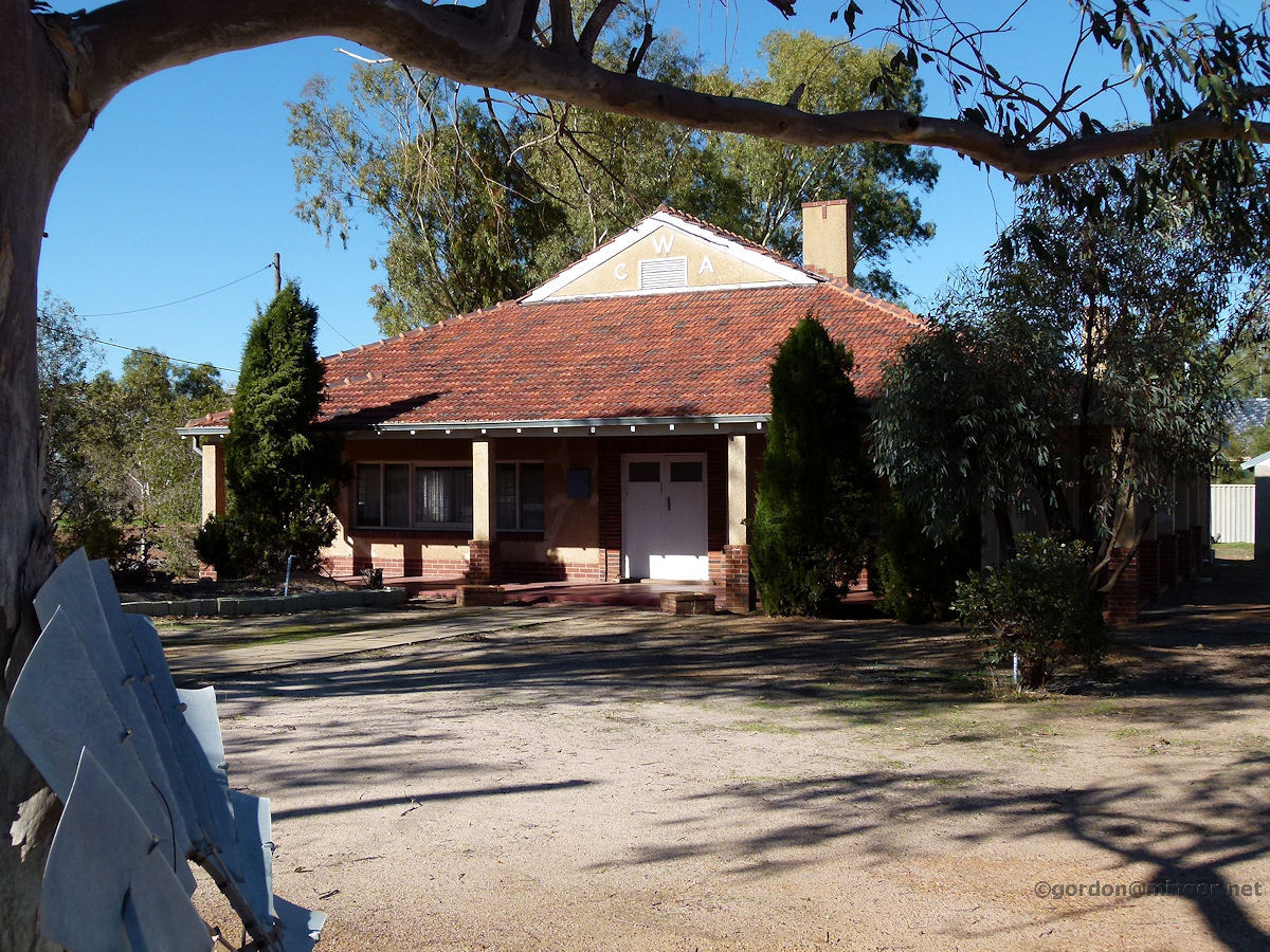 |
Tammin - CWA House The local Country Women's Association has its headquarters in the rather grand house set on a huge block. June 2011. Photos Ref: TAMM004 |
||
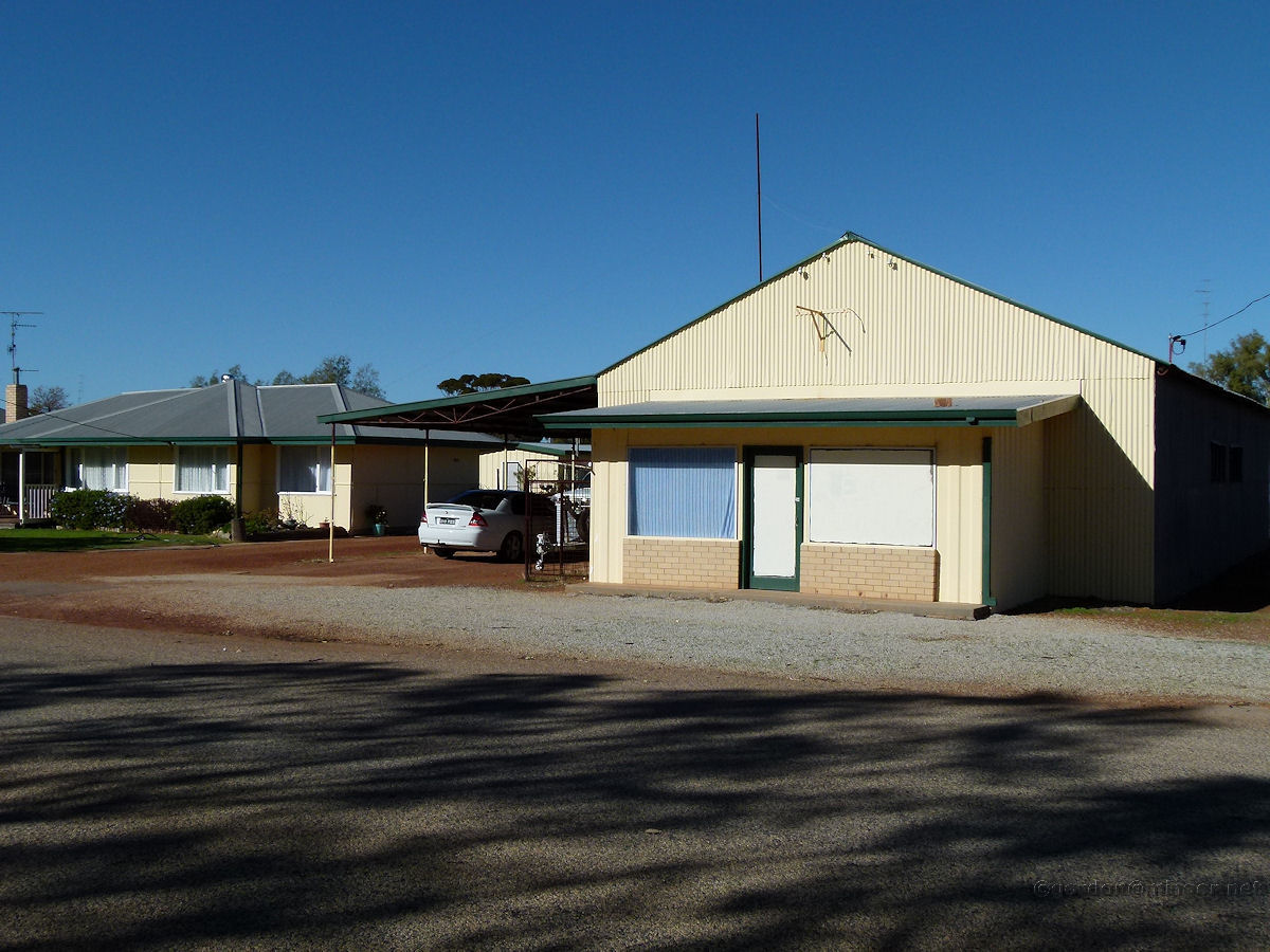 |
Tammin - Old Shop On a side-street in town, this looks like it might have been a farm provisioning shop at one stage judging by the size of the large shed at the rear. Now it seems to be part of that residence to the left. June 2011. Photos Ref: TAMM005 |
||
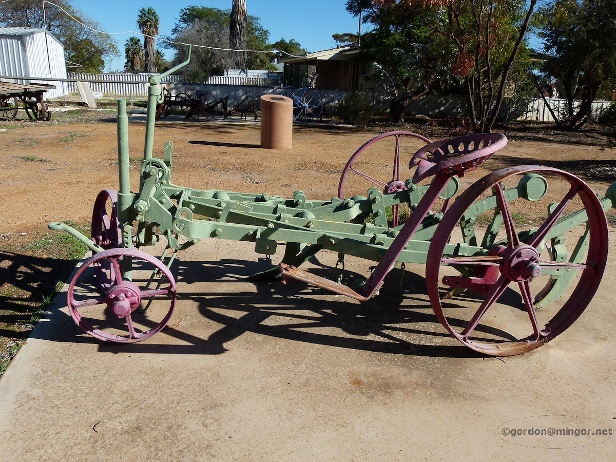 |
Tammin - Old Tractor Old farm machinery displays are common in many country towns. This looks like some kind of plough. June 2011. Photos Ref: TAMM006 |
||
 |
Tammin - House Most houses in Tammin appear to be rather modest but look quite comfortable. This is just one example. The town today is extremely quiet. June 2011. Photos Ref: TAMM007 |
||
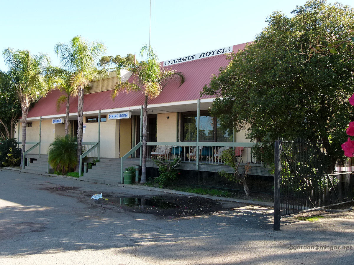 |
Tammin - Hotel On the north side of town on Donnan Street is the Tammin Hotel. An earlier hotel existed in town however it was damaged beyond repair during the October 1968 Meckering earthquake. June 2011. Photos Ref: TAMM008 |
||
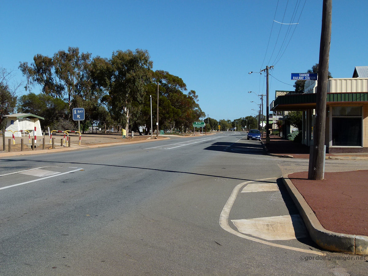 |
Tammin - Donnan Street This is a look down the main shopping area on Donnan Street in the north side of town. Up there turn left for York or right for Wyalkatchem. To the left of picture is the railway line. June 2011. Photos Ref: TAMM009 |
||
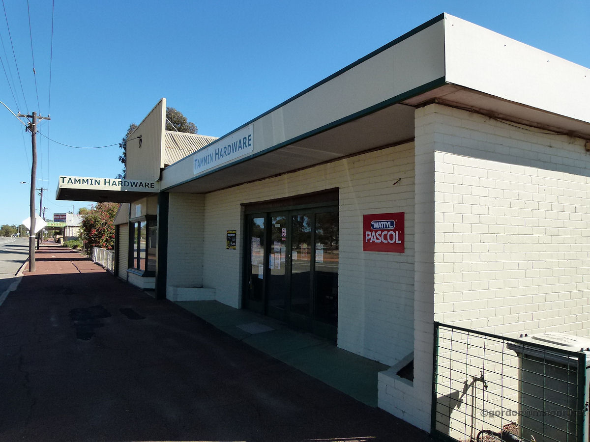 |
Tammin - Hardware Store Part of the main shopping area is the local hardware store. Looking through the windows, it looks pretty well stocked with whatever you might need. June 2011. Photos Ref: TAMM010 |
||
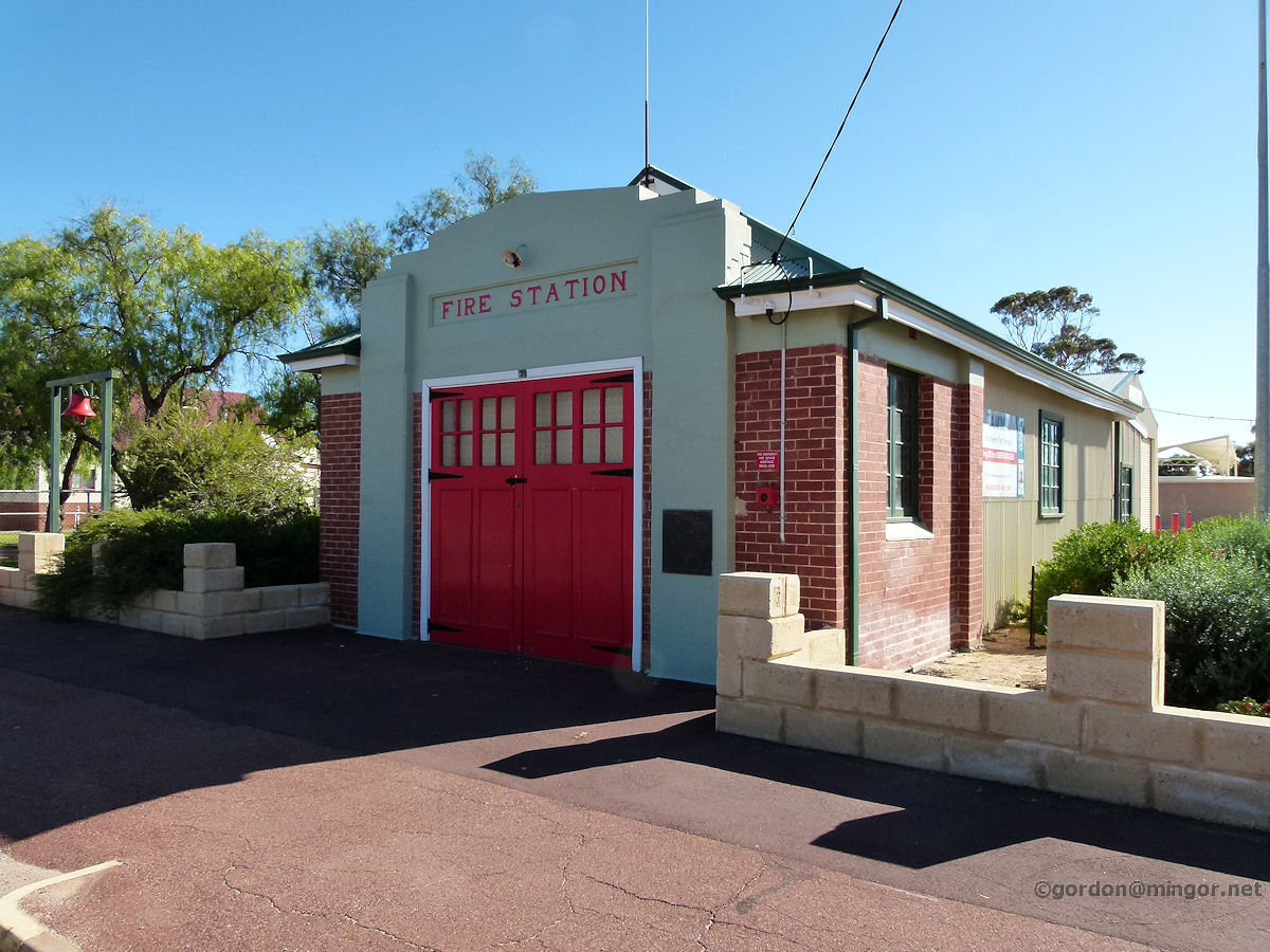 |
Tammin - Fire Station Bright red doors on the front of the fire station and a manual bell out the front. The station dates back to 1926. June 2011. Photos Ref: TAMM011 |
||
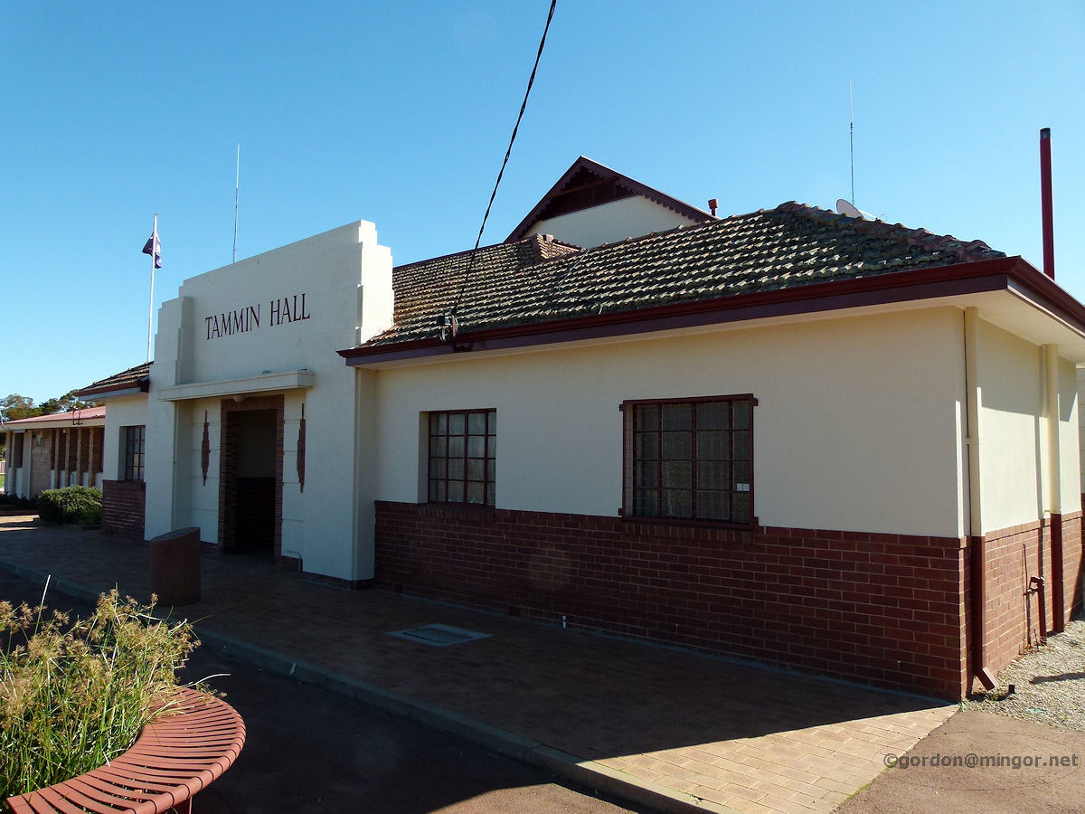 |
Tammin - Town Hall Construction of the Tammin Town Hall commenced in 1911. Over the decades the building has been extended and renovated many times to such an extent that evidence of the original building is hard to see. The destructive storm of 1953 didn't help matters. The Shire Council office is to the left of this building. June 2011. Photos Ref: TAMM012 |
||
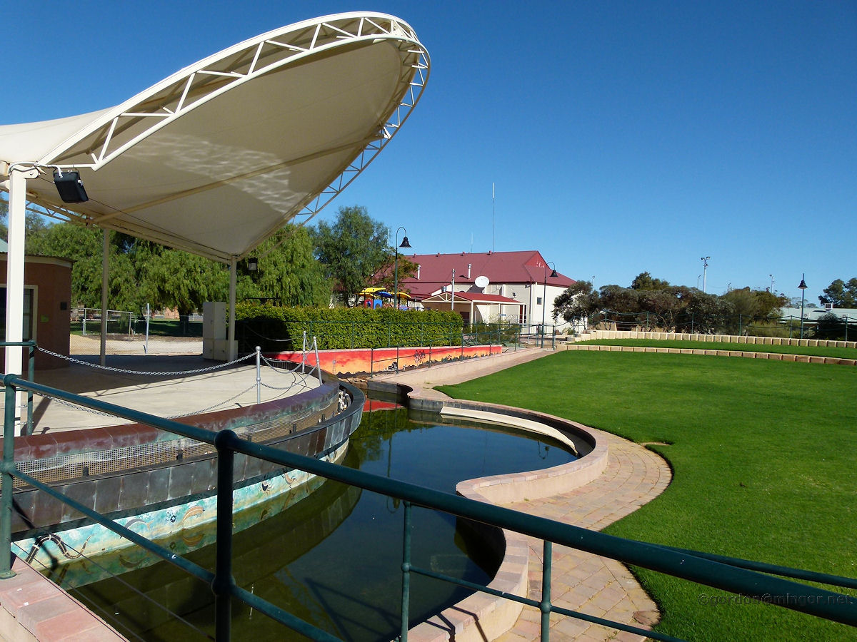 |
Tammin - Hydrology Model and Amphitheatre A little behind the Tammin Hall (you can see it over there in the background) is the Hydrology Model Park and Amphitheatre, named Kadjininy Kep. Inside the building just to the left of the stage are ecology displays featuring best practice land use and salinity issues. June 2011. Photos Ref: TAMM013 |
||
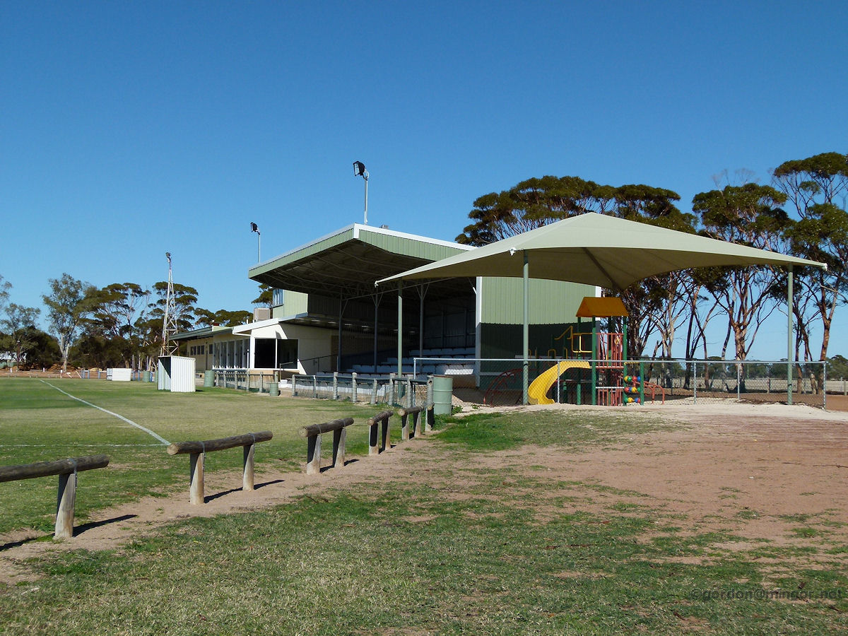 |
Tammin - Donnan Park Donnan Park is a recreation and sports complex a little to the north of the townsite. This photo features the grandstand and facility buildings. Today the ground in front of the grandstand is set up for soccer. June 2011. Photos Ref: TAMM014 |
||
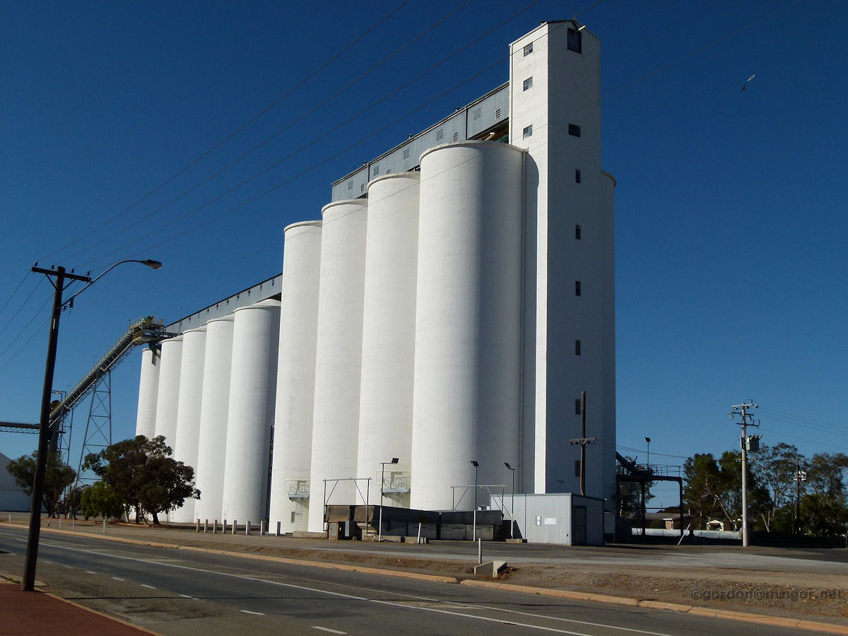 |
Tammin - Grain Silos A prominent feature of all these wheatbelt towns is the giant grain silos and handling facilities. Most are coloured grey or gleaming white possibly to reflect the sun to keep the contents as cool as possible. June 2011. Photos Ref: TAMM015 |
||
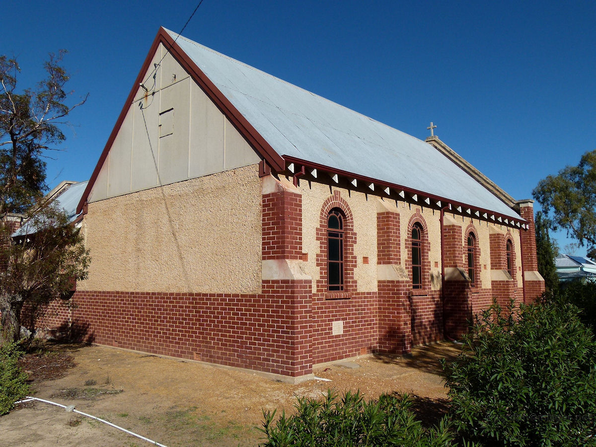 |
Tammin - St Marks Anglican Church This is St Marks Anglican Church which was constructed in 1932. The Foundation Stone was laid by John Packham, Esq., J.P. on 13th August 1932. June 2011. Photos Ref: TAMM016 |
||
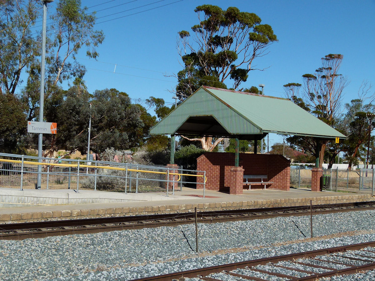 |
Tammin - Railway Station If you arrived in Tammin on the Avon Link or the Prospector then this is where you'd alight. June 2011. Photos Ref: TAMM017 |
||
All images published on this website are copyright © of the webmaster. See About section for clarification and special schools permission |
|||