| Photographs of Perth, Western Australia | |||
Kellerberrin - Photographs of Western Australia Kellerberrin is a medium-sized townsite located some 23 kms east of Tammin and 203 kms directly east of Perth. The Northam - Southern Cross railway was opened here in 1895. The town was gazetted in 1901 although settlement occurred earlier. The early settlers were apparently predominantly Irish. The name Kellerberrin is of Aboriginal origin and is derived from the nearby Killaburing (or Killaberrin) Hill. Killaburing Hill later became known at Kellerberrin Hill |
|||
| North to Trayning | East to Doodlakine | ||
| West to Tammin | |||
 |
Kellerberrin - Post Office The Kellerberrin Post Office building is close to the western end of town. It was constructed in 1912 and built with a semi-circular porch. The Postmaster's quarters were up on the top floor. The post office was officially opened on March 7, 1913. June 2011. Photos Ref: KELL001 |
||
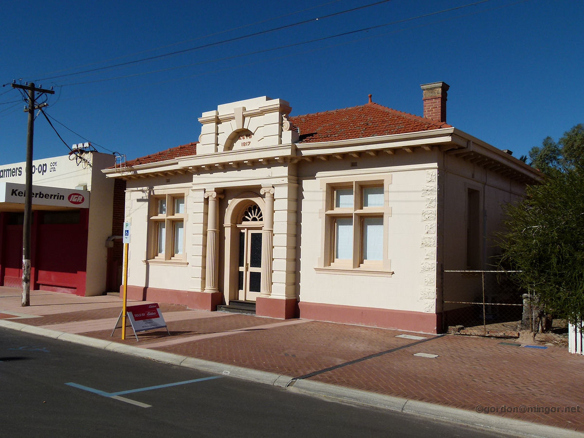 |
Kellerberrin - Old Bank of New South Wales Building This is the former Bank of New South Wales premises at 60 Massingham Street. This was erected in 1927. The bank first had a presence in town from 1910 at another place. The 1817 on top of the building is the year the Bank of N.S.W. was established, not the year this building was built. It looks like Elders has recently sold the building. June 2011. Photos Ref: KELL002 |
||
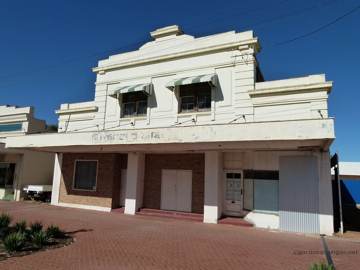 |
Kellerberrin - Old Regent Theatre This Massingham Street building is mostly boarded up and looks unoccupied. This was formerly the Regent Theatre and in the old days movies were shown most nights of the week and it had a picture garden behind with deck chairs for the summer. Concerts, balls etc were also held here. This was built circa 1928. June 2011. Photos Ref: KELL003 |
||
 |
Kellerberrin - Elders Store Elders makes its rural presence felt. This is a relatively large Thrifty Link store on Massingham Street. Whilst on the same site, the building is rather more elaborate than the Elders building of old (pre 1952). June 2011. Photos Ref: KELL004 |
||
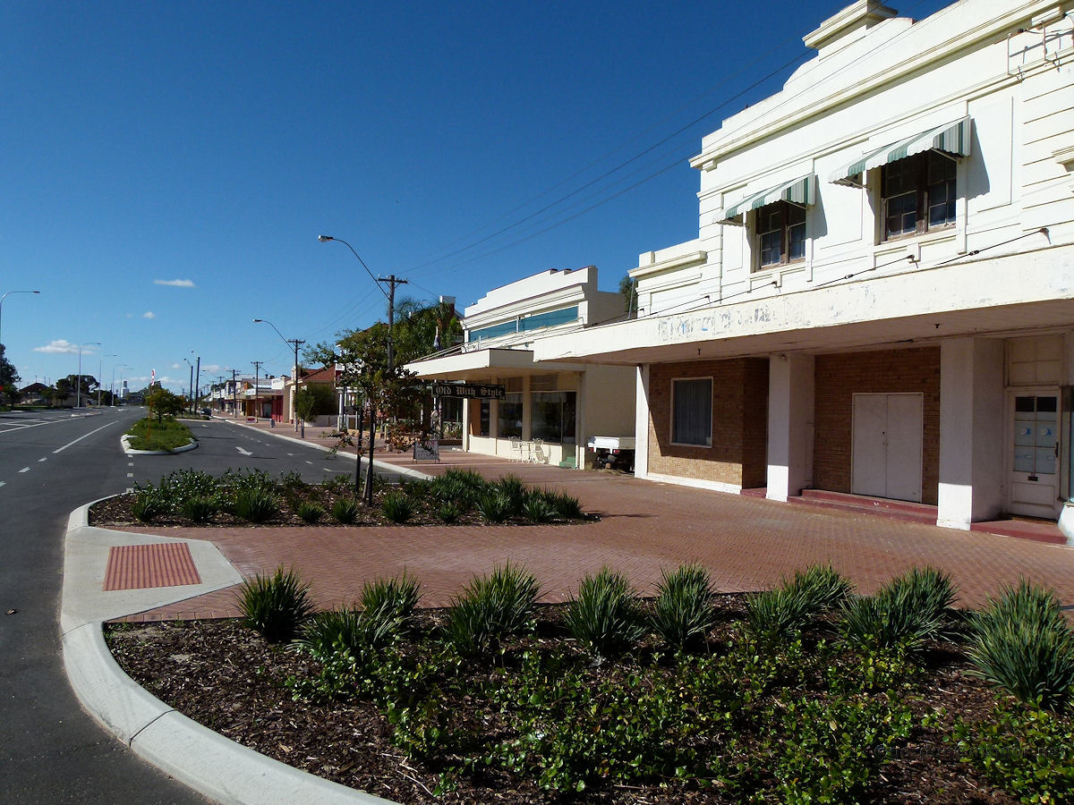 |
Kellerberrin - Massingham Street A Sunday afternoon view looking east down Massingham Street. Massingham Street runs east-west and is actually part of the Great Eastern Highway. June 2011. Photos Ref: KELL005 |
||
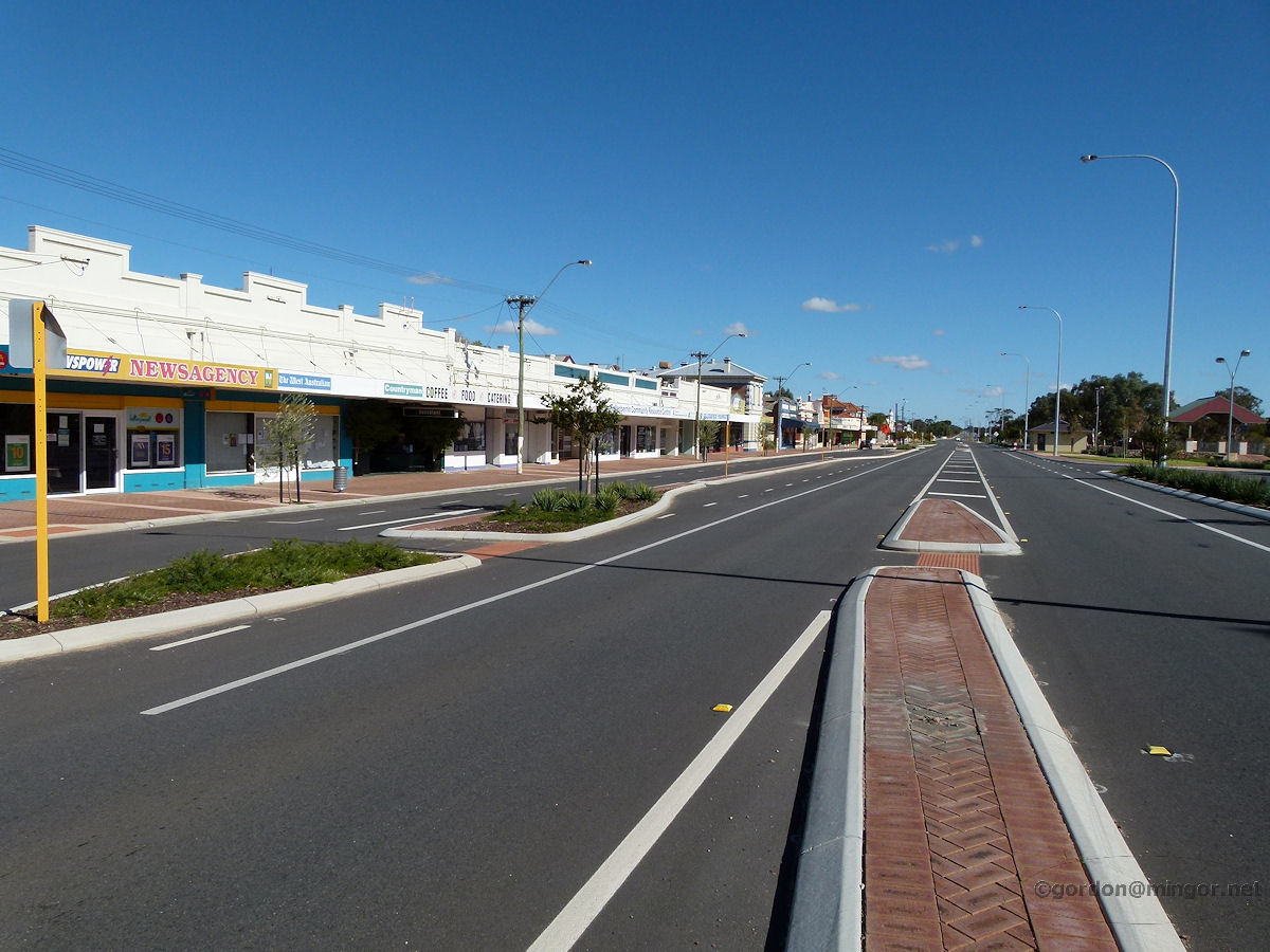 |
Kellerberrin - Massingham Street Another view looking west down Massingham Street. June 2011. Photos Ref: KELL006 |
||
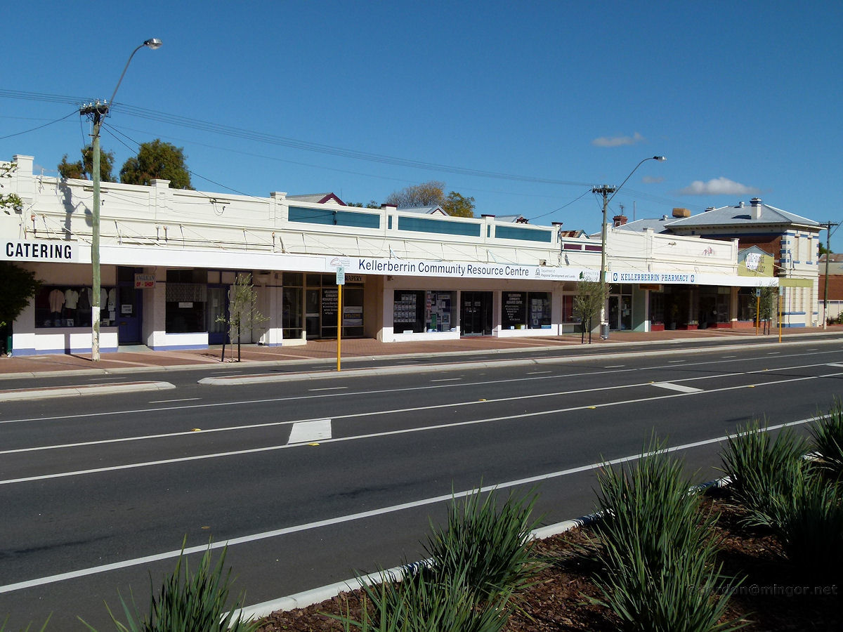 |
Kellerberrin - Massingham Street A slightly more front-on view of shops on the main street taken from about 100 metres west of the photo above. June 2011. Photos Ref: KELL007 |
||
 |
Kellerberrin - National Australia Bank The National Australia Bank building on Massingham Street. This was built in 1910-1911. The NAB bought this site in 1908. Prior to that, the bank operated out of temporary premises. The NAB seems to be the only operating bank in town at present. June 2011. Photos Ref: KELL008 |
||
 |
Kellerberrin - Anglican Church Op Shop A look through the windows of the Anglican Opportunity Shop on the main street. It's open Thursday, Friday and Saturday mornings only. June 2011. Photos Ref: KELL009 |
||
 |
Kellerberrin - Memorial Hall This is the local Memorial Hall. It was built in the 1960's and the site was formerly part of the Road Board complex, housing machinery and plant. The old hall was situated on Massingham St. June 2011. Photos Ref: KELL010 |
||
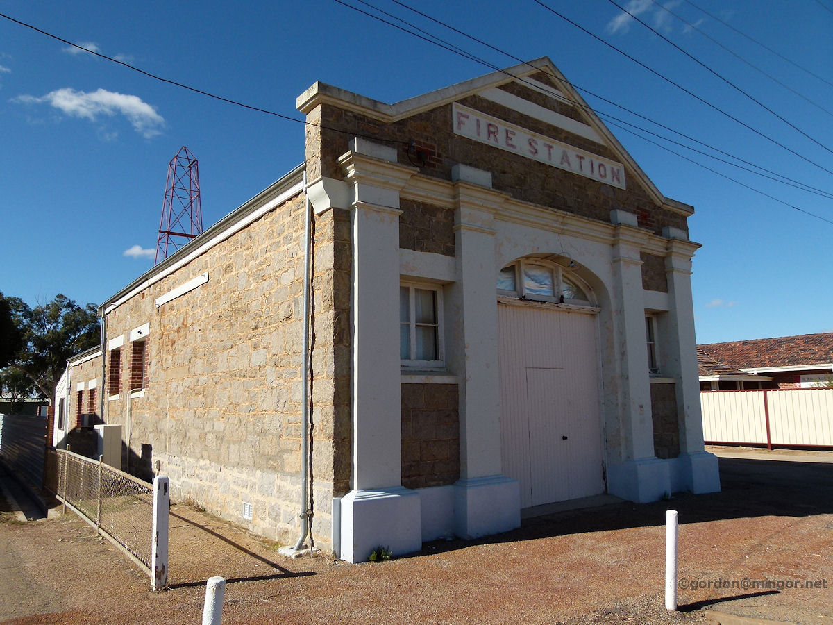 |
Kellerberrin - Fire Station The former Kellerberrin fire station. This was built in 1914 and extended in 1935. Local dances where held in here during the World War II years. June 2011. Photos Ref: KELL011 |
||
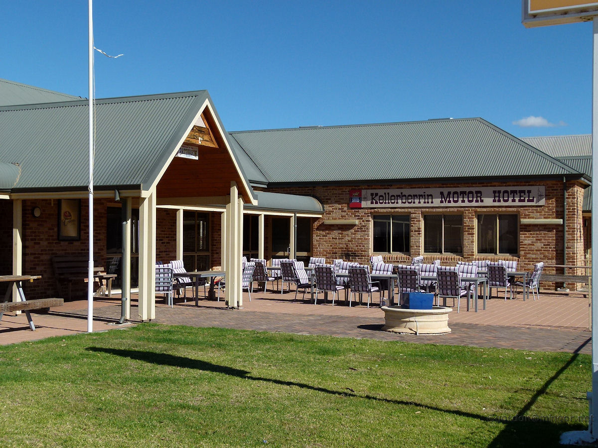 |
Kellerberrin - Motor Hotel This building was built post-1997. Kellerberrin had an old two-storey hotel which was built in 1906 but it was destroyed by fire in 1997. The old hotel stood on this site. June 2011. Photos Ref: KELL012 |
||
 |
Kellerberrin - Railway Station The Prospector and Avon Link pause here. In in the old days here were barracks for resting rail crews, loco sheds, multiple tracks on which were shunted wagons, vans, locos etc. The railway station was opposite the main part of town and it had a traditional wooden station building including a passenger waiting area. Here also was a loco inspection pit dug between the tracks, it being about 1½ metres deep and about 5 metres long, into which the odd unwary local would fall into when trespassing in the rail yards, going home from the pub late at night instead of going via the road crossings. (Story from a reader). June 2011. Photos Ref: KELL013 |
||
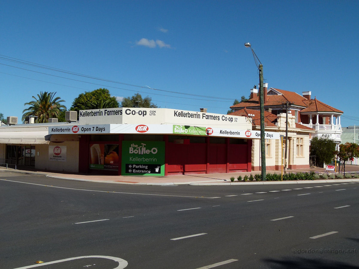 |
Kellerberrin - Farmers Co-Op The Kellerberrin Farmers Co-op which is two doors east from the Post Office. June 2011. Photos Ref: KELL014 |
||
 |
Kellerberrin - CWA House The Kellerberrin CWA rooms. This building is on Sewell Street. June 2011. Photos Ref: KELL015 |
||
 |
Kellerberrin - Anglican Church The Anglican Church of Australia, St John the Baptist, Kellerberrin. The Foundation Stone was laid by Hon. James Mitchell M.L.A., on 16th February 1910. June 2011. Photos Ref: KELL016 |
||
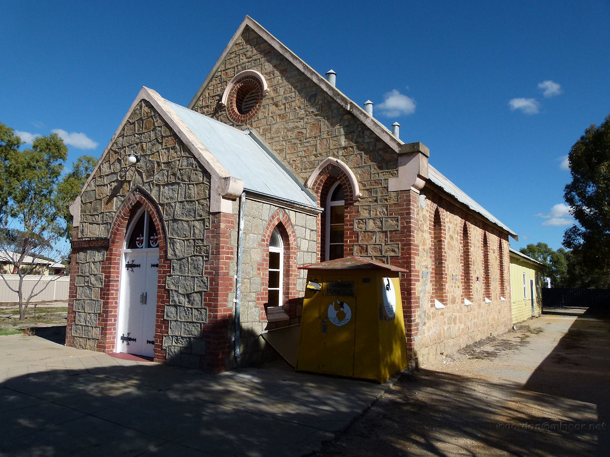 |
Kellerberrin - Uniting Church Originally a Methodist Church, the building was constructed and opened in 1910. The Reverend Fred Finch, the first Methodist Minister in the district, laid the Foundation Stone. The front porch was added in 1939 and rear hall around 1960. June 2011. Photos Ref: KELL017 |
||
 |
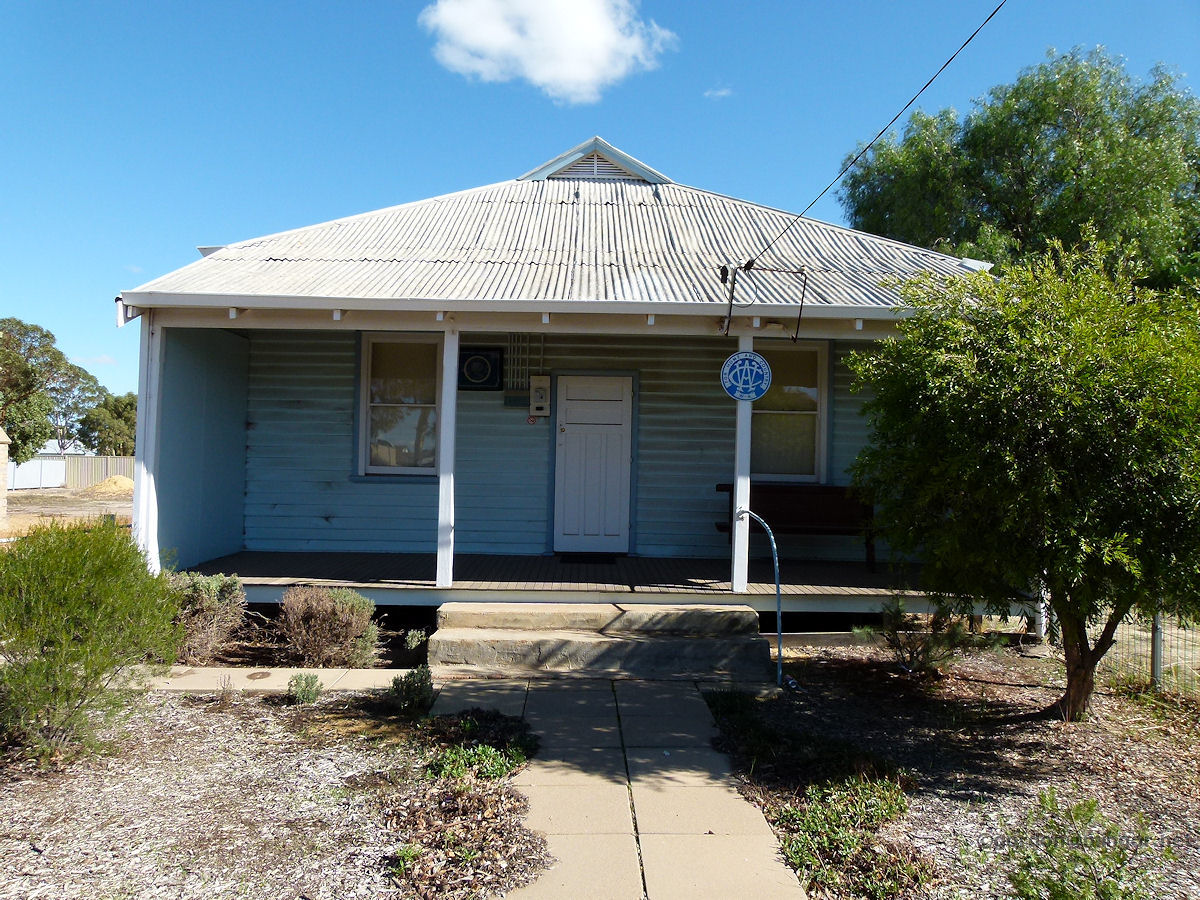
Kellerberrin - Elegant House A fine Kellerberrin house on the main street. Steeply pitched roof, a thoughtful colour scheme, cool verandah and meticulous maintenance all adds to up elegance. June 2011. Photos Ref: KELL018 |
||
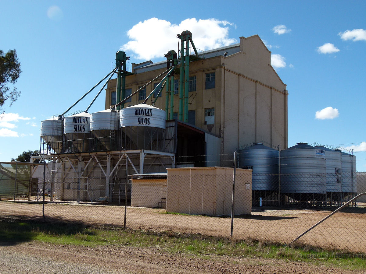 |
Kellerberrin - Moylans Old Flour Mill Moylan Silos currently occupy what was once this Flour Mill. I believe the mill is now actually used by Eastern Districts Seed Cleaning Co., whereas Moylan's construct those small-ish silos. There are hundreds of new silos on the land adjacent. June 2011. Photos Ref: KELL019 |
||
 |
Kellerberrin - District Museum This is now known as the Kellerberrin Historical Society District Museum. The building was constructed as the town's Agricultural Hall in 1898. It was used as a courthouse between 1937 and 1967. Some of the exhibits are next door in Pioneer park, June 2011. Photos Ref: KELL020 |
||
 |
Kellerberrin - Pioneer Park And here is a look in Pioneer Park - that's the District Museum Building behind. A few vintage tractors are shown in the picture. June 2011. Photos Ref: KELL021 |
||
 |
Kellerberrin - Bridge This looking bridge is used by the walkway to overpass a stream or drainage channel. June 2011. Photos Ref: KELL022 |
||
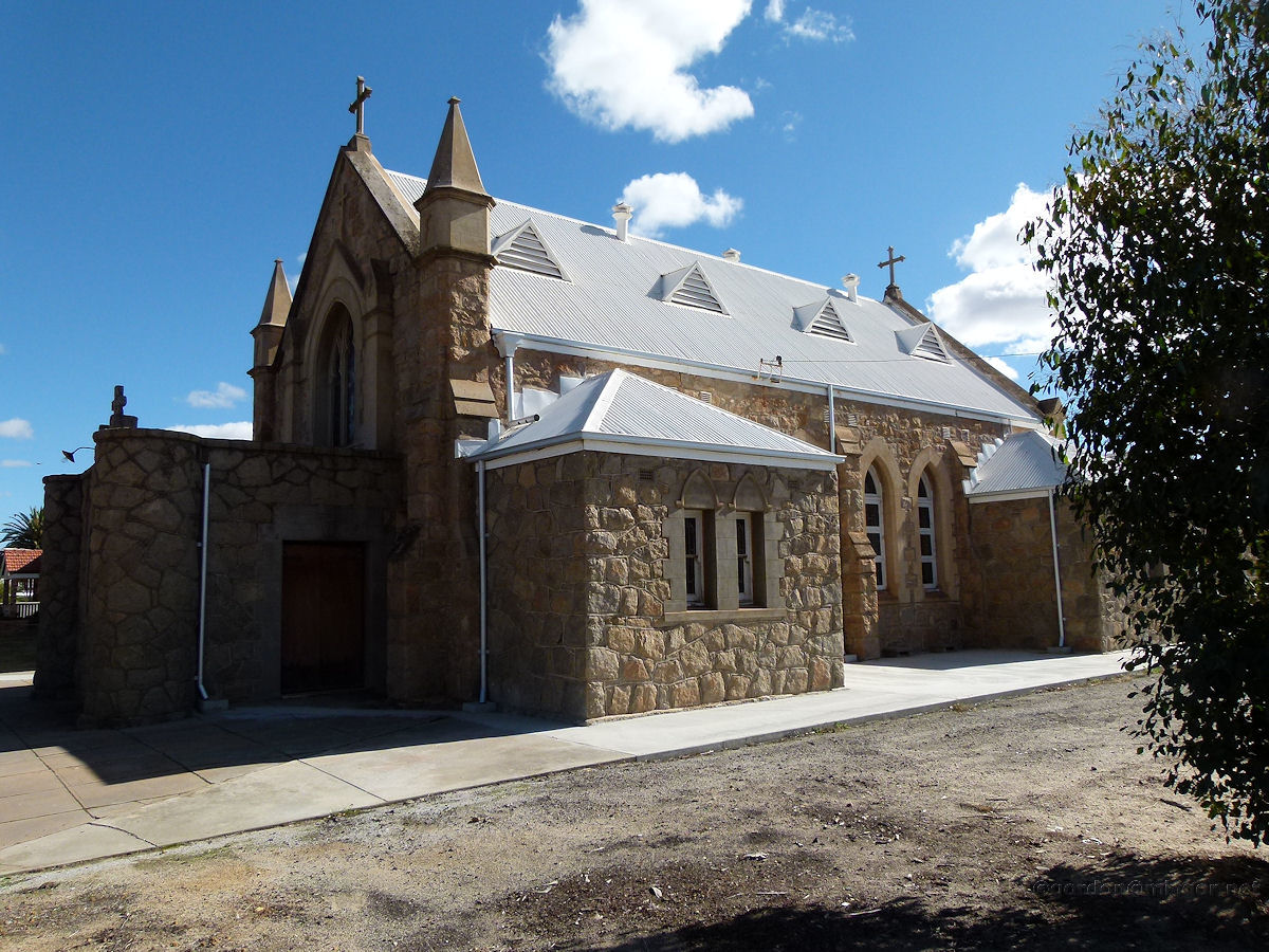 |
Kellerberrin - Catholic Church St Joseph's Catholic Church. This is on the north side of town. The Foundation Stone is written in Latin. The Church was dedicated and opened by the Reverendissimo Mons. Verling V.C., on the 5th October 1916. June 2011. Photos Ref: KELL023 |
||
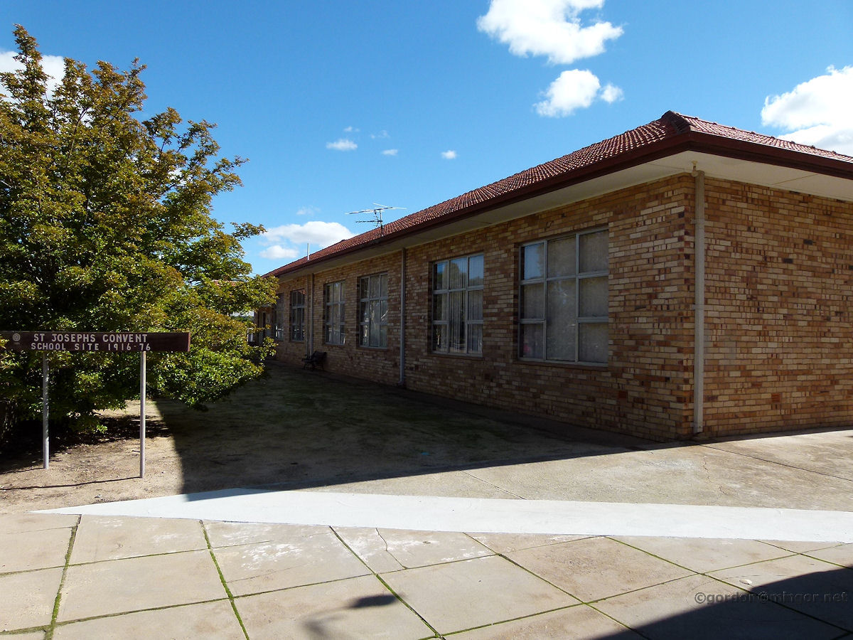 |
Kellerberrin - St Joseph's Catholic Convent Adjacent to the Catholic Church is the new St Joseph Convent. This Convent occupies what was the original Convent site during the period 1916-1976. St Joseph's order, in addition to running the Convent, also had a large group of buildings about 2 kms north of the town and situated just in front of the Kellerberrin Hill which was called the Preventorium. This was for children with chest complaints who needed nursing and a healthy environment. June 2011. Photos Ref: KELL024 |
||
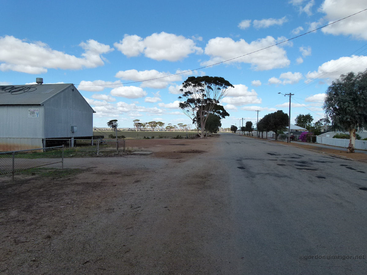 |
Kellerberrin - Side Street A view down a side street next to the roadhouse at the east end of town. You can see the edge of town and farmland beyond. That grey shed on the left is used for yabby storage. June 2011. Photos Ref: KELL025 |
||
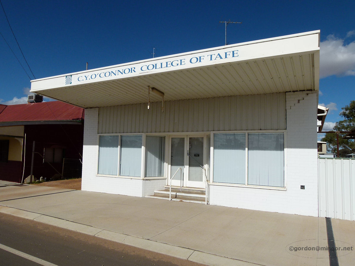 |
Kellerberrin - O'Connor College of TAFE At 118 Massingham Street is the C.Y. O'Connor College of TAFE. June 2011. Photos Ref: KELL026 |
||
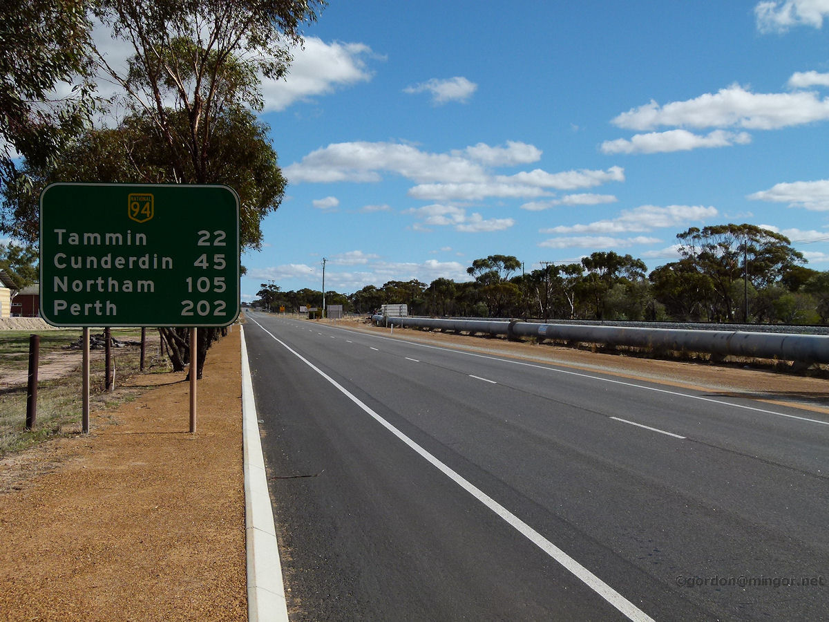 |
Kellerberrin - Great Eastern Highway This road sign is about one kilometre from town, heading west. June 2011. Photos Ref: KELL027 |
||
All images published on this website are copyright © of the webmaster. See About section for clarification and special schools permission |
|||