| Photographs of Perth, Western Australia | |||
Corrigin - Photographs of Western Australia A wheatbelt town located on the Brookton to Kondinin road, approximately 230 kms south-east of Perth. In 1913 when the town was gazetted, it was known as Dondakin after a nearby well. However, the locals called it Corrigin. Officials refused this name as it conflicted with a town called Korrijinn. This was resolved by the other town re-naming itself to Bickey. This occurred in 1914. Corrigin is named after a well and the name is of Aboriginal origin |
|||
| North to Ardath | South to Yealering | ||
| West to Aldersyde | East to Kondinin | ||
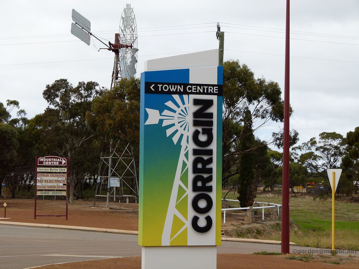 |
Corrigin - Town Sign Welcome to Corrigin. Actually, this is not on the outskirts of town but nearly right in the centre showing us the way to the shopping area. The town emblem is the windmill. Co-incidentally there is one right behind the sign in this picture. June 2013. Photos Ref: CRGN001 |
||
 |
Corrigin - Campbell Street Looking west down Campbell Street where the main shopping area is. The street is for one-way traffic with angle parking and fairly busy this morning. Katem's Supermarket is prominent. Beyond that are a number of shops including the newsagency. June 2013. Photos Ref: CRGN002 |
||
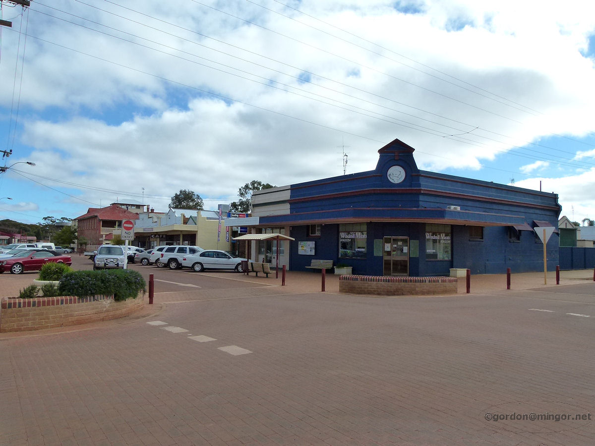 |
Corrigin - Campbell Street Another view looking west down Campbell Street this time focusing more on the north side. The large blue building is Windmill Meats, further down is a very congenial cafe (they do an excellent lunch, fair price and if you like you can eat it sitting on a settee in front of an open fire), and beyond that you can see the hotel. June 2013. Photos Ref: CRGN003 |
||
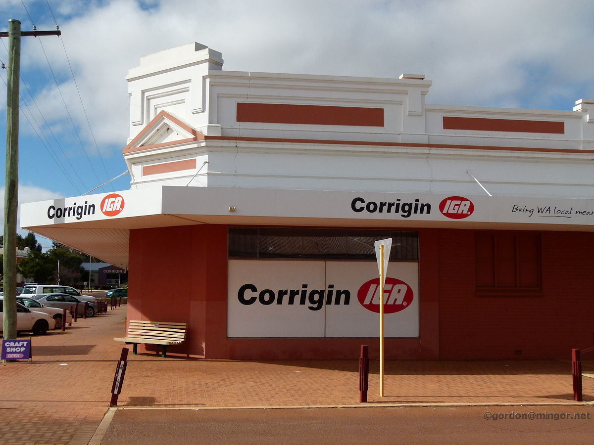 |
Corrigin - IGA Store Diagonally across the road from Windmill Meats is the local IGA store. This building was erected in 1927. It has formerly been known as the Corrigin Co-Operative, Wesfarmers Stores, Charlie Carters, Supavalue, Xtra Value, Foodland and now IGA. I wonder who will be next? June 2013. Photos Ref: CRGN004 |
||
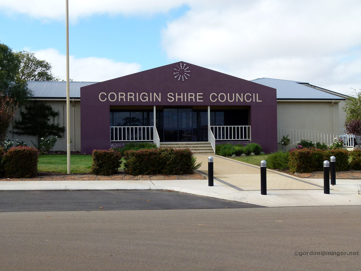 |
Corrigin - Shire Council At the top of Campbell Street is the Corrigin Shire Council building, erected in 1963. June 2013. Photos Ref: CRGN005 |
||
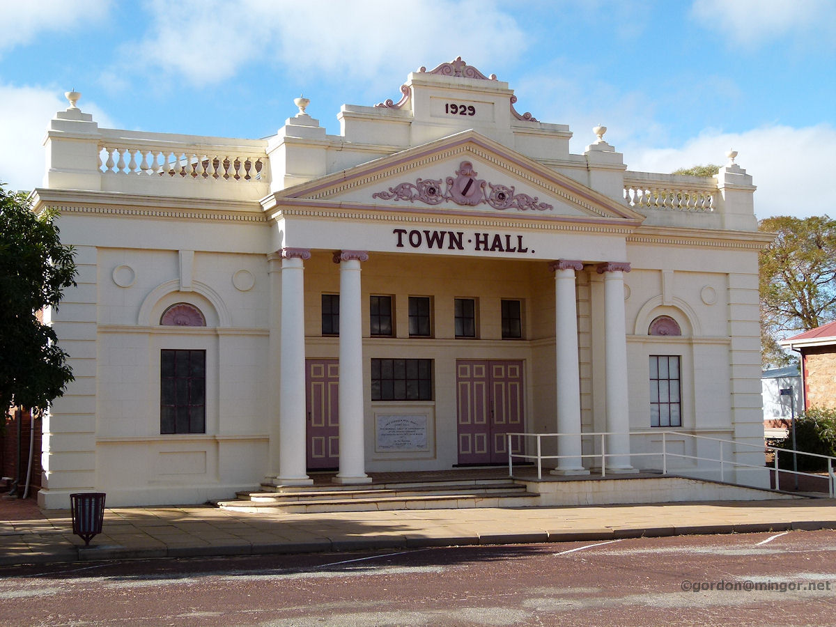 |
Corrigin - Town Hall The Corrigin Town Hall. This building was constructed in 1929. The large stone set on the front of the building commemorates the 20th March 1929 opening and was unveiled by the then Road Board chairman, J. Adams Esq. J. P. June 2013. Photos Ref: CRGN006 |
||
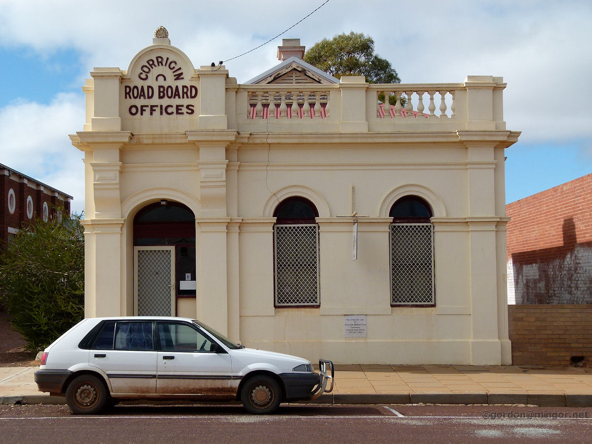 |
Corrigin - Road Board Next door to the Town Hall is the former Road Board Offices. The Foundation Stone was laid by Coulson Murphy Esq, Chairman of the Corrigin Road Board on 15th October 1923. Currently the building is occupied by Small Business Centre, Eastern Wheatbelt. June 2013. Photos Ref: CRGN007 |
||
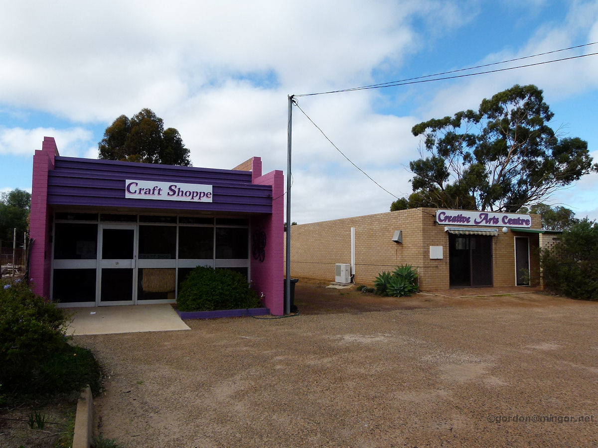 |
Corrigin - Craft Shop Just off Campbell Street are these shops. The Craft Shoppe and the Creative Arts Centre. June 2013. Photos Ref: CRGN008 |
||
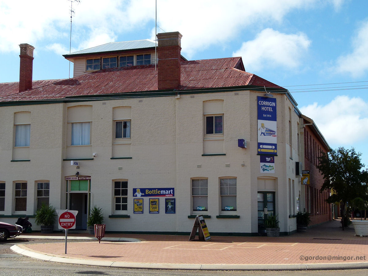 |
Corrigin - Hotel On the corner of Campbell and Watson Streets is the Corrigin Hotel. The cream face fronts Walton Street. This opened in 1915. Extensive modifications were made in 1927 and the re-modelled hotel was re-opened on 17th September 1927 by Hon. J. W. Hickey M. L. A. June 2013. Photos Ref: CRGN009 |
||
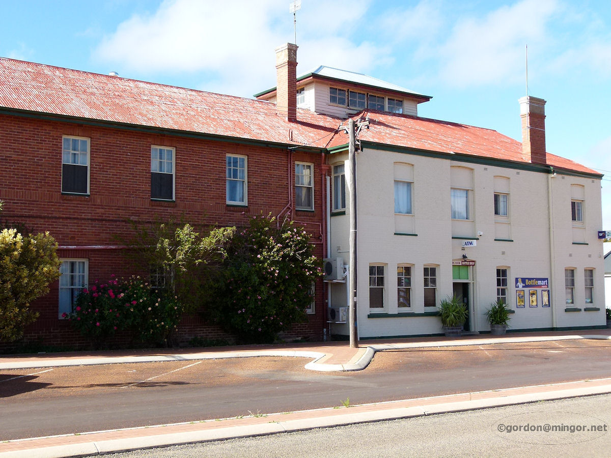 |
Corrigin - Hotel Another view of the Corrigin Hotel, featuring more of the Walton Street frontage. The brick part looks like the accommodation section. June 2013. Photos Ref: CRGN010 |
||
|
|
Corrigin - Empty Shops Almost opposite where the railway station is this row of empty shops. This is at 13 Walton Street. June 2013. Photos Ref: CRGN011 |
||
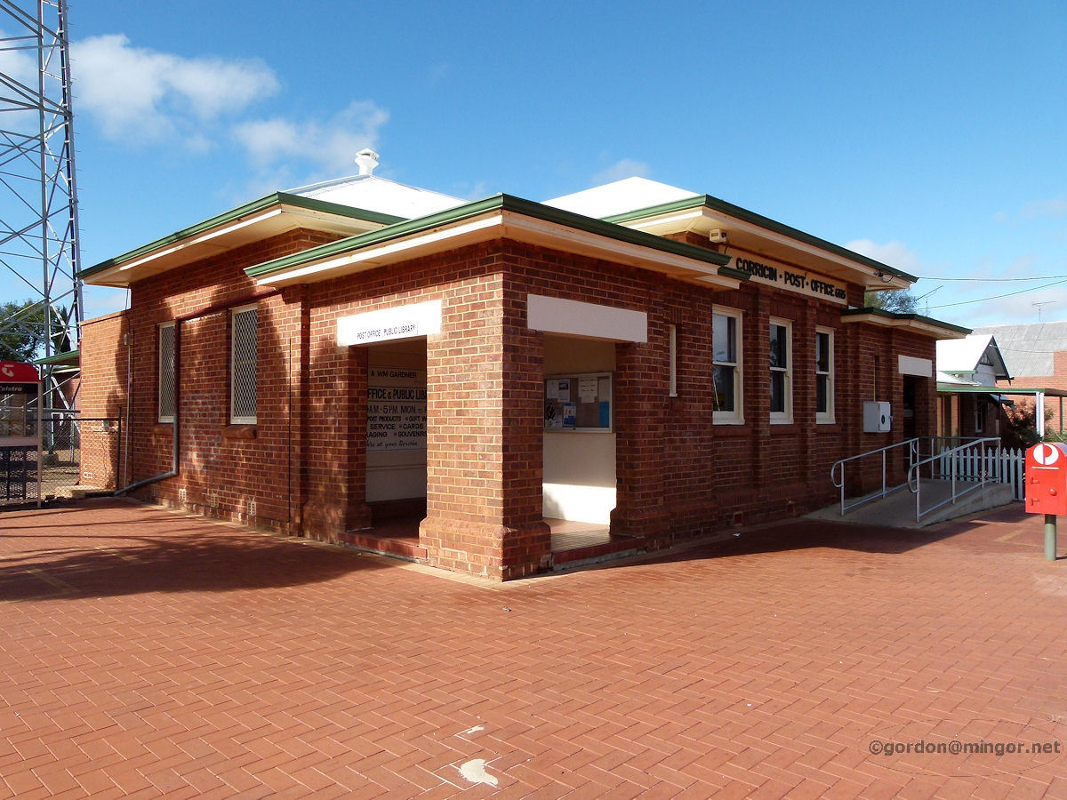 |
Corrigin - Post Office Walton Street seems to be more the commercial area whereas Campbell Street is for shopping. Here's the Post Office on Watson Street. It opened in 1925. June 2013. Photos Ref: CRGN012 |
||
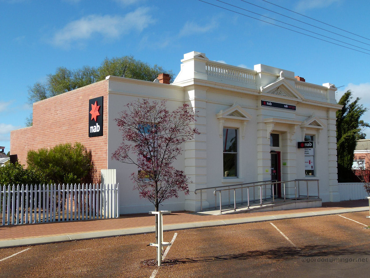 |
Corrigin - National Australia Bank Next door to the Post Office is the NAB building. This was the first bank to be opened in Corrigin. That occurred in 1923. June 2013. Photos Ref: CRGN013 |
||
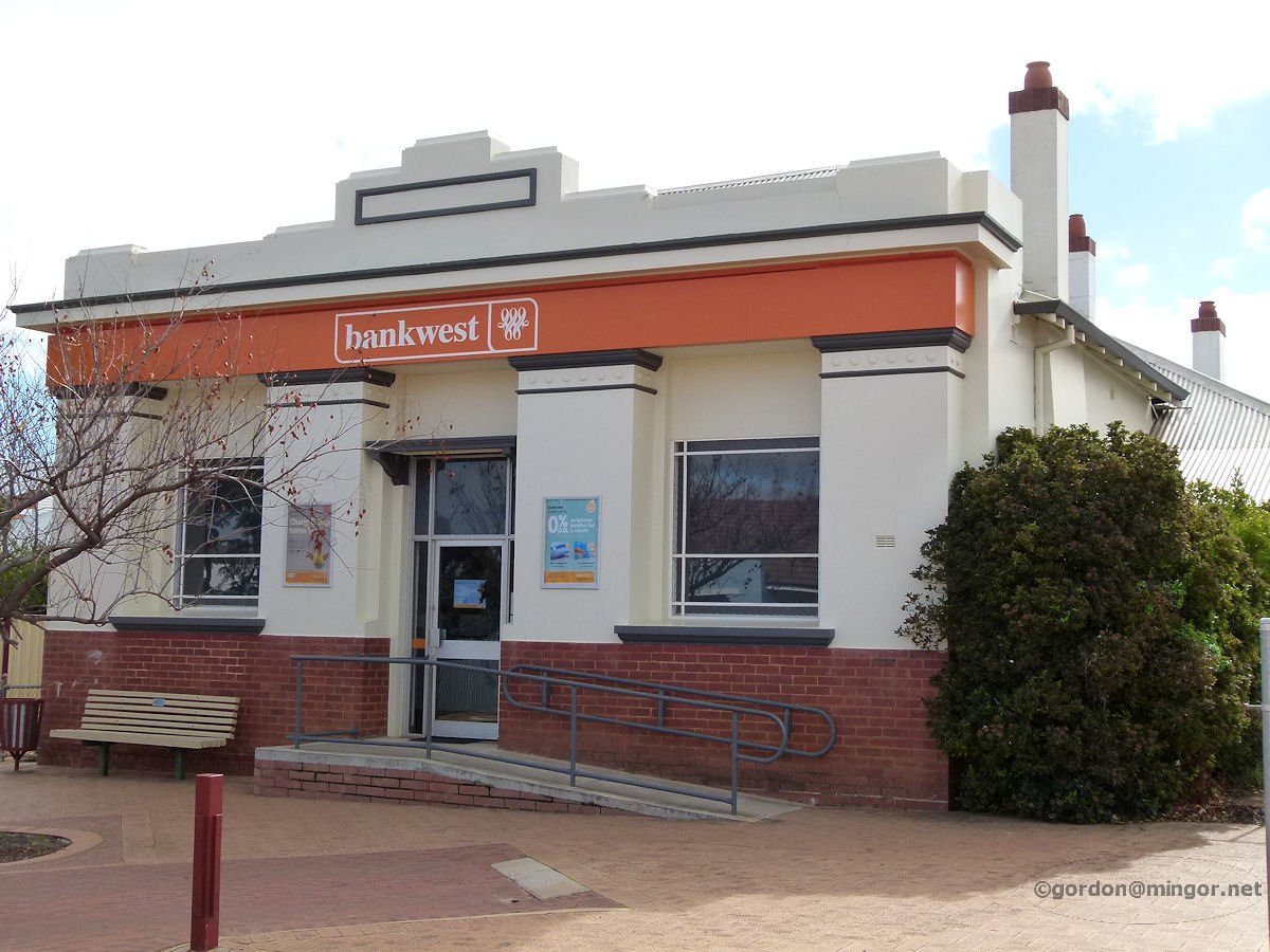 |
Corrigin - Bankwest Towards the top of Campbell Street up near the Shire Office is the Bankwest building. This was formerly the Bank of New South Wales and it was constructed in 1926. June 2013. Photos Ref: CRGN014 |
||
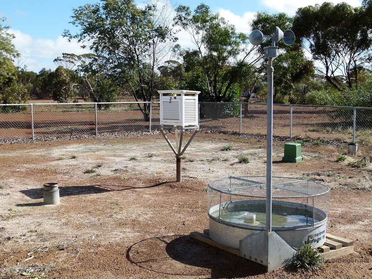 |
Corrigin - Weather Station I haven't come across one of these before in any town but of course each town has one. This is the local weather station measuring maximum and minimum temperatures, wind speed and evaporation rates. This is right next to the footpath on Walton Street. June 2013. Photos Ref: CRGN015 |
||
 |
Corrigin - Railway Station The Corrigin railway station. The original 1914 station burnt down in 1966 and was replaced by this brick building the same year. The station building is now used by the Corrigin Agricultural Centre right now. June 2013. Photos Ref: CRGN016 |
||
 |
Corrigin - Railway Station Another look at the railway station building this time including the old water tower which would have replenished steam locomotives in times gone by. June 2013. Photos Ref: CRGN017 |
||
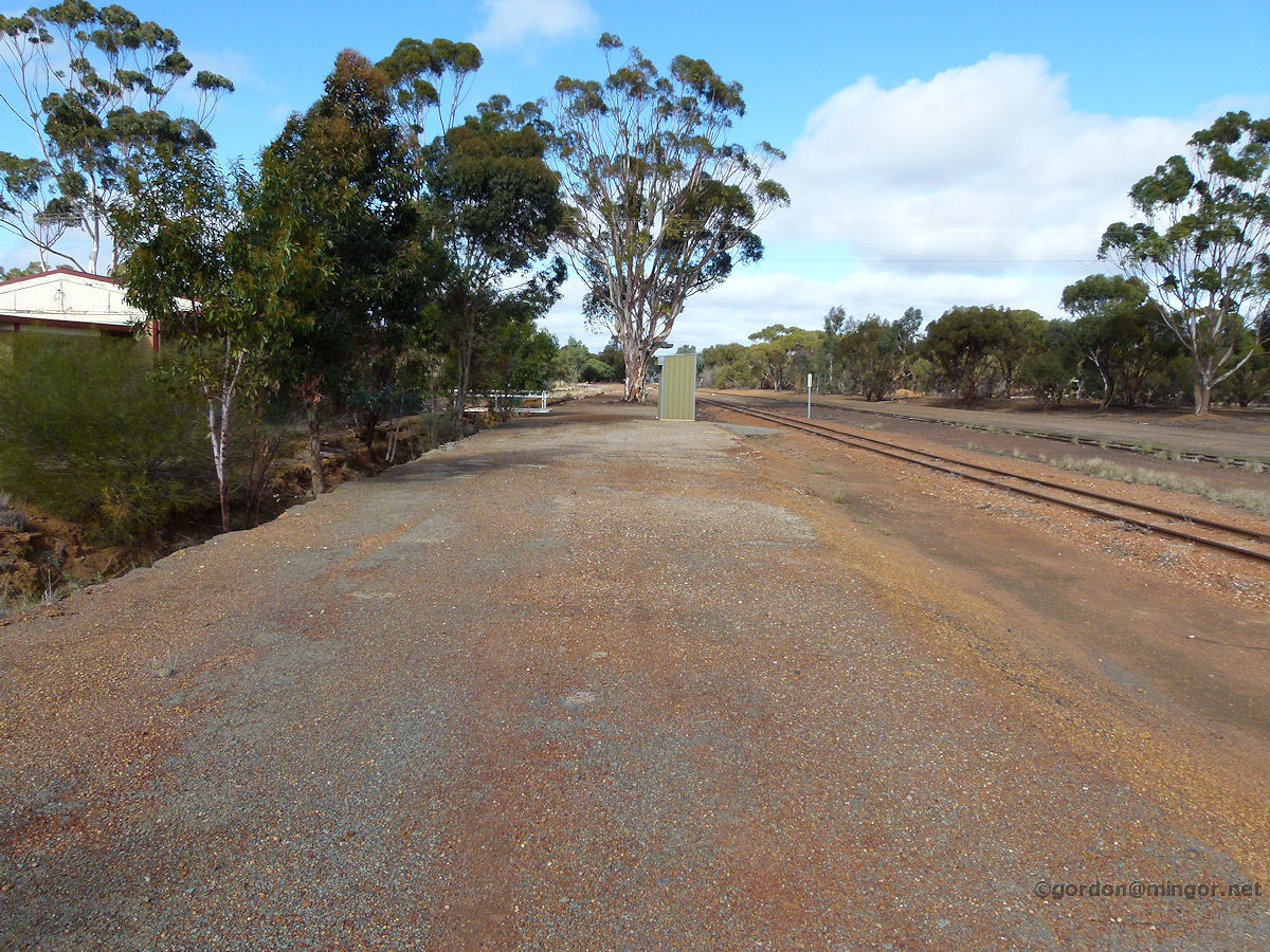 |
Corrigin - Railway Station Old Platform Looking down what would be the original Corrigin railway station platform. The surface is still mostly sealed and it is raised up against where a track would have existed. June 2013. Photos Ref: CRGN018 |
||
 |
Corrigin - St Matthews Anglican Church St Matthews Anglican Church within the Diocese of Bunbury. The Foundation Stone was laid by R. W. H. Moline, Archbishop of Perth, on 26th October 1954. June 2013. Photos Ref: CRGN019 |
||
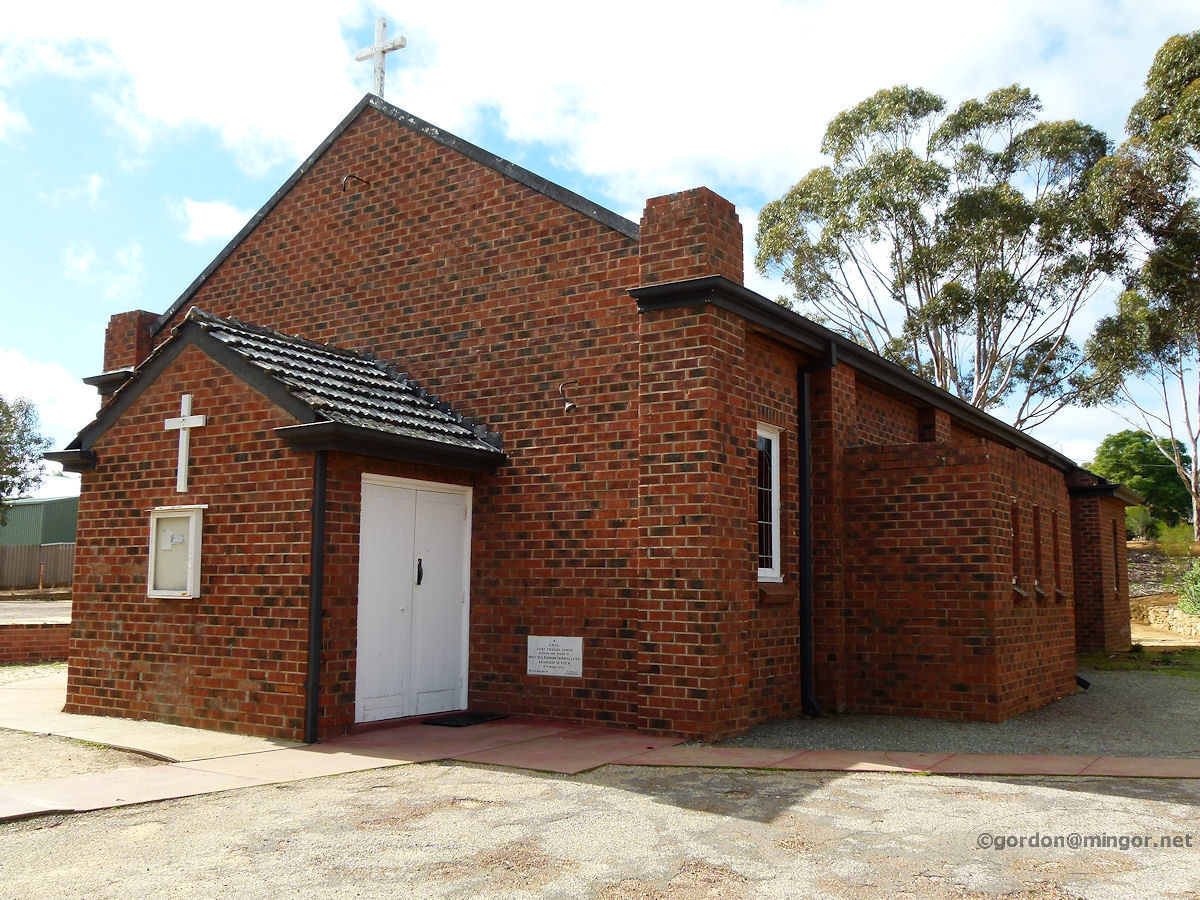 |
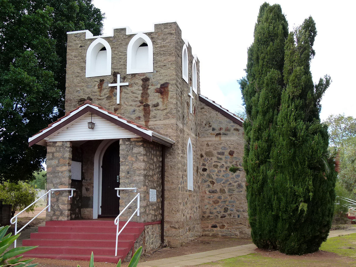
Corrigin - St Therese Catholic Church This is St Therese Catholic Church. The Foundation Stone was laid by Most Rev. Redmond Prendiville, Archbishop of Perth, on 11th March 1956. June 2013. Photos Ref: CRGN020 |
||
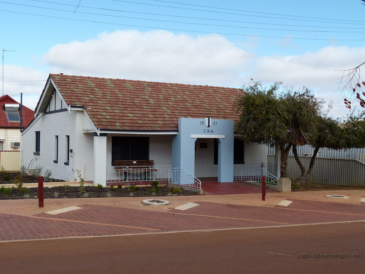 |
Corrigin - CWA Building The local C.W.A. building. A bit more substantial than in some towns and it still carries the traditional blue colour. These rooms were built for the CWA in 1951. In 1958 the building was extended. June 2013. Photos Ref: CRGN021 |
||
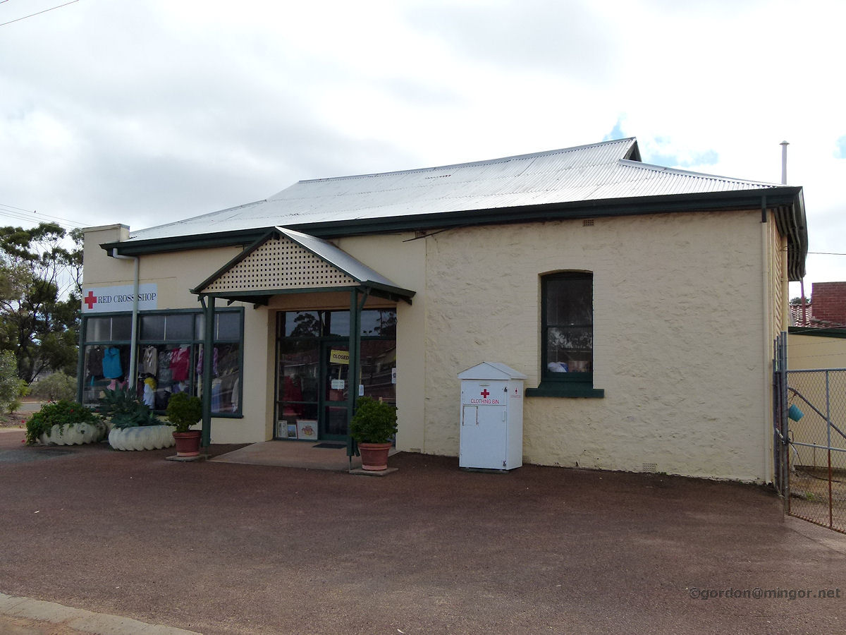 |
Corrigin - Red Cross Just off Walton Street is the Red Cross shop selling lots of pre-used goods, predominantly clothing, as they do. The building was constructed in 1922 as the RSL Anzac Memorial Hall. June 2013. Photos Ref: CRGN022 |
||
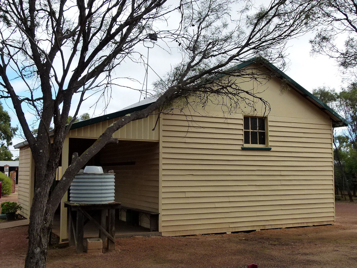 |
Corrigin - Museum The museum was not open when I passed through so I had look through the fence. Here is an old school-room. The sign on the front simply says 'Country School'. June 2013. Photos Ref: CRGN023 |
||
 |
Corrigin - Museum Still in the museum compound, all sorts or agricultural implements are on display, along with this red telephone box. June 2013. Photos Ref: CRGN024 |
||
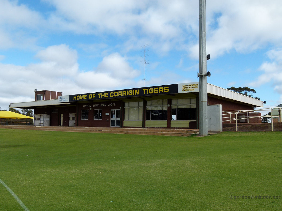 |
Corrigin - Football Tigers Home of the Corrigin Tigers, the local football ground which looks in tremendous condition. This is the Cyril Box pavilion, opened in 1979. Mr Box was the local Road Board secretary between 1935 and 1961, then later the Shire Clerk from 1961 until 1978. June 2013. Photos Ref: CRGN025 |
||
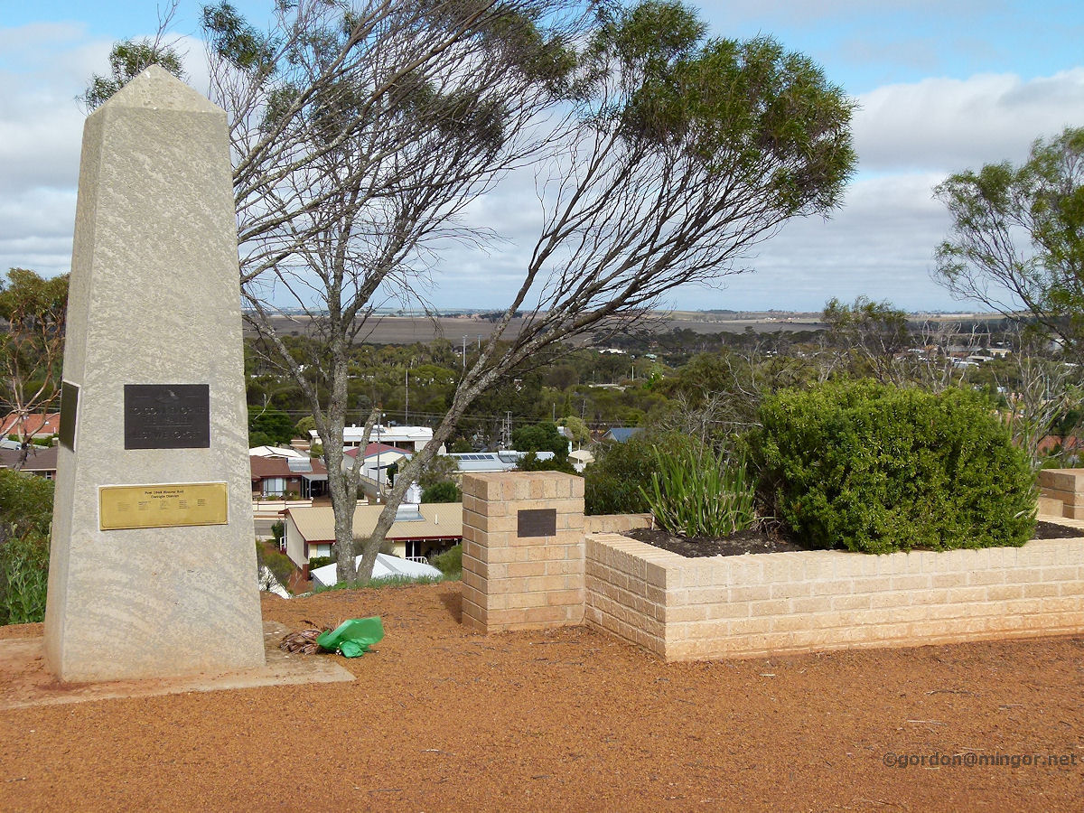 |
Corrigin - RSL Lookout The RSL Lookout overlooking the town. You can't actually see the town centre very clearly from here. The lookout contains this war memorial. June 2013. Photos Ref: CRGN026 |
||
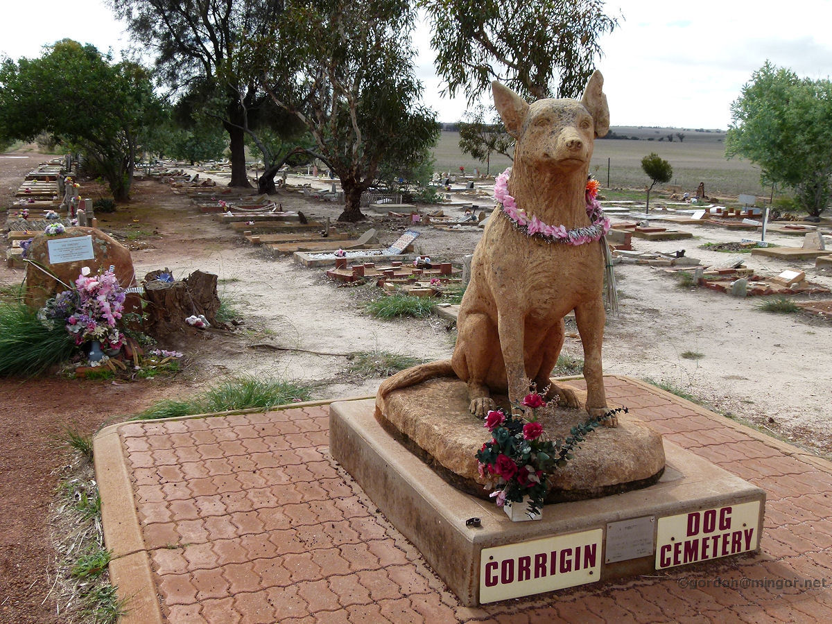 |
Corrigin - Dog Cemetery A few kilometres west of town on the main road is this dog cemetery. A lot of people have gone to great lengths to provide a decent burial for their best friends and a place where they can be remembered. The cemetery was established in 1975. June 2013. Photos Ref: CRGN027 |
||
All images published on this website are copyright © of the webmaster. See About section for clarification and special schools permission |
|||